
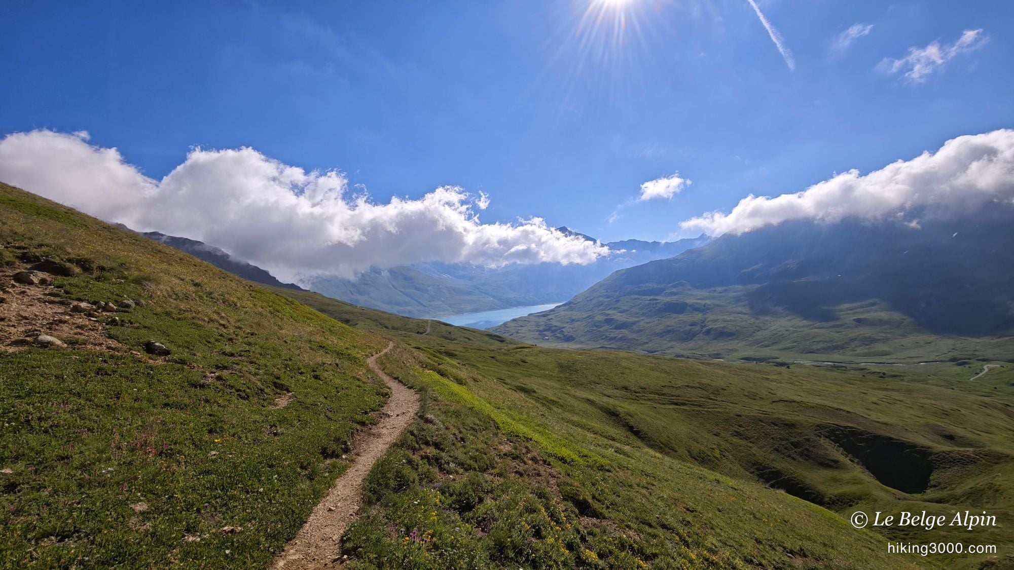
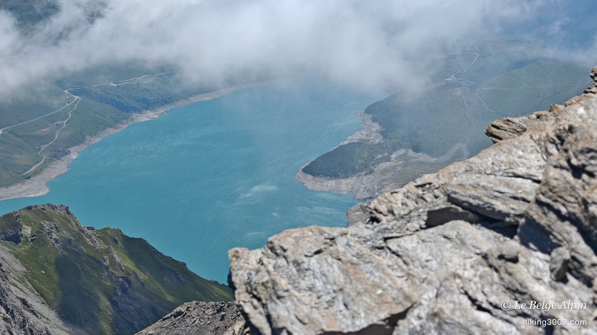
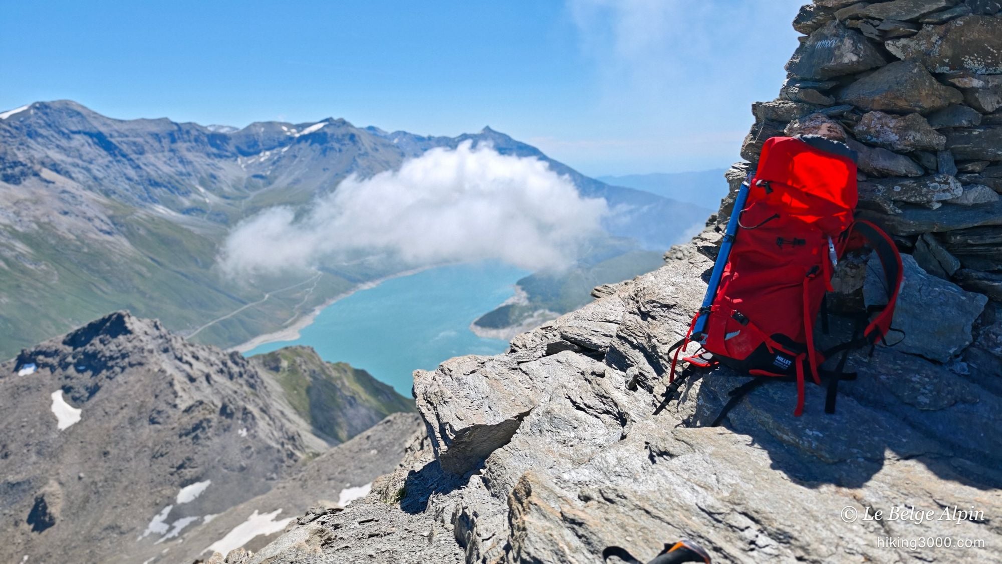
The Signal du Petit Mont-Cenis (3162m), above the turquoise Mont-Cenis lake in the Haute-Maurienne. 13.4 km, 1061m of ascent, meadows full of marmots, a 'dangerous route' sign that looks scarier than it is, and above all the first storm-free day of summer: a sea of clouds clinging to the massifs, breathtaking.
Some days make up for all the others. The Signal du Petit Mont-Cenis (3162m) was a hike I’d had my eye on last year without ever finding the window. This time I did it, and I landed on the first day of summer without an afternoon storm: clear skies from morning to evening, and above all a sea of clouds caught in the massifs that turned a fine outing into an incredible day.
The Signal is an accessible 3000er above the Mont-Cenis lake, in the Haute-Maurienne. You start high already, at 2120m by the hut, which makes the summit very reasonable for anyone wanting a taste of the high mountains without wrecking their legs.
A van night in the storm
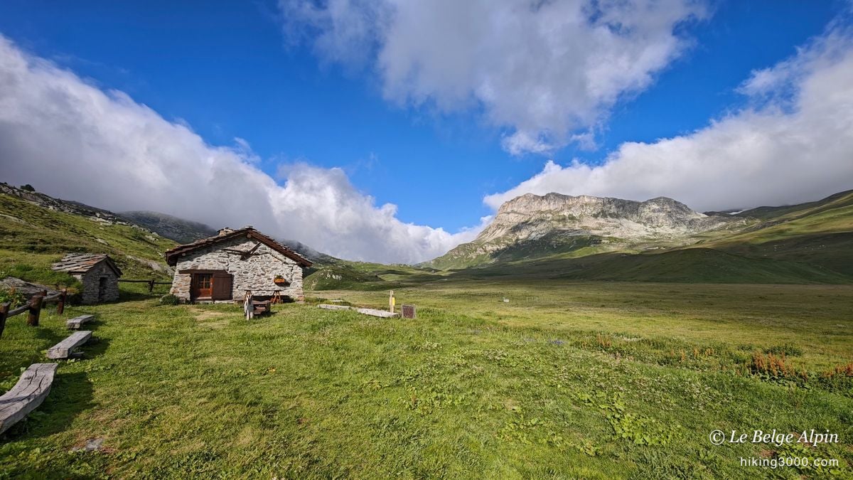

I drove up the evening before in the van, right next to the Refuge du Petit Mont-Cenis. Conditions were genuinely rough: a really violent wind, heavy rain, and the cold settling in. It must have dropped to three or four degrees overnight, and I woke up to 14 degrees inside the van. A bit chilly, but great. That kind of spartan night is part of what gives the summit its value the next day.
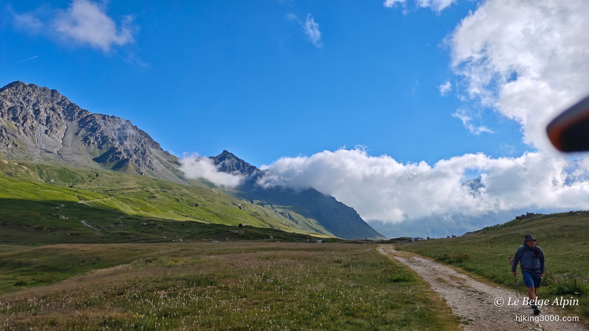
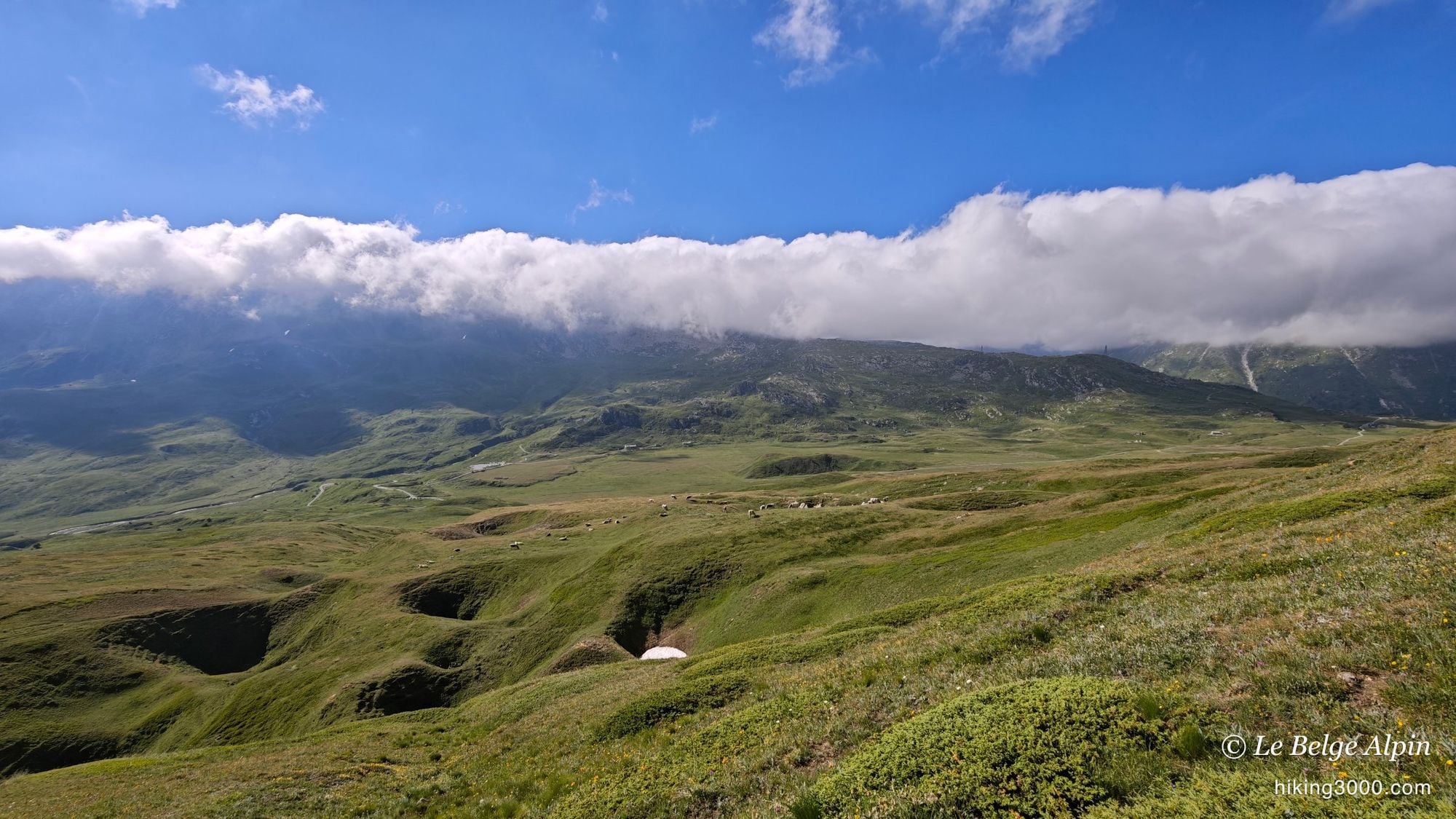
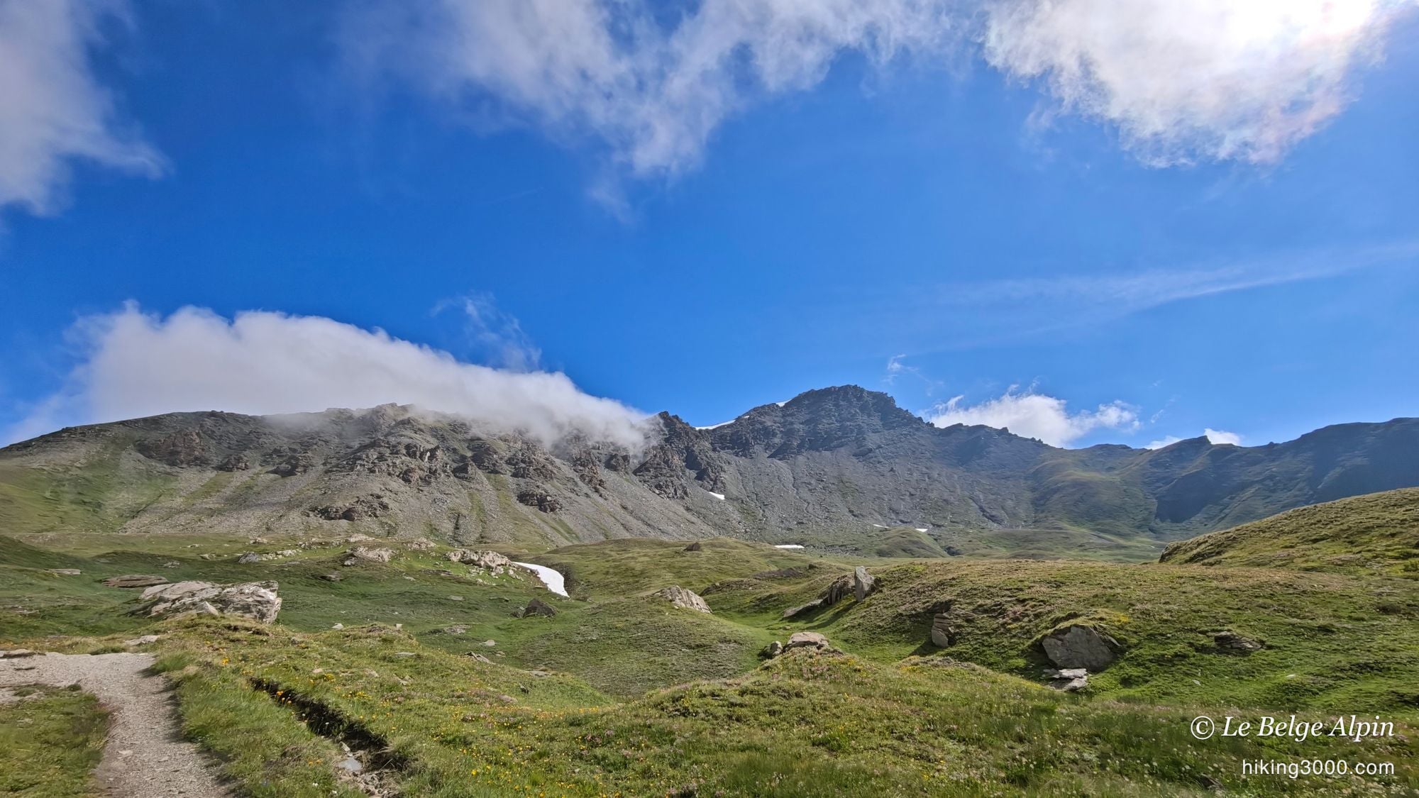
An early start, then, above the Mont-Cenis lake. The whole valley around the hut is superb, and the sky was already playing with the clouds hooked on the ridges.
The Petit Mont-Cenis valley, marmots and meadows

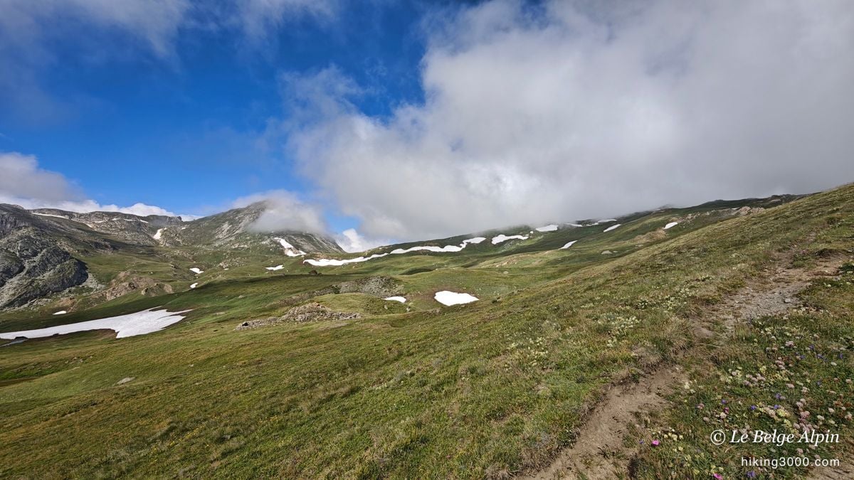
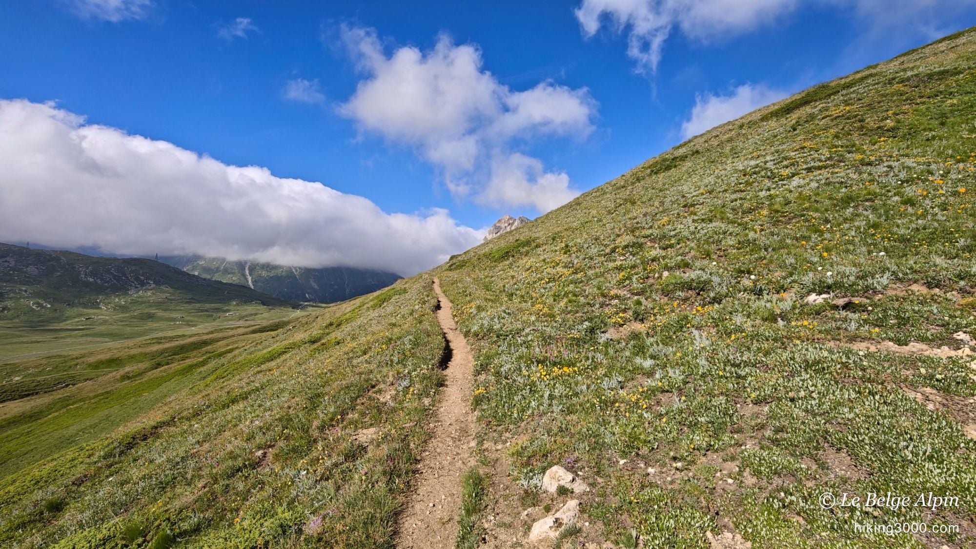
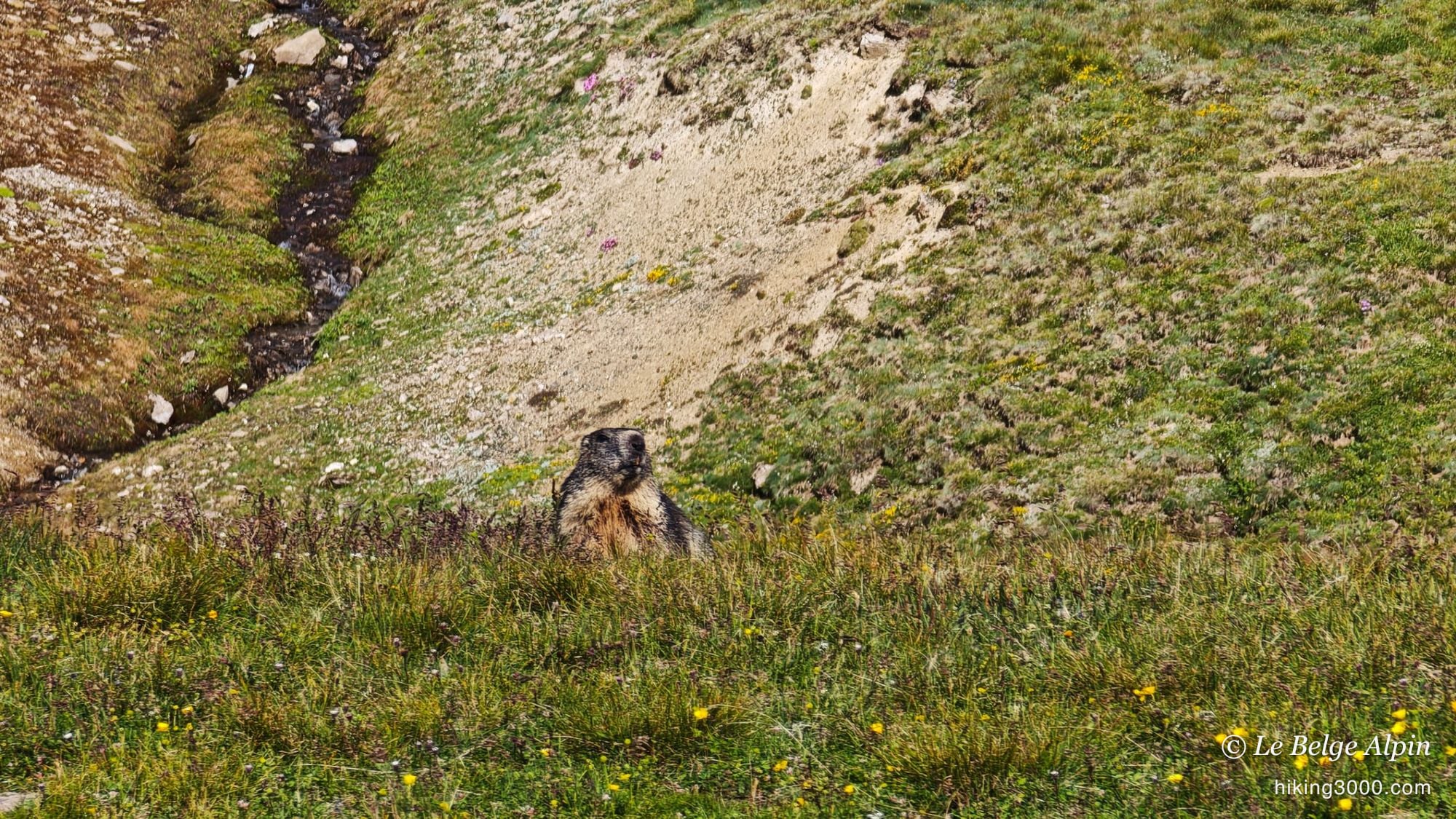
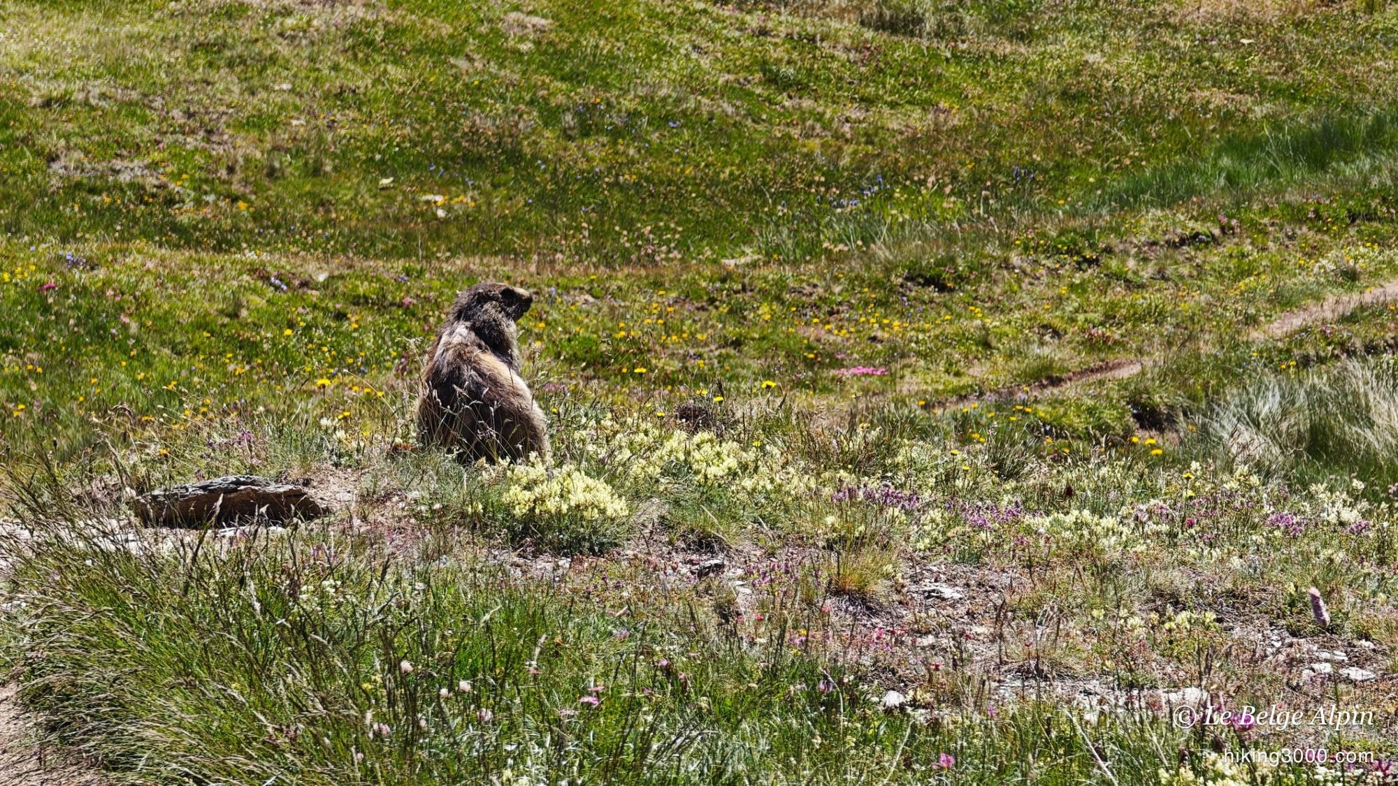
The climb to the Col de Sollières (2639m) is not hard. It goes up on small paths through the pastures, among a swarm of marmots whistling from one slope to the next. It’s a real walking pleasure, the kind of ground where you make progress with a smile and no strain. If this is your first outing on a 3000er, take a look at my notes on grading before you set off.
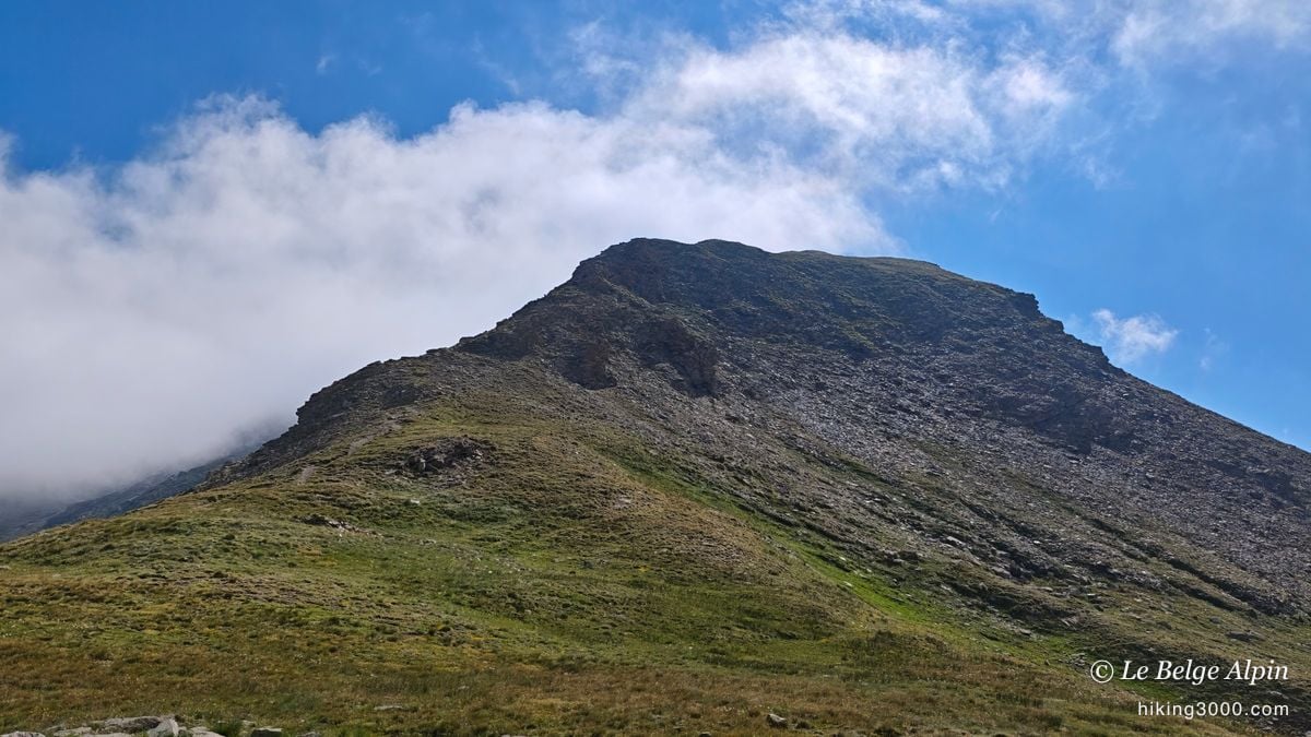
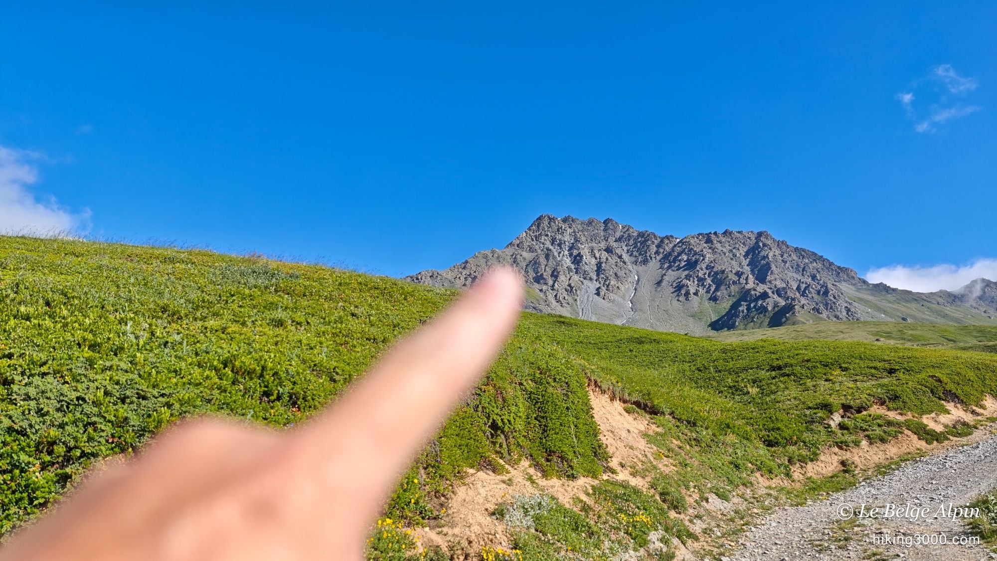
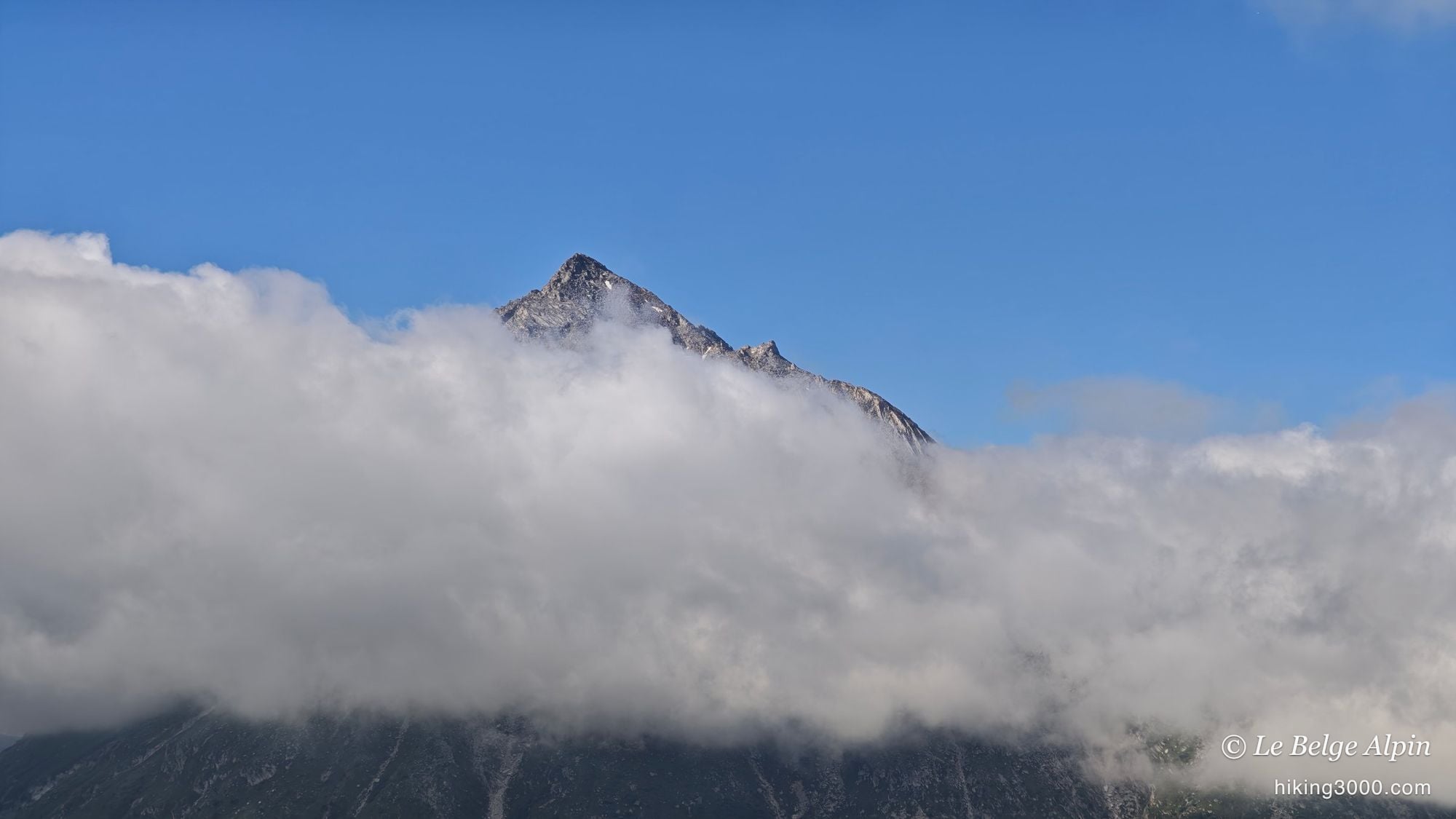
The valley is carpeted with flowers at this time of year, with a few snow patches still holding in the hollows. And behind it, the dry pyramid of the Signal slowly reveals itself, very rocky above the short grass.
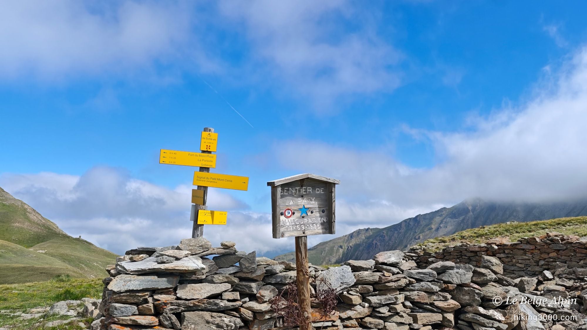
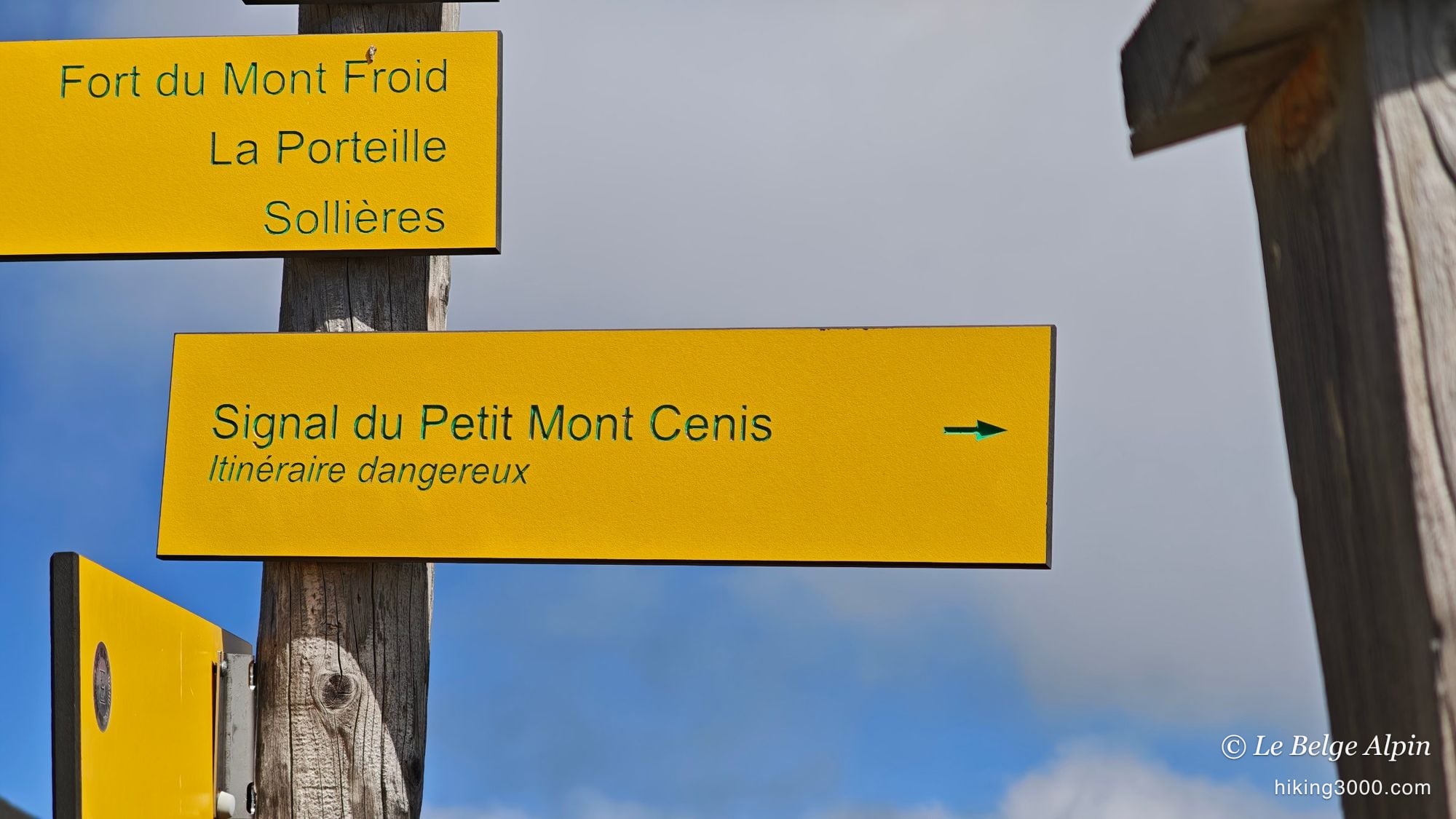
The “dangerous route” that really isn’t one
At the Col de Sollières, you turn right to tackle the Signal, and there you meet a little sign warning of a dangerous route. Honestly, it’s fine. I’ve seen far worse, I expected something much more committing than this.
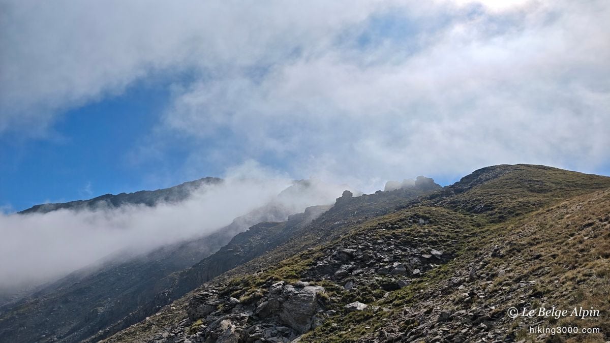
It’s true that at moments it’s a little airy, with a few spots where you have to place your hands, and some loose stones. But truly, nothing insurmountable for anyone used to mountain terrain. The sign looks alarming, but only the very last metres before the summit are genuinely steep. Don’t let the warning at the col put you off.
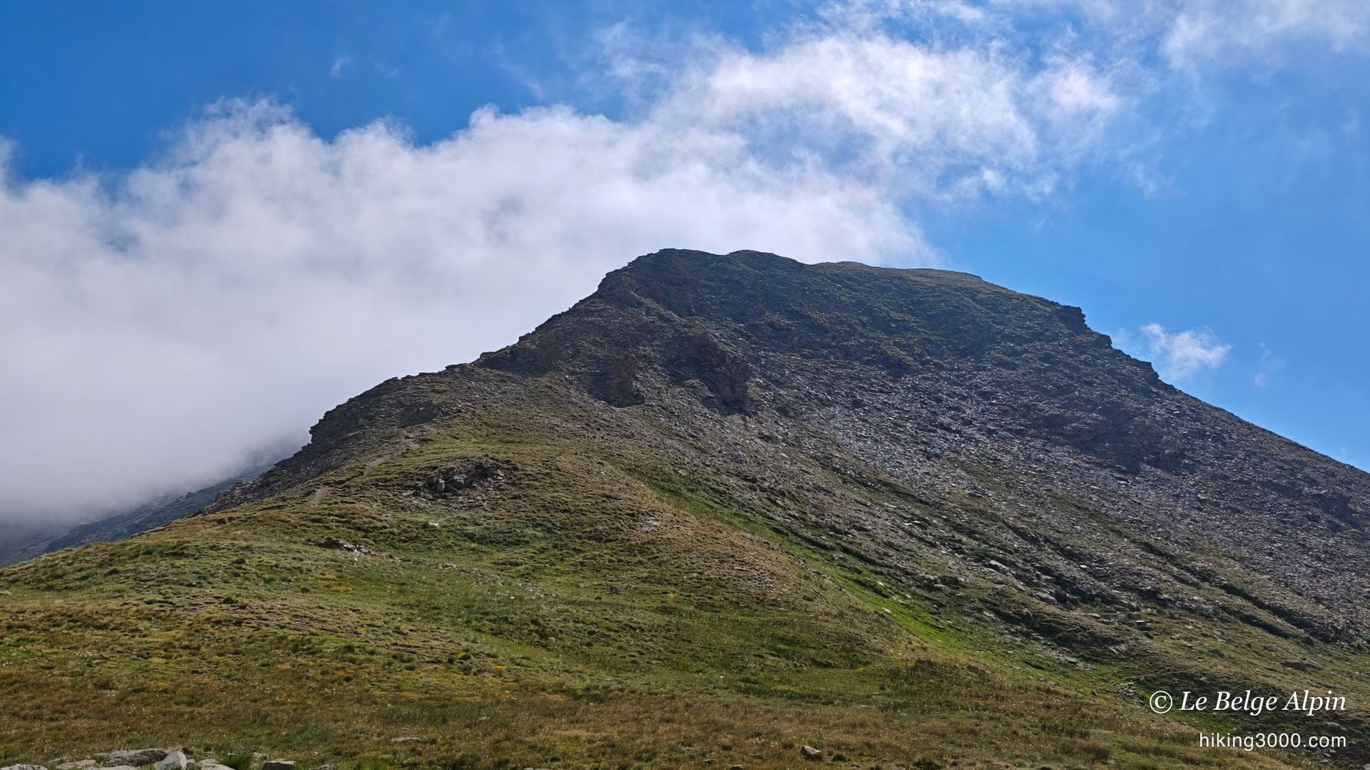
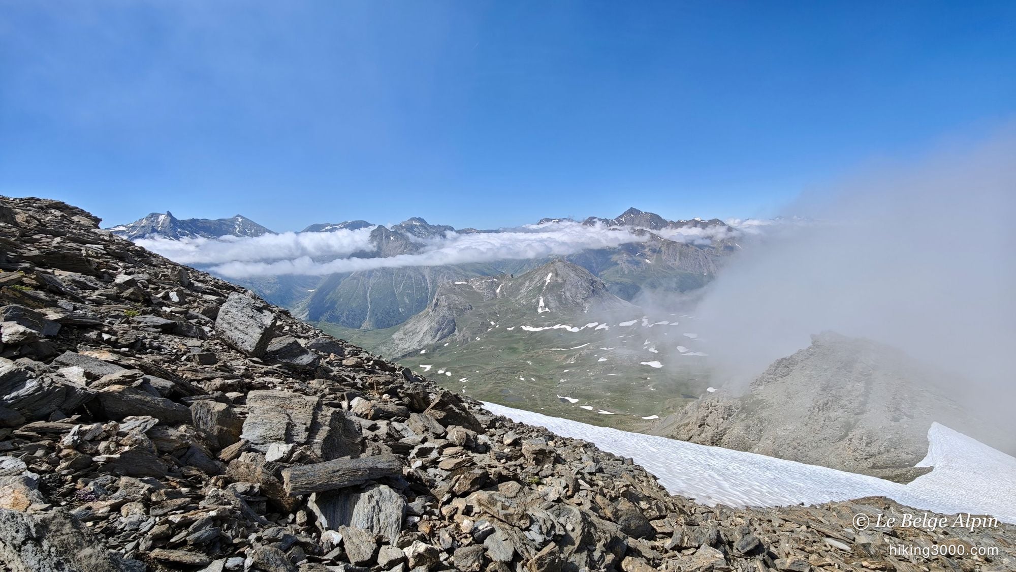
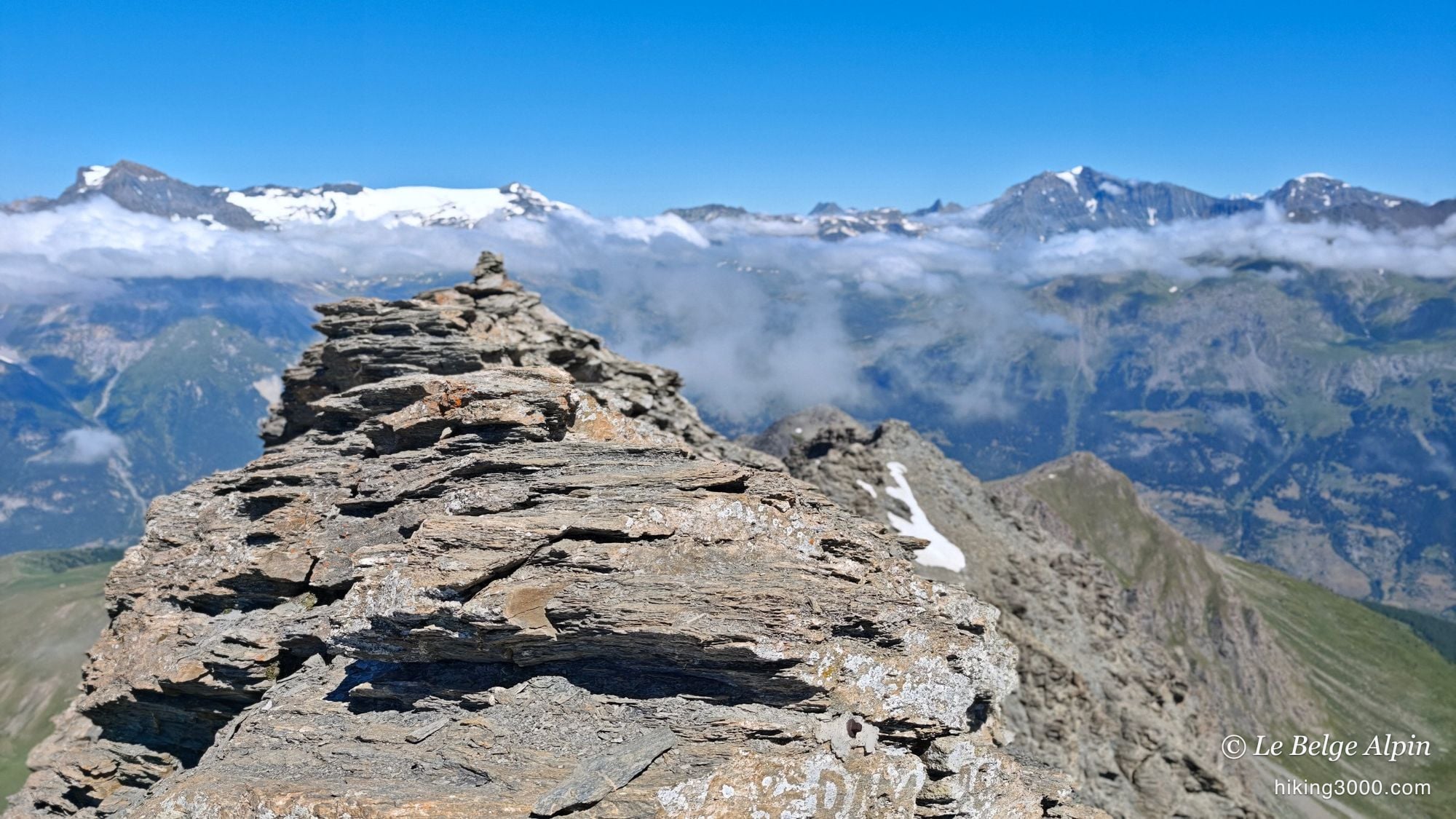
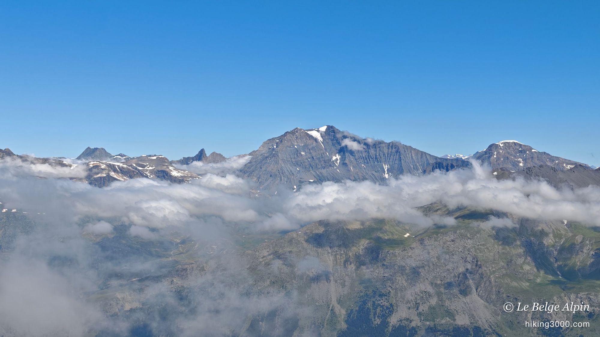
The sea of clouds, and a summit at 3162m
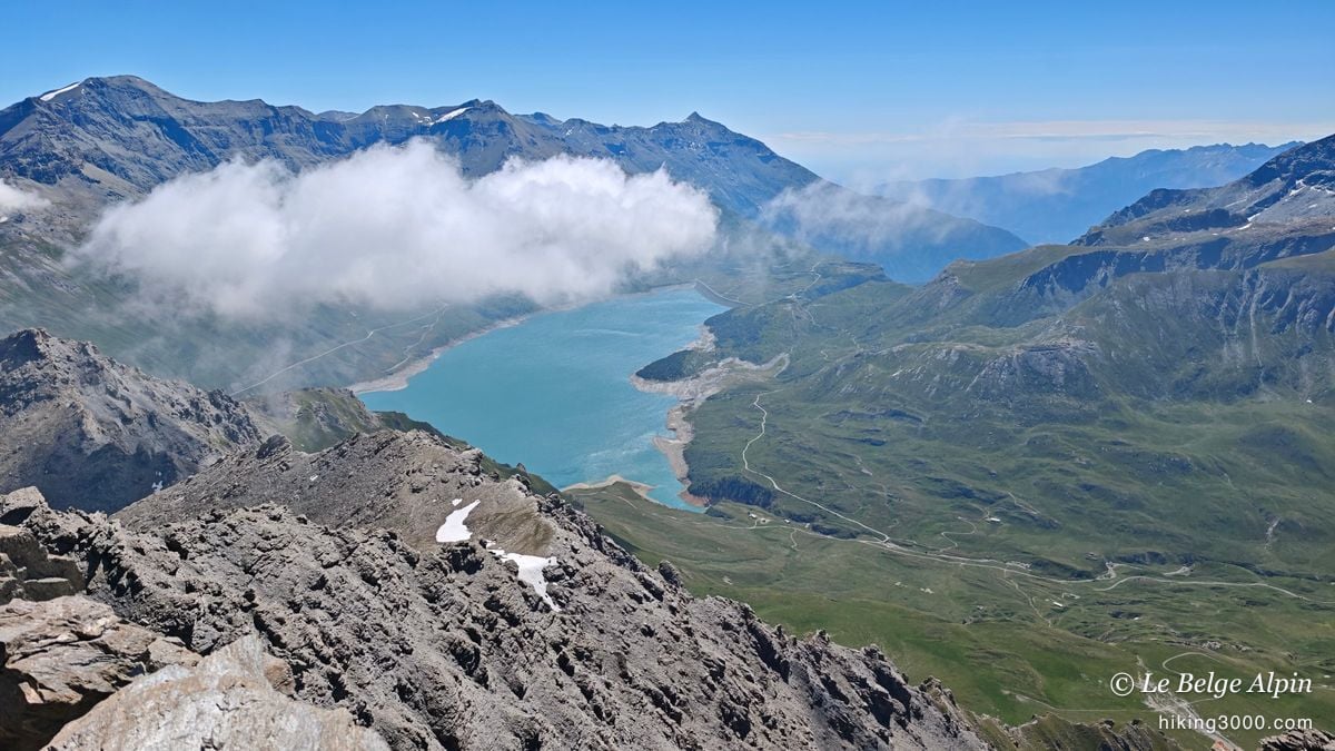

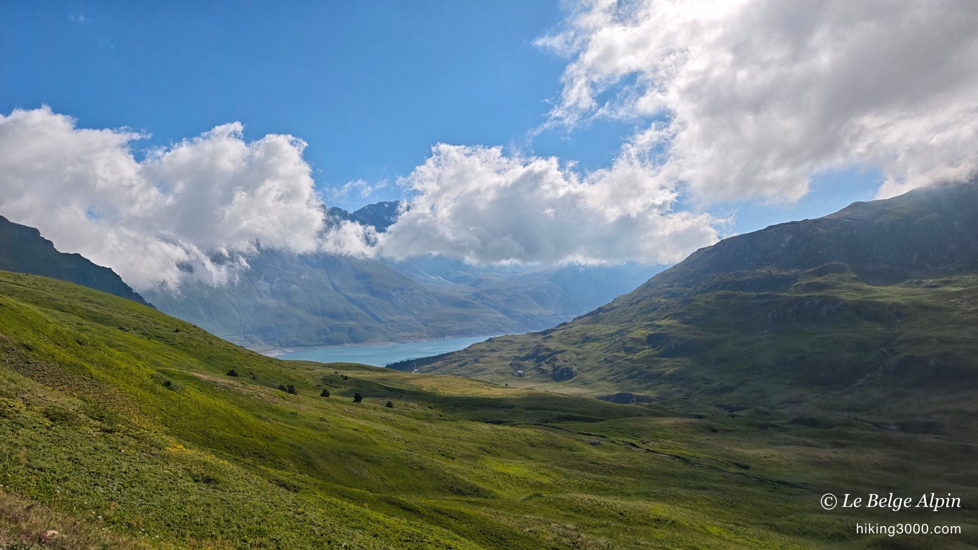
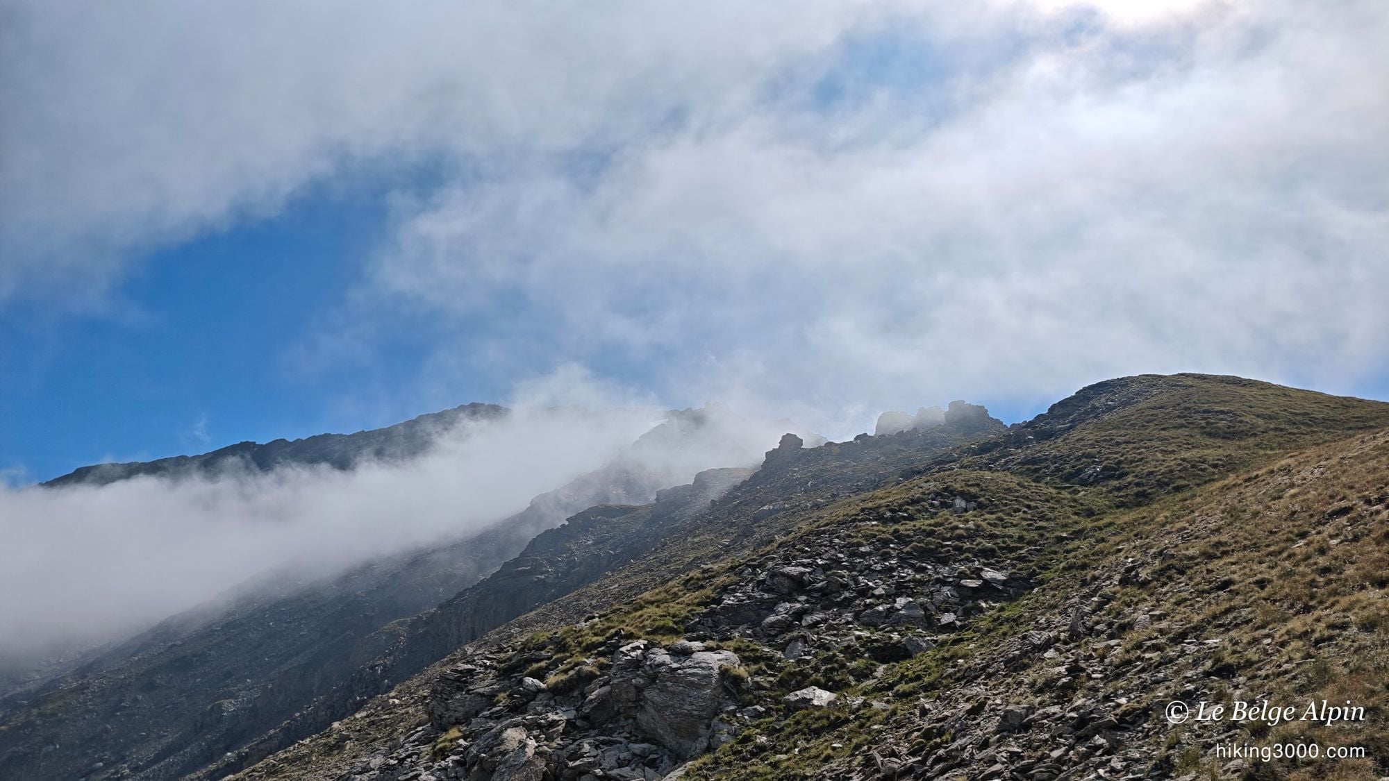
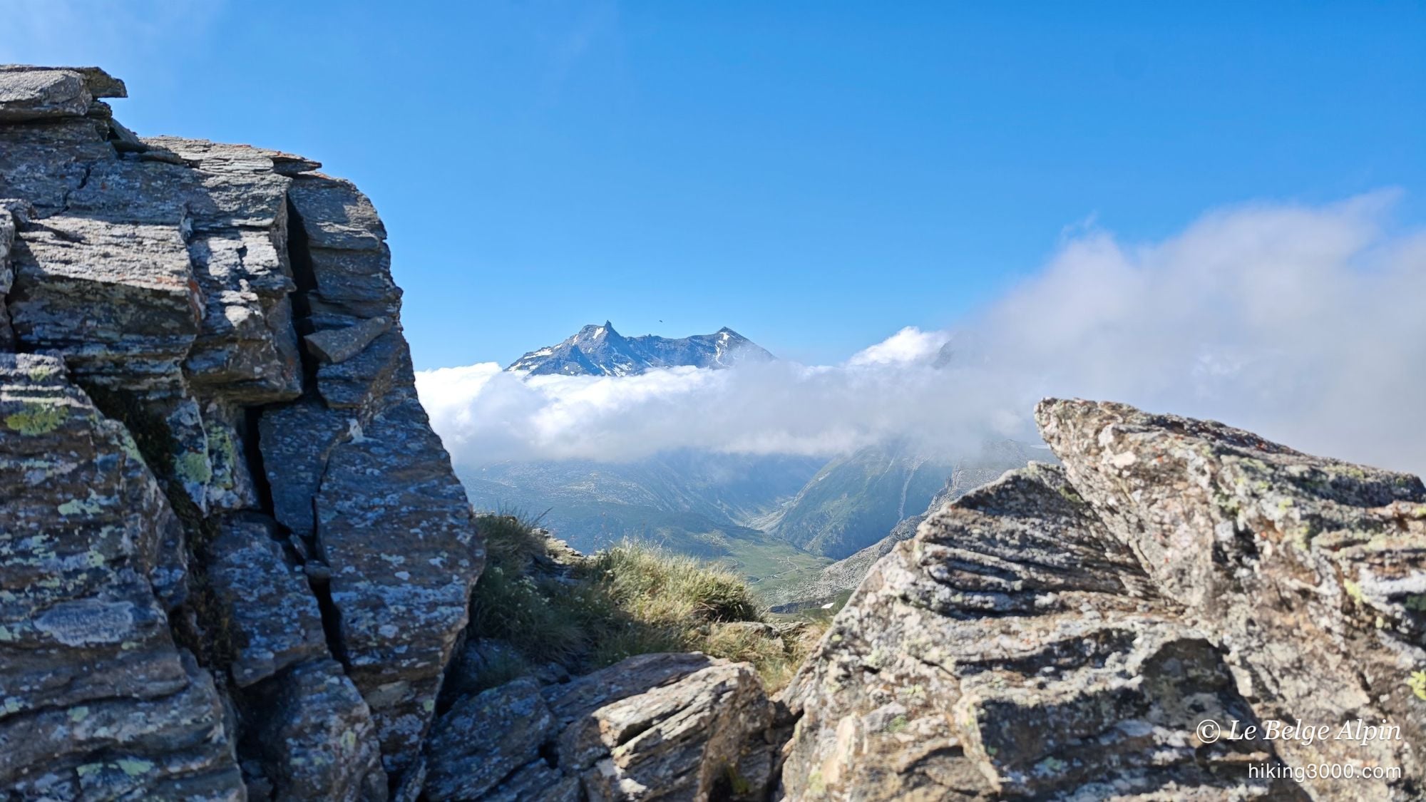
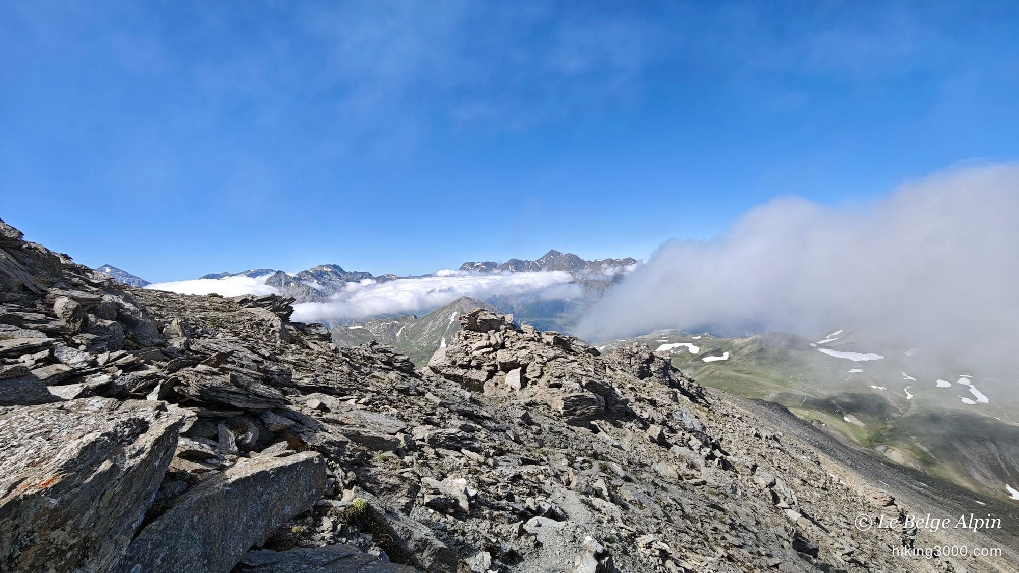
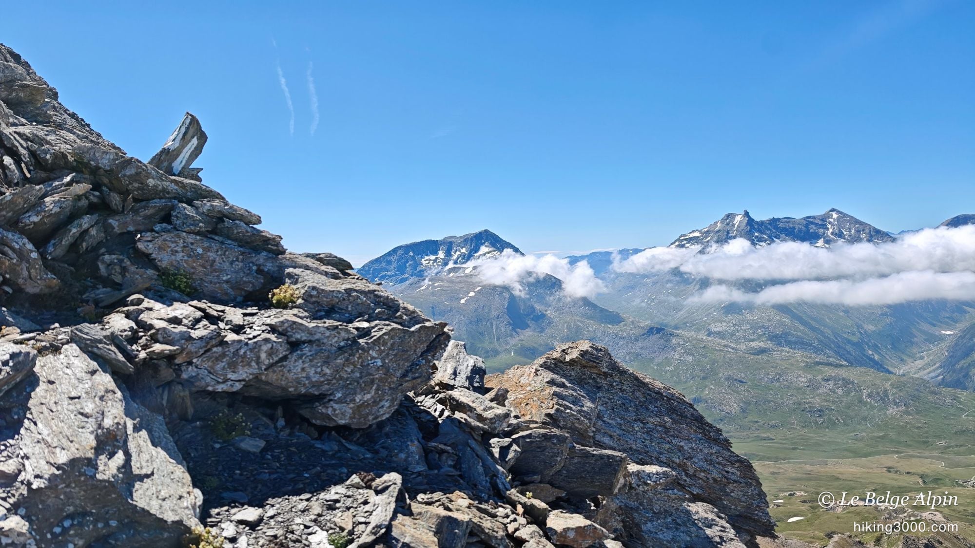
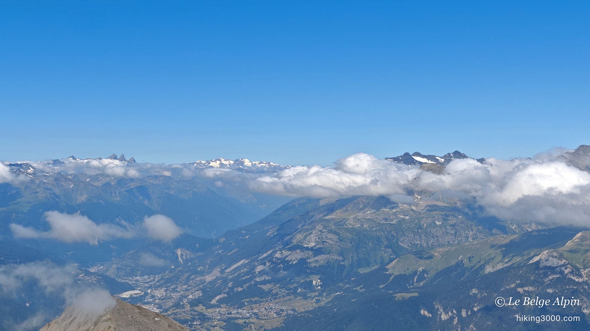
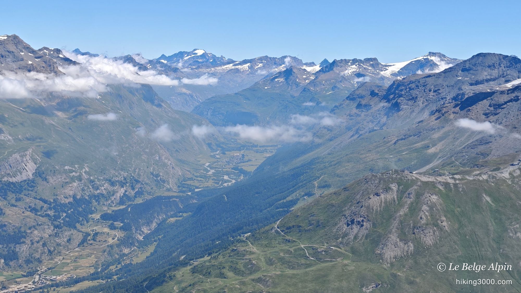
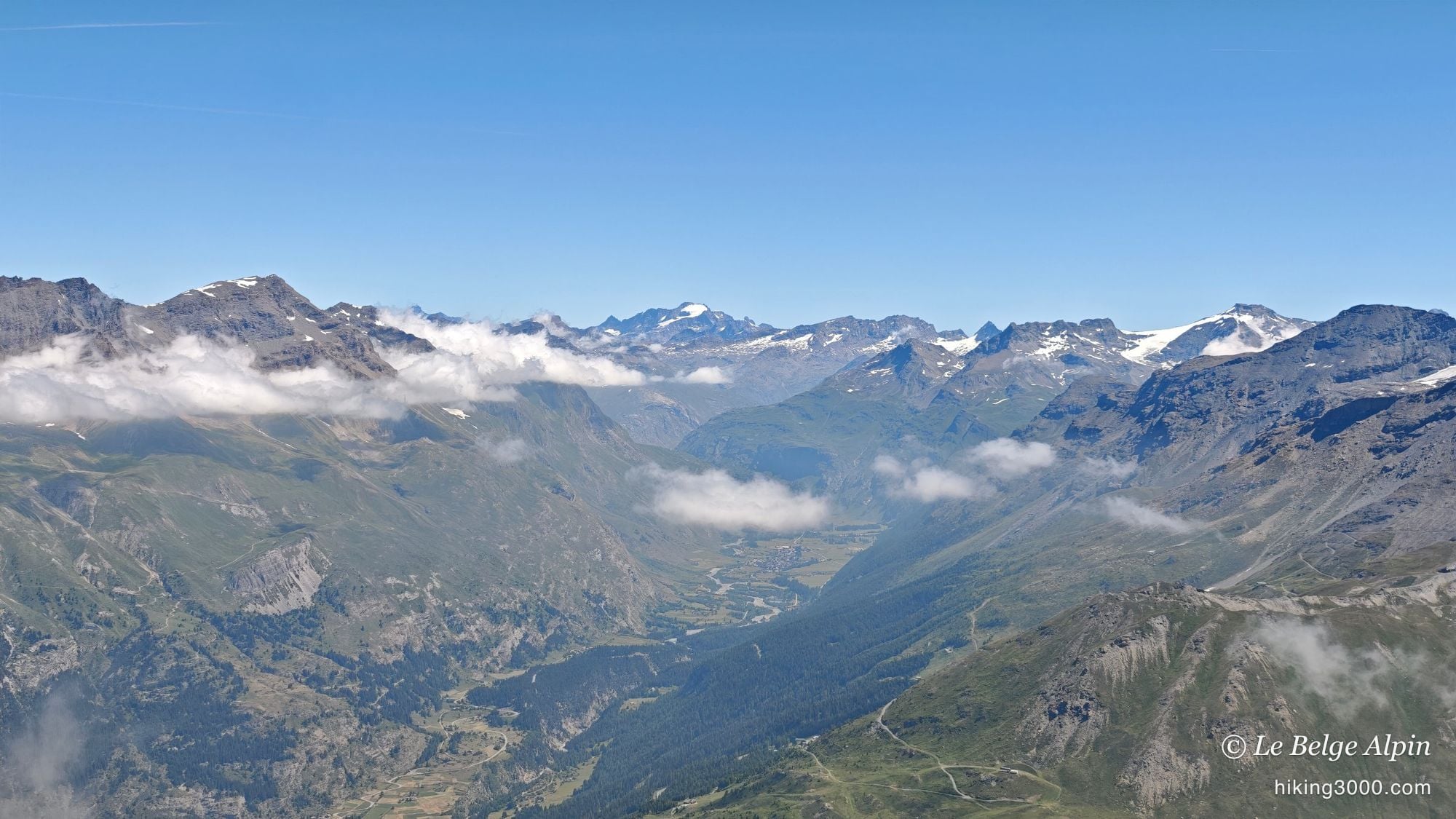
What made the day was the sky. There were huge amounts of cloud in the morning, caught in the massifs, with real seas of clouds in the valleys. Finding yourself in the fog at times, then above it, then below it, is a spectacle I never tire of. I always find the mountains more beautiful with clouds like that, and here we were spoiled.
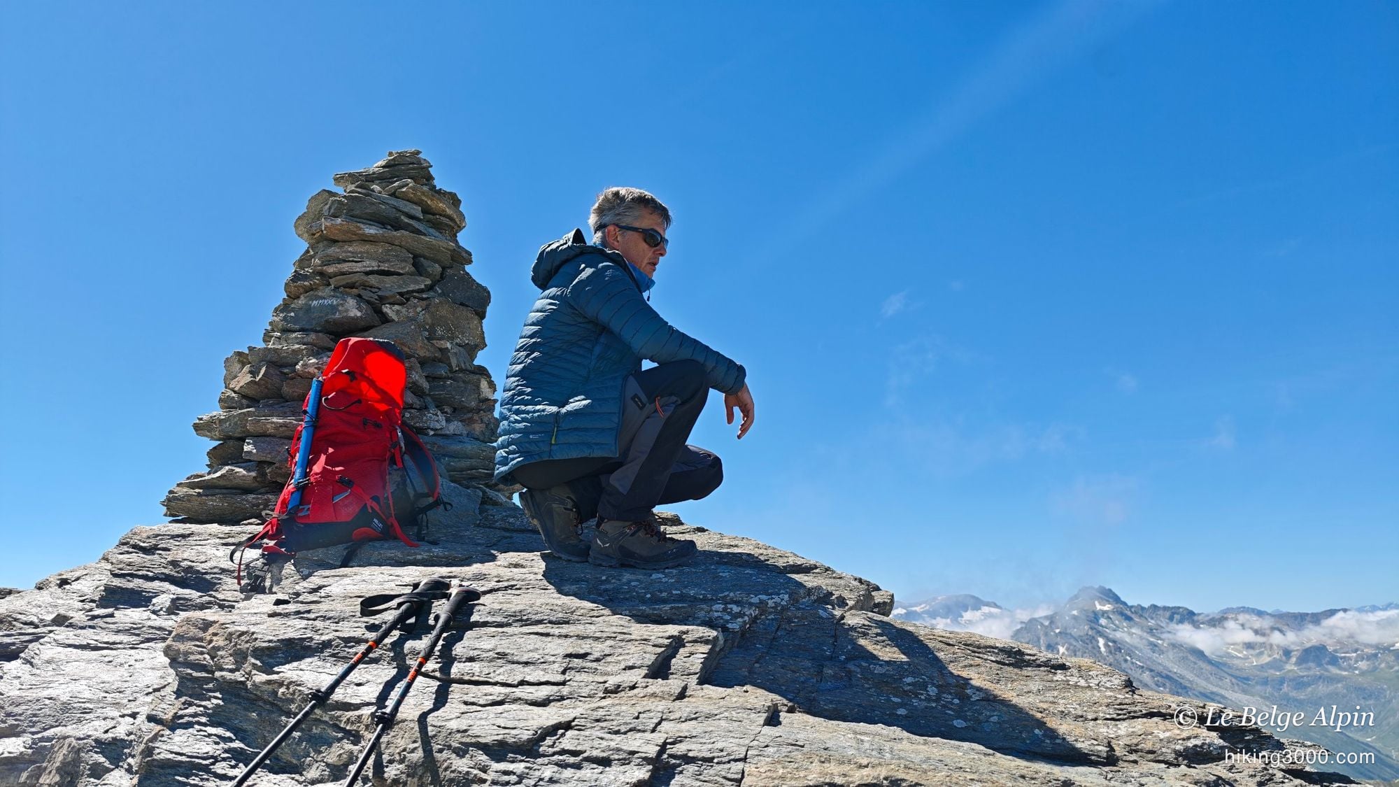
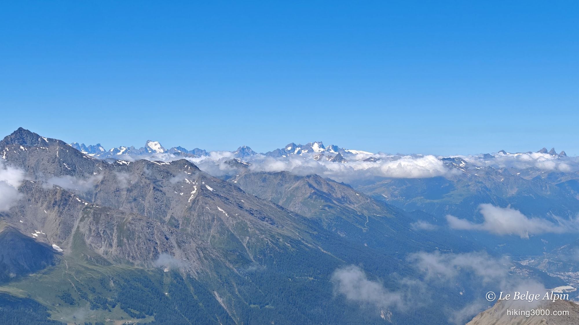
And the summit, at 3162m, what a change of scenery. It’s very rocky, steep, not a blade of grass left. But the view is jaw-dropping. You see the whole Maurienne valley, the Vanoise on the Pralognan side with the Grande Casse and Grande Motte, the Gran Paradiso on the Italian side, the Écrins behind, Italy opening up. And right below, the Mont-Cenis lake, vast and turquoise. Truly a superb outing.


Practical information
The Signal du Petit Mont-Cenis (3162m) is climbed from the Refuge du Petit Mont-Cenis, above the Mont-Cenis lake, in the Haute-Maurienne: 13.4 km and 1061m of ascent for a genuinely accessible 3000er. Allow between 4h30 and 5h round-trip depending on your pace, knowing that most of the route, up to the Col de Sollières, is easy.
The only thing to watch is the final ridge. Nothing nasty, but a little exposure and hands on the last metres, to be done in dry weather and with good boots. In summer, set out early: afternoon storms build fast over the Mont-Cenis, and the morning throws in the marmots and, with a bit of luck, the sea of clouds. A call to the hut or the Haute-Maurienne Vanoise Tourist Office beats any app for conditions.
And if you like these quiet 3000ers of the Haute-Maurienne, take a look at the Ouille Allegra above Bessans, the Col du Carro toward Bonneval, or the Col de l’Agnel below Mont d’Ambin, in the same spirit.
Practical info
Starting point
From Lanslebourg (Val-Cenis), drive up to the Mont-Cenis pass on the D1006, pass the reservoir, then turn right onto the road descending toward the Refuge du Petit Mont-Cenis. Park in the small lot around 2120m, just before the hut. The road ends narrow: come up early, especially in summer. The trail is then well marked up to the Col de Sollières.
GPX track
Import the GPS track into your watch or app (Garmin Connect, Komoot, Gaia GPS, Iphigenie...).
Sign in to downloadMountain huts
Refuge du Petit Mont-Cenis, 2120m
Staffed in summer, at the foot of the route, at the head of the Petit Mont-Cenis valley. Trailhead for the hike and a pleasant stop on the way back. Booking advised to sleep over.
Tourist office (current conditions)
Haute-Maurienne Vanoise Tourist Office, Val-Cenis branch
Lanslebourg, 73480 Val-Cenis
Garmin track
Gallery
30 photos, click to enlarge


Weather, Lanslebourg-Mont-Cenis
Conditions and forecasts for the itinerary
In the mountains, conditions change fast. A thunderstorm can become dangerous, fog disorients, residual snow slows every step. Before leaving, check the bulletins, plan a stable weather window, and when in doubt, call the tourist office or the local guides office.
Learn to read mountain weather →Questions fréquentes
Is the Signal du Petit Mont-Cenis dangerous?
+
A 'dangerous route' sign stands at the Col de Sollières, and it does look intimidating. In practice it's very manageable: only the very last metres before the cairn are a little steep and airy, with hands needed here and there and a few loose stones. Nothing insurmountable for a hiker used to mountain terrain. I honestly expected something far harder.
What's the difficulty and elevation gain?
+
Around 1061m of ascent over 13.4 km, roughly 4h30 to 5h round-trip. The climb to the Col de Sollières (2639m) is easy, on good trails. Only the final ridge toward 3162m calls for some care. You start high already (2120m), which makes this 3000er very reasonable.
When should you do this hike?
+
From July to September. Early in the season some snow patches linger up high, with no real difficulty. The morning is often the best time: in summer, storms build fast over the Mont-Cenis in the afternoon. Set out early, it's also when you'll see the most marmots in the meadows.
What can you see from the summit?
+
A 360-degree panorama. Below, the turquoise Mont-Cenis lake. All around, the upper Maurienne, the Vanoise on the Pralognan side with the Grande Casse and Grande Motte, the Gran Paradiso on the Italian side, the Écrins in the distance and much of the border Alps. Under a sea of clouds, the spectacle is even stronger.