
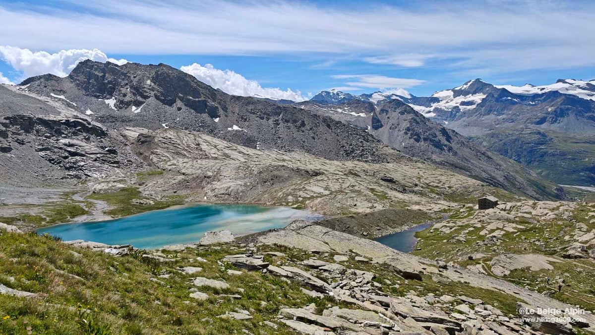
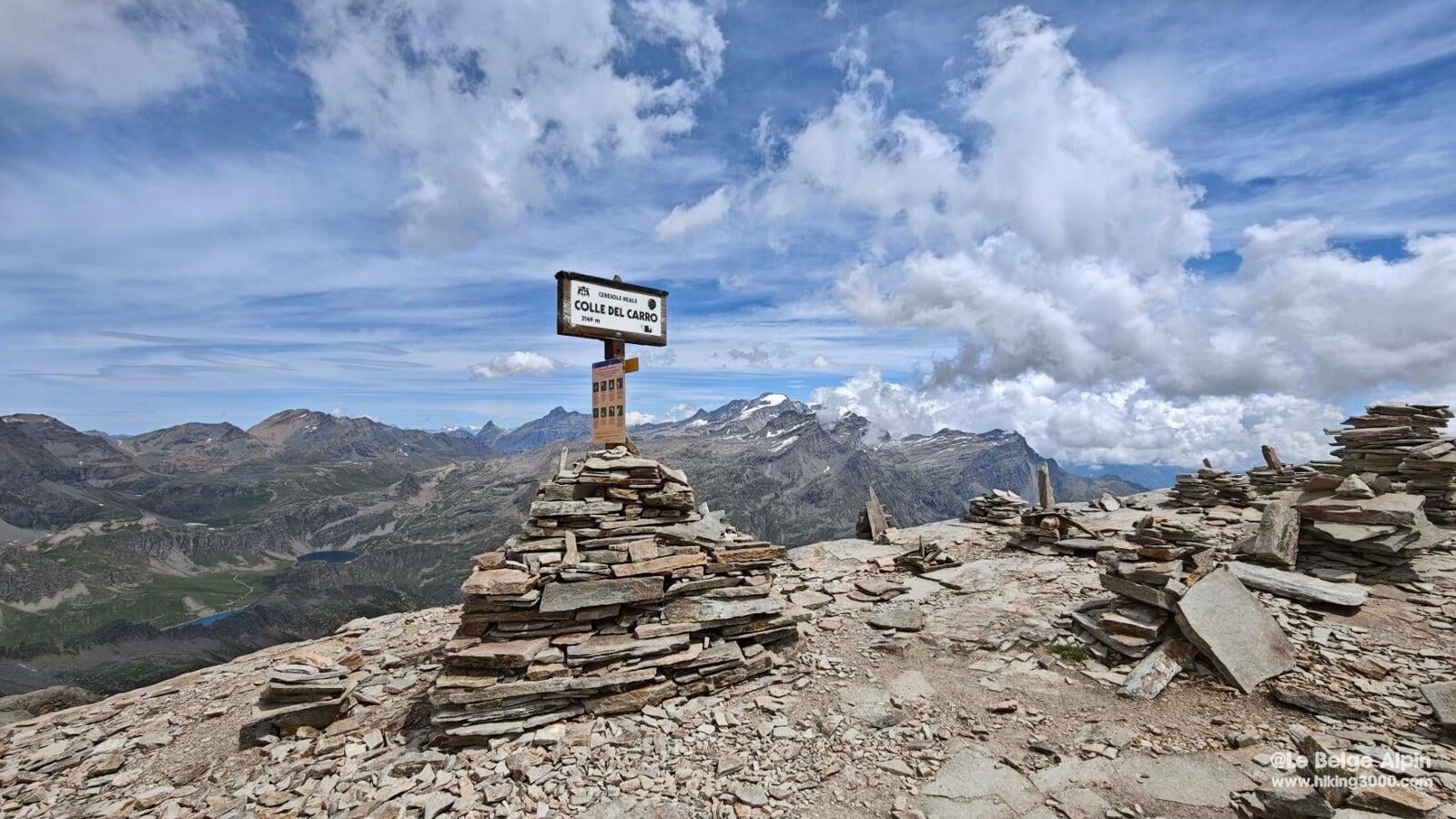
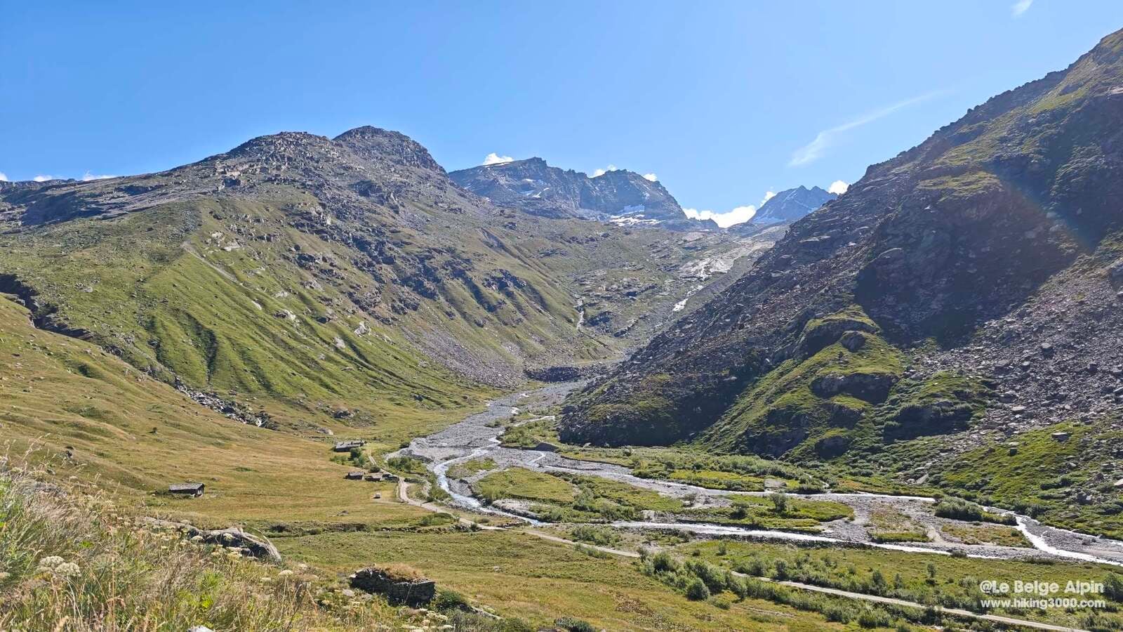
From the hamlet of l'Ecot at Bonneval-sur-Arc, a long climb to the Refuge du Carro and then to the pass (3149 m) that watches over the Italian border. High-altitude lakes, moraine, and a forest of cairns.
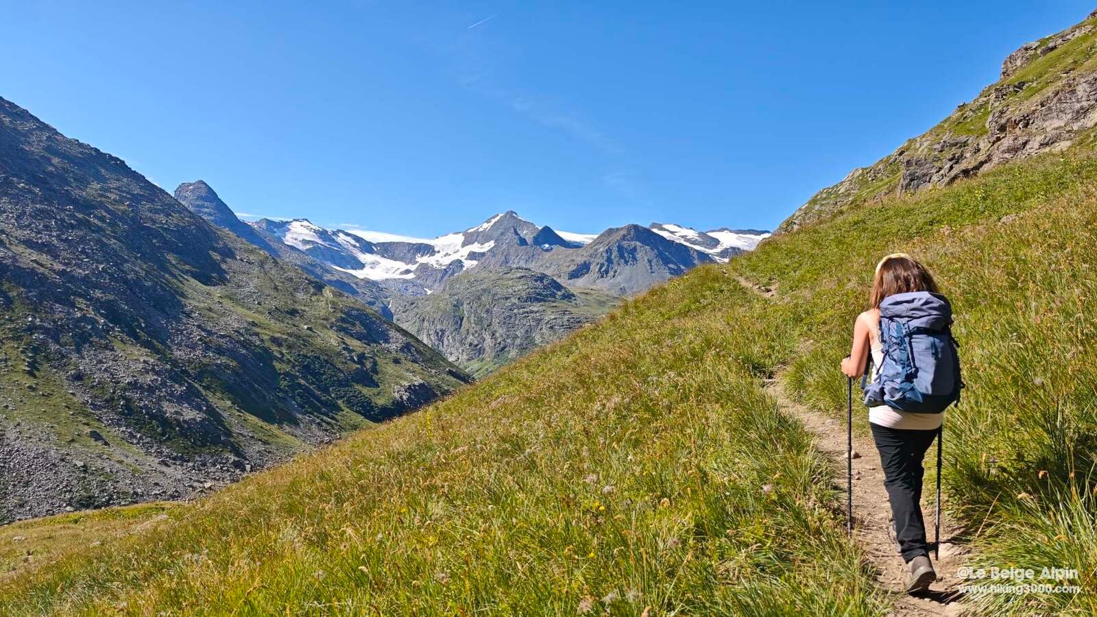
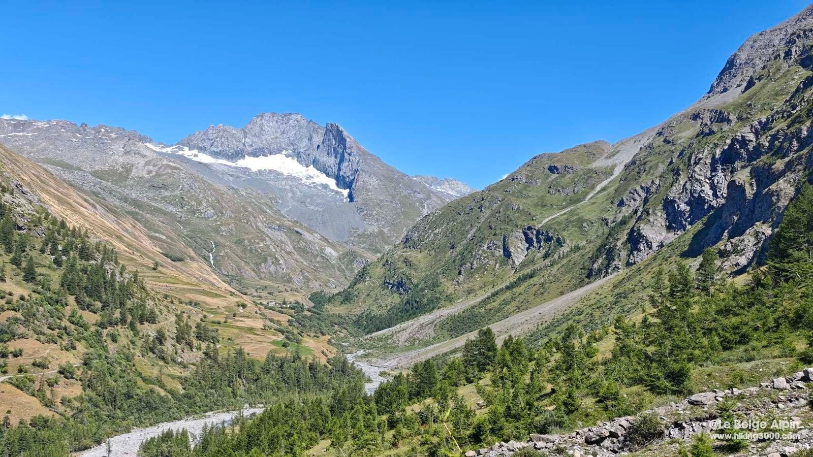
Second day of our week in the Haute Maurienne with my mountain partner. The day before we opened with the Pointe de Tierce. Today we stay in the same area but switch valleys: heading to L’Ecot, a small hamlet perched in the Duis valley in the heart of the Vanoise National Park, aiming for the Col du Carro at 3149 m.
We park at the l’Ecot parking (7 euros a day in summer, not cheap but it works), which is also the end of the line for the seasonal shuttle from Bonneval-sur-Arc if you prefer to leave the car down the valley. The hamlet is typically Savoyard: a few chalets, farms still in activity, an authentic atmosphere that sets the tone right away.
First stop: the Refuge du Carro

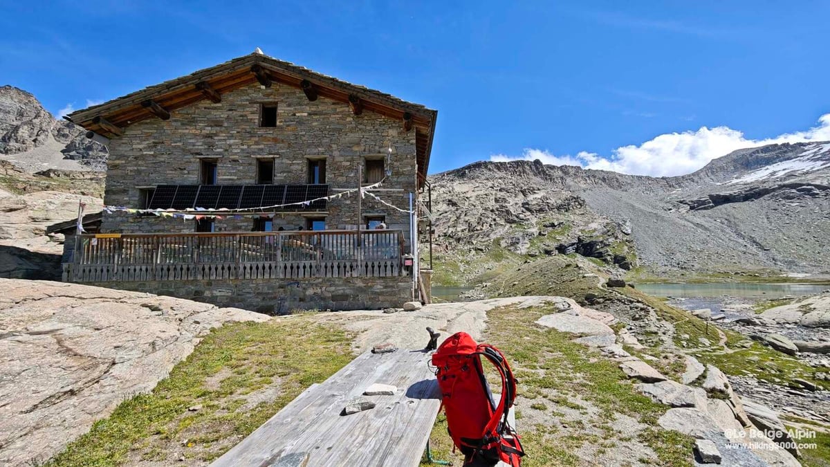
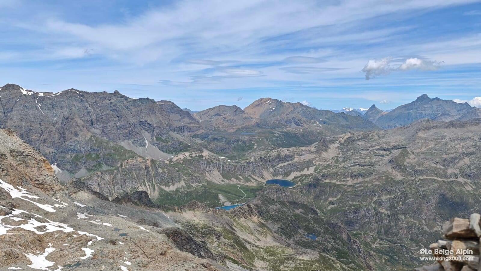
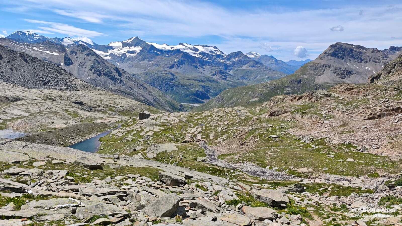
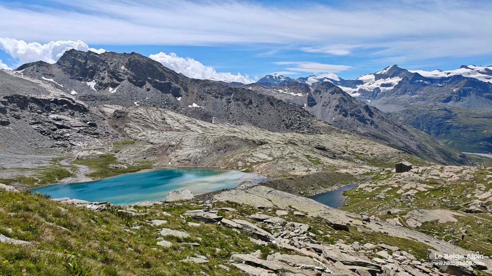
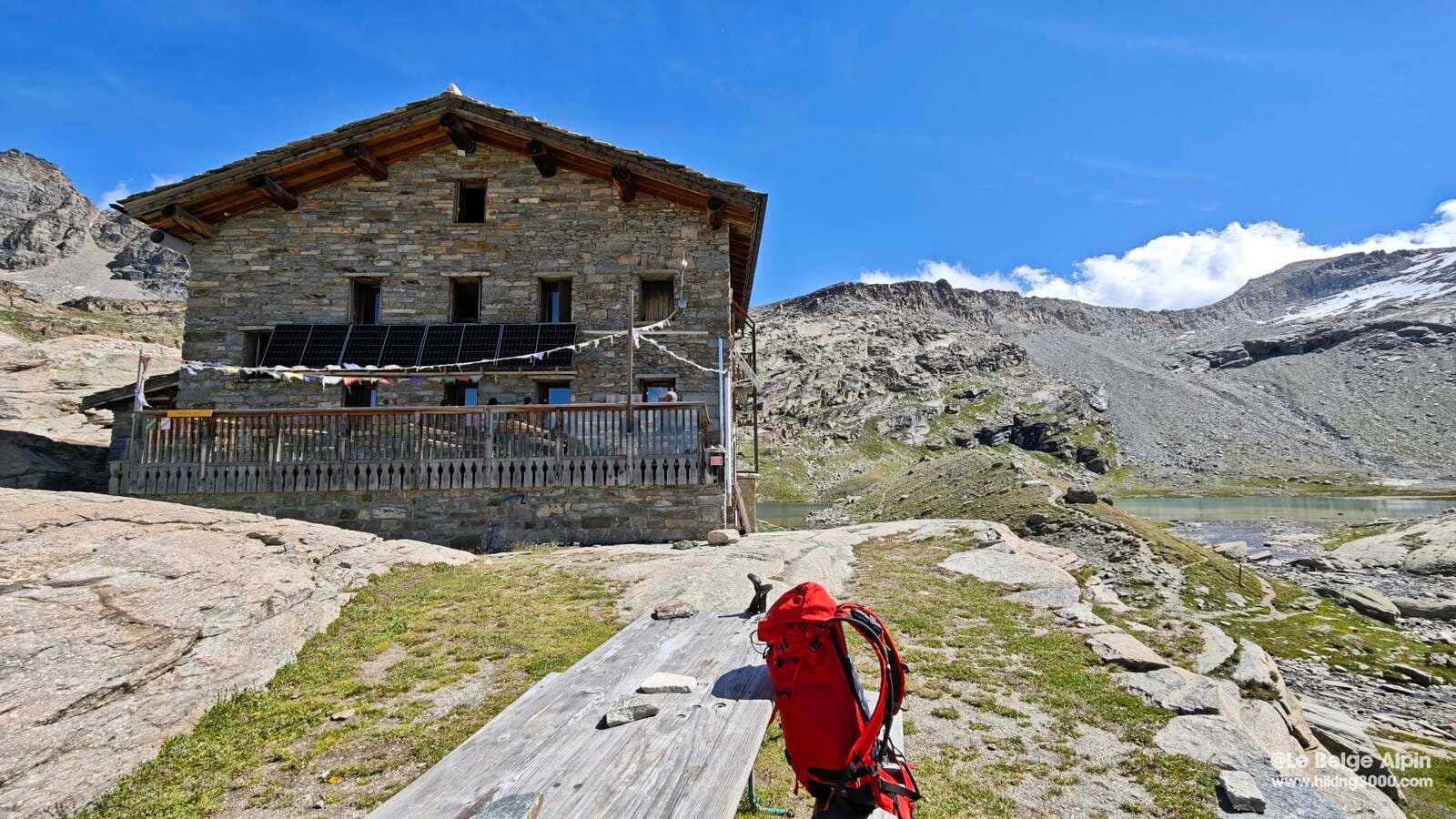
First intermediate target: the Refuge du Carro, perched at 2759 m between Lac Noir and Lac Blanc. It is the highest mountain hut in Savoie, ideal for a night of acclimatization before more ambitious climbs (Albaron, Grande Aiguille Rousse).
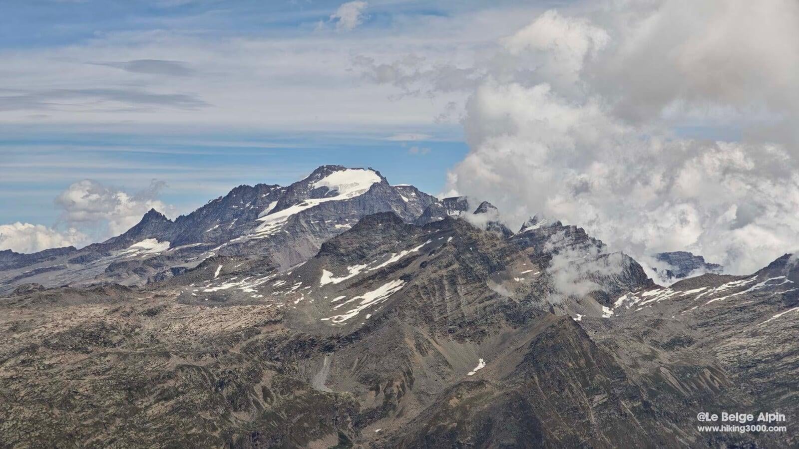
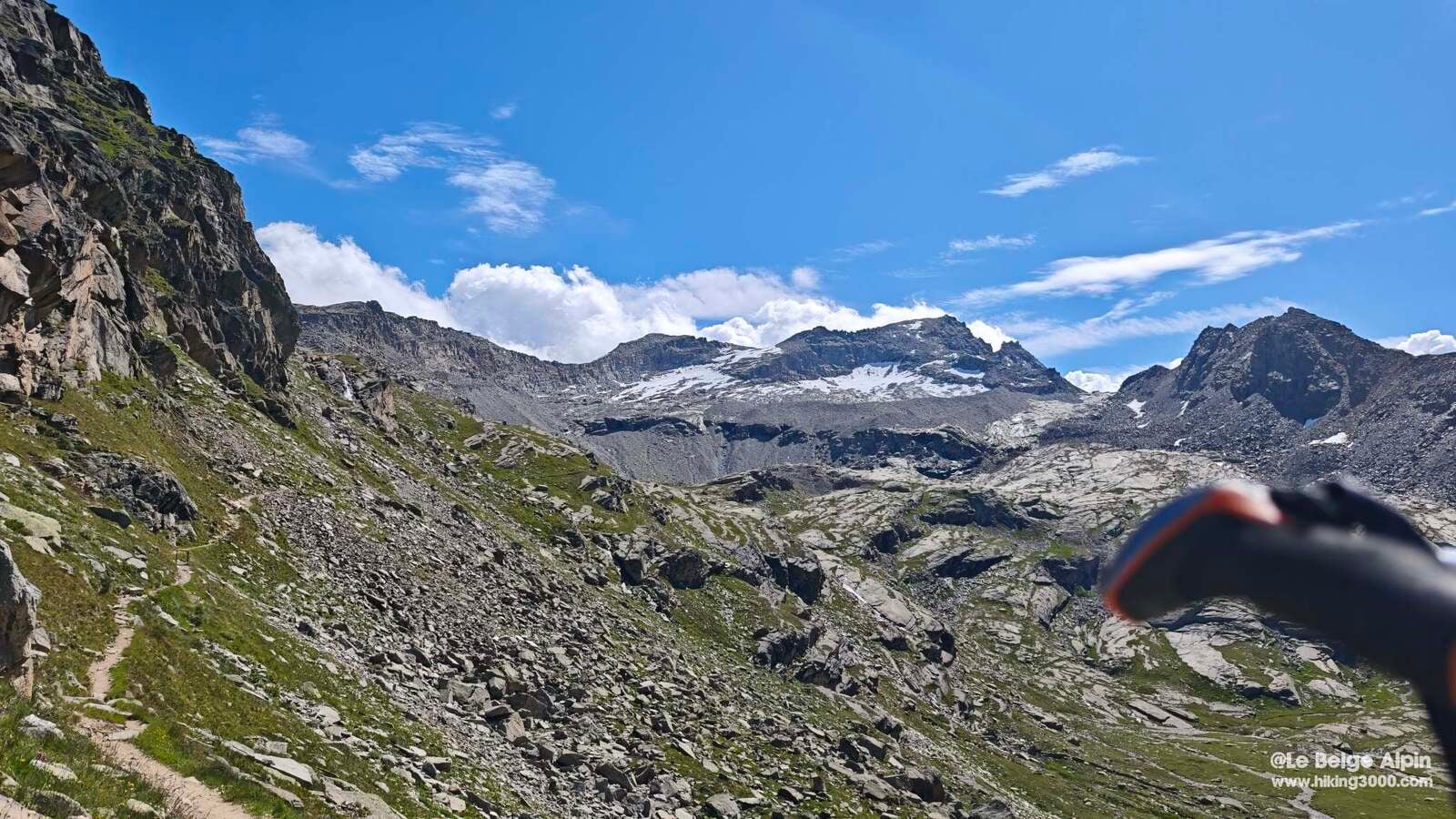
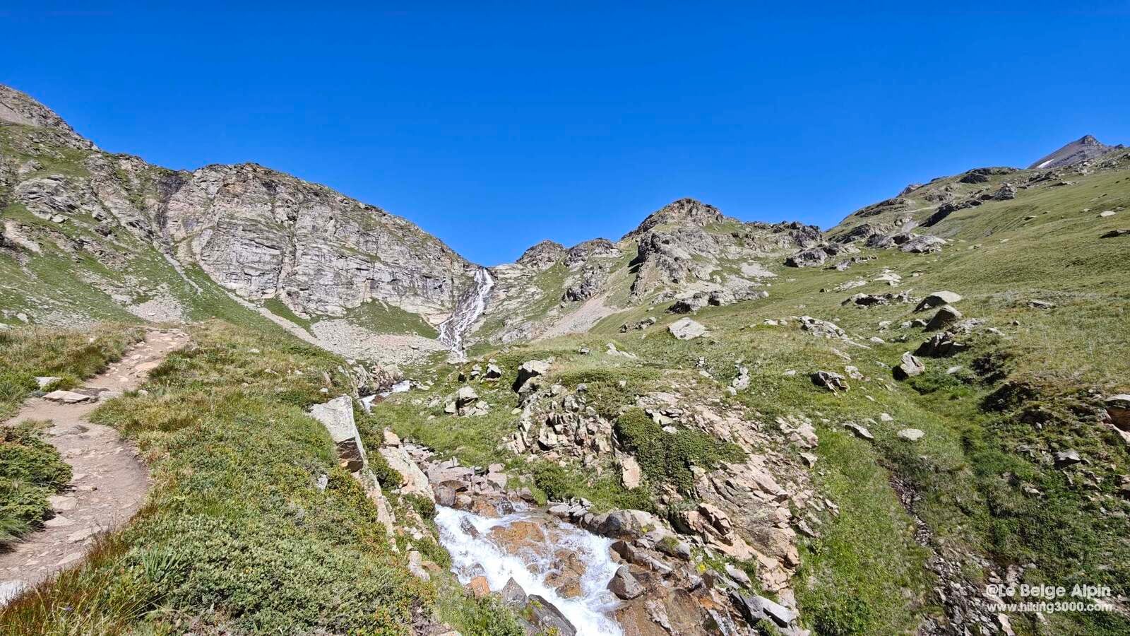
The trail climbs decisively but without traps, you move up through alpine pastures then shift into the mineral zone. The wardens are welcoming, we had a drink and recharged before tackling the rest. The hut offers splendid panoramas over the Albaron glaciers and the Levanna border ridge. On its own it would already be worth the trip.
The final climb to the pass
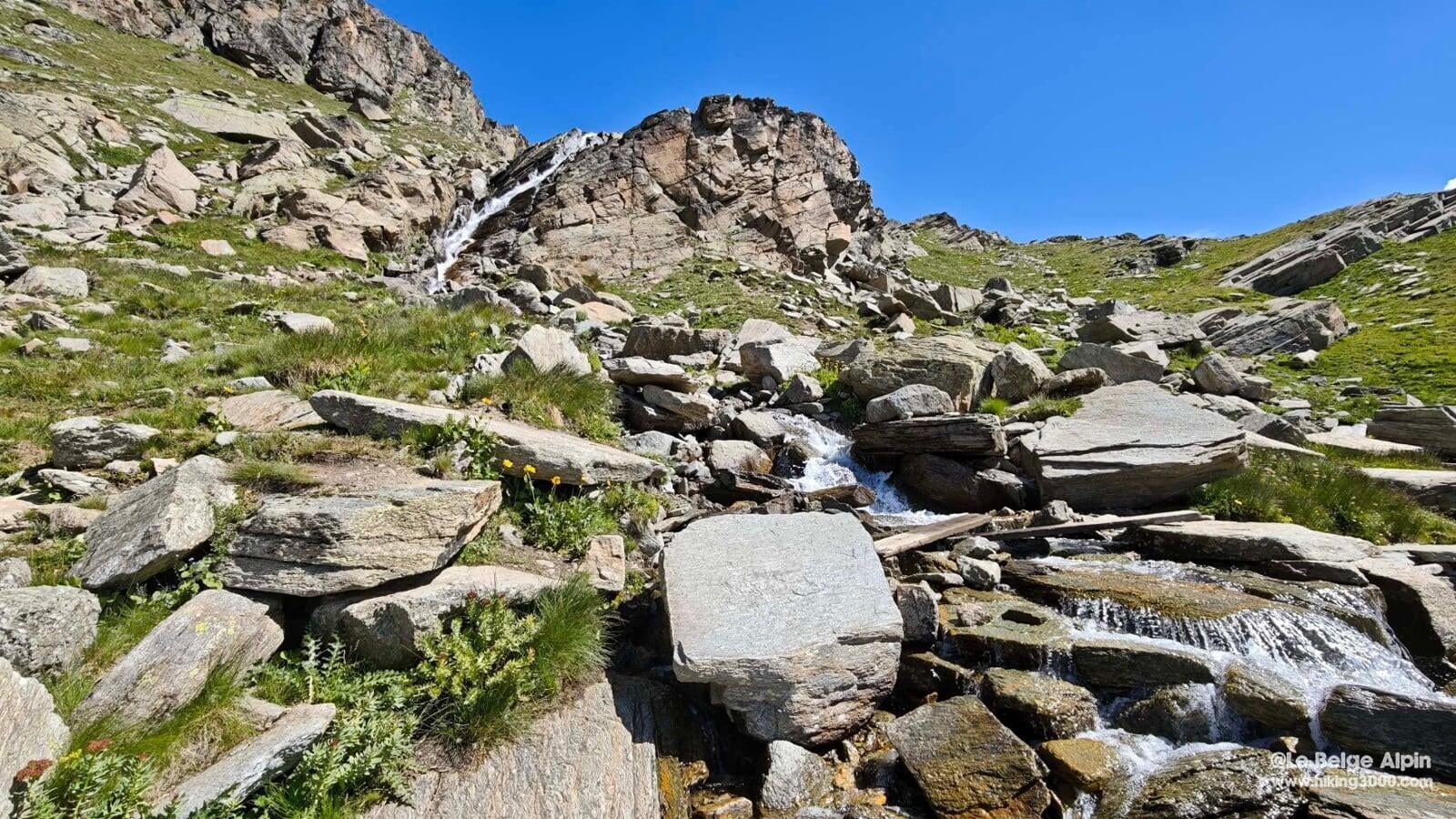
From the hut to the pass, 400 m of gain remain and the scenery flips completely. Unstable scree, shifting moraine: no technical section in the mountaineering sense, but real attention is needed to avoid slips. The trail zigzags, you place your feet methodically.
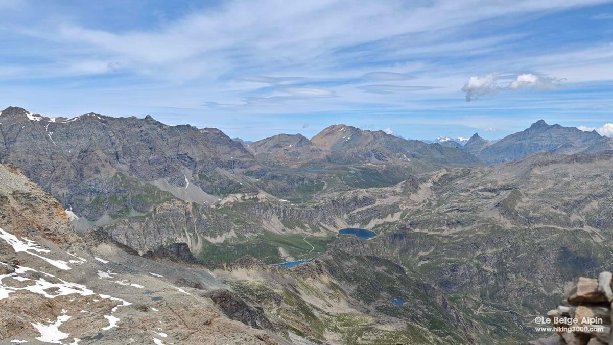
Then the ridge arrives, and the show opens up all at once: Italian panorama toward the Gran Paradiso, a glimpse of Mont Blanc to the north, and on the Maurienne side the park’s glaciers. My partner, taking in the view, said to me:
“You see the Gran Paradiso, okay. But here, we are already in the little paradise.”
I will keep that line.
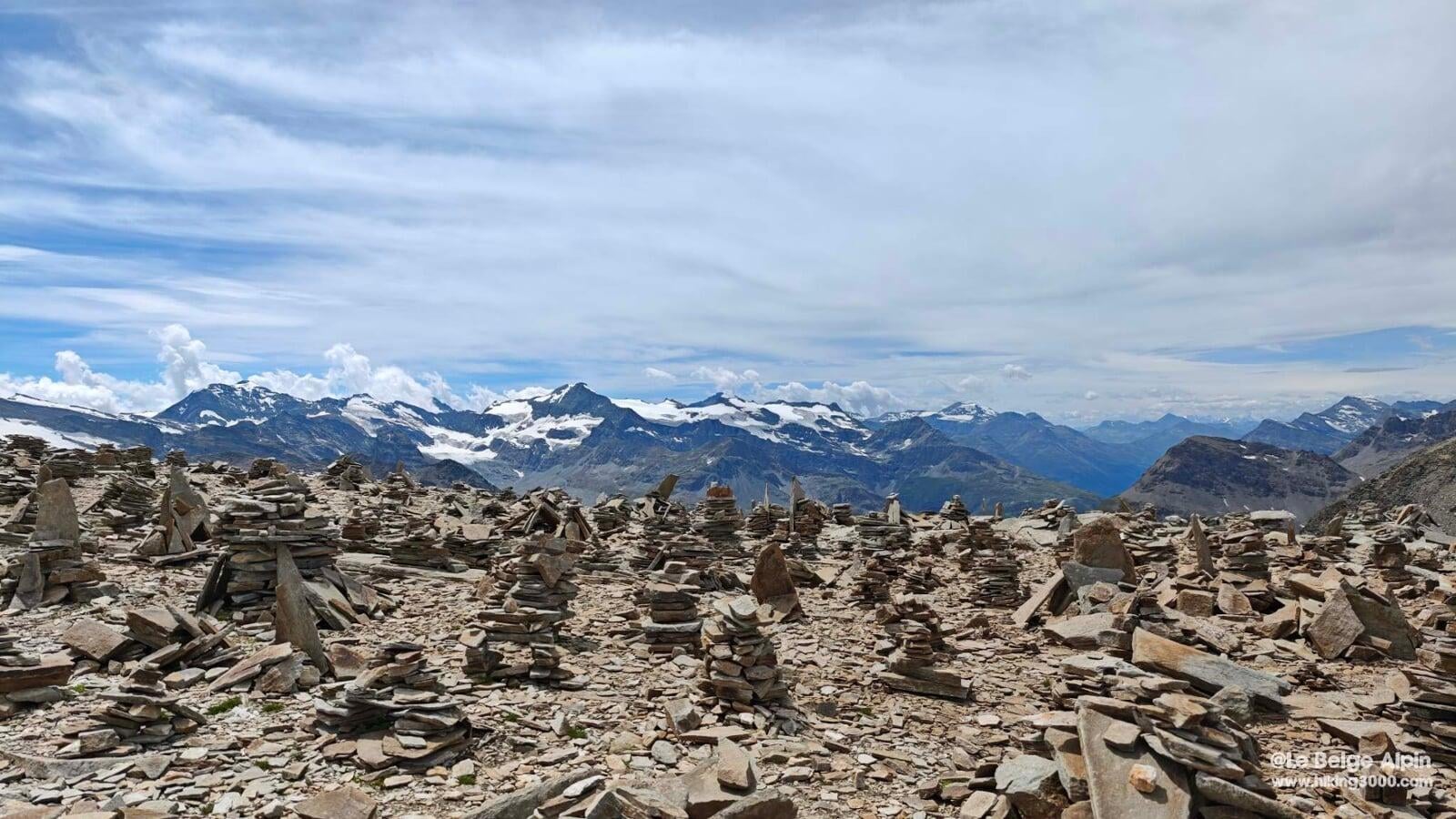
The forest of cairns
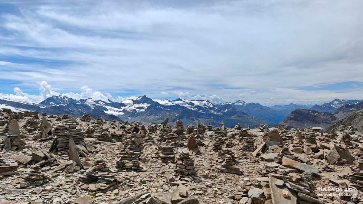

At the pass, the oddity jumps out: hundreds of cairns, some a metre tall, stacked by generations of hikers and shepherds who have crossed this point for centuries. It is not a summit in the classic sense, more a threshold, a cross-border pass planted with a forest of stones, at once compass and collective memory.
We took our time lingering up there, eating a bite, watching the light settle on the Levanna. At 3149 m the constant wind cuts, but the reward is full.
Historical anecdote, the cross-border pass
The Col du Carro was long a strategic crossing between France and Italy, linking the Arc valley to the Val d’Orco. Historically, it was used by Piedmontese shepherds to move their herds, and by smugglers who took advantage of the pass’s isolation.
It is also via this pass that some early-20th-century mountaineers reached the Western Levanna and the Grande Aiguille Rousse, linking the Carro and Evettes huts. Today it remains a symbolic junction between two mountain cultures, marked by those cairns stacked by the thousands.
Practical info
This is not an outing for beginners despite the lack of technical difficulty. 1200 m of gain spread over 19 km out-and-back, altitude at the pass that can sting if you are not acclimatized. Plan on 6h30 to 7h depending on pace and hut stops.
The Italian descent toward Ceresole Reale, via the cables, is another matter entirely: it is a via ferrata with lanyards and harness mandatory. If that is your plan, gear up accordingly and arrange the return logistics (no simple shuttle car between the two valleys).
For conditions, state of passages, late snow cover, Arc water level for crossings, a phone call to the Bonneval-sur-Arc tourist office or to the warden of the Refuge du Carro is more reliable than any online weather service.
Practical info
Starting point
From Bonneval-sur-Arc, continue on the D902 up to the hamlet of l'Ecot and the parking (2036 m, 7 euros per day in summer). Seasonal shuttle available from Bonneval if you prefer to leave the car at the bottom. Marked trail right from the parking.
GPX track
Import the GPS track into your watch or app (Garmin Connect, Komoot, Gaia GPS, Iphigenie...).
Sign in to downloadMountain huts
Refuge du Carro (FFCAM), 2759m
The highest mountain hut in Savoie, perched between Lac Noir and Lac Blanc. Staffed from mid-June to mid-September. Ideal base camp for mountaineers (Albaron, Levanna, Grande Aiguille Rousse).
Tourist office (current conditions)
Office de Tourisme Haute-Maurienne Vanoise, Bonneval-sur-Arc
Le Village, 73480 Bonneval-sur-Arc
Garmin track
Gallery
13 photos, click to enlarge
Video
A few shots from the outing
Weather, Bonneval-sur-Arc
Conditions and forecasts for the itinerary
In the mountains, conditions change fast. A thunderstorm can become dangerous, fog disorients, residual snow slows every step. Before leaving, check the bulletins, plan a stable weather window, and when in doubt, call the tourist office or the local guides office.
Learn to read mountain weather →Questions fréquentes
When is the best time to hike up to the Col du Carro?
+
From July to mid-September. Earlier, lingering snowfields can complicate the pass (3149 m). After mid-September, risk of early snow and the hut closes.
Do you need mountaineering gear?
+
No, not for the pass on the French side. Sturdy hiking boots, poles useful for the descent, helmet recommended in the moraine section. For the Italian descent to Ceresole Reale (via cables), it is a via ferrata: lanyards and harness are mandatory.
Can you stay at the Refuge du Carro without booking?
+
For daytime meals, yes. To sleep, booking is mandatory in high season via the FFCAM website. It is the highest hut in Savoie, very popular in July and August.