
The Col de l'Agnel (3091m) closes off the Val d'Ambin, above Bramans in the Haute-Maurienne, right below Mont d'Ambin. I was aiming for the summit that day, and I stopped at the col: 19.8 km, 1281m of ascent, waterfalls, snowfields and a valley all to myself. One of the finest days of my season, and a lesson I repeat often here: knowing when to turn back is part of the job.
The Col de l’Agnel (3091m) is the wild shoulder that closes off the Val d’Ambin, above Bramans, right below Mont d’Ambin (3378m). That’s where I stopped that day. To be honest, I was aiming for the summit, not the col, but I stopped at the col, and not out of frustration: it was the right call, and the day remains one of the finest of my season. So I’m telling the route as I lived it, summit shelved and col fully savoured.
Hiking3000 is meant to be a site about committing routes. So far I’ve mostly put up hard or very hard hikes, but rarely true committing mountain terrain. A few years ago I’d stumbled on a website listing genuinely serious routes in the Maurienne, and I told myself that was sort of the ultimate goal for mine. Mont d’Ambin was the first on that list. I’d been planning it for two or three years without ever finding the right window, and the Col de l’Agnel, right under the ridge, is its finest antechamber.
A route I’d had my eye on for years
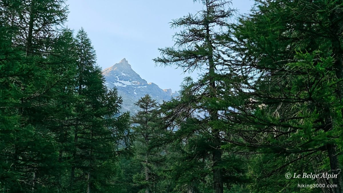
What makes Mont d’Ambin a bit committing is that the summit isn’t a hike: once you leave the Col de l’Agnel, it’s fully off-trail for nearly 300 metres of ascent, and early in the season there’s bound to be hard snow up there. With storms forecast every afternoon, I bivouacked the evening before at the foot of the route, at the Pont d’Ambin, so I could start early and clear the upper section before things turned.
The plan was sound. My body, less so. I’ve been going non-stop for two weeks, I’m 47, I live on the flat plains of Belgium, and when I’m not hiking here I’m out on via ferrata. I never really stop. I felt from the climb that something was off, and that’s a piece of data you can’t override with willpower.
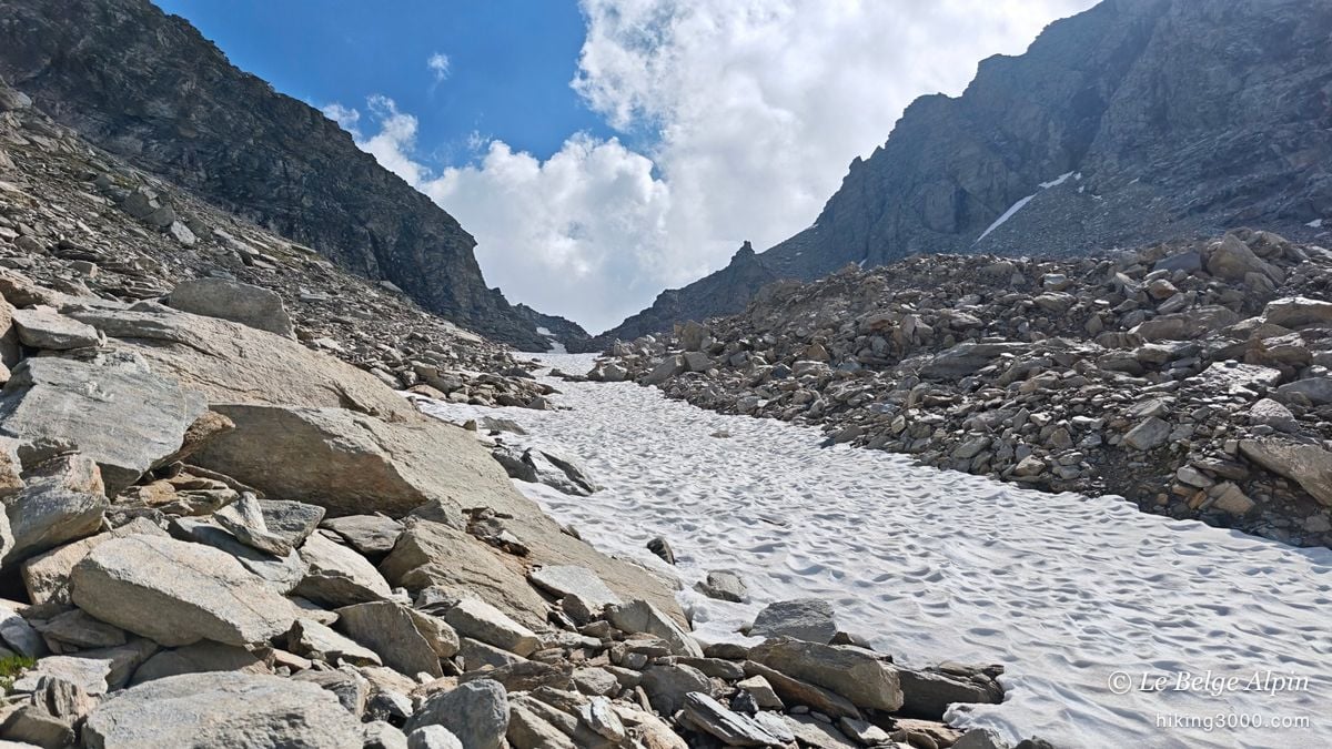
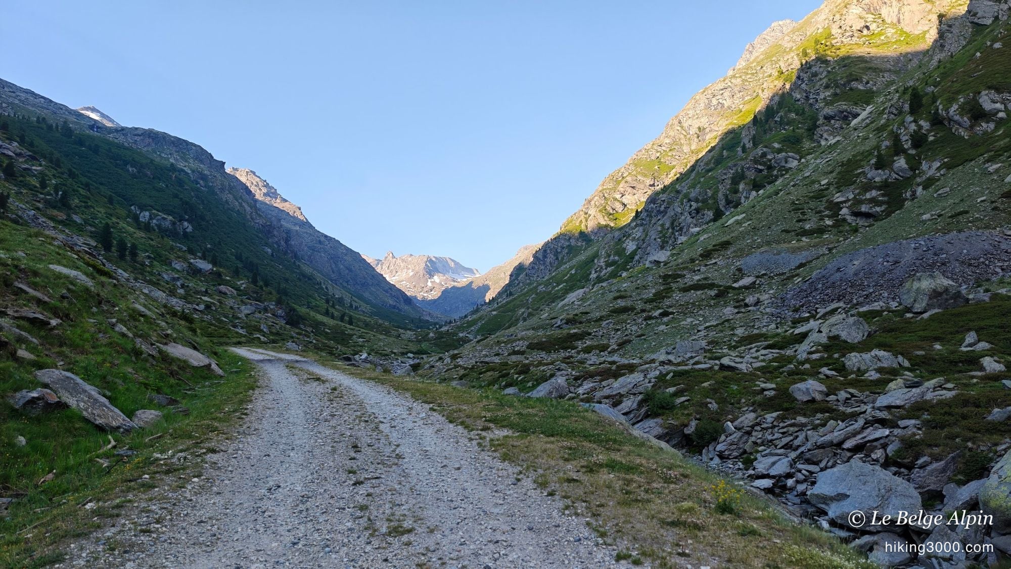
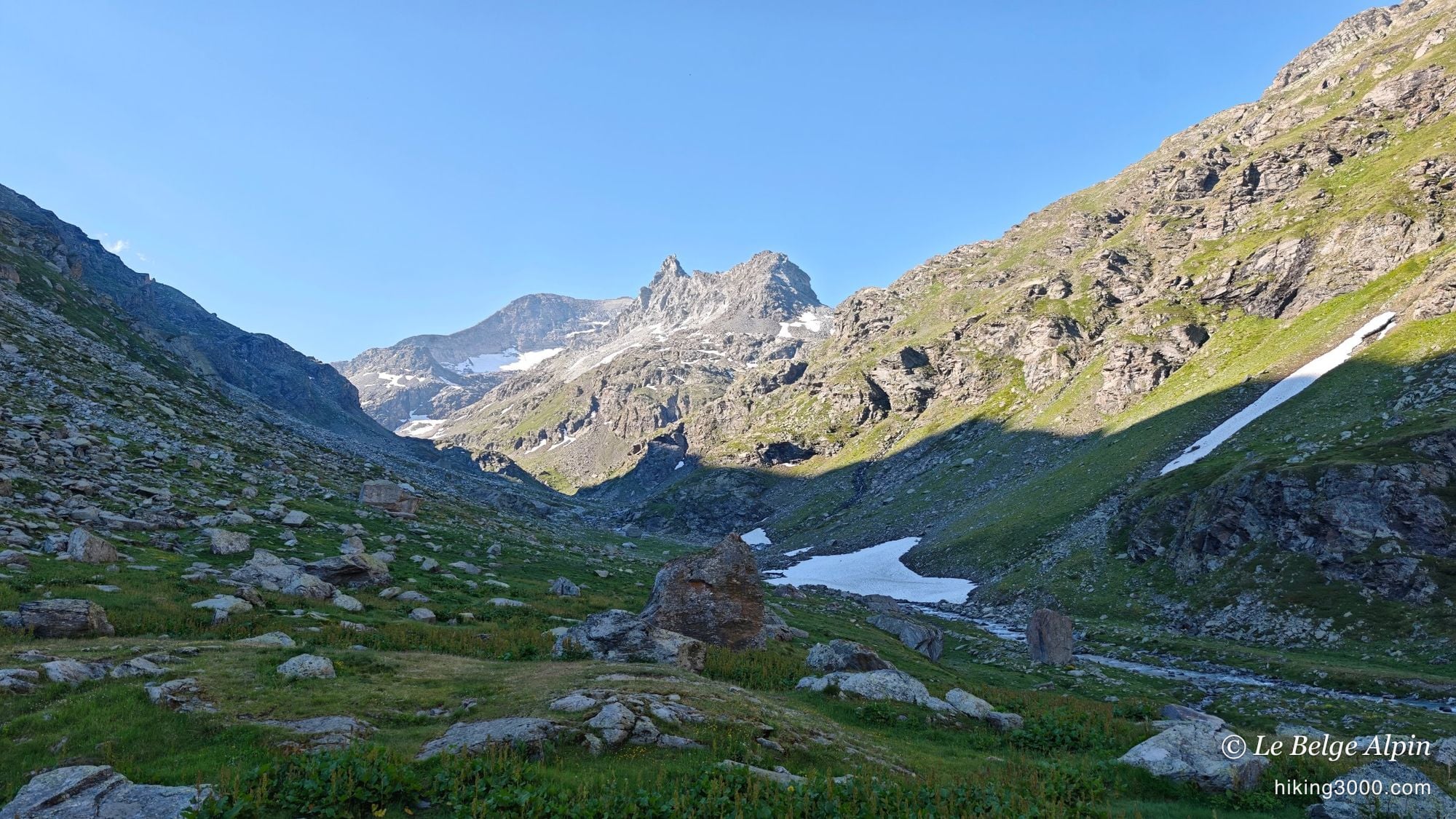
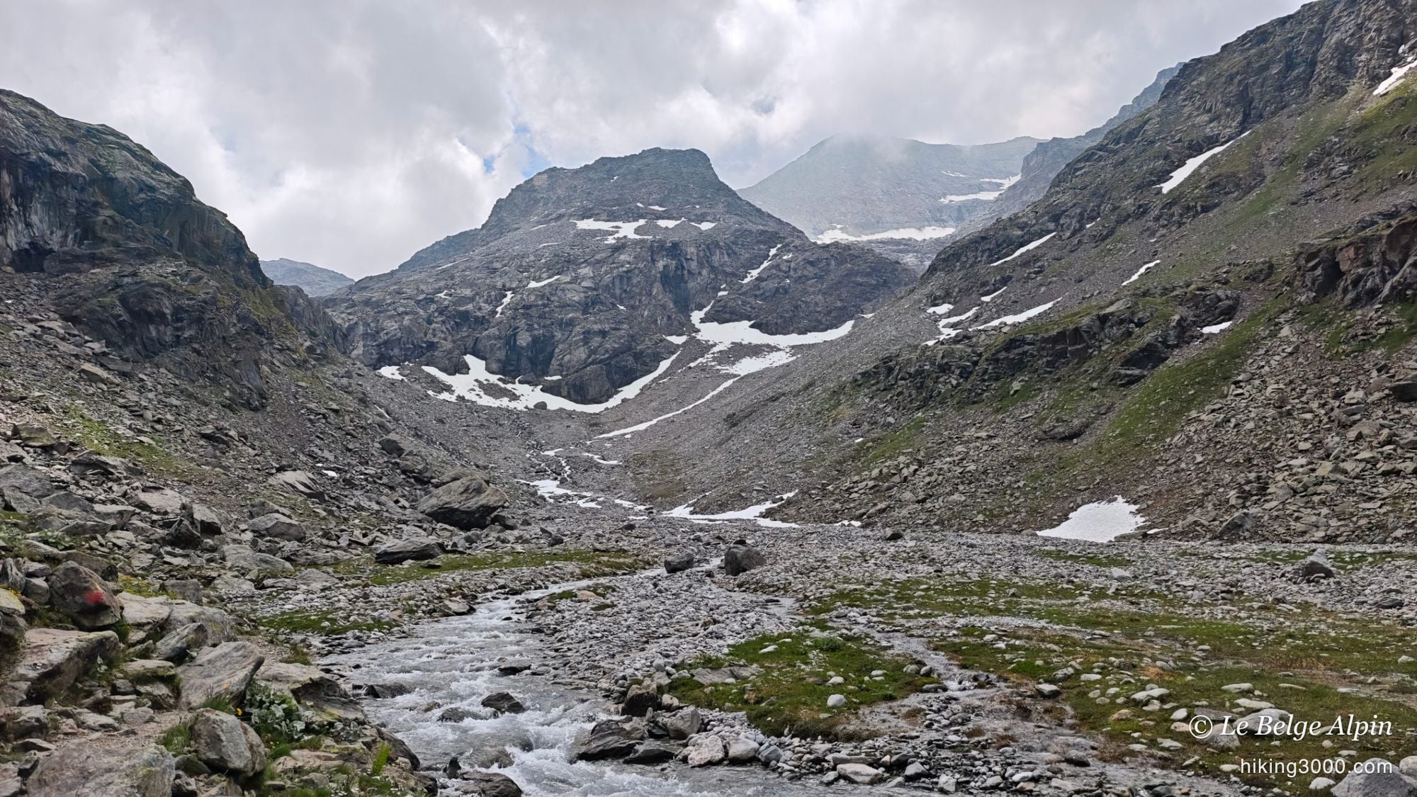
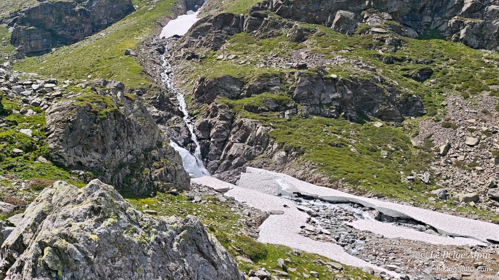
The Val d’Ambin, water and snowfields
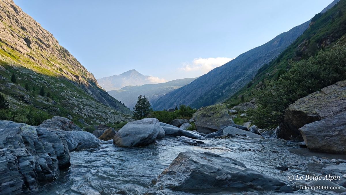

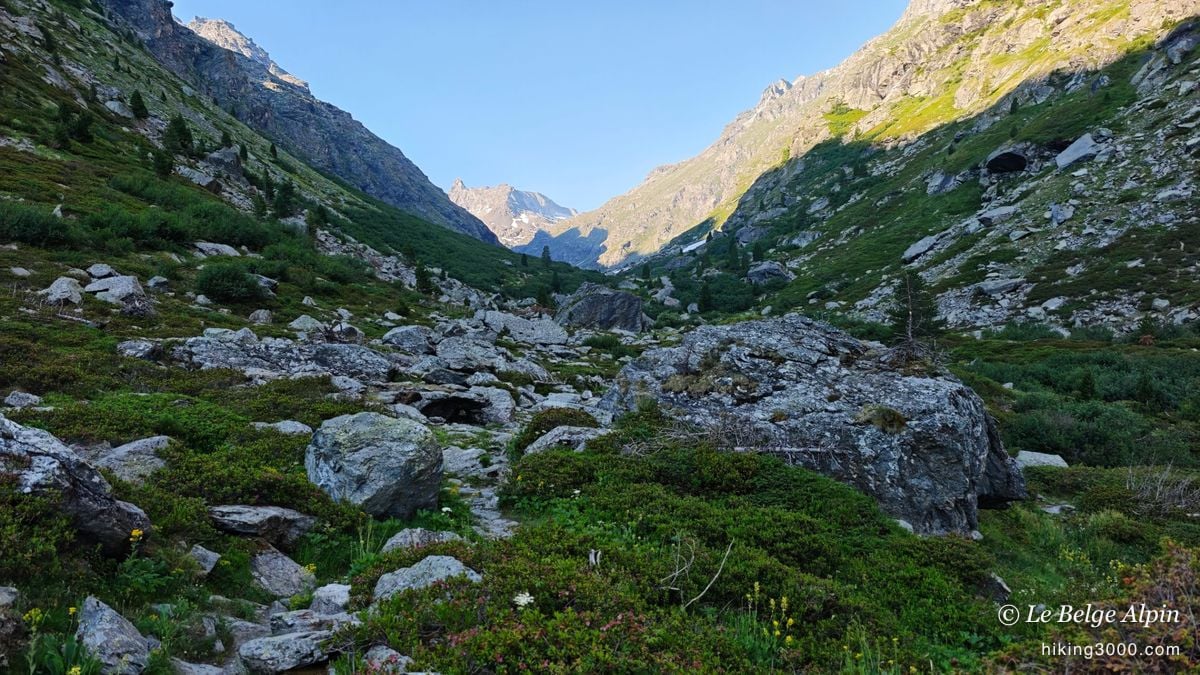
The Val d’Ambin is magnificent, and I choose the word carefully. It reminds me of the Chavière valley on the Pralognan side, in the Vanoise: water running everywhere, waterfalls, and still plenty of snowfields at this time of year. As far as the hut, it’s straightforward, you just follow a good path along the torrent.
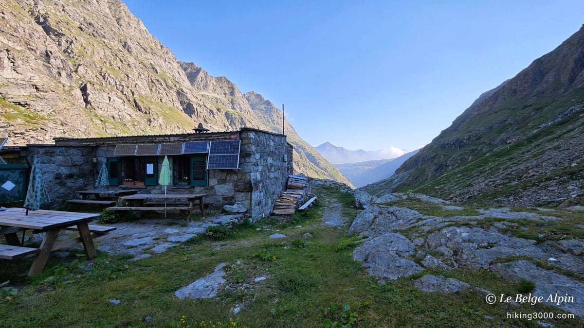
The Ambin hut (2270m) is exactly the kind of place I stand up for. A small stone mountain refuge, with its tables outside and its solar panels, not yet turned into a high-altitude hotel. Because mountains have become fashionable, and a lot of the big Alpine huts are permanently full, they’ve turned into factories. This one is something else, and I genuinely enjoyed passing through.

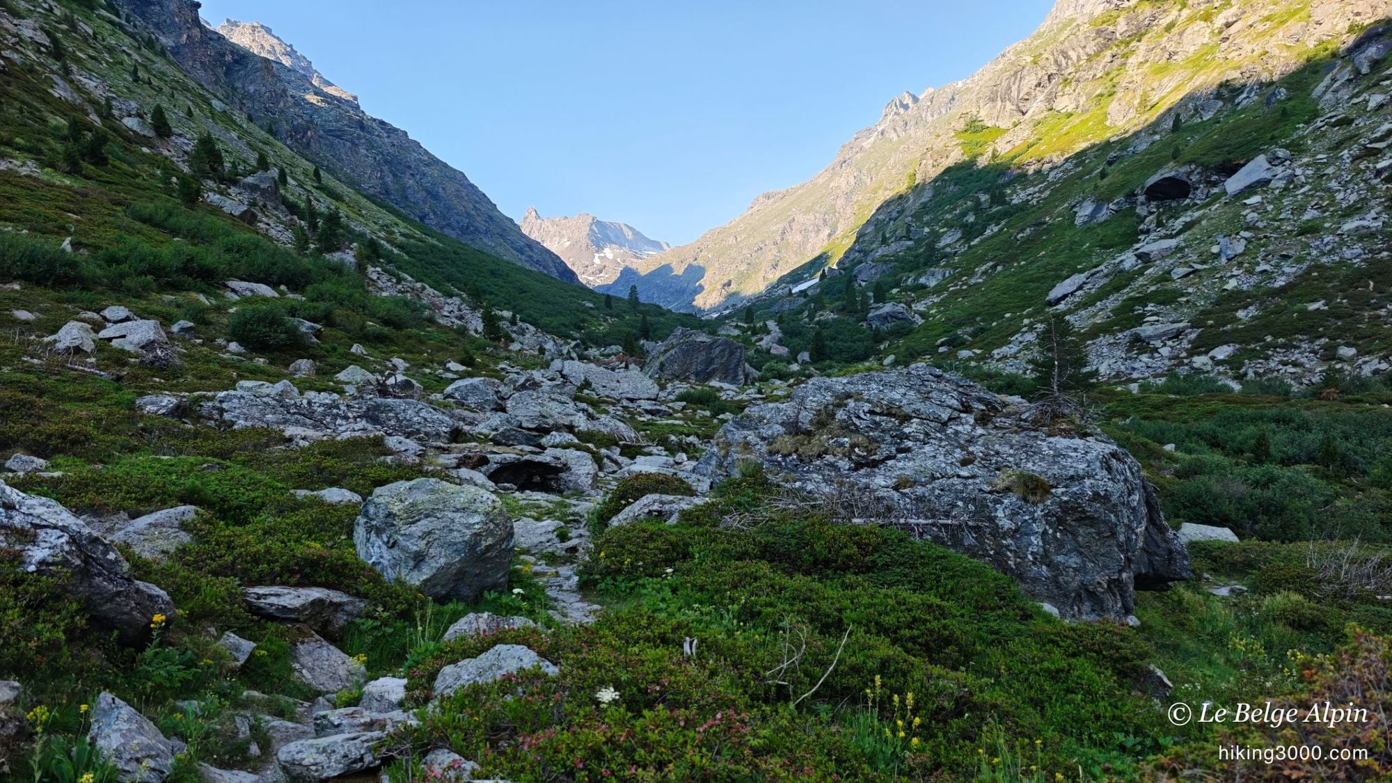
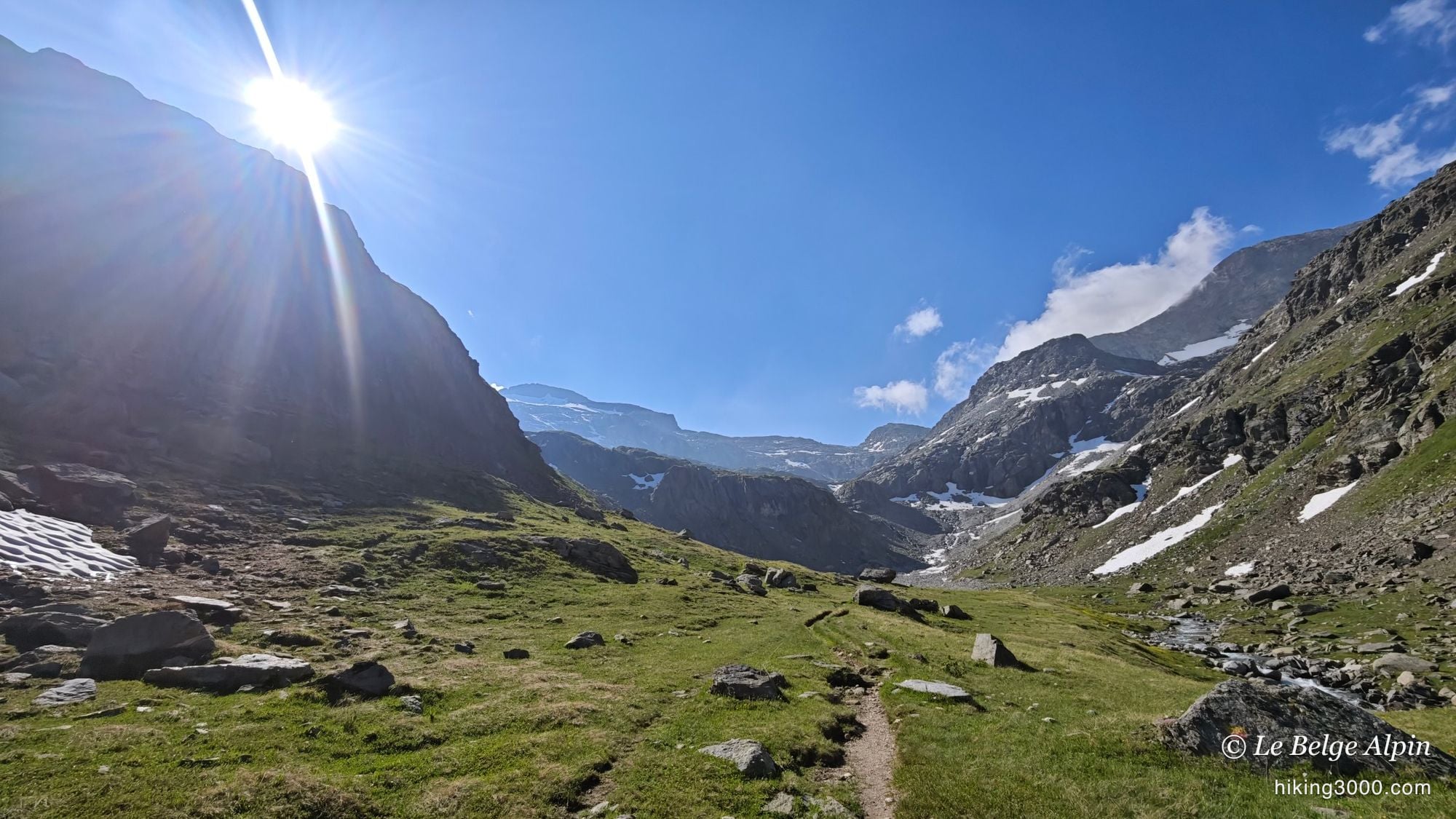
Past the hut, you keep climbing through the valley, still on a relatively simple path. It’s a proper glacial valley to walk up, wide, with the peaks slowly closing in. If you’re new to this kind of ground, take a look at my notes on grading before aiming for the top.
Choosing the hard way
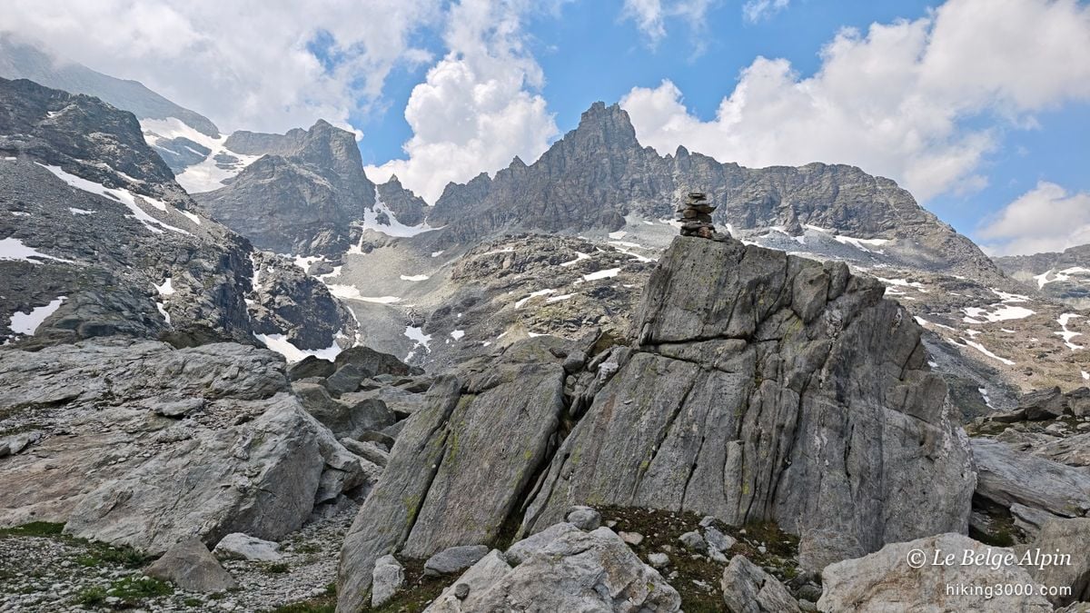
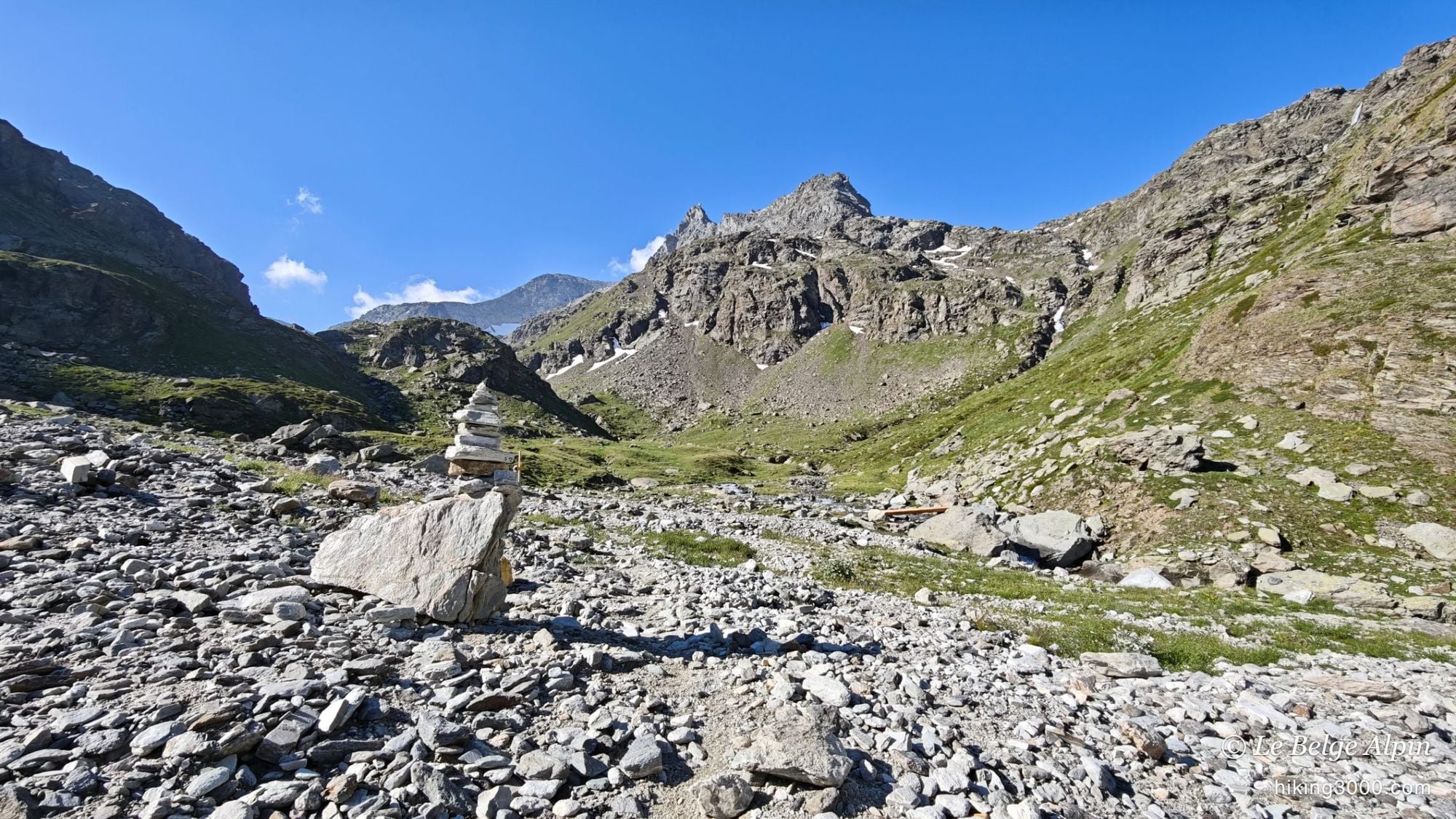
At the head of the valley, two options for the upper section. Either you carry straight on to skirt a peak and reach the Lac d’Ambin (2683m), a variant that passes lower over the Col d’Ambin (2899m): that’s the easy way. Or you head left, straight into the moraine, toward the Col de l’Agnel: that’s the hard way, and the most direct one below the summit. I took the moraine.
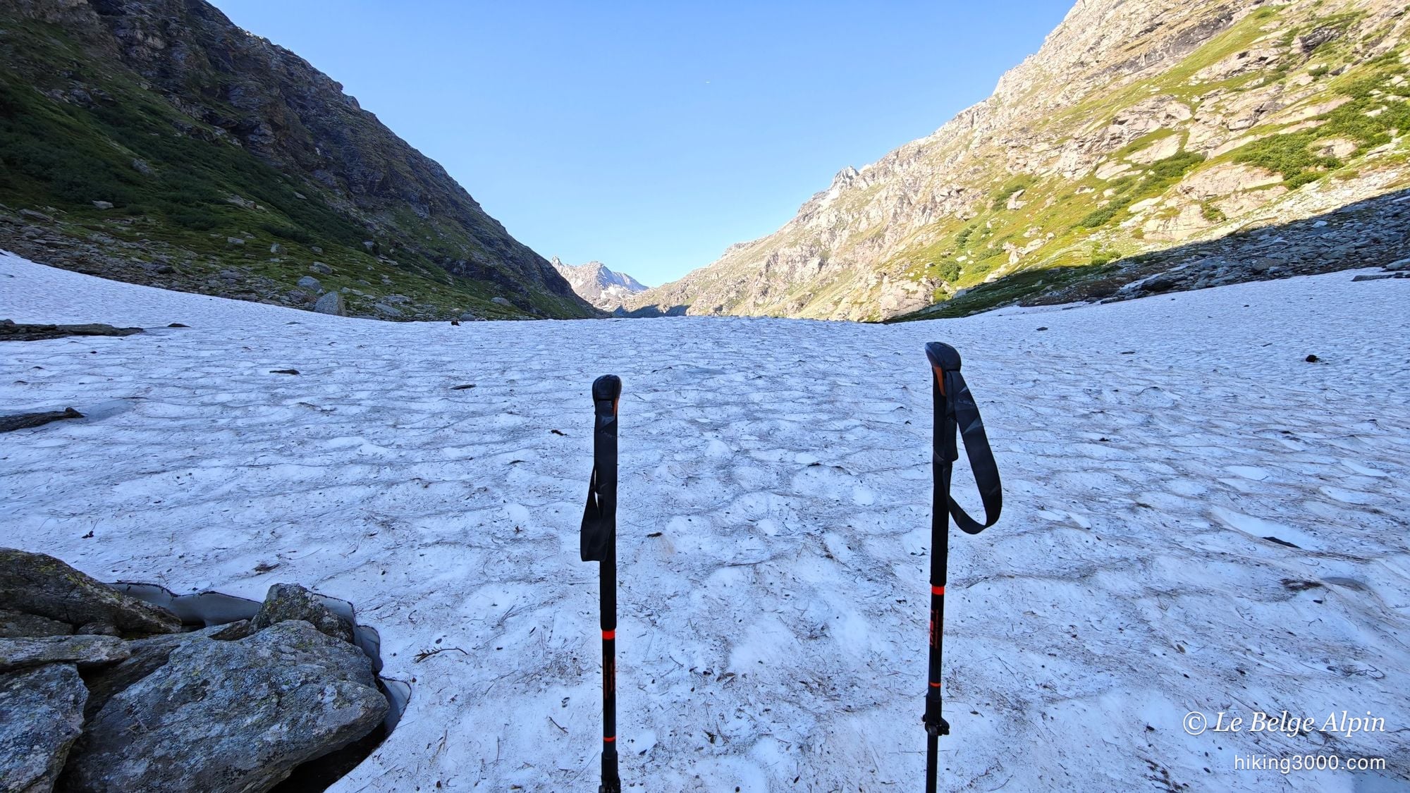
A bit like at the Ouille Allegra two days earlier, the faint paths aren’t marked and there’s not much traffic. You navigate by cairns as best you can, and it climbs steeply through the scree. There are snowfields you can either skirt or climb directly, with no real danger as long as the snow isn’t iced over. That’s where the outing tips over to the committing side: no more waymarks, bare rock, and the feeling of climbing into a place where you’re entirely alone.
The fog, and the turnaround
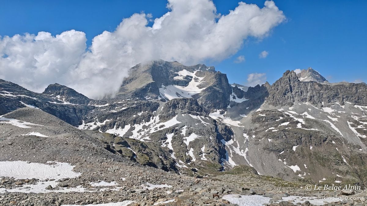
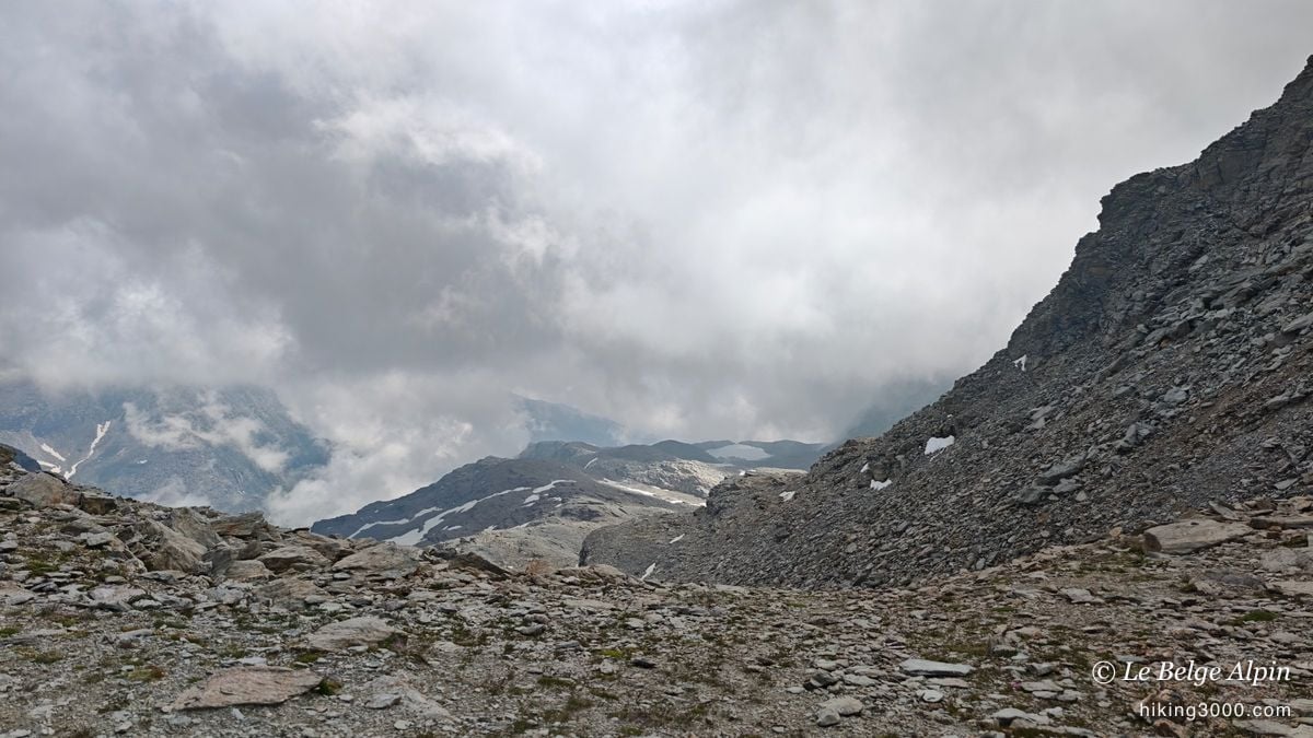
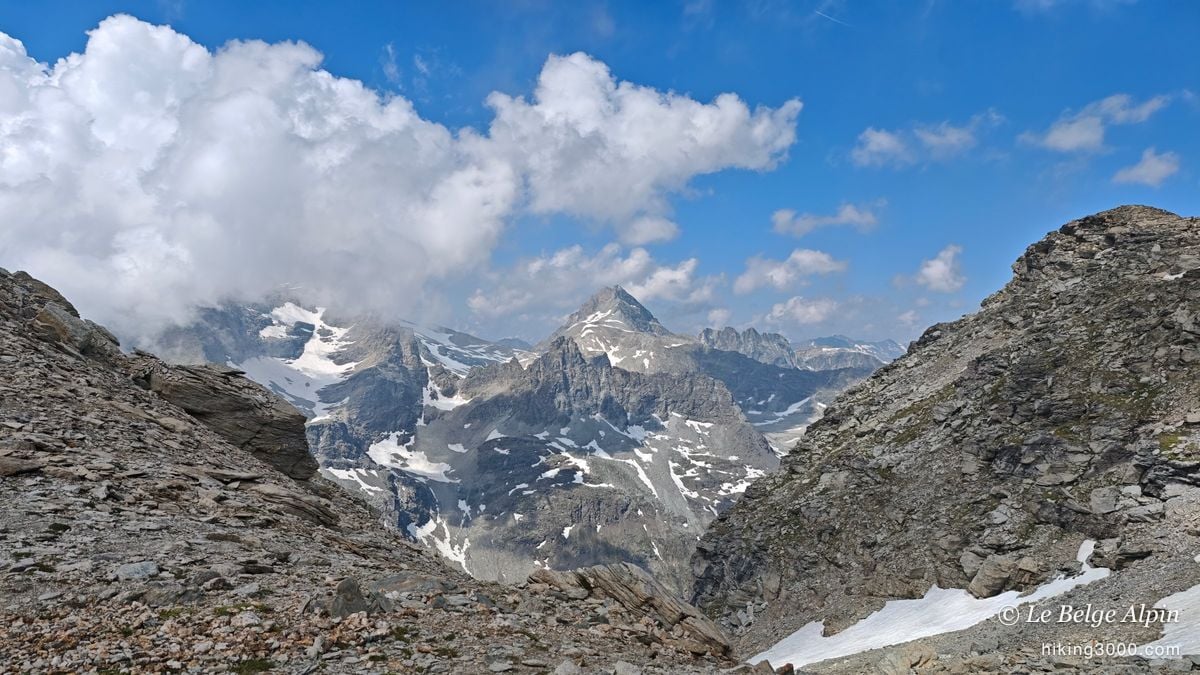
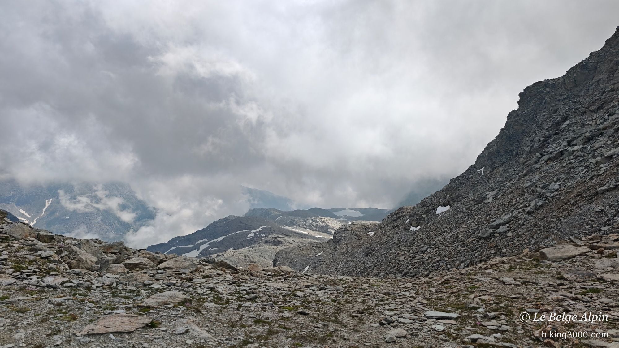
At the Col de l’Agnel, the atmosphere is superb: high mountains all around, a complete change of scenery. But the big cumulus clouds were climbing the valleys, and the summit suddenly disappeared into the fog. I did the maths: the accumulated fatigue, the summit smothered, a mountain I don’t know, and a final stretch in full snow and pure navigation.
Knowing when to turn back is part of being a mountaineer, it isn’t a failure. It’s one of the points I keep making in my preparation articles. So for once, I applied it to myself: I gave up the summit and stayed at the col. The mountain will always be there. Before taking on this kind of route, learn to read a sky on the turn: I cover it in my weather notes.
I still took the time to grab a few photos at the right moment, between two banks of cloud. And honestly, for the Val d’Ambin and that climb alone, the day was well worth the trip.
Coming down slowly, and a chamois

The descent confirmed what I’d felt on the way up: I’d asked too much of my body. Normally I come down fast. This time my legs couldn’t back me up, so I came down slowly, carefully, which almost never happens to me. No matter: there was no one to hurry me along.
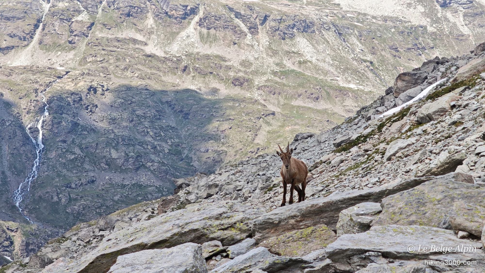
And then there was the chamois. Perched on the ridge, calm, with the whole valley dropping more than a thousand metres behind it. You can’t order up these encounters, and they’re often worth as much as a summit. That’s another reason I go up.
All told, two days of rest were in order before heading out again. I still have four other big committing routes on my Maurienne list. I don’t know how many I’ll attempt this year, because I have a lot of work back in Belgium and I’m not sure I’ll be able to stay long in the mountains. But there are still a few things I care about up there before I pack up.
Practical information
This isn’t an outing for beginners, even if the lower part is easy. The Col de l’Agnel (3091m) is reached from Bramans, in the Haute-Maurienne, via the Val d’Ambin: a long day of 19.8 km and 1281m of ascent, with Mont d’Ambin (3378m) right above for anyone who wants to push on to the summit. Allow around 7h round-trip depending on your pace and breaks, knowing my legs were heavy that day. The Ambin hut (2270m) is the central waypoint of the valley, reached on a simple path before the ground turns rocky, and it makes an ideal place to split the route or to start for the summit the next morning.
The real business of this route is up high: steep cairned moraine, late snowfields and, for the summit, an off-trail section exposed to snow early in the season. In June, set out knowing the conditions may stop you at the Col de l’Agnel, and accept that in advance. For real-time conditions, a phone call to the Haute-Maurienne Vanoise Tourist Office or the hut beats any app.
And if you like these quiet border 3000ers of the Maurienne, take a look at the Ouille Allegra or the Col du Carro, wild outings in the same spirit, right next door.
Practical info
Starting point
From Modane, reach Bramans (part of Val-Cenis), then take the narrow D100 road climbing toward Le Planay and the Pont d'Ambin. Leave the car around 1870m, at the start of the Val d'Ambin trail. The road is narrow and ends as a track: come up early, parking spaces are limited in summer. The path to the hut is wide and well marked, things only get tricky higher in the valley.
GPX track
Import the GPS track into your watch or app (Garmin Connect, Komoot, Gaia GPS, Iphigenie...).
Sign in to downloadMountain huts
Refuge d'Ambin, 2270m
Small mountain hut, staffed in summer, on the Val d'Ambin trail. A perfect stop to split the day or to set off for Mont d'Ambin the next morning while it's cool. Booking advised.
Tourist office (current conditions)
Haute-Maurienne Vanoise Tourist Office, Val-Cenis branch
Bramans, 73500 Val-Cenis
Garmin track
Gallery
17 photos, click to enlarge


Weather, Bramans
Conditions and forecasts for the itinerary
In the mountains, conditions change fast. A thunderstorm can become dangerous, fog disorients, residual snow slows every step. Before leaving, check the bulletins, plan a stable weather window, and when in doubt, call the tourist office or the local guides office.
Learn to read mountain weather →Questions fréquentes
What's the difference between the Col de l'Agnel and Mont d'Ambin?
+
Mont d'Ambin (3378m) is the summit, the high point of the massif, reached on off-trail terrain from the Col de l'Agnel (3091m). That col is the shoulder that opens onto the final ridge. You can perfectly well aim for the col alone: it's already a big mountain day, and the switch to rocky terrain is enough to give you that high-altitude feel. That's exactly where I turned back that day. Not to be confused with the lower Col d'Ambin (2899m), reached via the Lac d'Ambin variant.
When is the best time for the Val d'Ambin and Mont d'Ambin?
+
From July to September. In late June, as I did, there's still a lot of hard snow high in the valley and on the approach to the col, which complicates navigation and makes the snowfields treacherous in the morning. The further into summer you go, the clearer the path becomes and the safer the terrain.
Is Mont d'Ambin a simple hike?
+
No. As far as the Ambin hut (2270m), it's a fine, accessible walk. But the upper valley, the moraine and above all the roughly 300 metres of off-trail ground between the col and the summit are committing hiking, even easy mountaineering early in the season with snow. Map, GPS, a sense of direction and good conditions are all required.
Is there a hut on the route?
+
Yes, the Ambin hut at 2270m, staffed in summer. It's a friendly little mountain refuge, about 1h30 of walking from the car park. Many people stop there for the day. For the summit, sleeping at the hut the night before lets you tackle the upper section early, before the afternoon storms build, which is the rule in summer.
When should you turn back in the mountains?
+
When the balance of evidence tips the wrong way: real fatigue, weather turning, summit in the fog, unfamiliar ground and uncertain snow. That day, all those signals lined up at the col. Turning back isn't a failure, it's a decision. The mountain will still be there next time.