
My first 3000er of the season, in the Haute-Maurienne above Bessans. The Ouille Allegra (3130m), a 13.8 km loop with 1329m of ascent, deserted alpine pastures, unapologetic off-trail and a final stretch of pure navigation. A summit where you meet no one.
Here is my first 3000er of the season, and I am pretty pleased. I had been avoiding the Haute-Maurienne until now, because a lot of snow was still lying around this early in the season. But with the heat of the last few days, it has melted well, so I went back to my favourite corner. The Haute-Maurienne is a place that means a lot to me, so much that I would happily leave more than my gear up there: I would gladly settle my whole life here. That’s a bit complicated for now, but anyway.
I started exploring the area two or three years ago, and there are summits everywhere, plenty of 3000ers and genuinely lovely things to do, some of them quite committing. The Ouille Allegra was one of the outings I had spotted a while back. Last night I told myself: one day I’ll do it. And there we go, I planned it and we went up. It is a fine climb, 3130 metres, with a start around 1800m, so 1329m of ascent over the day. Not for every pair of boots.
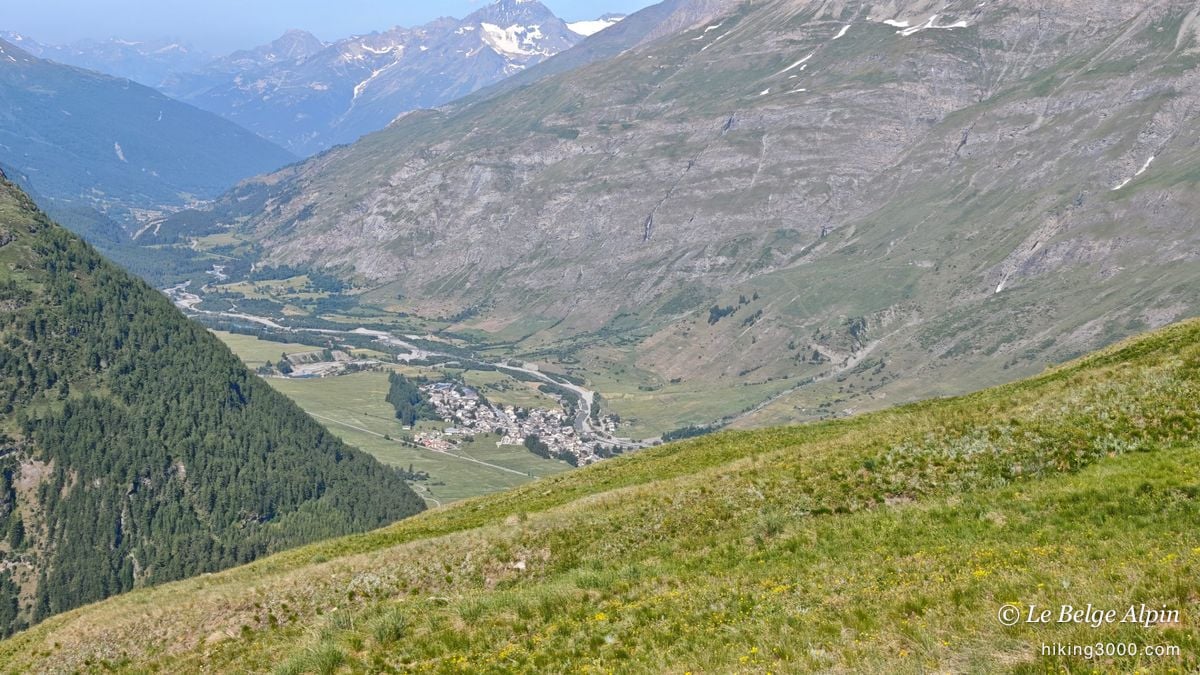
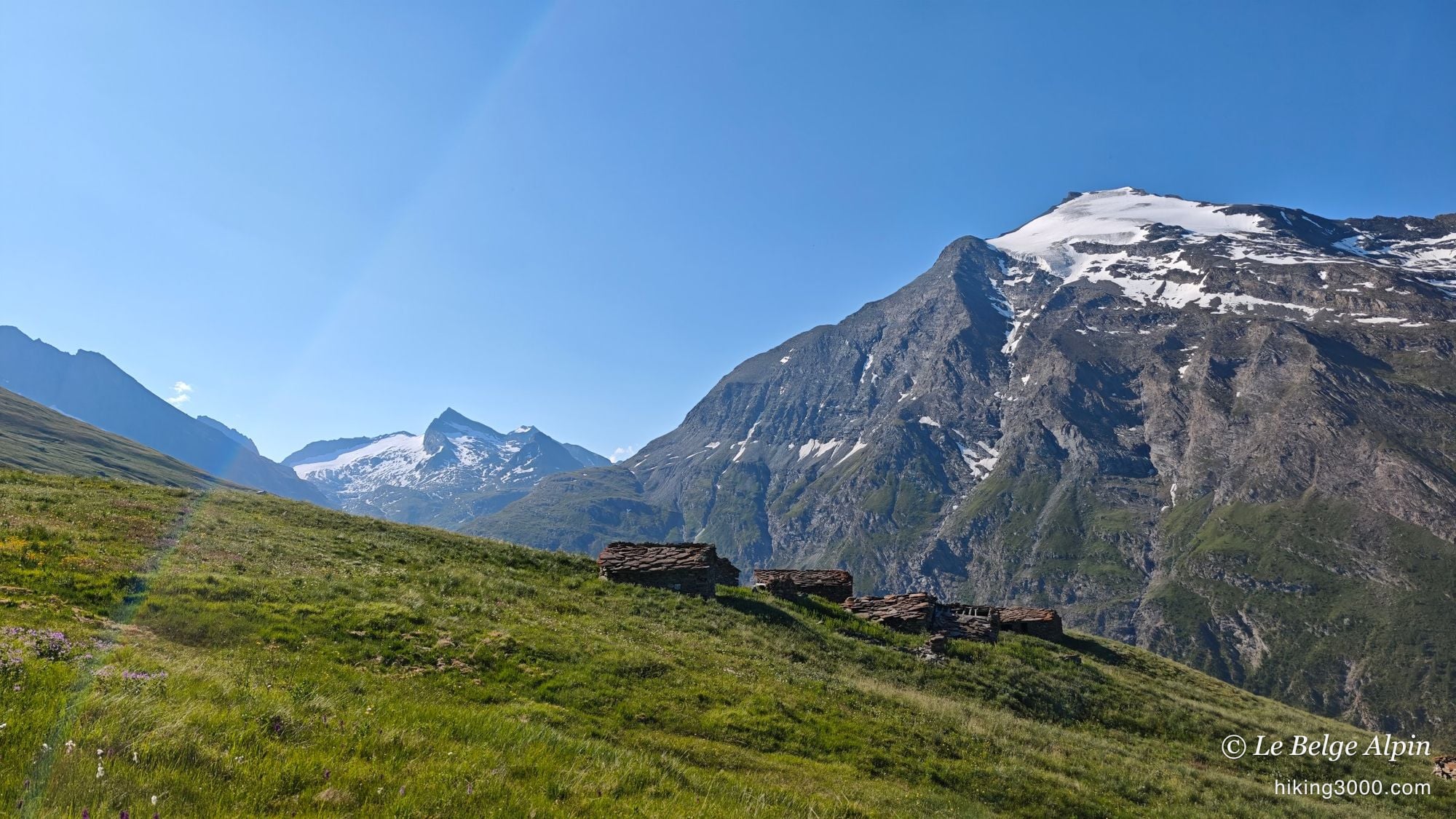
Alpine pastures, and a detour to dodge the guard dogs
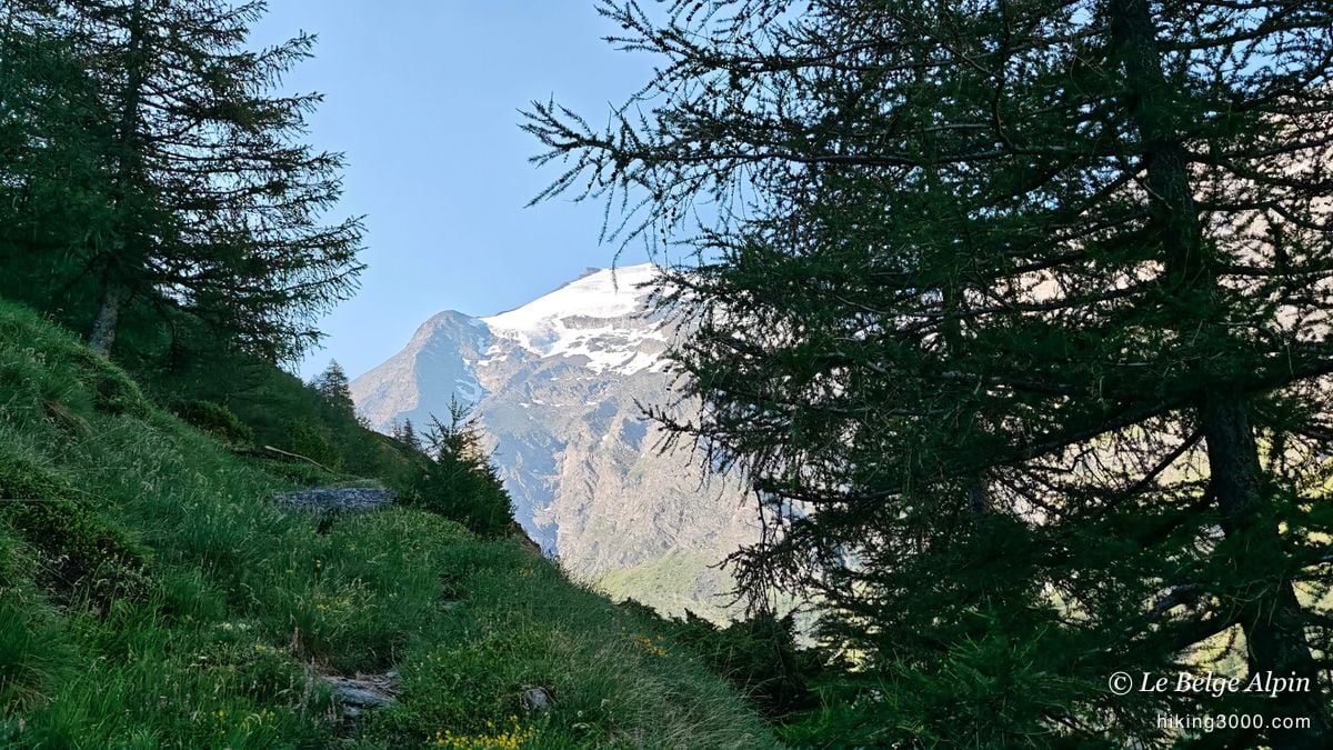
The start is simple: driveable shepherd roads, it goes by easily. You can even cut across faint tracks that climb a bit harder, but nothing nasty. Then you reach the alpine pastures, and there I found a flock guarded by four or five patous, the big Pyrenean mountain dogs. I chose not to push my luck: I went completely off-trail to skirt around them.
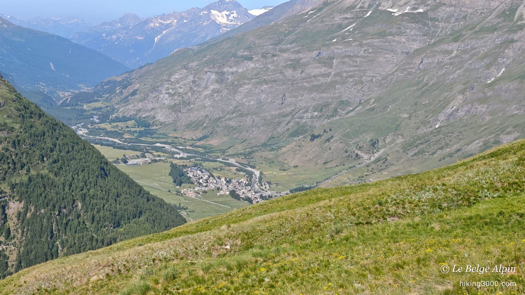
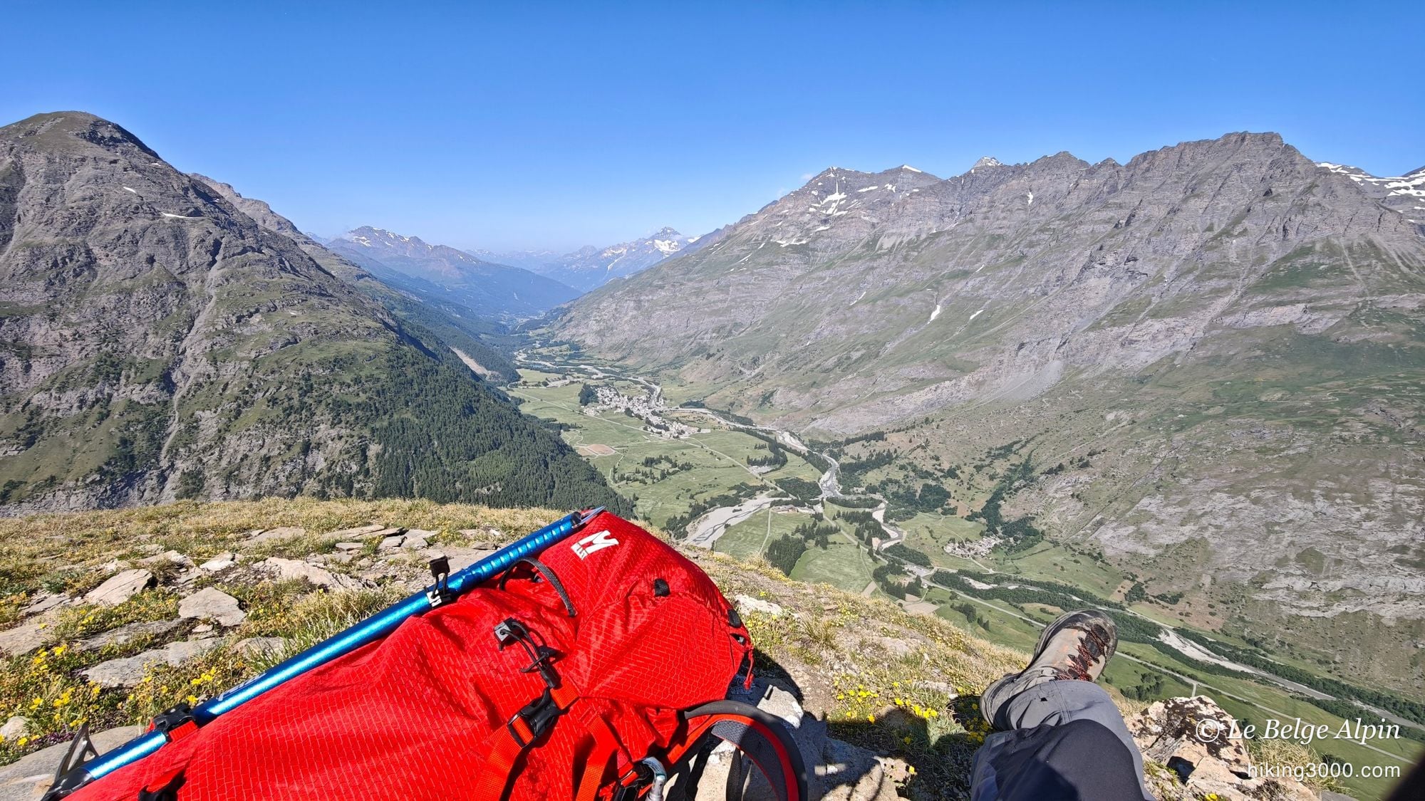
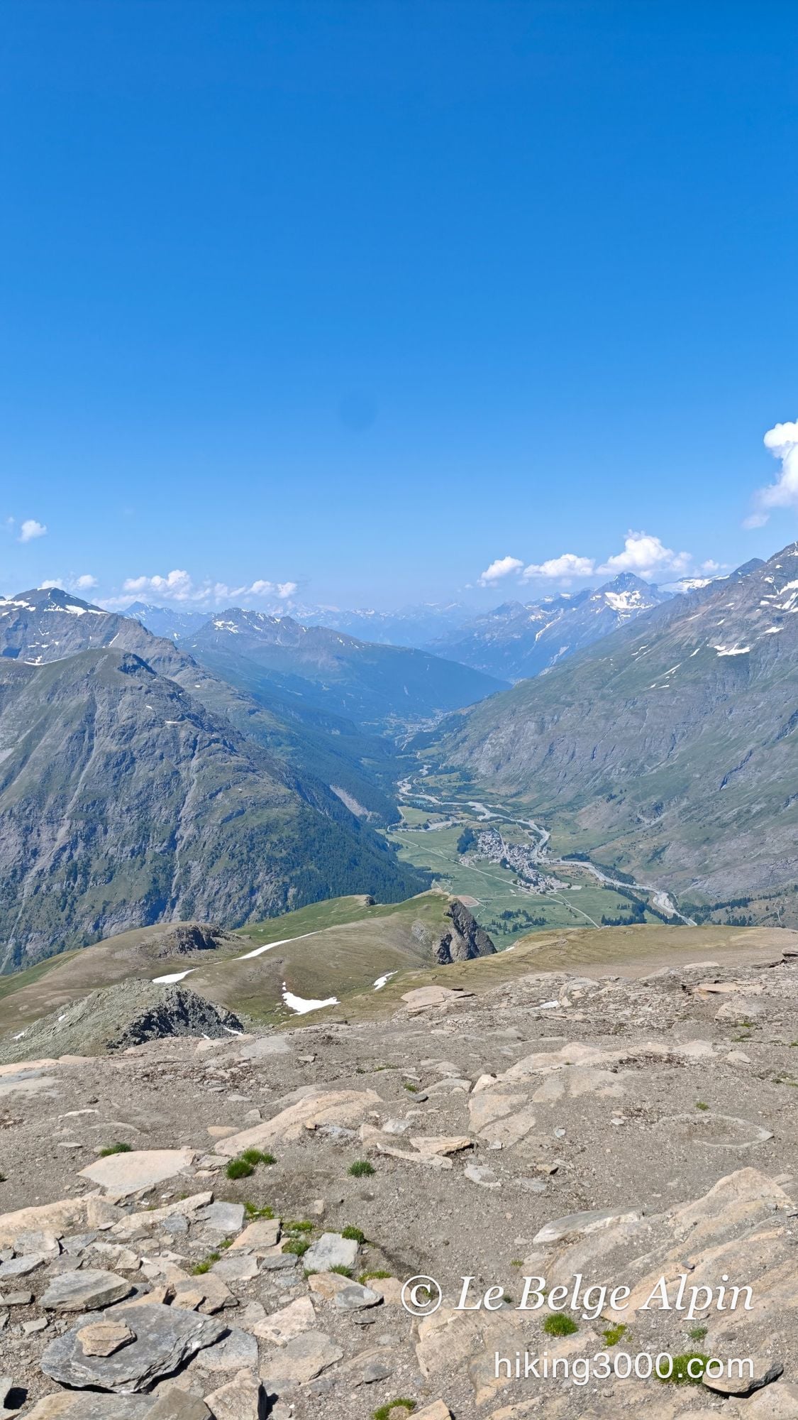
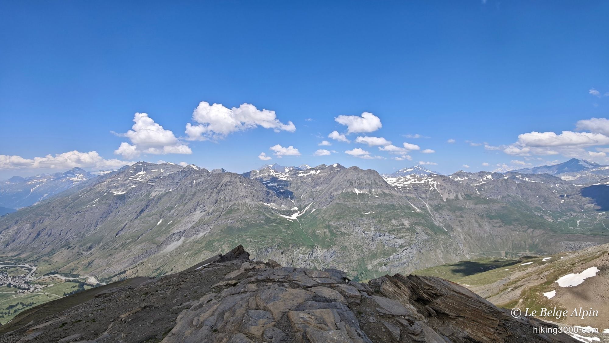
And it turned out to be a good call. I traversed the pastures on the slope, through the short grass, and I really loved it. It is the kind of forced detour that ends up being the best moment of the day. The Arc valley stretches out below, Bessans is no more than a handkerchief of rooftops, and you already get that feeling of vast space all to yourself.
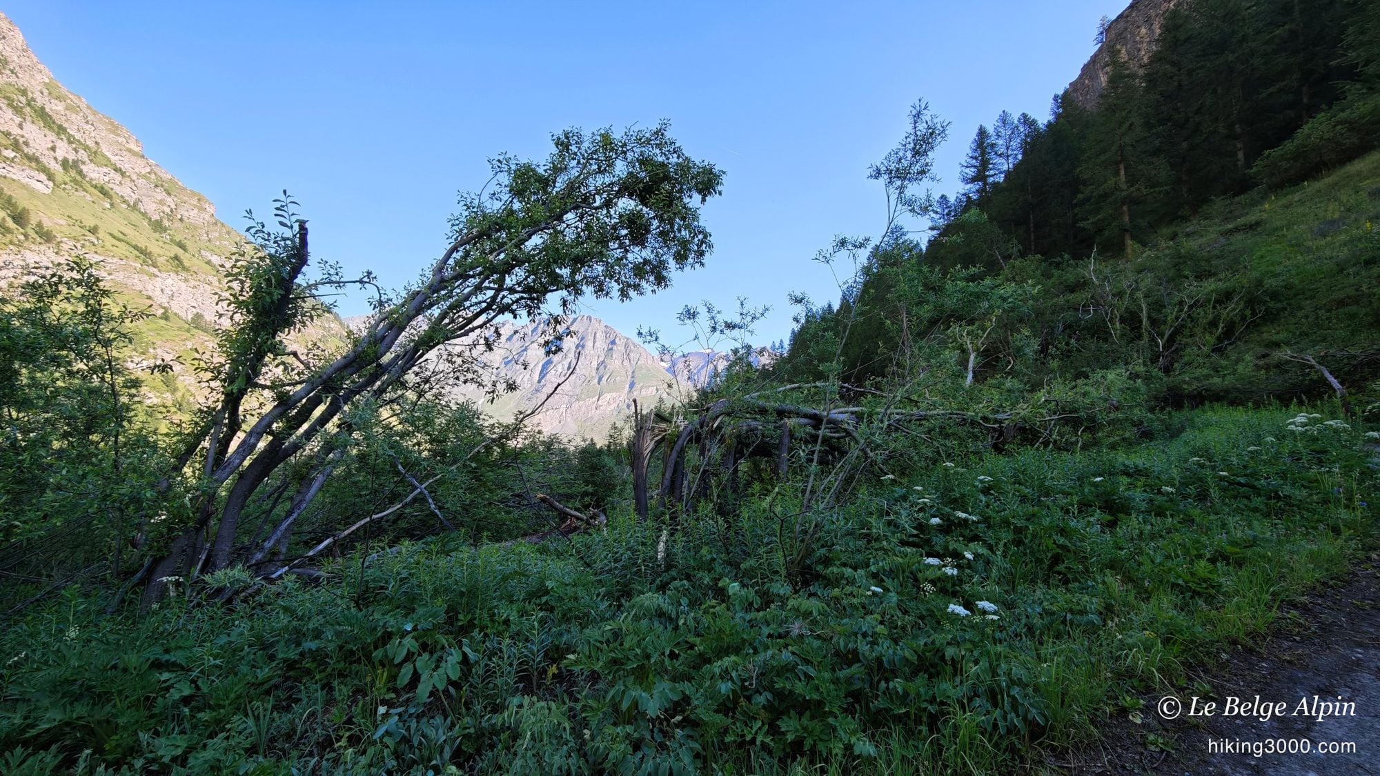
When the trail fades


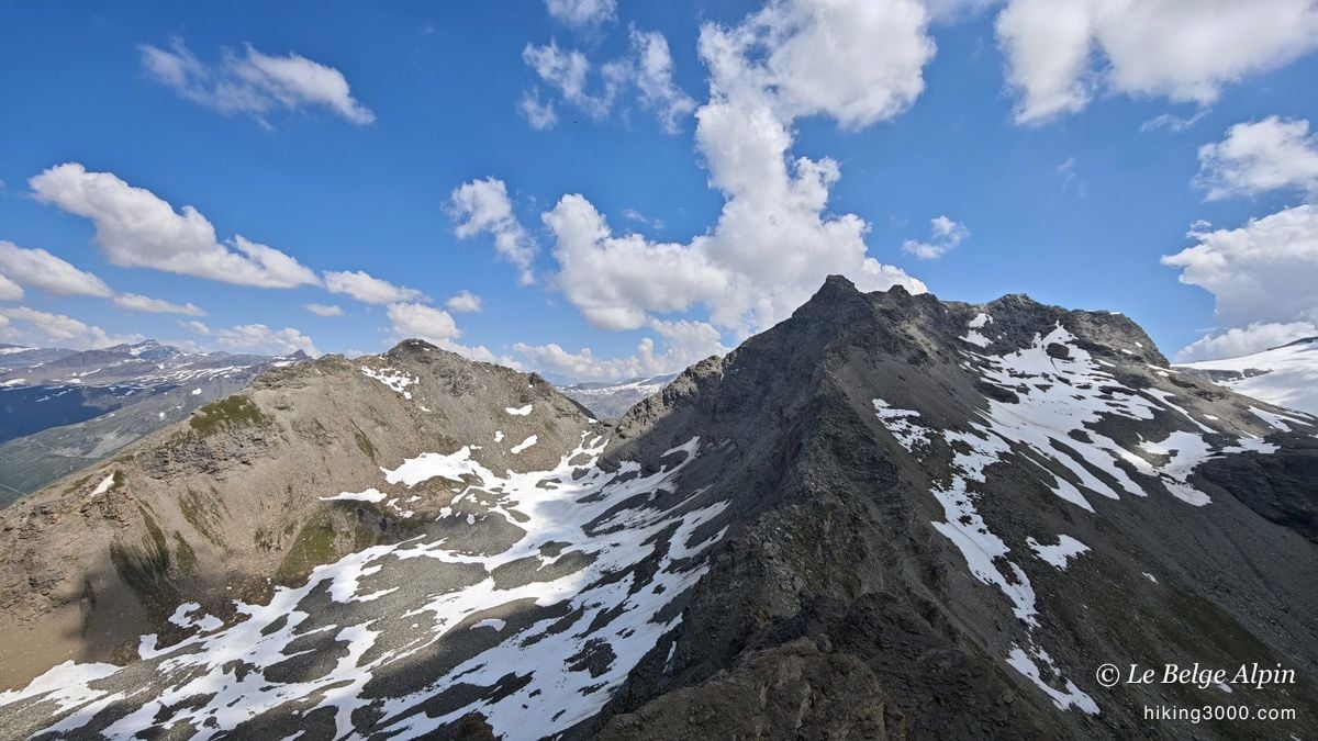
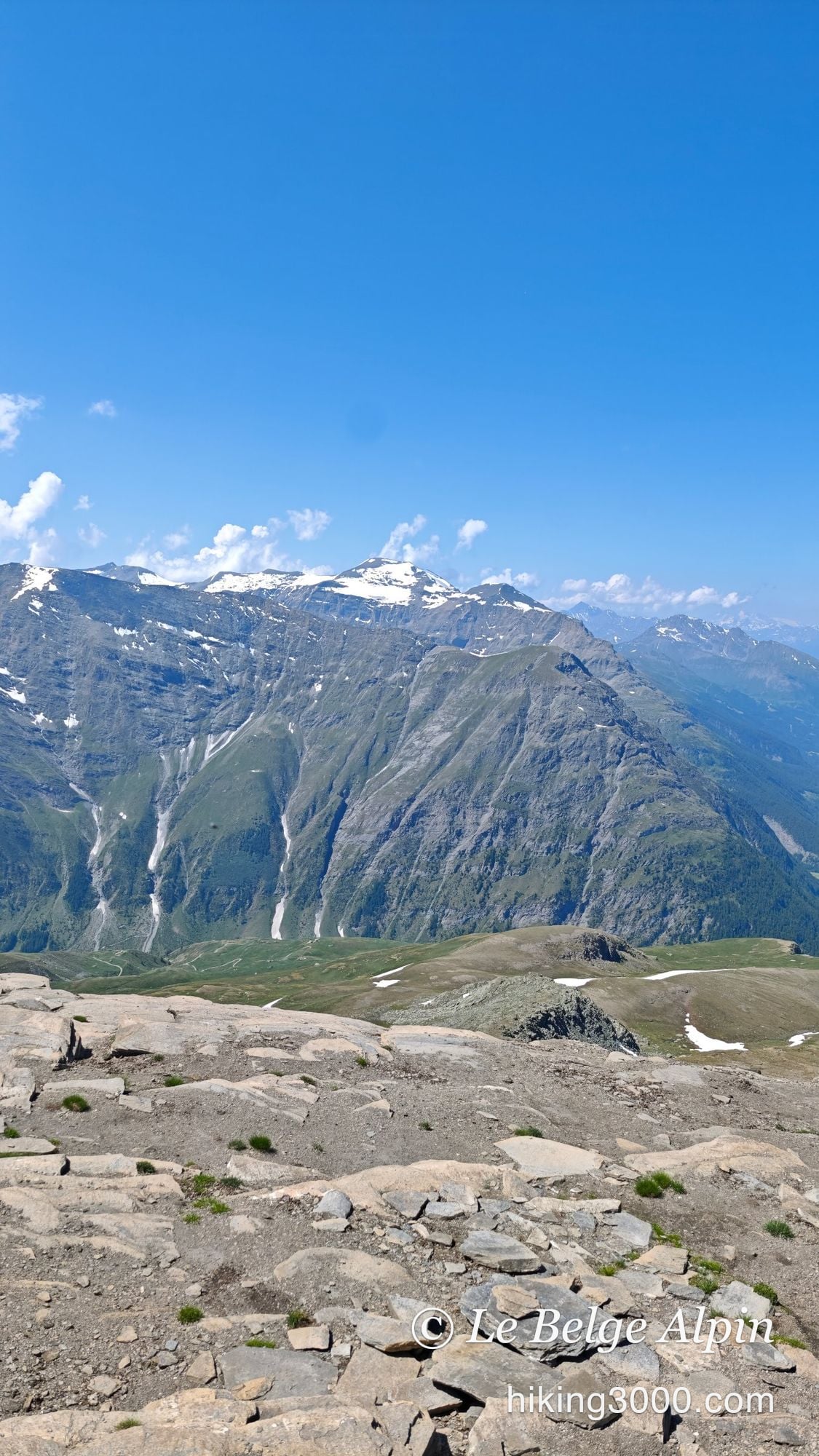
Past the pastures, as you reach the moraine, the path is no longer really marked. This is an outing where almost no one goes, and it shows: the trails are barely there. My GPX track will get you to the right place, but honestly, I would not advise following it to the letter. I went a bit as the mood took me, and I even treated myself by leaving the readable bits of path, just for fun, because it is a place where there is truly no one. Might as well make the most of it.
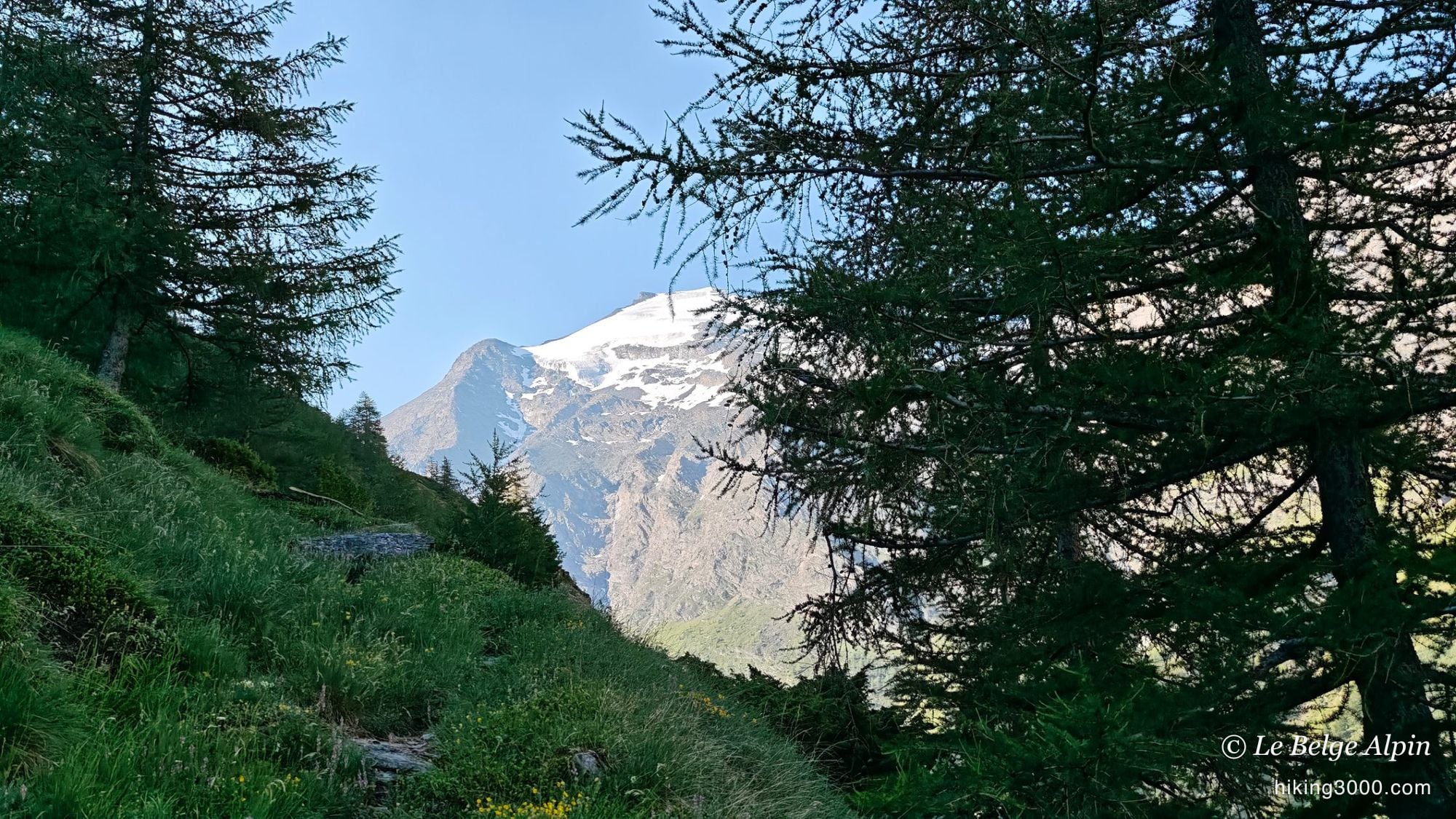
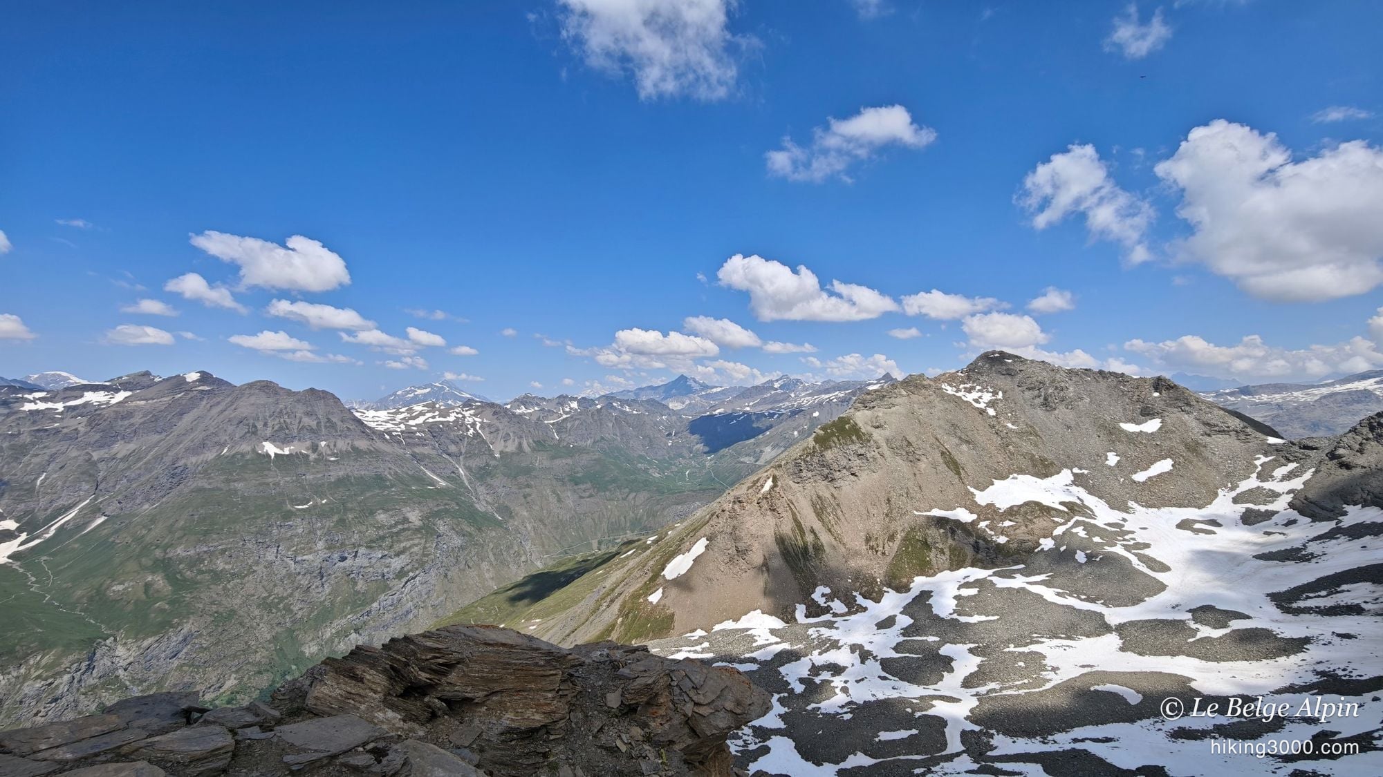
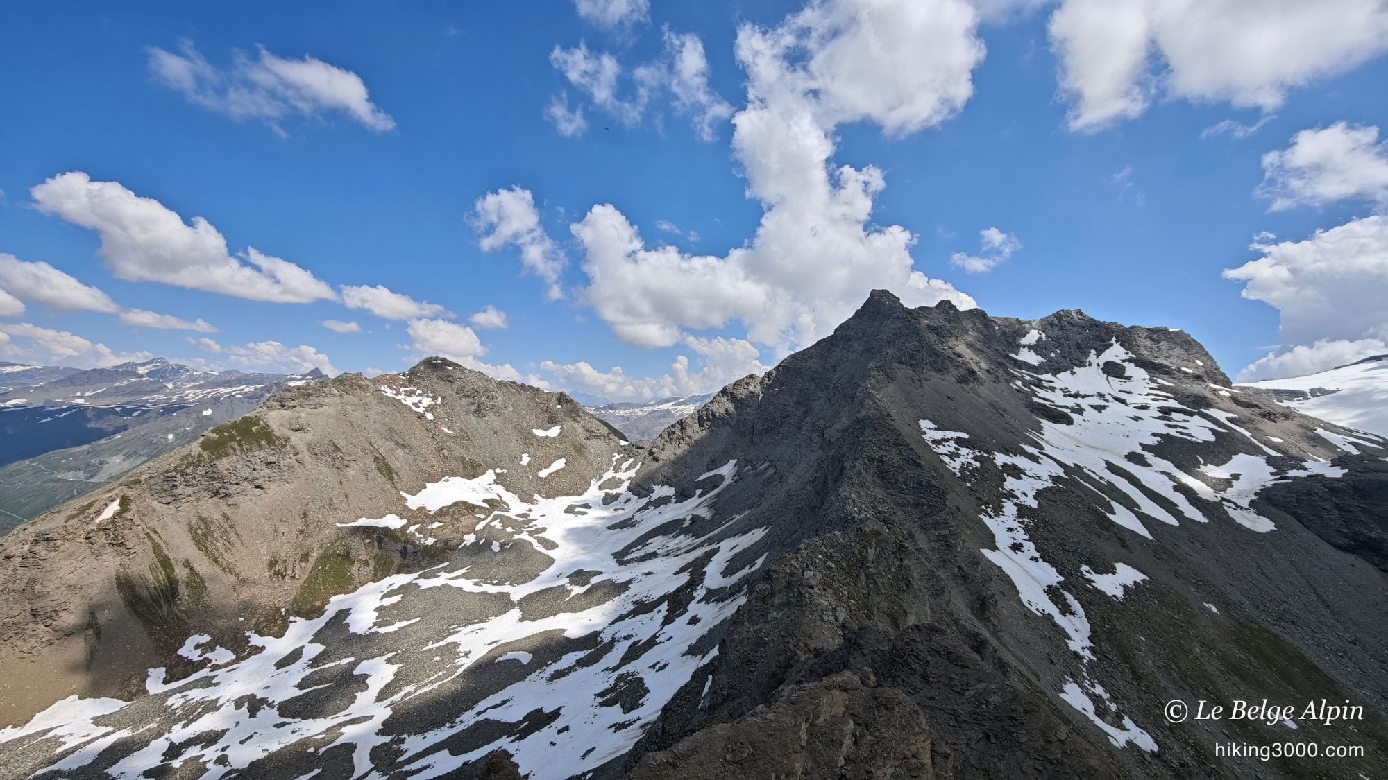
So the whole final part is navigation rather than trail-following. Nothing to worry about, though: it never climbs very hard, the ground is walkable, there are a few scree slopes but nothing out of the ordinary. No technical difficulty, no big drop. Just knowing where you are going and anticipating your line well. If you are new to this kind of terrain, have a look at my notes on ratings and the gear list before setting off.
The summit, and the silence
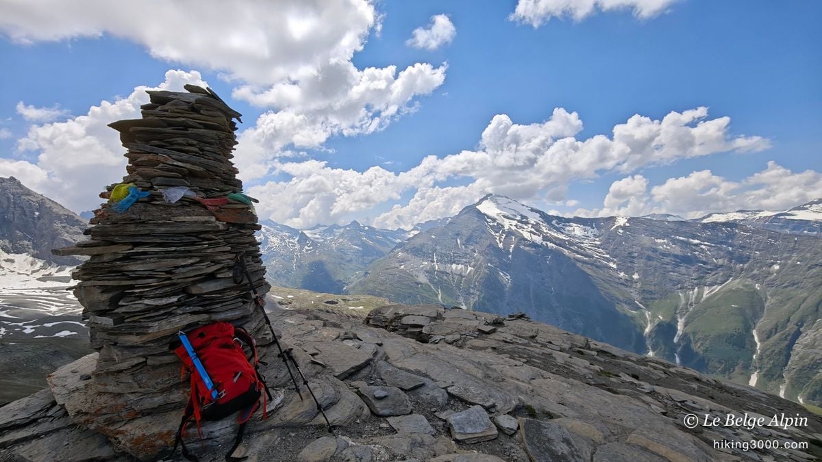

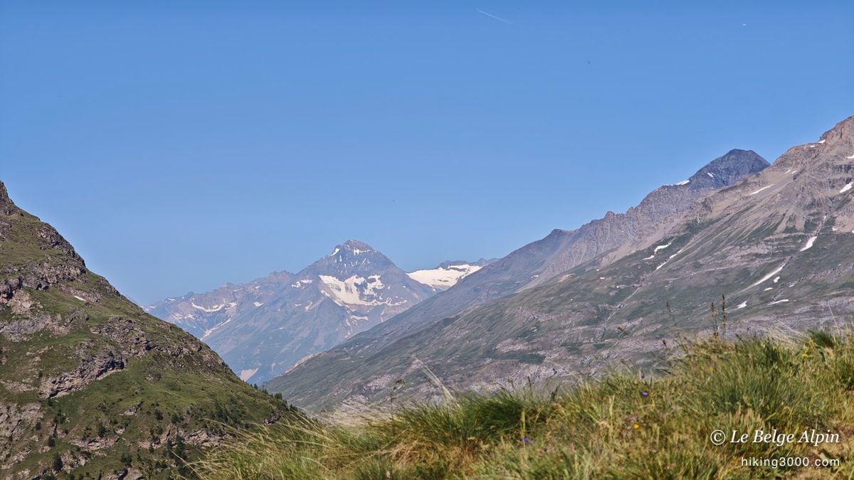
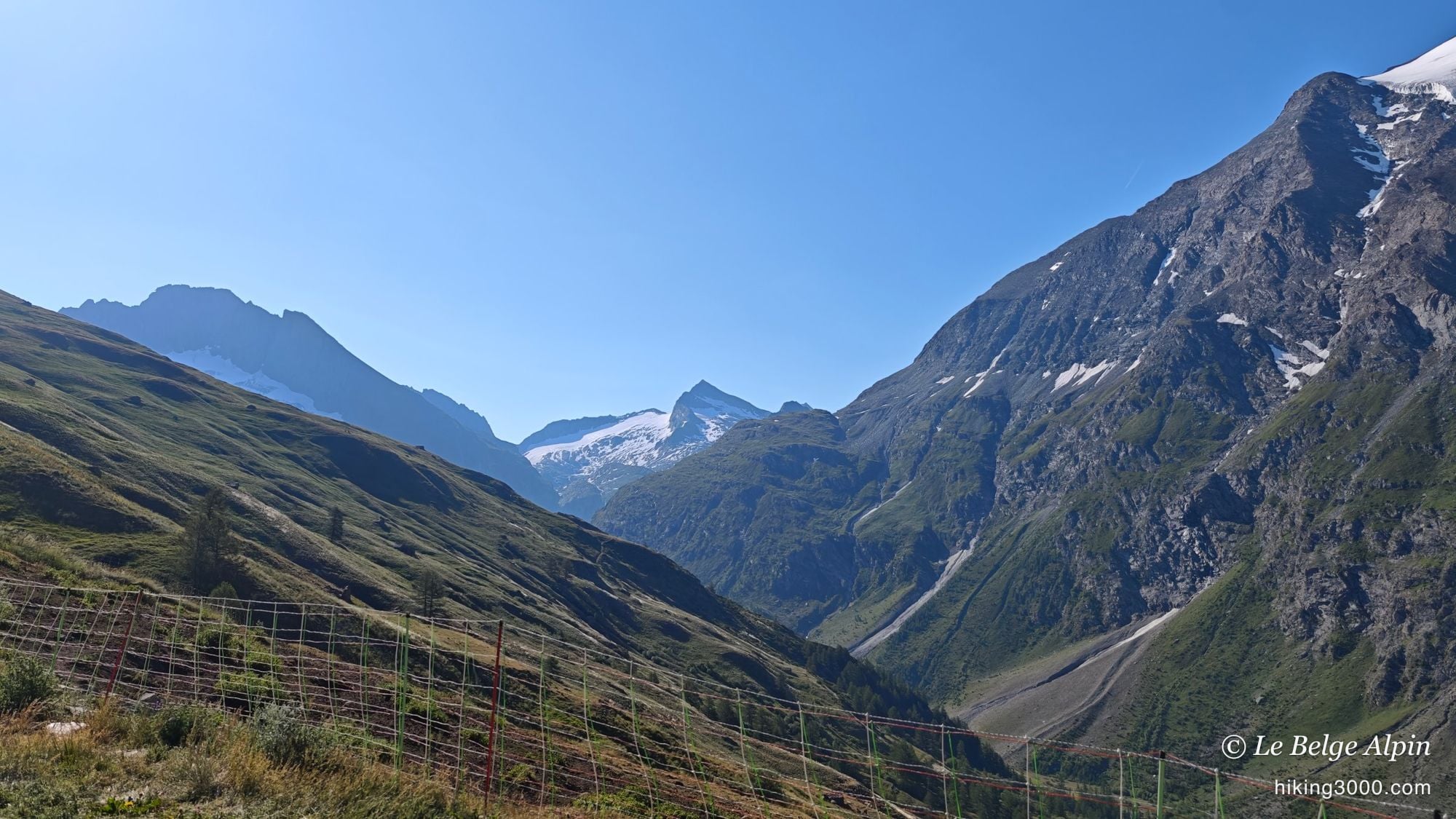
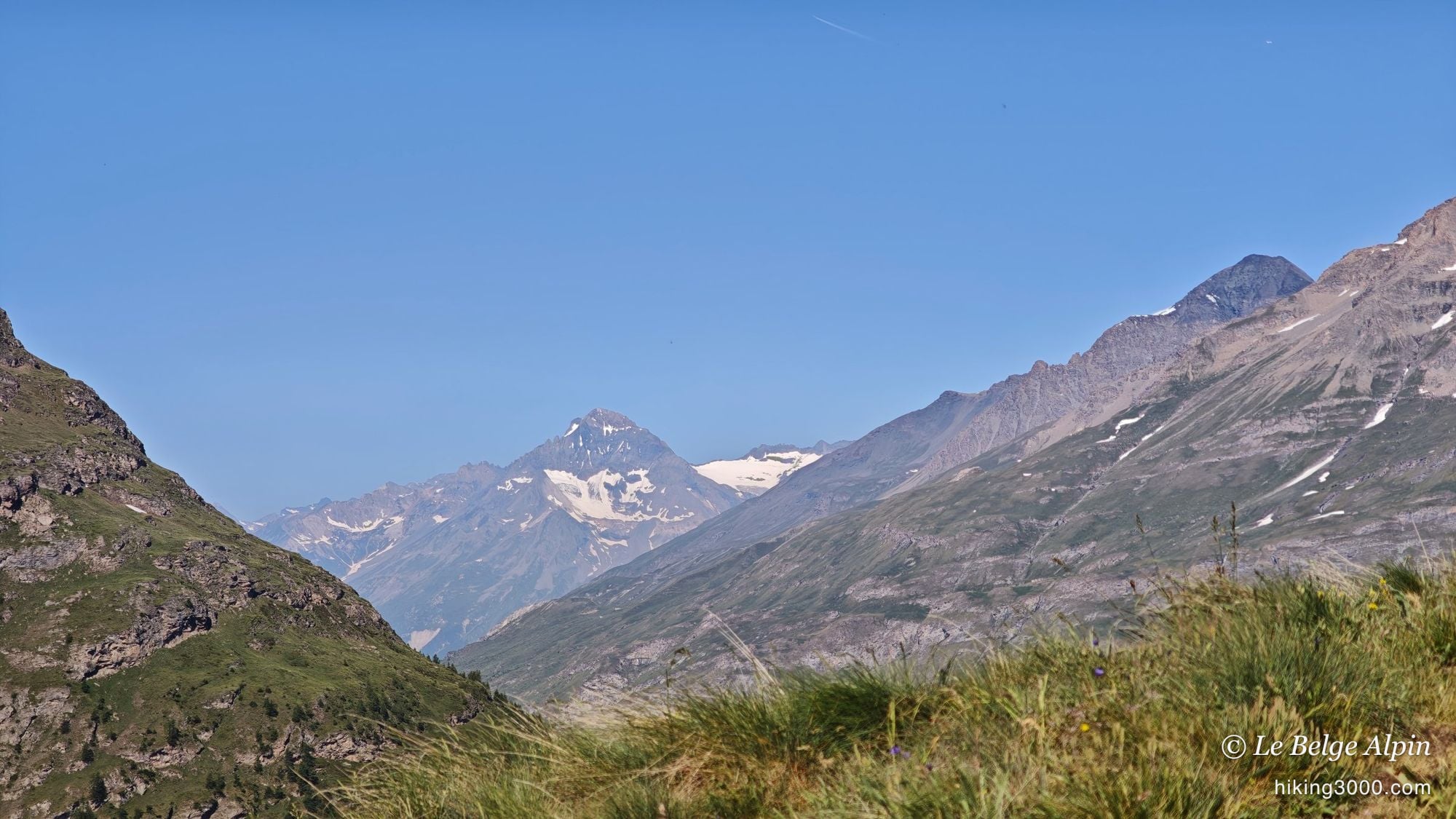
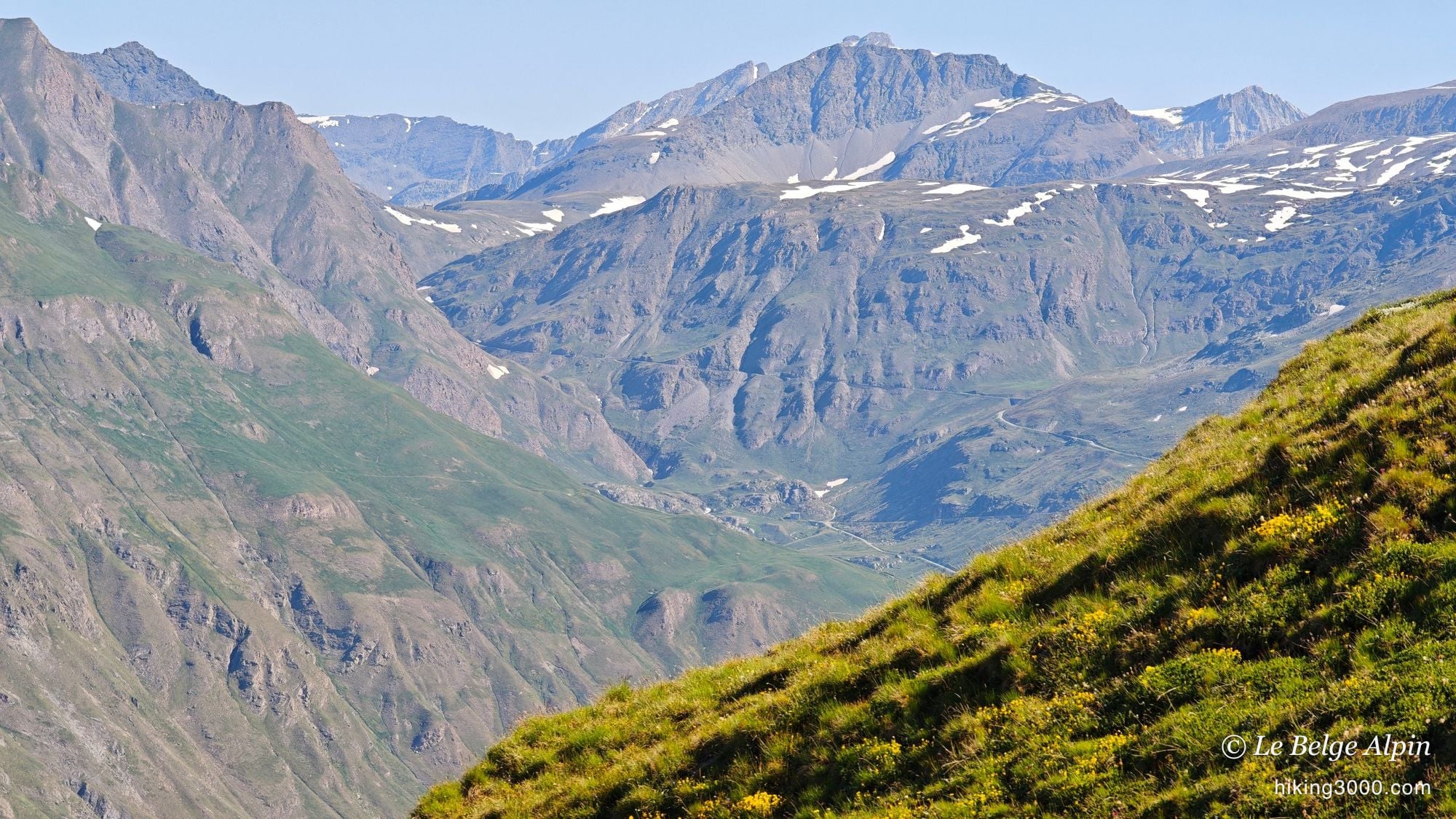
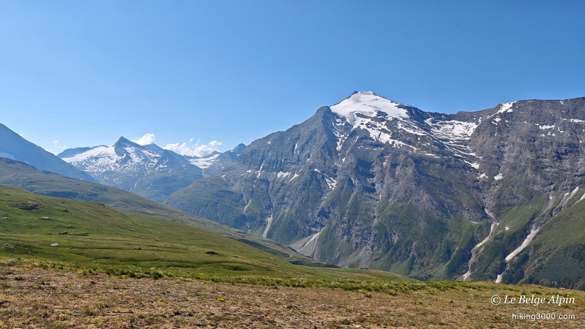
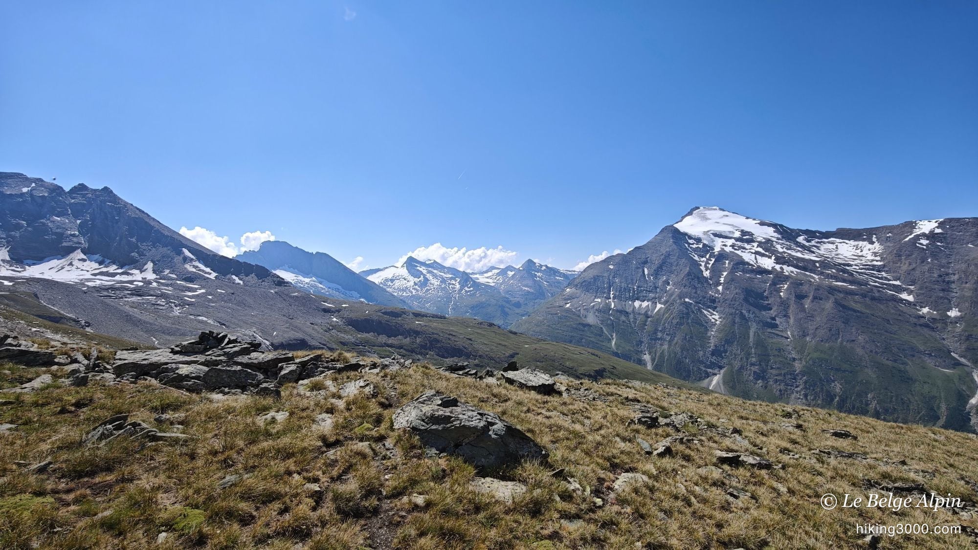
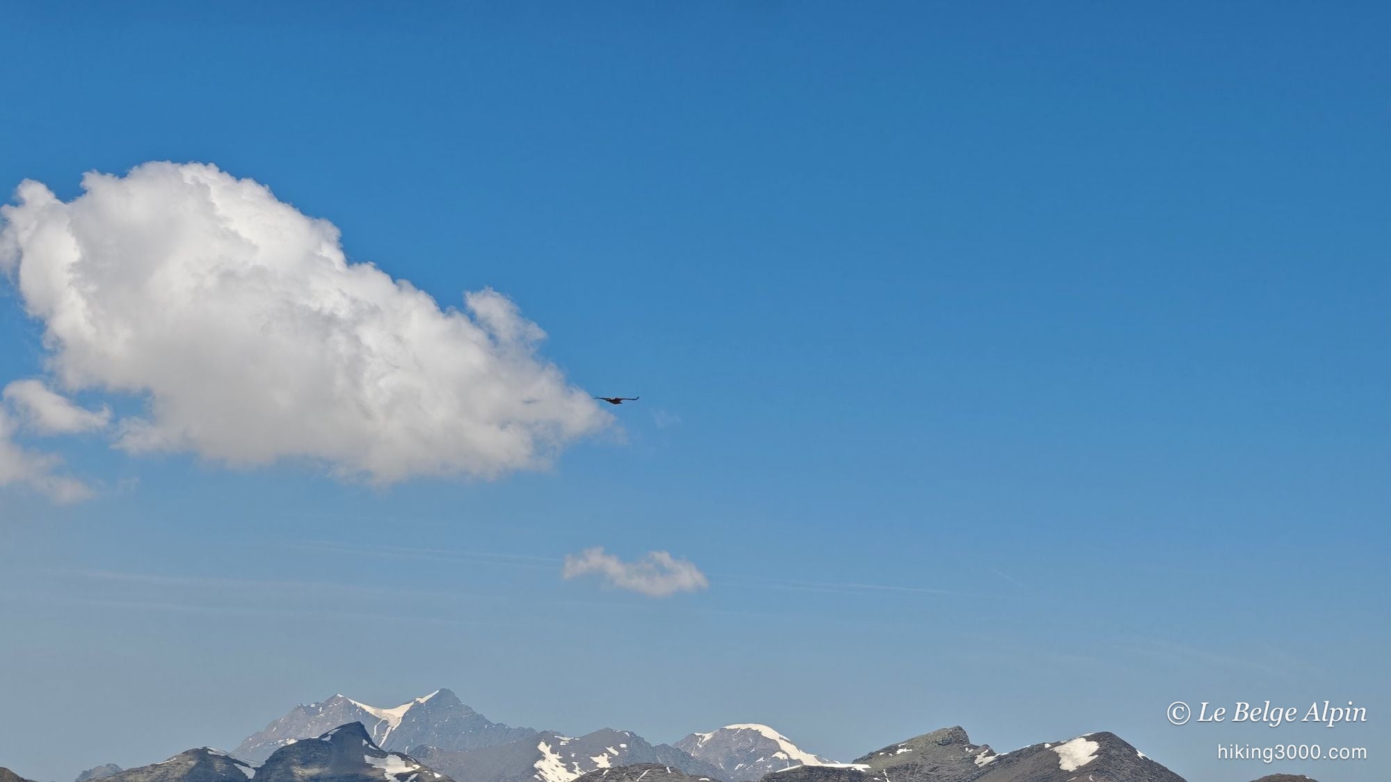
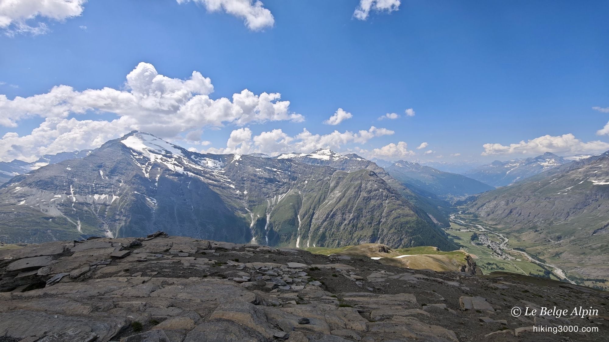
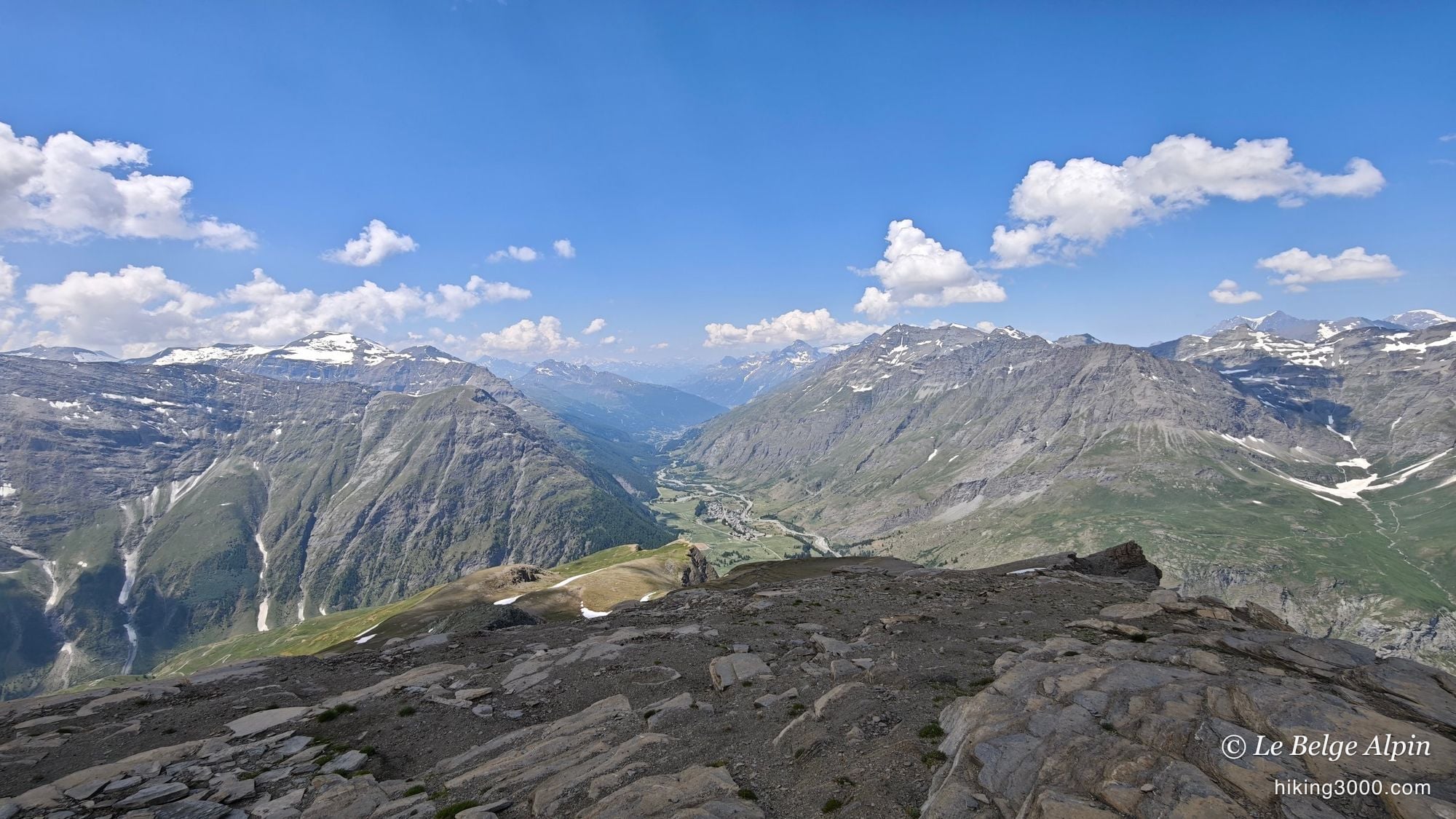
And then the summit. 3130 metres, a cairn, and silence. The Ouille Allegra is surrounded by higher peaks, yet the panorama is no less immense: the north face of the Pointe de Charbonnel right across, a good chunk of Mont Blanc to the north, the Gran Paradiso on the Italian side, the Albaron and the Aiguilles d’Arves in the picture. And above all of that, what strikes me most: there is no one. It is exactly what I came looking for.
I lingered up there a while. At this kind of altitude, even in fine weather, the wind always ends up calling you to order, but the reward is full.
The descent, letting go
On the way down you see the paths a little better, because from above you can guess them more easily. But they cut off, they do not run all the way: it really is a very low-traffic area, and that is precisely what makes it precious. I cut across the pastures again, for the pleasure of it and to dodge the flock and its guard dogs one more time.
And near the end, I left the switchbacks of the shepherd road. For once, I felt like coming down easy, without thinking about every foot placement on tricky ground. Those little driveable tracks that drop away can almost feel like Belgium. So my track is a bit longer on the way back than on the way up. A personal indulgence, fully owned.
Practical information
This is not an outing for beginners, despite the absence of technical difficulty. 1329m of ascent over 13.8 km, a summit above 3000m, and above all a second half where you have to be able to navigate on your own. Allow about 5h30 door to door depending on your pace and breaks, bearing in mind that I walk fairly fast.
The key thing to take in: the isolation. No hut on the route, no reliable water point, and almost no passage. Go self-sufficient in water and food, take warm layers, and count on no one to bail you out up there. That is the price of such a quiet place.
For conditions, residual snow early in the season especially, a phone call to the Haute-Maurienne Vanoise Tourist Office in Bessans beats any online forecast. And if you like these quiet border 3000ers of the valley, go and see the Col du Carro or the Pointe de Tierce, in the same spirit, right next door.
Practical info
Starting point
From Bessans (D902 in the Haute-Maurienne), follow the pastoral track climbing south of the village (start around 1808m). The lower part uses driveable shepherd roads, easy to follow. Above the pastures the route becomes barely marked: map, GPS and a sense of direction are essential. No dedicated shuttle, you leave the car at the side of the track.
GPX track
Import the GPS track into your watch or app (Garmin Connect, Komoot, Gaia GPS, Iphigenie...).
Sign in to downloadTourist office (current conditions)
Haute-Maurienne Vanoise Tourist Office, Bessans
Place de la Mairie, 73480 Bessans
Garmin track
Gallery
19 photos, click to enlarge

Video
A few shots from the outing
Weather, Bessans
Conditions and forecasts for the itinerary
In the mountains, conditions change fast. A thunderstorm can become dangerous, fog disorients, residual snow slows every step. Before leaving, check the bulletins, plan a stable weather window, and when in doubt, call the tourist office or the local guides office.
Learn to read mountain weather →Questions fréquentes
When is the best time to climb the Ouille Allegra?
+
From July to September. I did it in late June, but only because the heat had already melted most of the snowfields. Earlier in the season, residual snow makes both the navigation and the final approach harder, as they run over barely marked ground.
Is the route waymarked?
+
The lower part is, on well-trodden shepherd roads. But the whole upper section, above the pastures, is almost unmarked: very few people go there and the paths are barely visible. It is navigation, not technical difficulty. A map and a GPS are essential.
Are there any dangerous or exposed sections?
+
No. No drop-offs, no airy passages, a few scree slopes and nothing more. The only real issue is knowing where you are going and anticipating your line in an area where you are completely alone. Isolation is the main thing to manage.
Do I need to carry water and food?
+
Yes, go self-sufficient. There is no hut and no reliable water point on the route, and no one to help you out. Carry the day's water, something to eat, and warm layers: at 3130m, even in fine weather, the wind chills you quickly.