
Committed alpine hike above Bessans, between the Ribon valley and the Averole valley. 1500 m of elevation gain and 20 km for a 360 degree view over the Averole and Ribon glaciers, the Dent Parrachee and the Gran Paradiso. With its chapel perched at 3000 m, the legacy of an alpine priest from the 1930s.
Today I am back in my valley of the heart: the Haute Maurienne, and more specifically Bessans. Long a regular of the Tarentaise, I ended up setting down my boots here. Fewer tourists, more summits, more wilderness. A raw energy I love. I think in the coming years I will spend a lot of time around here, there is so much to do. Honestly, I do not even know where to start to feed the site.
This week was the long-awaited moment to meet up with my mountain partner for our traditional week of committed hikes. You may know her already: she shows up in every big outing on the site.
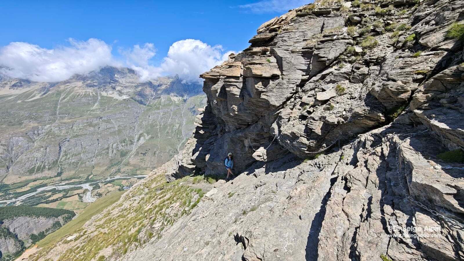
I already had a solid month of mountain in my legs, so we “eased” her in with 1500 m of elevation gain and almost 20 km on the clock. Not bad for a warm-up, right? Especially since we flirt with 3000 m of altitude, hardly a casual stroll.
A loop between Ribon and Averole

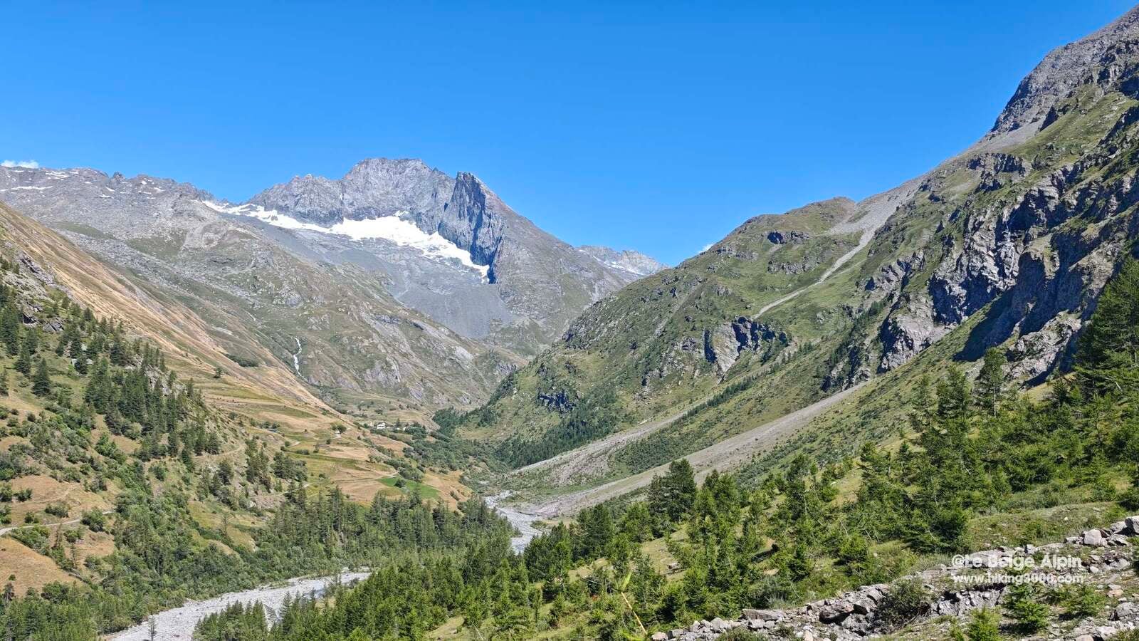
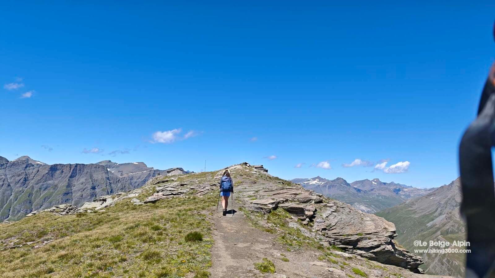
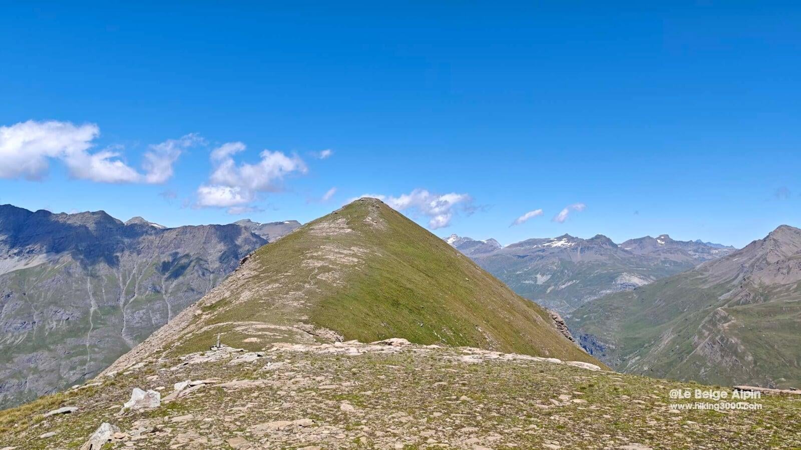
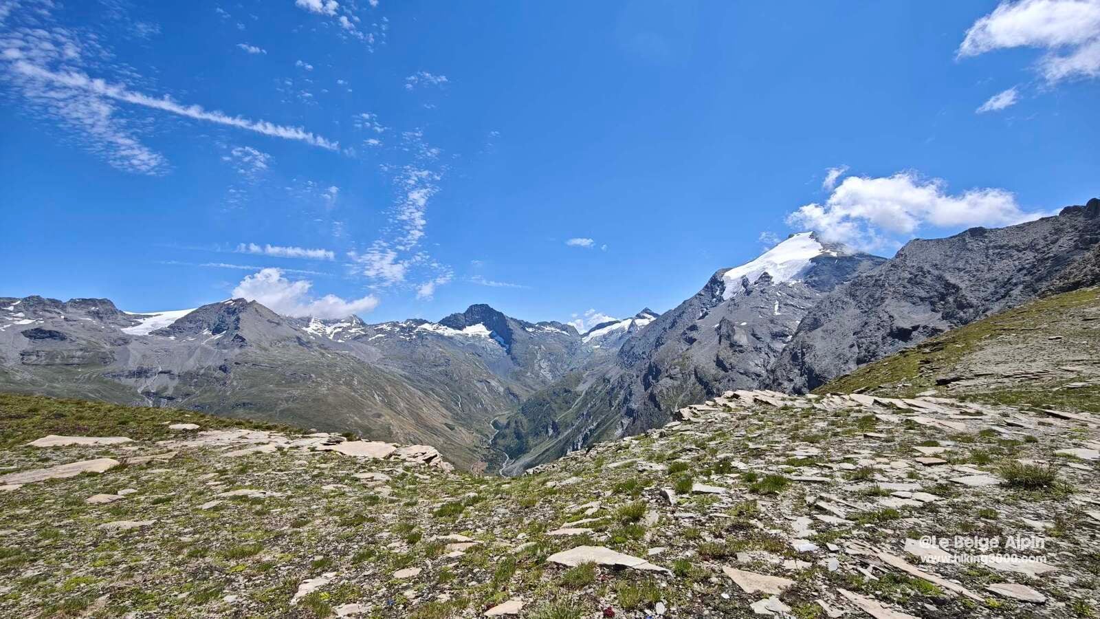
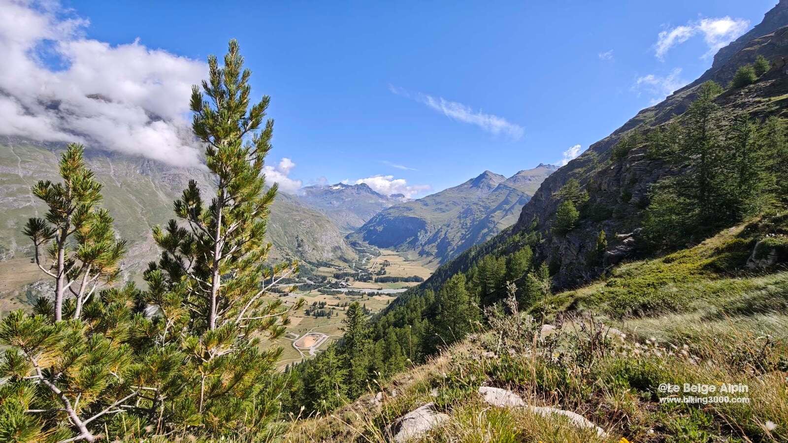
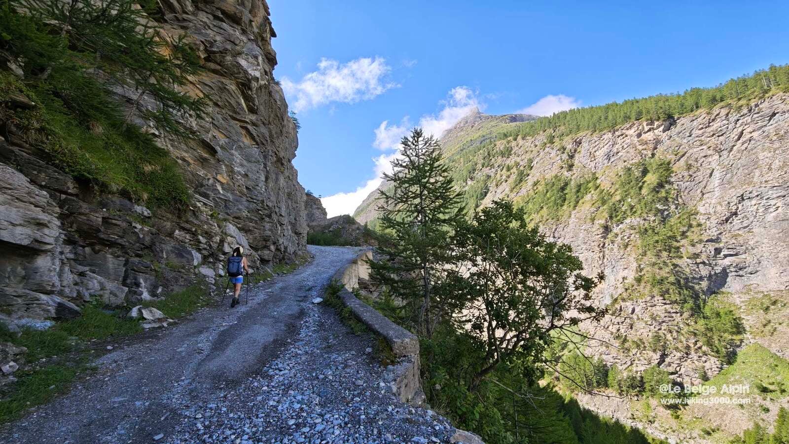
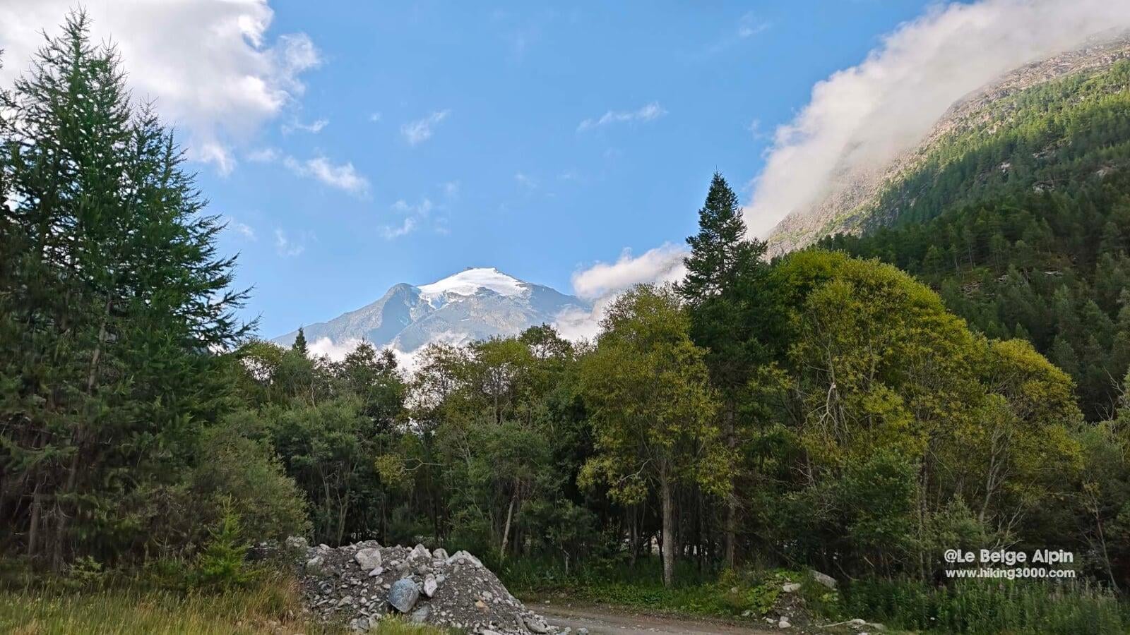
We chose to climb via the Ribon valley, where the trail is well traced. The ascent is steady but physical. Once at the summit, the reward is total: a grand 360 degree view.
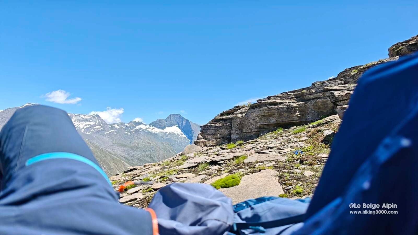
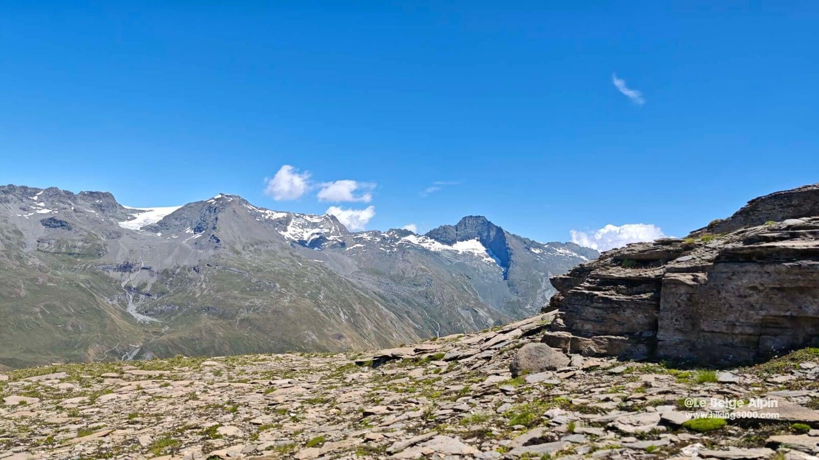
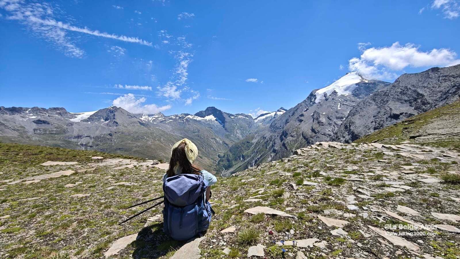
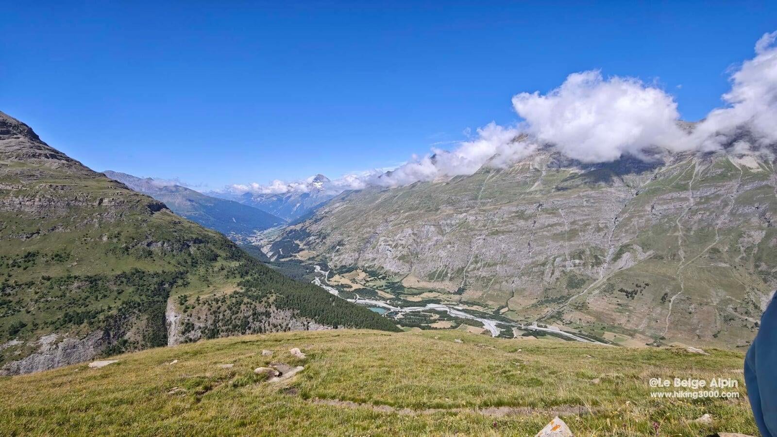
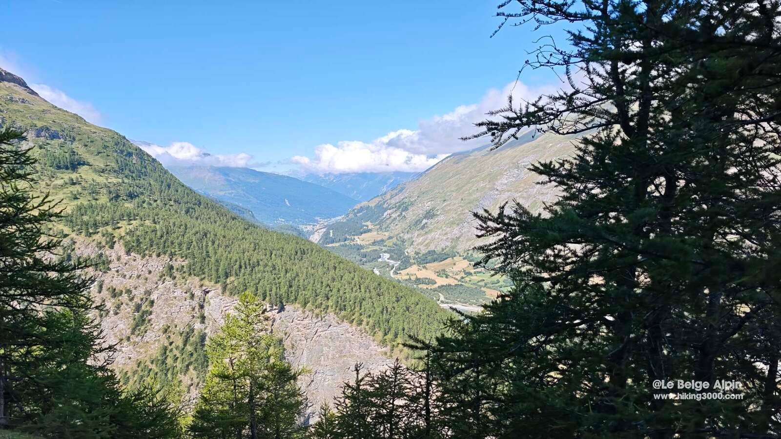
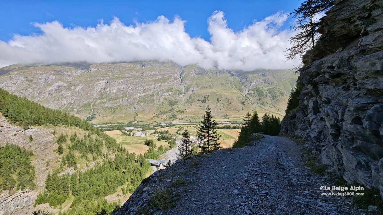
We overlook Bessans by more than 1000 m, the Pointe de Charbonnel stands right across from us, as do the Averole and Ribon glaciers, within eyeshot. Further on you can make out the Vanoise glaciers, the Dent Parrachee, the Aiguilles d’Arves, and even the Gran Paradiso in the background. The kind of viewpoint that makes you want to pull out the IGN map and spend the afternoon there.
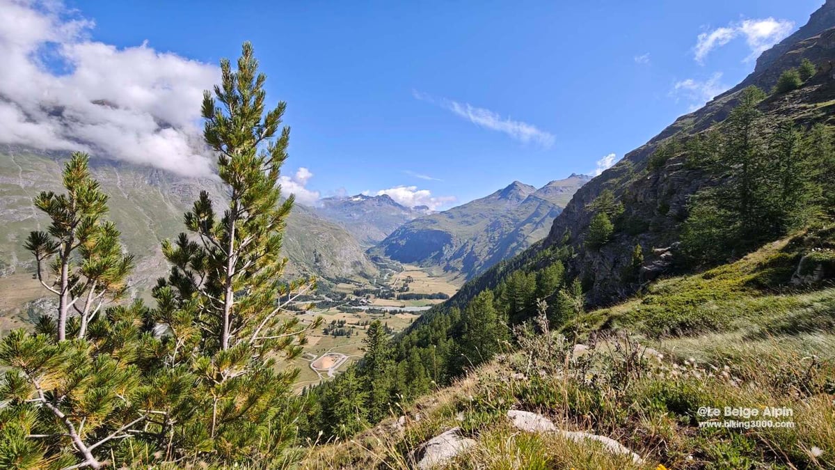
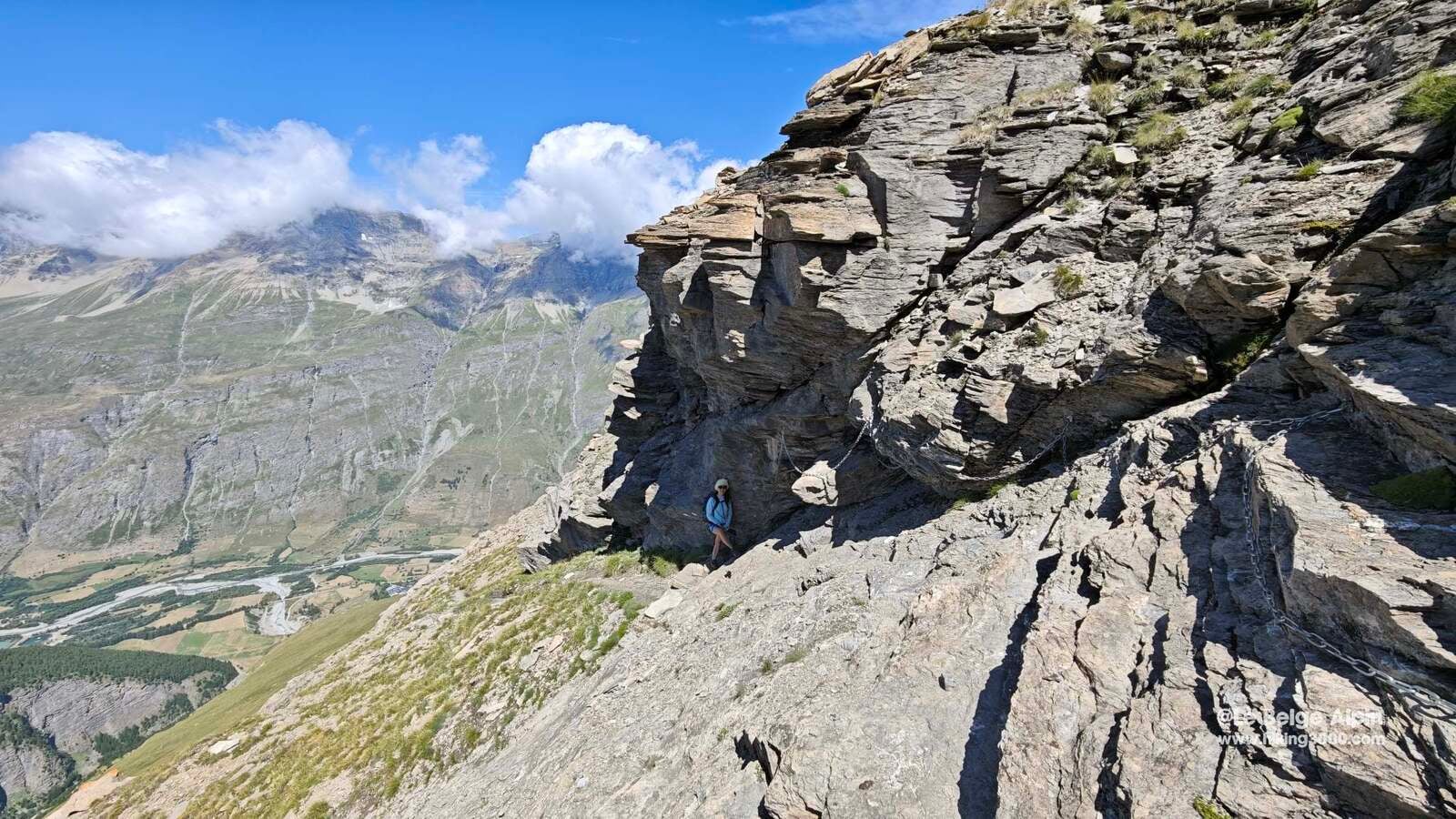
The descent runs down the Averole valley side, a bit wilder and clearly less busy. The trail is more discreet, but cairns and yellow-and-blue markers guide you well. A warning though: several bridges have been washed away by recent floods. Reportedly only two remain passable to switch banks, so follow my GPS track carefully if you do not want to end up with wet feet.
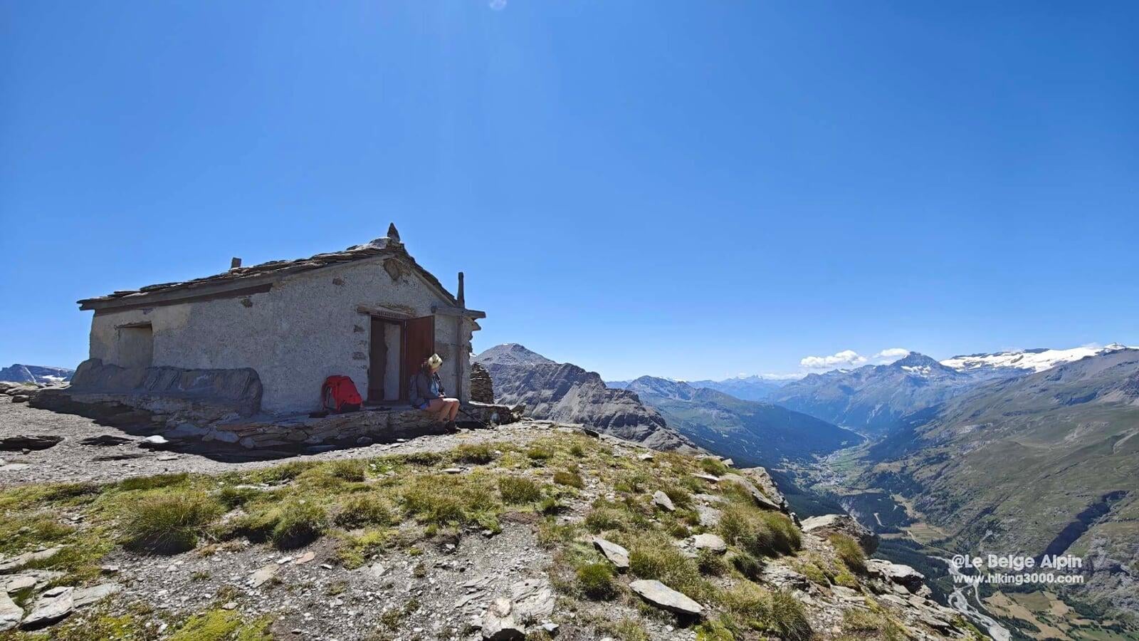
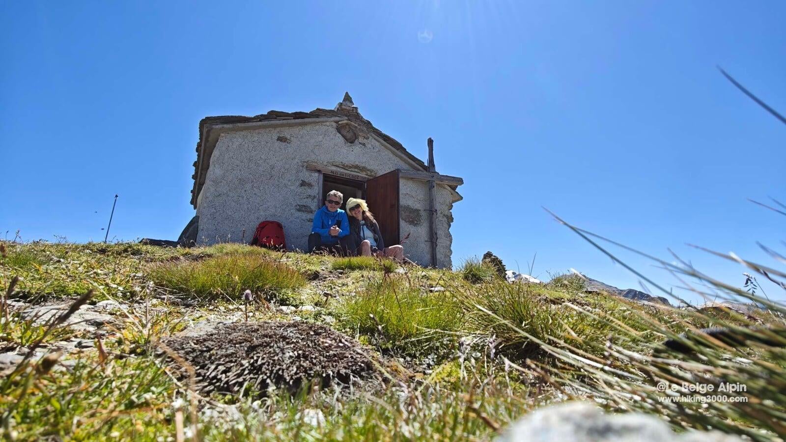
Historical anecdote, the chapel at 3000 m


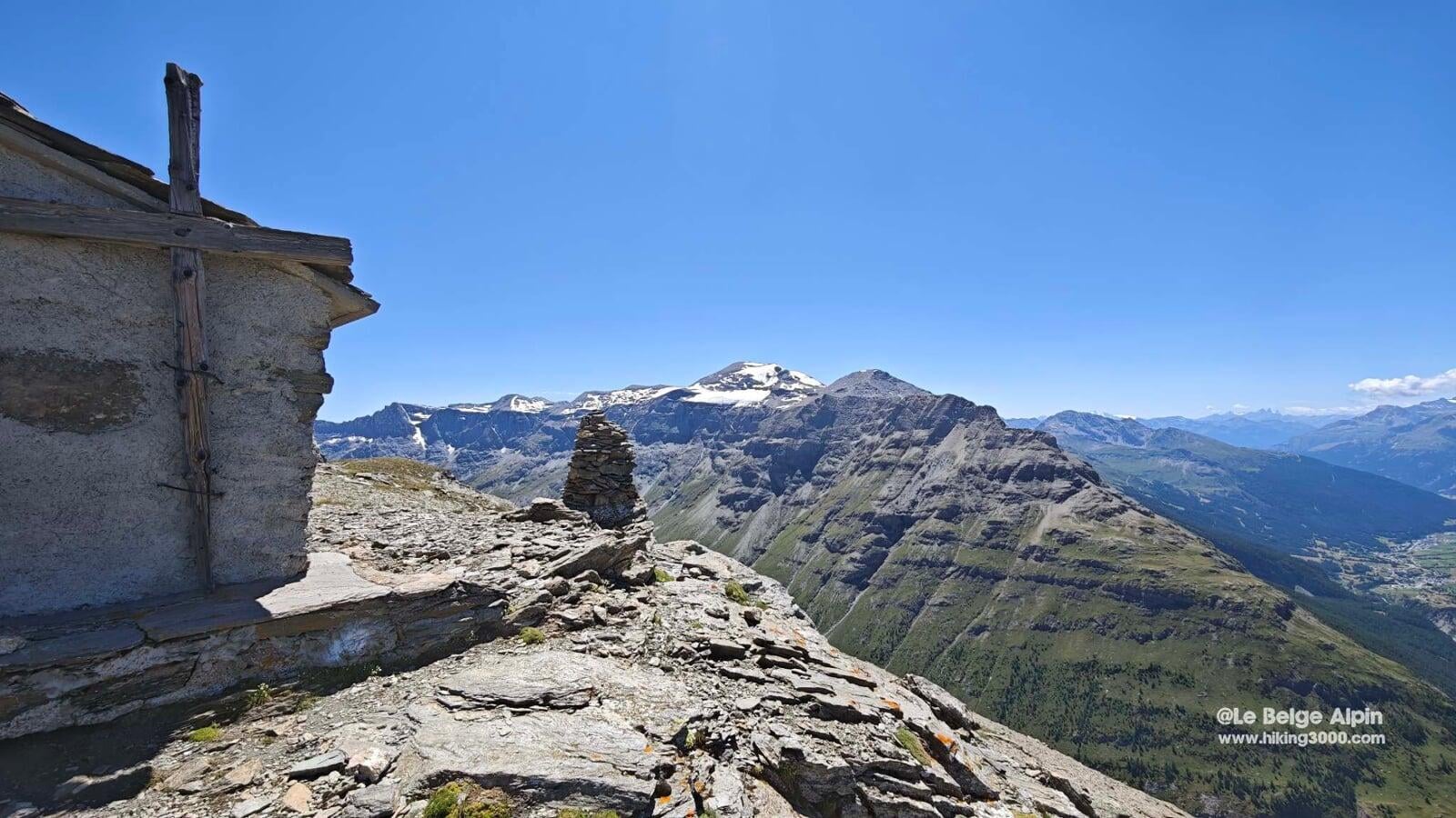
Just above the Pointe sits a chapel perched at nearly 3000 m. Yes, a real stone chapel, built in 1939 by Abbe Jean-Baptiste Carletti, the priest of Bessans, in memory of his parents.
He would climb up there often, on foot of course, to celebrate mass. He is said to have carved the stones himself with the inscriptions still visible today. A pilgrimage is said to have taken place every summer, led by the faithful of Bessans all the way to the summit, with songs, banners, and an improvised open-air mass.
It is still the custom today to open the chapel door to air it out, then close it when leaving. And if you feel weak or too exposed to altitude, rumor has it a bottle of sacramental wine is stashed in a corner. Reserved for sacred emergencies, of course.
Before you leave
If you want to extend the outing over two days, the Refuge d’Averole (FFCAM) at 2210 m, in the Averole valley just below, is ideal. Staffed in summer (19/06 to 12/09 in 2026).
For up-to-date conditions (bridges, residual snow, vehicle access), the Bessans branch of the Haute Maurienne Vanoise tourist office is a good contact. They know the ground and do not hesitate to relay reports.
To go further
- Understanding FFRandonnee E/T/R ratings
- Reading mountain weather
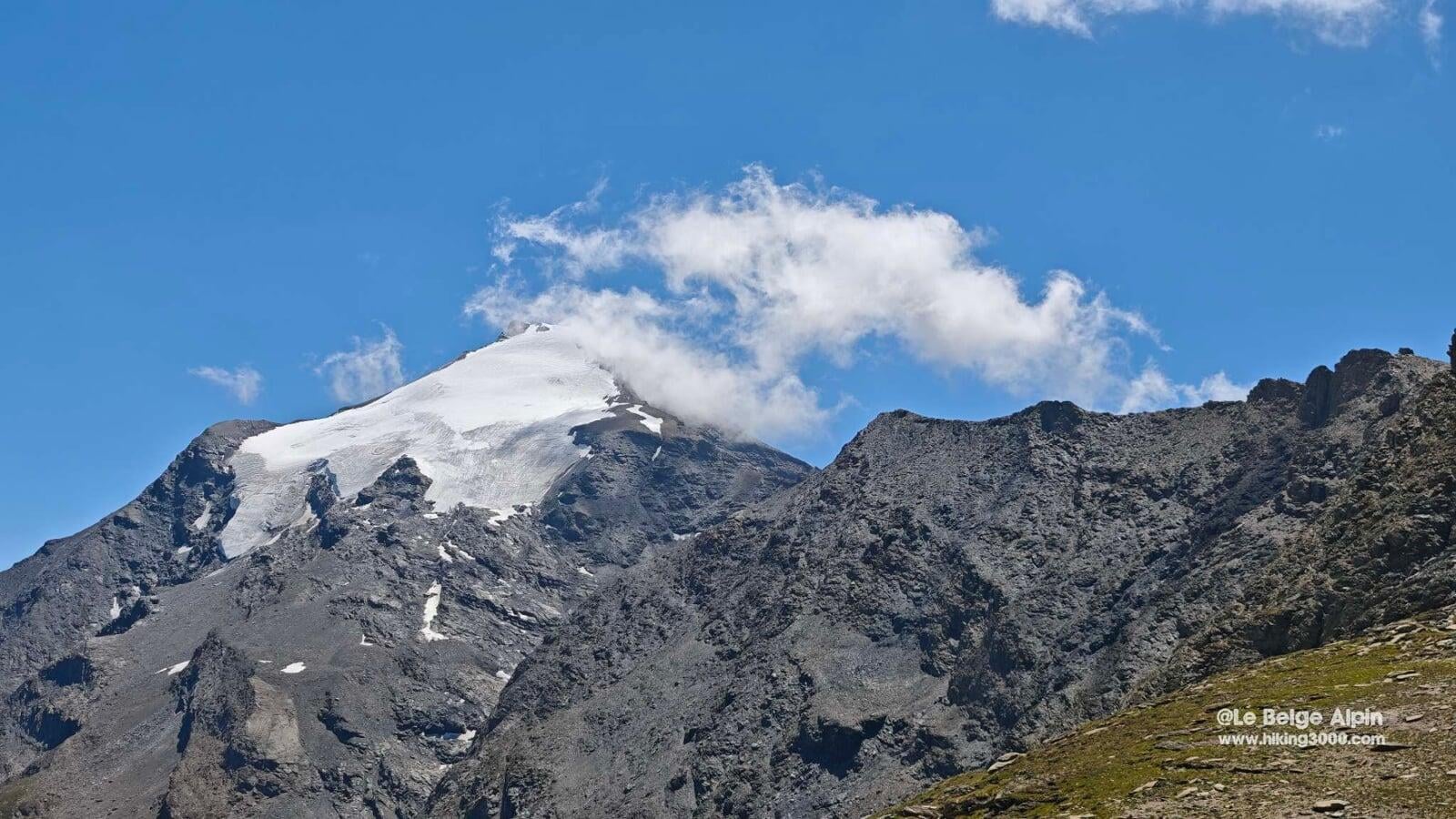
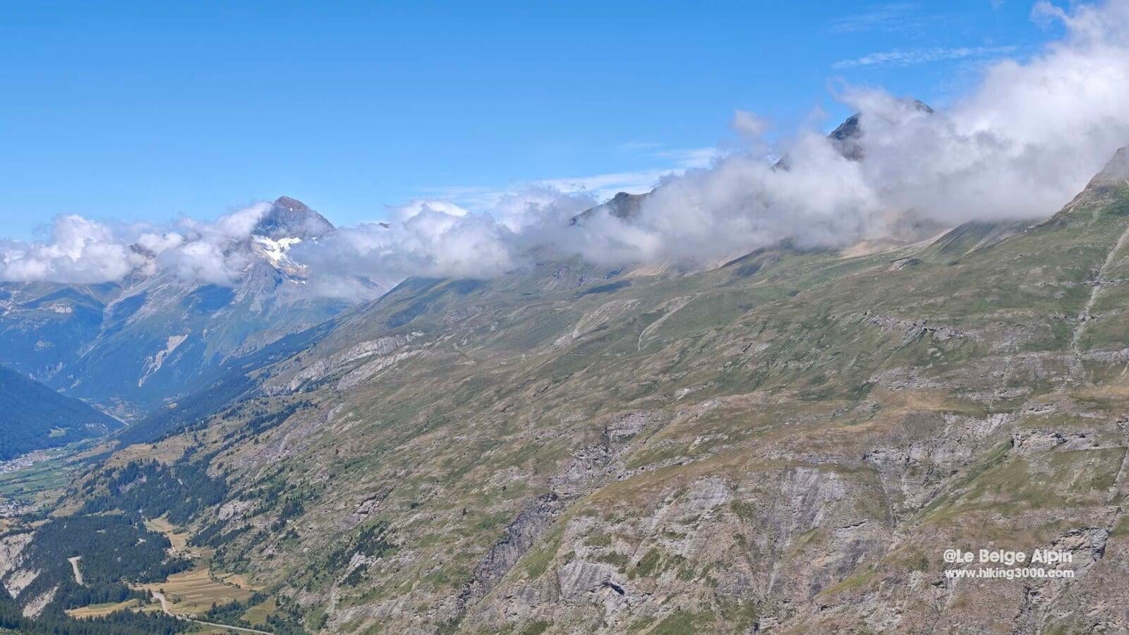
- The Pointe de Tierce belongs to the Vanoise massif, facing the Pointe de Charbonnel (3752 m) with the Gran Paradiso (4061 m) in the background.
Practical info
Starting point
From Bessans (Haute Maurienne), drive to the Ribon valley parking. Climb via the Ribon valley, descend via the Averole valley (loop).
GPX track
Import the GPS track into your watch or app (Garmin Connect, Komoot, Gaia GPS, Iphigenie...).
Sign in to downloadMountain huts
Refuge d'Averole (FFCAM), 2210m
Between Vanoise National Park and Italy. 2026 season: spring 13/03-09/05, summer 19/06-12/09.
Tourist office (current conditions)
Office de Tourisme de Haute Maurienne Vanoise, Bessans branch
Rue de la Maison Morte, 73480 Bessans
Garmin track
Gallery
25 photos, click to enlarge


Weather, Bessans
Conditions and forecasts for the itinerary
In the mountains, conditions change fast. A thunderstorm can become dangerous, fog disorients, residual snow slows every step. Before leaving, check the bulletins, plan a stable weather window, and when in doubt, call the tourist office or the local guides office.
Learn to read mountain weather →Questions fréquentes
What is the elevation of the Pointe de Tierce?
+
The Pointe de Tierce peaks at 2973 m in Haute-Maurienne, above Bessans (Savoie), between the Ribon valley and the Averole valley.
How long does the Ribon-Averole loop take?
+
Plan on 8 to 9 effective hours for 20 km and 1500 m of elevation gain, not counting breaks. The climb via the Ribon is steady, the descent via Averole is wilder.
Is there a mountain hut near the Pointe de Tierce?
+
Yes, the Refuge d'Averole (FFCAM), at 2210 m in the Averole valley, is staffed from 19/06 to 12/09 in 2026. Phone: +33 4 79 05 96 70. Ideal for splitting the outing over two days.
What is the best season for the Pointe de Tierce?
+
July, August and September. Residual snow can make ridge sections tricky before early July. Check the state of the Averole valley bridges (washed away by recent floods) with the Bessans tourist office.
Is this hike suitable for beginners?
+
No. FFRandonnee rating E4-T2-R3: high effort (1500 m gain, 8h), some airy ridge sections, summit above 2900 m. Mountain experience and good fitness are required.