
Committed hikes,
no shortcuts.
Alpine 3000s, Pyrenees, wild Belgian trails and via ferrata. Documented firsthand, with GPS tracks, field notes, and the honest story behind each summit.
Hiking3000 is a handmade hiking journal, not a trail database. Every route here has been walked by me, photographed step by step, and written from field notes. You will find 24 documented hikes spanning the French Alps, the Pyrenees, the Belgian Ardennes, and a handful of signature via ferratas, plus a preparation section to get ready for engaged alpine terrain.
I am David, a Belgian CEO, former sysadmin, self-taught mountain hiker. I document what I actually do: the difficulty, the beauty, the mistakes, the refuge coffee, the sudden storm, the 4 a.m. start. No scraping, no AI-generated routes, no volume play. Just one hiker sharing what he has walked, in the hope it helps the next one.
Most articles are currently in French. English translations are rolling out progressively. You can already navigate the catalog, the interactive map, the Belgium and via ferrata guides in English. Individual trail pages will follow.
Alpine summits, Belgian trails, preparation you can trust
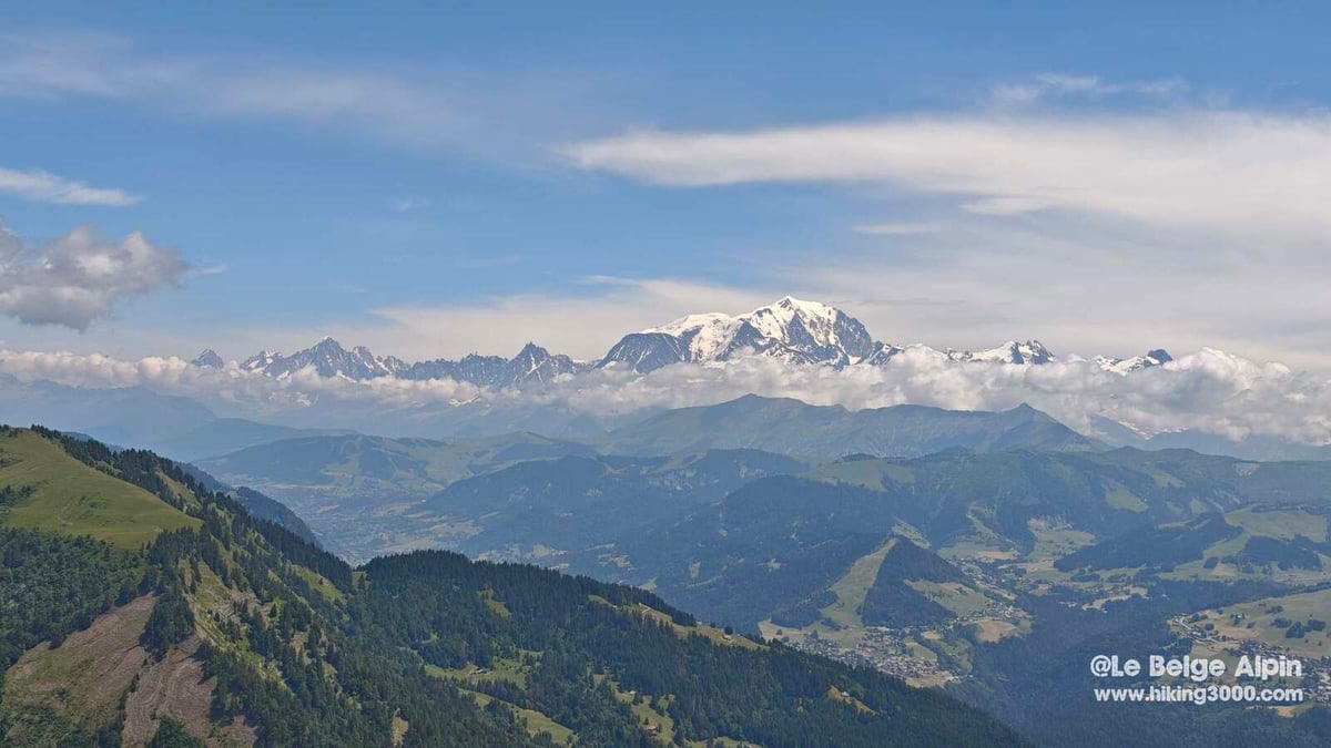
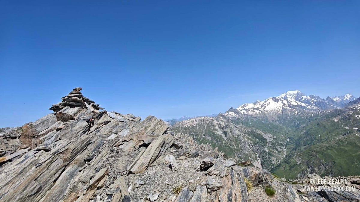
19 committed hikes above 2500 m
From Maurienne to the Ariège, engaged alpine summits with full field reports, GPX tracks, altitude profiles and French FFRandonnée ratings.
BelgiumWild Ardennes trails and via ferrata
The Belgian hub: how to hike and climb in a country people forget has real wilderness. Complete via ferrata guide with CAB access, grades and gear.
PreparationBefore you commit, read this
Ratings explained (FFRandonnée E/T/R system), gear essentials, reading alpine weather. The minimum you need before walking into engaged terrain.
Recently documented trails
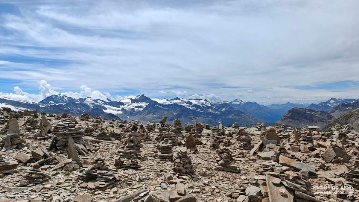
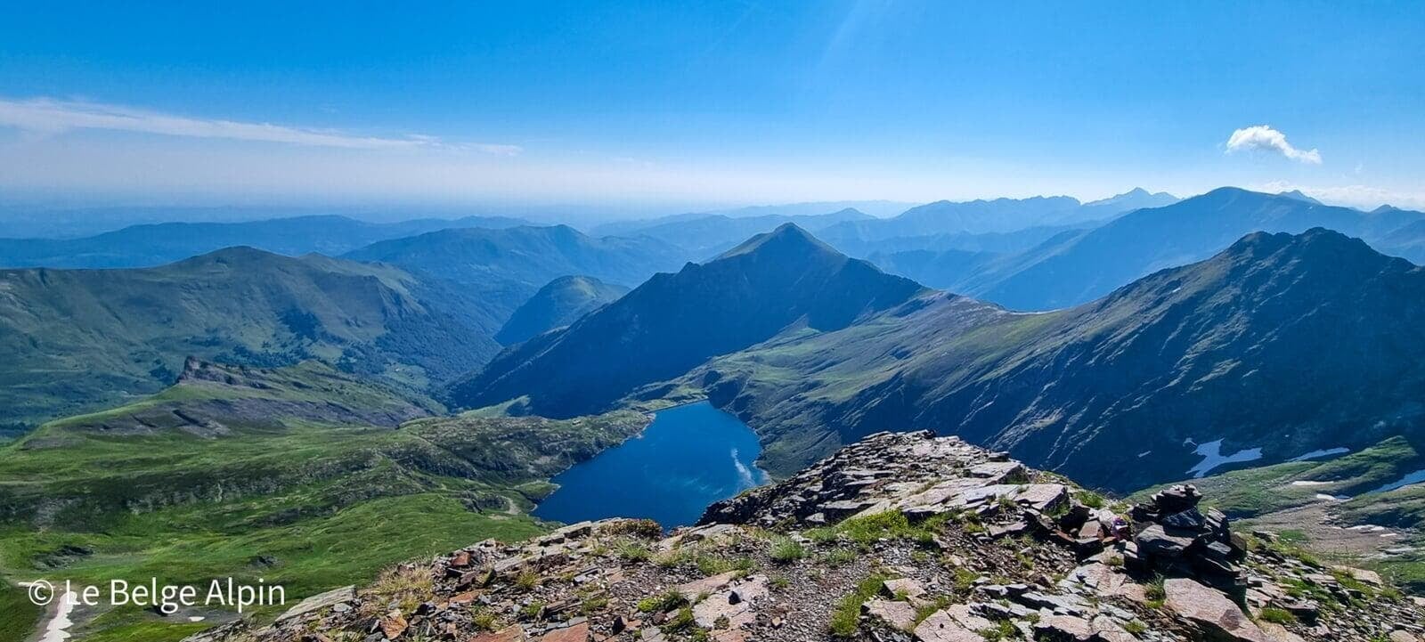
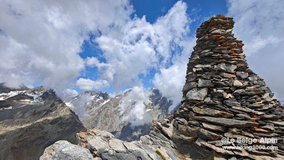
Col du Carro (Maurienne, 3149m)
Depuis le hameau de l'Écot à Bonneval-sur-Arc, une longue montée au Refuge du Carro puis au col (3149m) qui veille sur la frontière italienne. Lacs d'altitude, moraine et forêt de cairns.
Pointe de Tierce (Maurienne, 2973m)
Randonnée alpine engagée au-dessus de Bessans, entre vallée du Ribon et vallée d'Avérole. 1500 D+ et 20 km pour un 360° sur les glaciers d'Avérole et du Ribon, la Dent Parrachée et le Grand Paradis. Avec sa chapelle perchée à 3000 m, héritage d'un curé alpin des années 1930.
La Blanche (Écrins, 2953m)
Depuis le vallon de Narreyroux, 1400m de D+ pour un sommet à peine sous la barre des 3000m, avec un final câblé et un panorama qui dévoile la Barre, les Bans et le Pelvoux quand les nuages daignent s'écarter. Idéal pour un randonneur confirmé qui cherche un sommet calme en haute saison.
Mont Charvin par la Via Ferrata (Aravis, 2409m)
Depuis les alpages au-dessus d'Ugine, montée hybride randonnée + via ferrata au Mont Charvin (2409 m). 1073 m de D+, 11,7 km, câbles de juillet à octobre, panorama Mont Blanc exceptionnel. Baudrier et longes obligatoires pour la partie câblée.
Pointe de la Terrasse (Beaufortain, 2881m)
Depuis le Cormet de Roselend (1950 m), 900 m de dénivelé pour atteindre la Pointe de la Terrasse (2881 m). Passeur de Pralognan, pente terre raide, pierrier instable et quelques pas d'escalade II pour une vue imprenable sur le Mont Blanc côté italien. Réservé aux montagnards expérimentés.
Boucle Chanxhe et Esneux sud (21 km, 650 D+)
Randonnée au cœur de la région d'Esneux, entre forêts, étangs et campagne. Une boucle pleine de charme, malgré quelques passages sur route, avec une belle montée sauvage dans le Bois du Rond Chêne. Parfait pour découvrir la région liégeoise autrement.
Firsthand mountain writing, not content farming
I hike solo most of the time, in the Alps, the Pyrenees, and the massifs surrounding Belgium where I live and work. I am not a guide, not a journalist, not a sponsored ambassador. I run a small telecom company by day and, on weekends, I walk into big terrain.
Everything you read on Hiking3000 comes from my boots, my notes, my photos, and a deliberate editorial choice: slow, artisanal, a counterpoint to volume platforms like AllTrails or Komoot. If I have not walked it, it is not on the site.
More about me →
Questions we get before every trail
Can you do via ferrata in Belgium?
+
Yes. Belgium has 8 main via ferrata routes, run by the Belgian Alpine Club (CAB) or privately. Non-members can buy a day invitation. Grades range from F (Pont-à-Lesse, beginners) to ED (Fond des Cris, confirmed climbers). Full guide in the Belgium section.
Which 3000 m Alpine peak is suitable for a beginner in alpine hiking?
+
There are accessible 3000s. They require good fitness and stable weather but no mountaineering gear. Examples: Pointe de Tierce (Haute-Maurienne, 2973 m), Col du Carro, Mont Pelat. Typical profile: 1500 to 2000 m vertical gain, early start, marked trail, acclimatization to altitude.
What is the difference between hiking, via ferrata and mountaineering?
+
Hiking is done on foot on trails, with no specific gear beyond good boots. Via ferrata progresses on equipped rock (cables, rungs) with harness, lanyard and helmet. Mountaineering involves rope techniques, crampons and ice axe on snow, ice or rock at high altitude. Hiking3000 covers the first two.
Who writes Hiking3000?
+
David, a.k.a. Le Belge Alpin, Belgian, CEO of a Belgian telecom company, former sysadmin, self-taught mountain hiker. Every trail published here has been walked by me, documented with my GPS track, my photos, my field notes. No scraping, no AI-generated routes.
Ready to see what is documented?
The full catalog is free to browse, the interactive map shows every route on one view. Create an account to download GPX tracks and leave field reports.