
From the Bouillouses shuttle car park (2014 m), ascent of the Pic du Carlit (2921 m), highest point of the Pyrenees-Orientales. 1216 m of gain, 17 km, crossing a dozen alpine lakes, a more athletic finish through rocky ground.
Second day of our 2023 Pyrenees trip with my hiking partner. We are recovering from the ascent of the Canigou and its 2000 metres of elevation gain. Unlike the Alps, in the Pyrenees there are no tarmac passes to bring you up to 2000 metres: trailheads often start low, which means serious elevation gains.
But in the end, isn’t the reward even better? I am convinced the view has to be earned, and in this region, it has to be earned all the more. So we set our sights on the Pic du Carlit, iconic summit and highest point of the Pyrenees-Orientales at 2921 metres.
The shuttle and the lakes
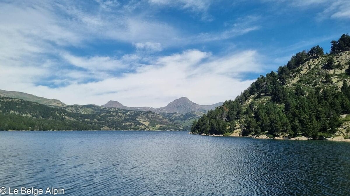

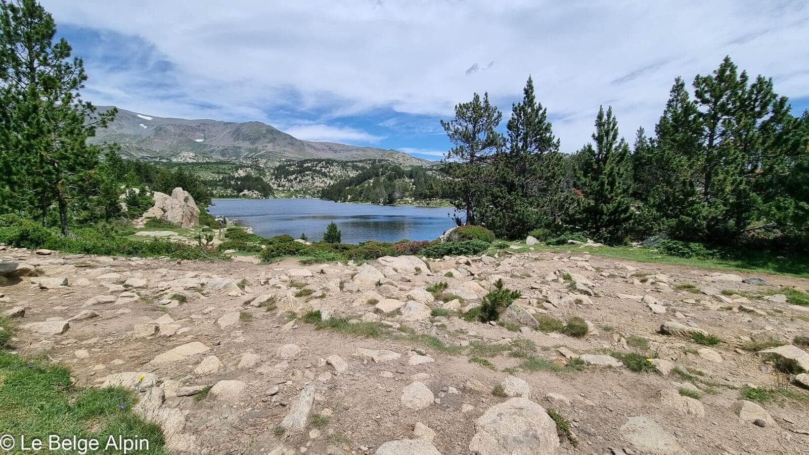
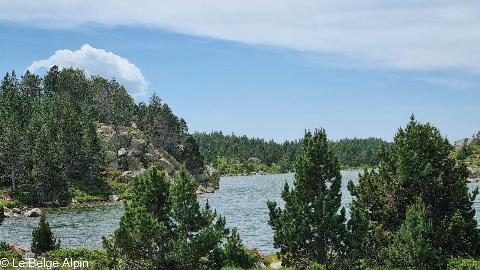
Sadly, driving to the start of our hike is no longer possible, because of the effects of mass tourism. Locals have taken steps to protect these wild spaces. A shuttle is available for hikers, and we take it before starting our climb towards the Pic du Carlit and the 12 stunning lakes that surround it like unbreachable ramparts.
Small moment of weakness: my friend and I give in to a soft-serve ice cream at the little restaurant at the foot of the first lake, even though this one is artificial. But the reflections of the surrounding summits in its deep blue waters quickly make us forget the artificiality. The ice cream may have played its part too.
Climbing between tarns and mountain pines
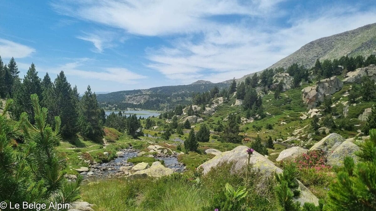

The hike is easy and well marked over most of the route. You cross a series of small lakes and tarns, each with its own character: rounded granite and mountain pines for some, reeds and deep water for others. A nice horizontal progression that gently prepares you for the final climb.
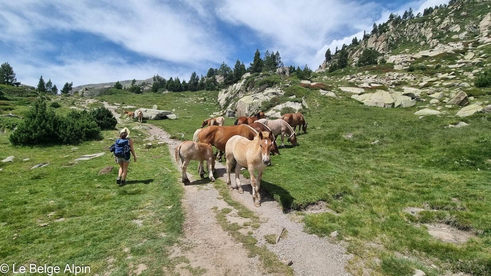
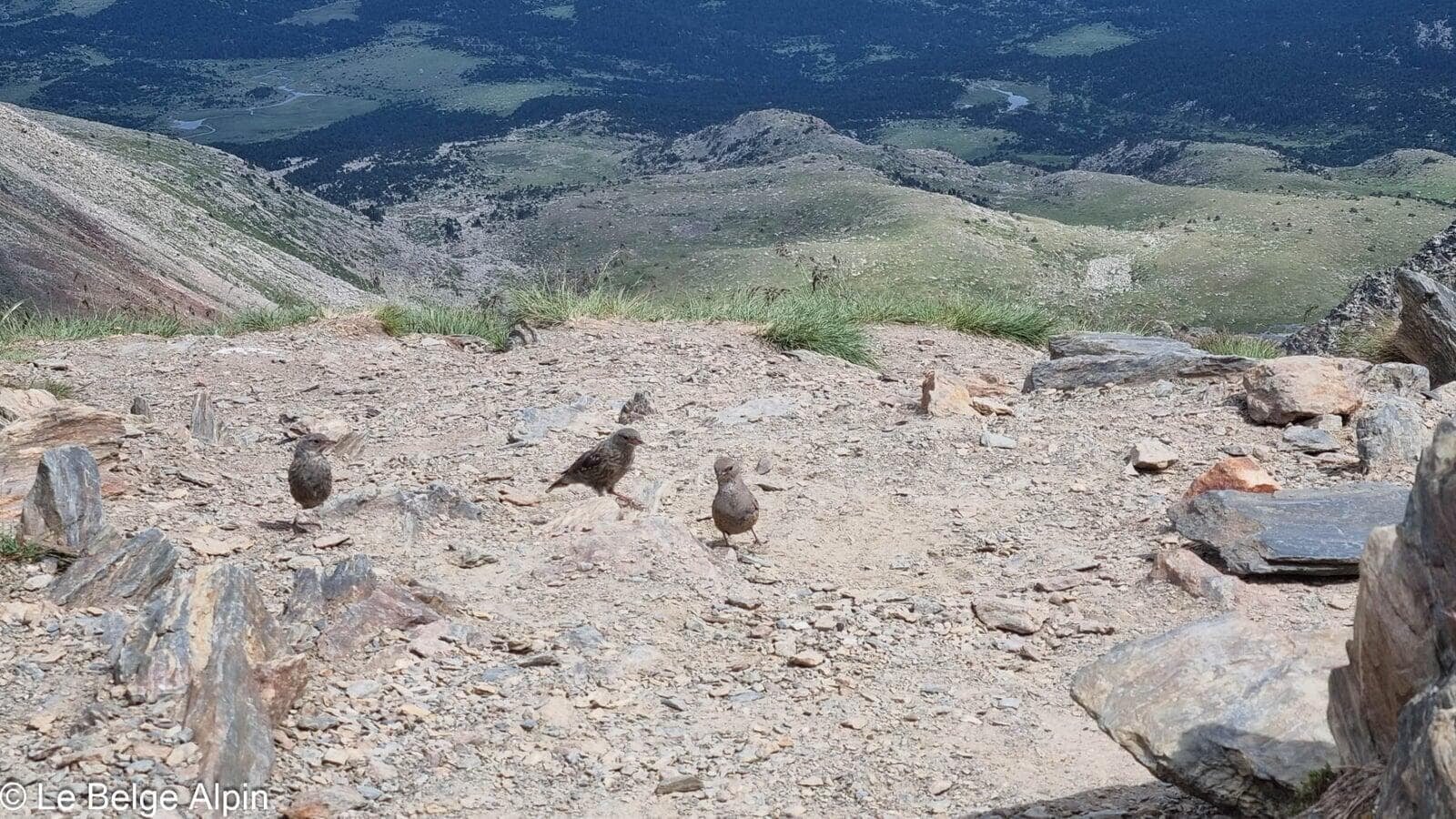
Wild horses are common in the area. We came across a group right in the middle of the trail, in no hurry at all. We go round them calmly, take in their smell for a moment, and carry on.
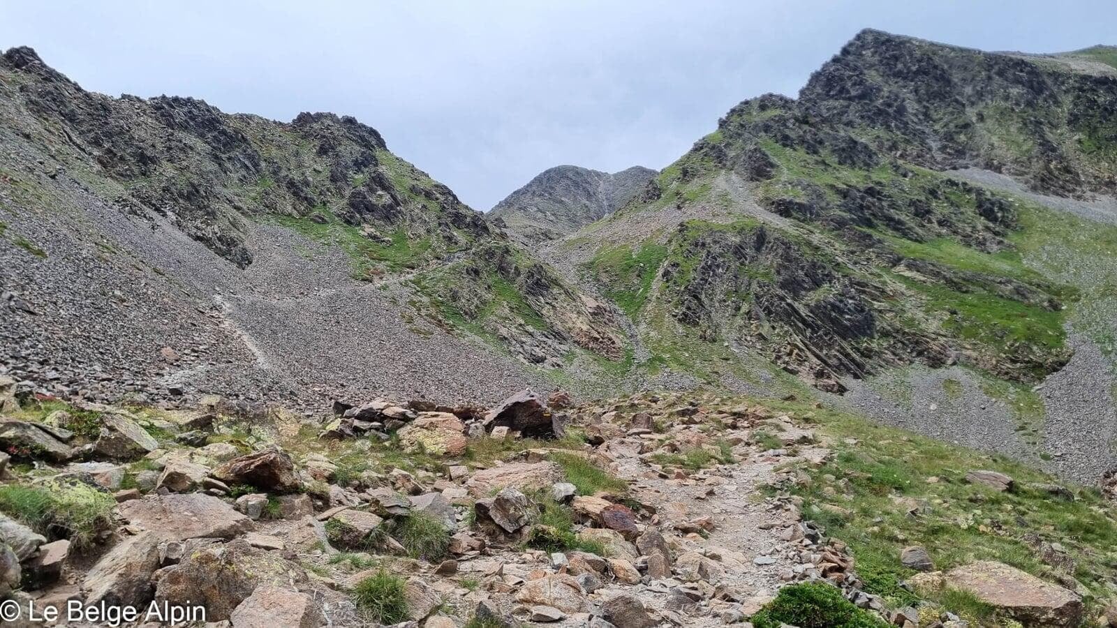
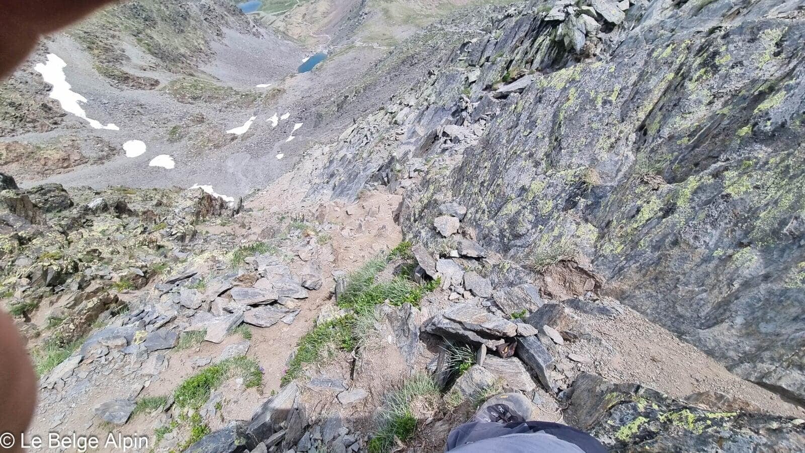
The rocky pull

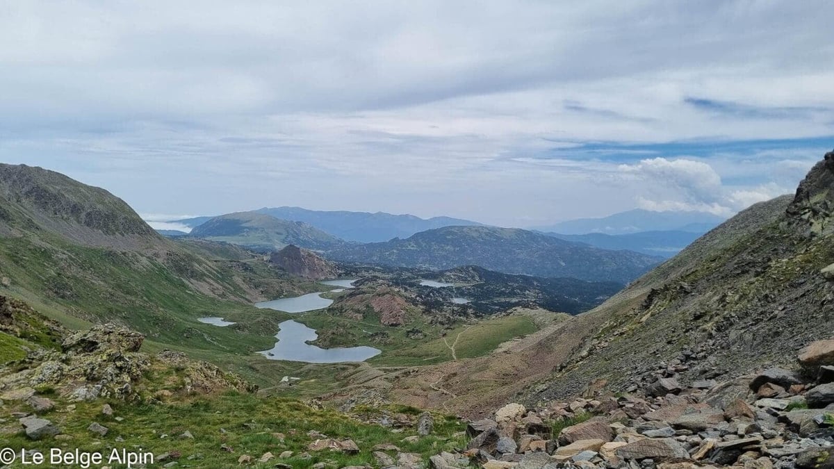
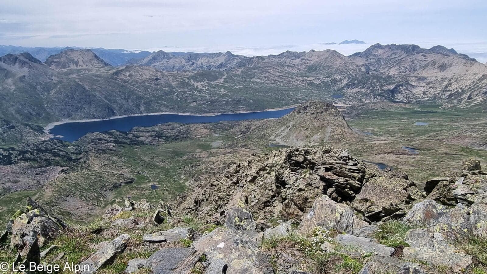
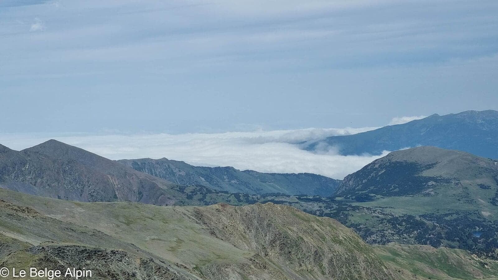
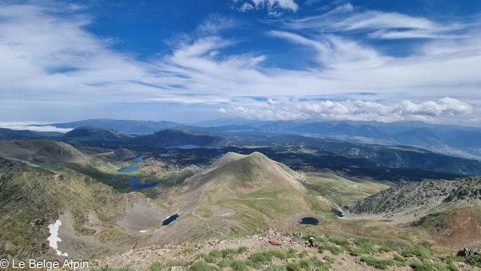
The end is a bit more athletic, with a section through rocky ground, but nothing insurmountable. The trail rises sharply, the stones shift a little, you place your feet with care. At the pass, the show is complete: below, the tarns form a blue necklace that seems endless. You understand why the Carlit is a classic of the eastern Pyrenees.
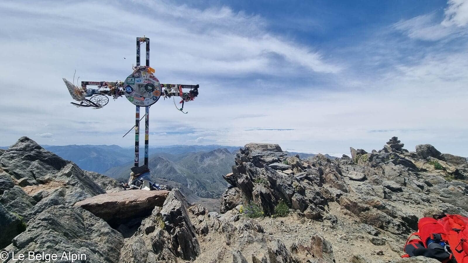
At the summit, panorama and decorated cross
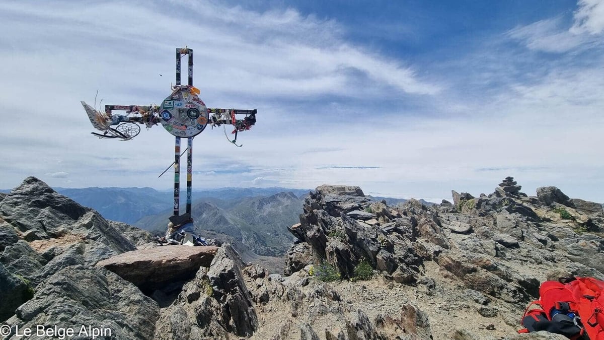

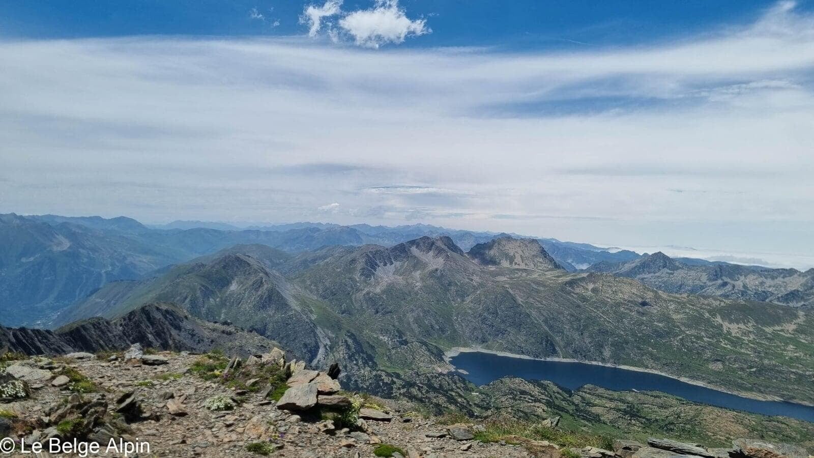
At the summit, a decorated summit cross, loaded with offerings, stickers, and small items left by previous hikers. At 2921 m, you see far: the Cerdagne plain to the south, Andorra to the west, and in clear weather the Mediterranean to the east. One of the most open views in the eastern Pyrenees.
The descent follows the same line, with the pleasure of passing each lake again in reverse. Watch out for the last shuttle: check timetables when you arrive, you do not want to end the day stranded on the forest road.
Practical info
1216 m of gain, 17 km, count 7 to 8 hours including breaks (and the ice cream). In peak season, the shuttle access dictates the timing: note the last shuttle as soon as you arrive. The Refuge des Bouillouses at the trailhead is a good plan B for food or lodging if you want to start early.
For conditions, a call to the Font-Romeu tourist office will give you the state of the trail and the current shuttle timetable.
Practical info
Starting point
From Font-Romeu or Mont-Louis, reach the Bouillouses station. In peak season (July-August), private car access is prohibited: parking at the end of the forest road + mandatory shuttle to the lake. Check timetables on the tourist office site. Out of season, you can drive all the way up to the lake.
GPX track
Import the GPS track into your watch or app (Garmin Connect, Komoot, Gaia GPS, Iphigenie...).
Sign in to downloadMountain huts
Refuge des Bouillouses (CAF), 2023m
At the trailhead, on the lakeshore. Food and lodging. Handy for splitting into two days or starting early on the Carlit at dawn.
Tourist office (current conditions)
Office de Tourisme Pyrenees 2000, Font-Romeu
82 Avenue Emmanuel Brousse, 66120 Font-Romeu
Garmin track
Gallery
14 photos, click to enlarge


Weather, Font-Romeu-Odeillo-Via
Conditions and forecasts for the itinerary
In the mountains, conditions change fast. A thunderstorm can become dangerous, fog disorients, residual snow slows every step. Before leaving, check the bulletins, plan a stable weather window, and when in doubt, call the tourist office or the local guides office.
Learn to read mountain weather →Questions fréquentes
Is the Bouillouses shuttle mandatory?
+
Yes, in peak season (July-August) private car access to the lake is prohibited to protect the site. Parking at the end of the forest road, then a paid shuttle runs all day. Out of season, you can drive up to the refuge.
What is the hardest part?
+
The last 200 metres: unstable rocky ground, a bit more athletic than the rest. Nothing technically intimidating, but you feel the altitude and accumulated effort. Experienced hikers reach the summit without issue, beginners can stop at the pass (the view from there is already very fine).
How many lakes do you pass?
+
Around 12 lakes visible along the route, the Lac des Bouillouses (artificial) and then a series of natural glacial tarns between the Bouillouses and the pass. That's the main charm of the Carlit: a necklace of lakes, each with its own character.