
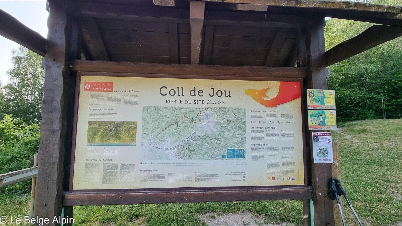
From the Col de Jou (1125 m), ascent of the Pic du Canigou (2785 m) via the Refuge des Mariailles. 27 km, 1700 m of gain, the last section close to scrambling. The mythic Catalan summit, between sea and mountain.
After my three-week solo trip in the Alps, I meet up with my wandering friend in the small village of Villefranche-de-Conflent. We plan the first stages of our Pyrenees trip and pick the Pic du Canigou for our first adventure as a pair.
We set off from the Col de Jou at 1125 m and decide to carry the bivouac kit up so we can split this heavy gain over two days. 1700 m of gain in one go over 27 km is serious, even for strong walkers.
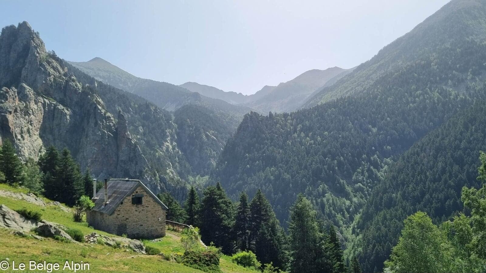
Day 1, climb to the Refuge des Mariailles


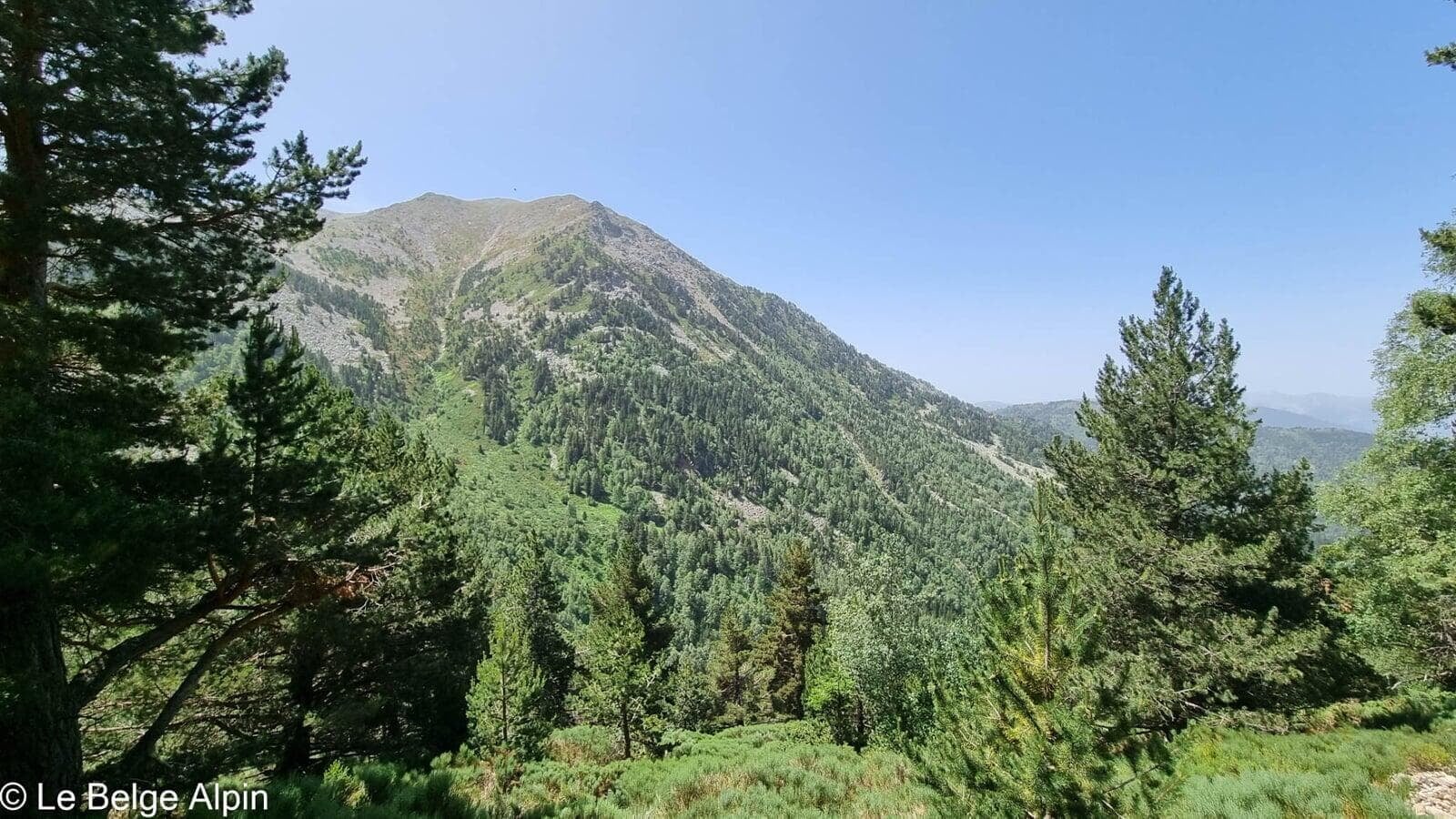
After two hours of walking, we already arrive at the Refuge des Mariailles. We choose to leave our bivouac kit there and make the ascent in one push, as we are both strong walkers. With the pack weight gone, we start the second part of the hike that leads us to this mythic summit, perched between the Mediterranean and the start of the range.
About the GPS track. Since we had planned for two days, I had stopped my watch when we reached the refuge, then restarted it when we decided to push on. As a result, the first section Col de Jou → Mariailles was never recorded. The downloadable GPS track therefore only covers the upper part (Mariailles → summit → return). The figures in the data sheet (27 km, 1700 m of gain) do match the full real route from the Col de Jou, cross-checked against several sources: for the lower part, count double what the track shows.
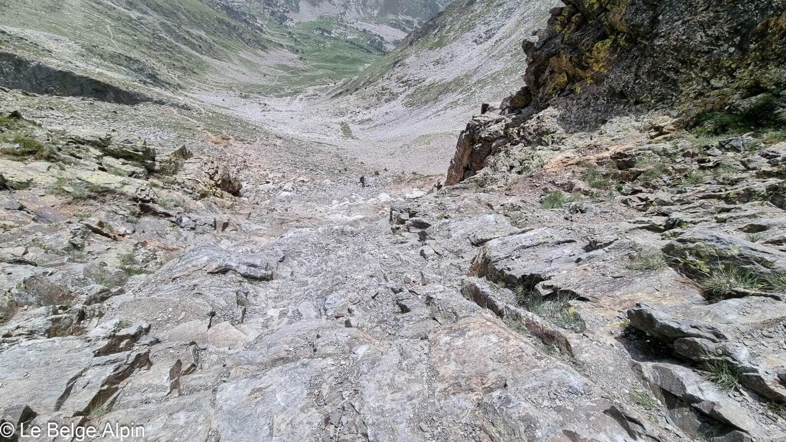
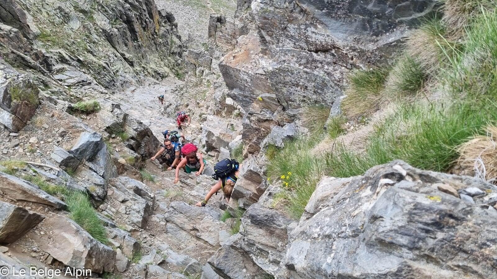
Final climb, scrambling joins in
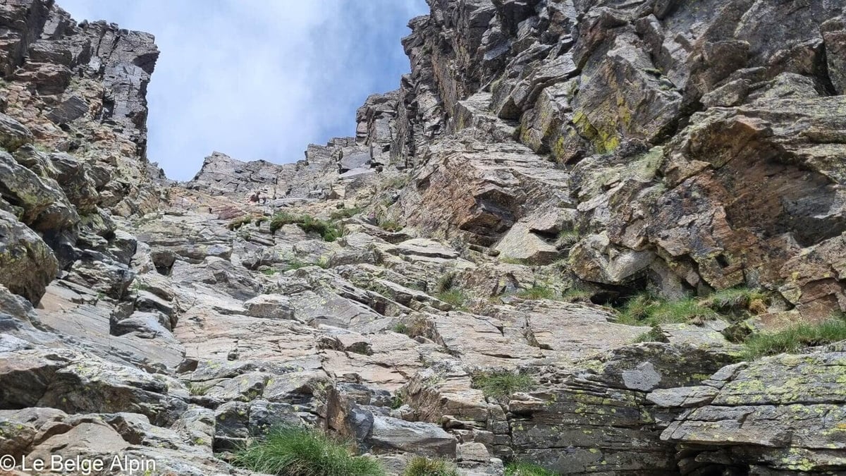
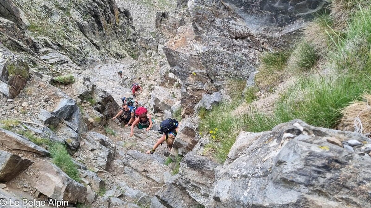
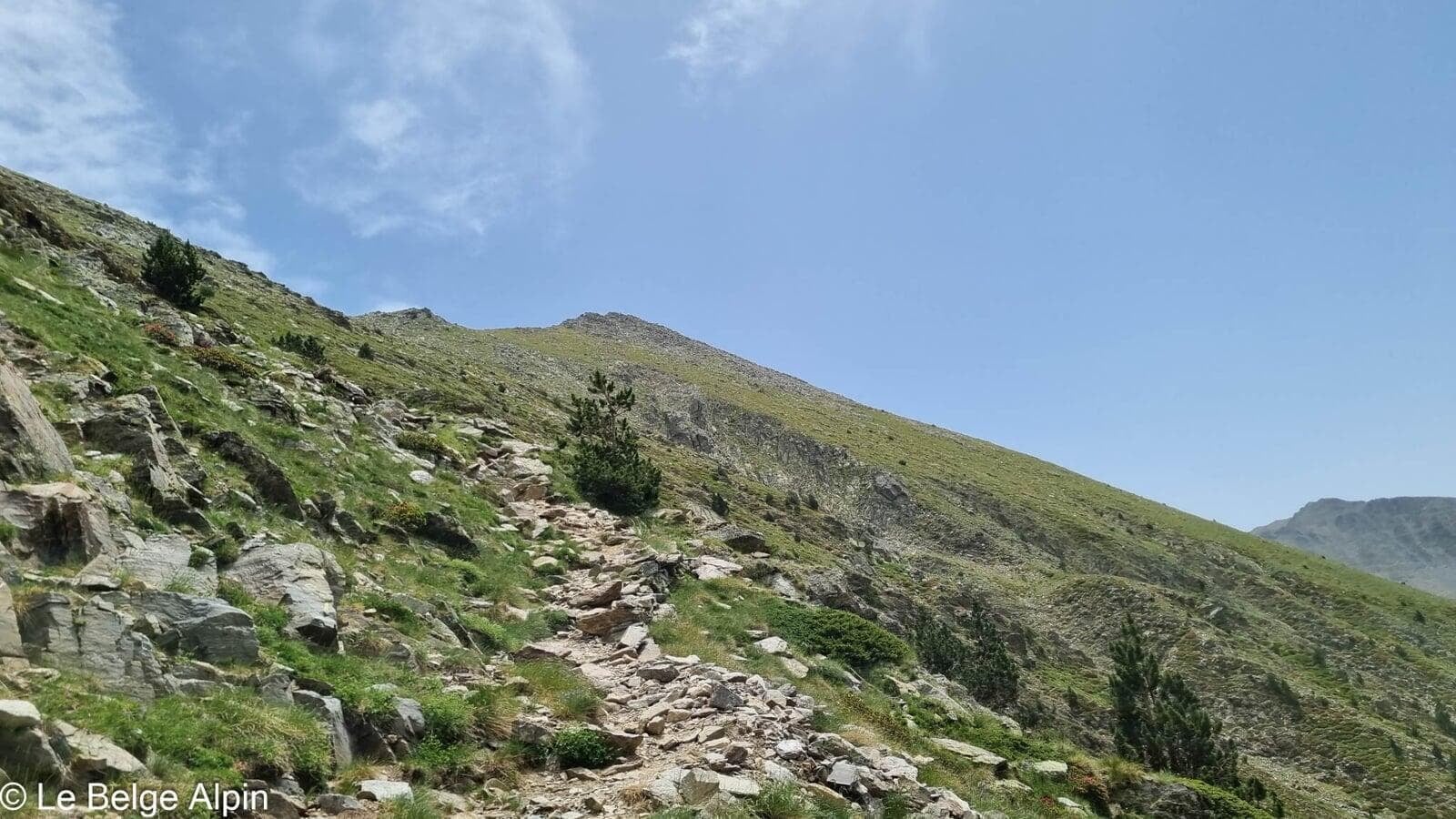
Approaching the summit, the last part becomes closer to scrambling than to hiking. We cross paths with, and help out, a few people stuck in this steep passage. It’s one of the classic traps of the Canigou: plenty of hikers show up unaware of this section and find themselves a bit blocked halfway up.
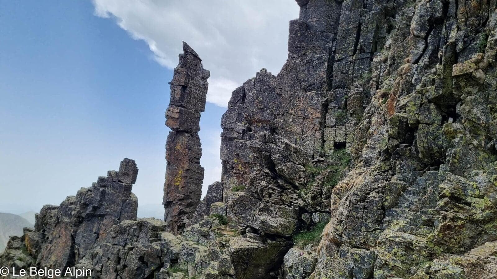
My friend and I are fairly comfortable on this kind of terrain and reach the summit without much trouble. The rock needles that frame the final couloir give the range a recognisable granite signature. No wonder the Canigou is visible from so far across the Roussillon plain.
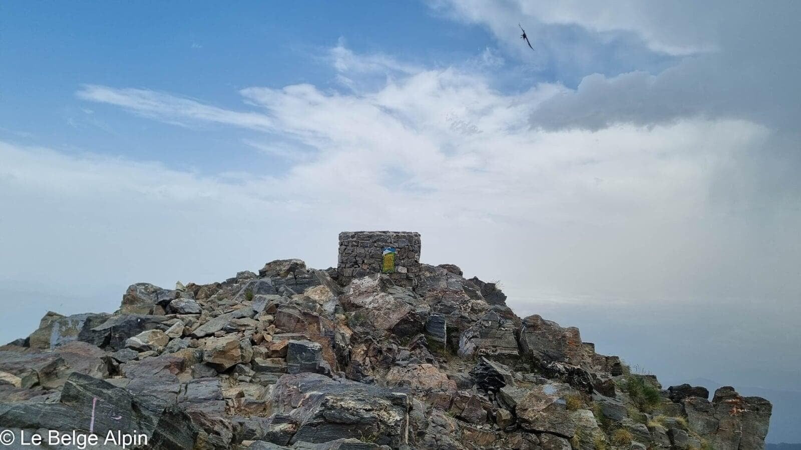
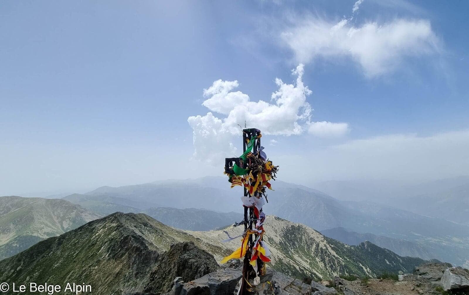
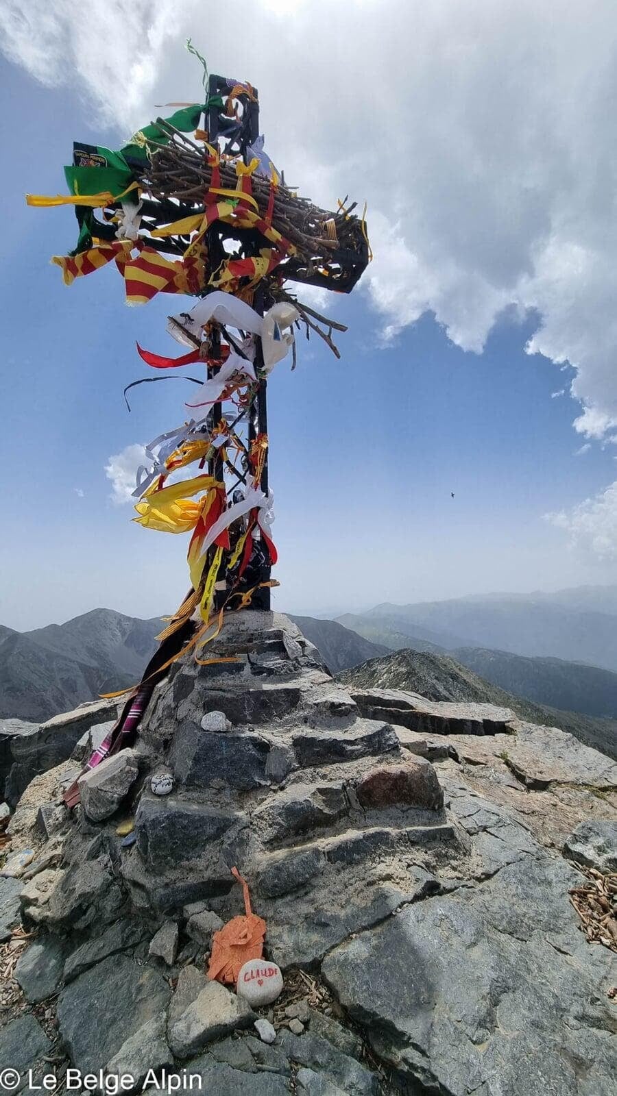
At the summit, Catalan ribbons and the Mediterranean


At the summit, the ribbon-adorned cross speaks to the Canigou’s place in the Catalan imagination. Every 23 June, the St John’s fire is lit here and redistributed to all villages in Catalonia, a centuries-old tradition that makes this summit a true place of pilgrimage.
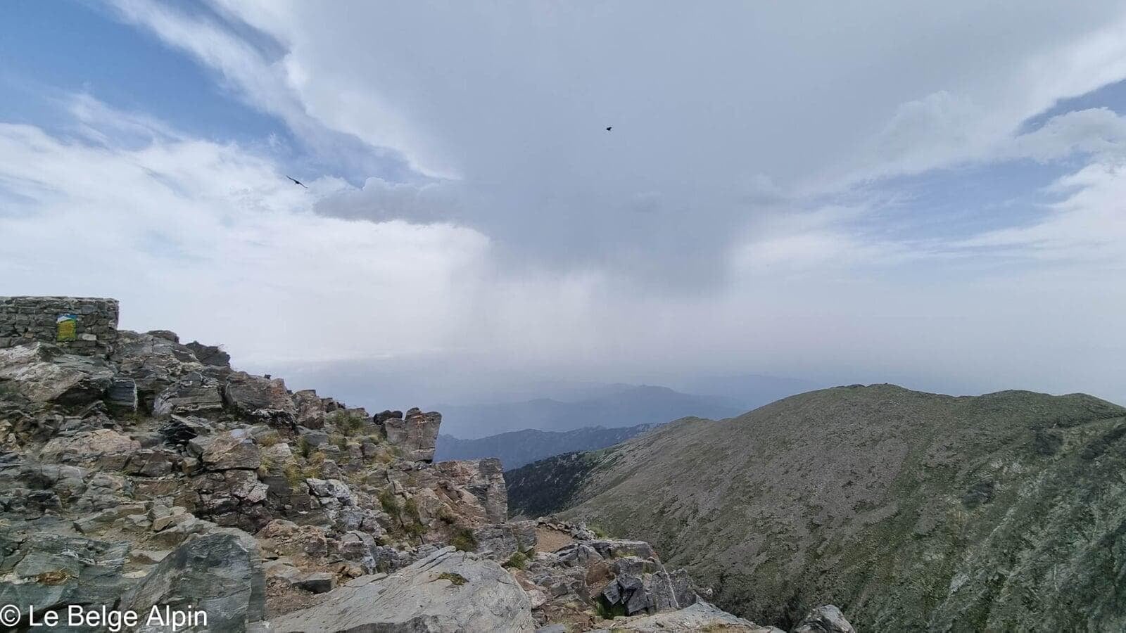
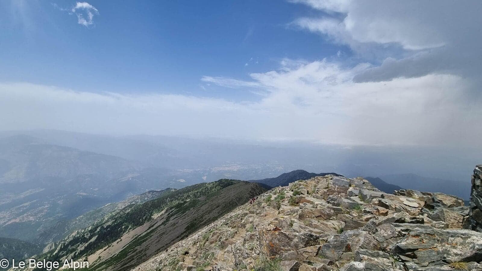
In clear weather, you can see the Mediterranean, the Roussillon plain, and the entire Pyrenean chain stretching west. A rare viewpoint, at the meeting of sea and high mountain.
Legend, how the Canigou came to be
A beautiful Catalan legend tells the birth of the summit:
“God stretched out his right hand and touched the ground with only three fingers spread apart: his thumb, his index finger, and his middle finger. As soon as he withdrew his hand, from the mark left by the index finger Mount Olympus was born, from the trace of the middle finger Mount Sinai sprang, and from the imprint left by the thumb rose Mount Canigou. The Mediterranean Sea could then take shape.”
It’s hard not to feel something for this poetry when you have the summit under your feet and the sea on the horizon.
Descent and Pic du Carlit the next day
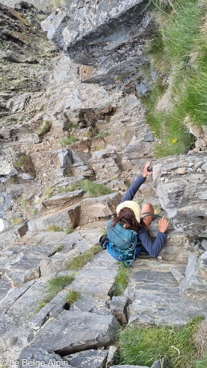

The descent demands as much or more care than the climb. The scrambling section is done facing in on the last few metres, mixing poles and hands. Back to Mariailles to pick up the bivouac kit, then down to the Col de Jou.
The next day, we link up with the Pic du Carlit in the Cerdagne, the second day of our Pyrenean trip.
Practical info
1700 m of gain over 27 km from the Col de Jou, or 800 m of gain if you start from Cortalets. Count around 10 hours of walking on the day if you push through as we did, or split it over two days bivouacking at Mariailles if you prefer. The ideal season runs from June to October, outside of which there is a risk of late or early snow on the rocky part.
For accommodation, reservation strongly recommended at the Refuge des Mariailles in summer. For conditions, a call to the Canigou tourist office or directly to the refuge warden will give you the state of the scrambling section and expected numbers.
Practical info
Starting point
From Perpignan or Prades, reach Casteil and then drive up to the Col de Jou (1125 m) via the track. Parking at the pass, trailhead well signed. Alternative: start higher from the Refuge des Cortalets (2150 m), for a much shorter loop, but you miss half the atmosphere.
GPX track
Import the GPS track into your watch or app (Garmin Connect, Komoot, Gaia GPS, Iphigenie...).
Sign in to downloadMountain huts
Refuge des Mariailles (FFCAM), 1718m
Staffed from April to November. A must-stop if you start from the Col de Jou, allows you to go up light on day 2. Good food, warm welcome, cows grazing nearby.
Refuge des Cortalets (FFCAM), 2150m
Another possible base, closer to the summit. 4x4 access possible from the north.
Tourist office (current conditions)
Office de Tourisme Canigou, Vernet-les-Bains
2 Rue de la Chapelle, 66820 Vernet-les-Bains
Garmin track
Partial GPS track
A special case on this hike: we had planned it over two days, but we reached the Refuge des Mariailles in barely two hours and decided to do it all in one push. I had stopped my watch at the refuge and restarted it when we set off again, so the first section Col de Jou → Mariailles was never recorded. The GPS track below only covers the upper part (Mariailles → summit → return). The figures in the data sheet (27 km, 1700 m of gain) match the full real route from the Col de Jou; for the lower part, count double what the track shows.
Gallery
15 photos, click to enlarge


Weather, Vernet-les-Bains
Conditions and forecasts for the itinerary
In the mountains, conditions change fast. A thunderstorm can become dangerous, fog disorients, residual snow slows every step. Before leaving, check the bulletins, plan a stable weather window, and when in doubt, call the tourist office or the local guides office.
Learn to read mountain weather →Questions fréquentes
Can the Canigou be done in a single day?
+
Yes, from the Refuge des Cortalets (2150 m), around 800 m of gain, that's the short variant. From the Col de Jou via Mariailles as described here, it's about 1700 m of gain over 27 km, too long for one day unless you're well trained. Better to bivouac at Mariailles. We did it in one push, but we were both well trained.
Is the summit technical?
+
The last section (final 50-100 metres) uses hands, easy scrambling grade. No roped climbing, but you need to be comfortable on rock. You regularly see hikers caught out by this section, stay cautious, especially on the way down.
Why is the Canigou a sacred summit for the Catalans?
+
Since the Middle Ages, the Canigou has been regarded as the sacred summit of Catalonia. Every 23 June, the St John's fire is lit at the summit and redistributed to all Catalan villages. The ribbons and flags at the summit cross are offerings from pilgrims who carry on this tradition.