
L'Aiguillette (2610 m), in the Massif de la Blanche above Seyne-les-Alpes, but by the tough variant: from Méolans-Revel on the Ubaye side, with nearly 5 km of sharp ridges before the summit. 24 km, 2046 m of ascent, airy sections where you put your hands down, and brutal heat. A big mountain day, for sure feet only.
L’Aiguillette (2610 m) is a quiet summit in the Massif de la Blanche, above Seyne-les-Alpes, on the hinge between the Préalpes de Digne and the Ubaye. Most hikers climb it gently from the Seyne side, by the Crête des Gliérettes or the Col de Bernardez. I went up another way: from Méolans-Revel, on the Ubaye side, by a long string of ridges that turns the walk into a big mountain day.
The day before, I had flown a long paragliding flight over the lake of Serre-Ponçon, invited by an instructor friend at the Les Ailes du Lac club. If the sky tempts you, the flight video is here. I slept in my van on the take-off car park. This ridge traverse to L’Aiguillette is something he had told me about two years earlier, on a first trip to fly with him. That evening I planned it out for real, and in the morning I set off.
From the valley floor to the first crests

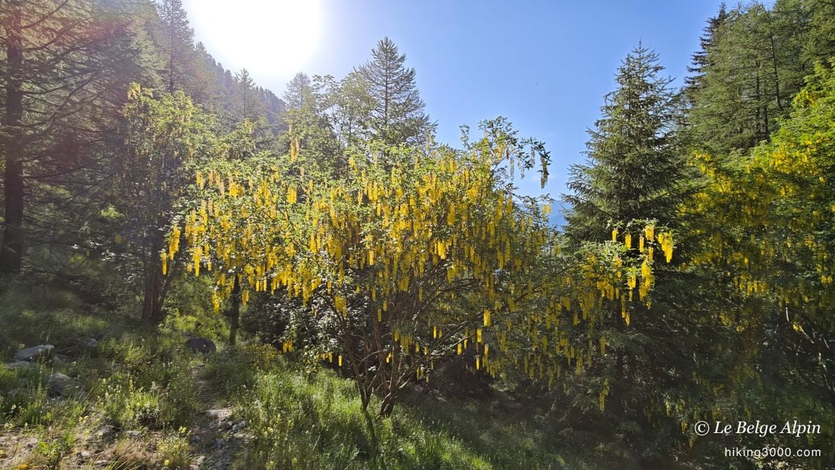
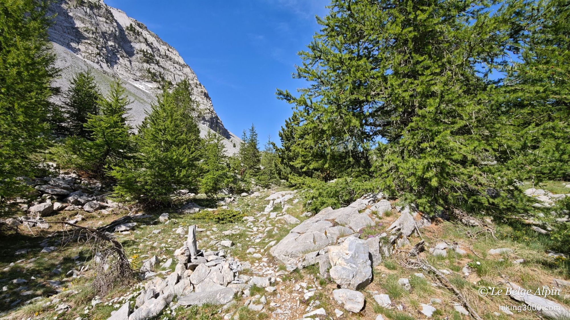
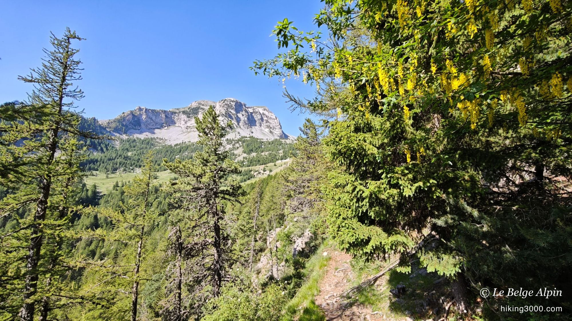
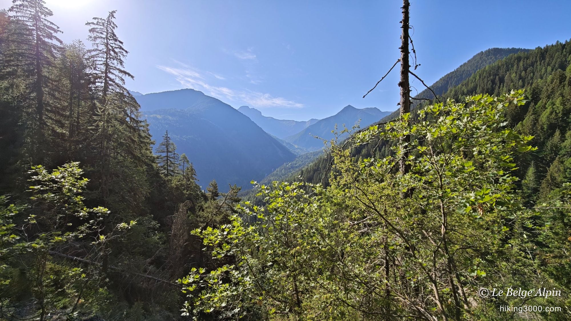
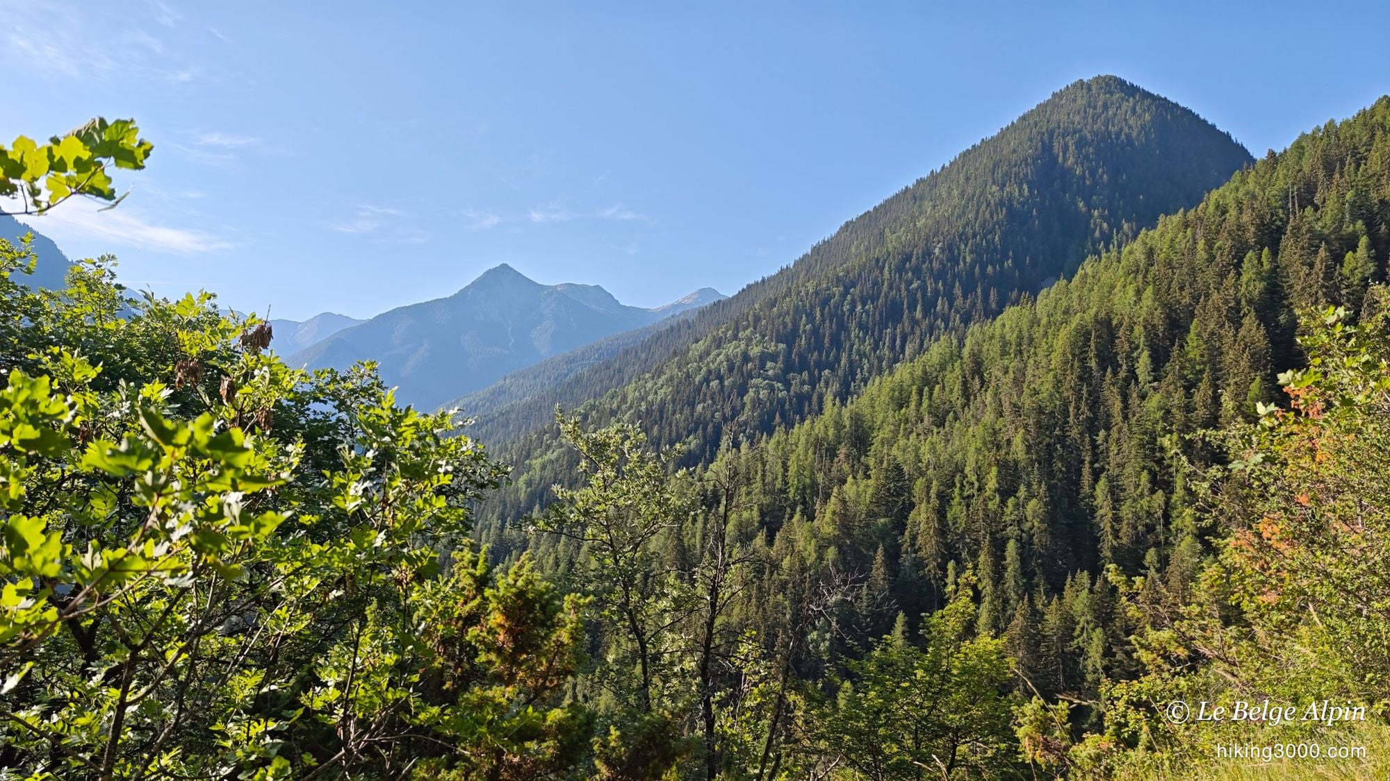
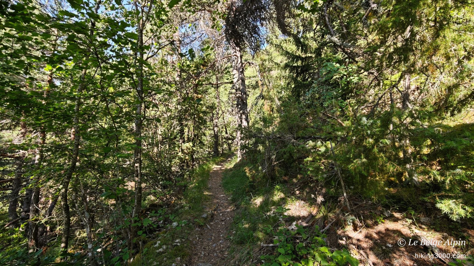
Start at the bottom of the valley, around 1272 m, in a forest still cool at that hour. As usual, I had not picked the easy way: instead of the smooth route from Seyne, I attacked low, on the Ubaye side, to reach the crest from below.
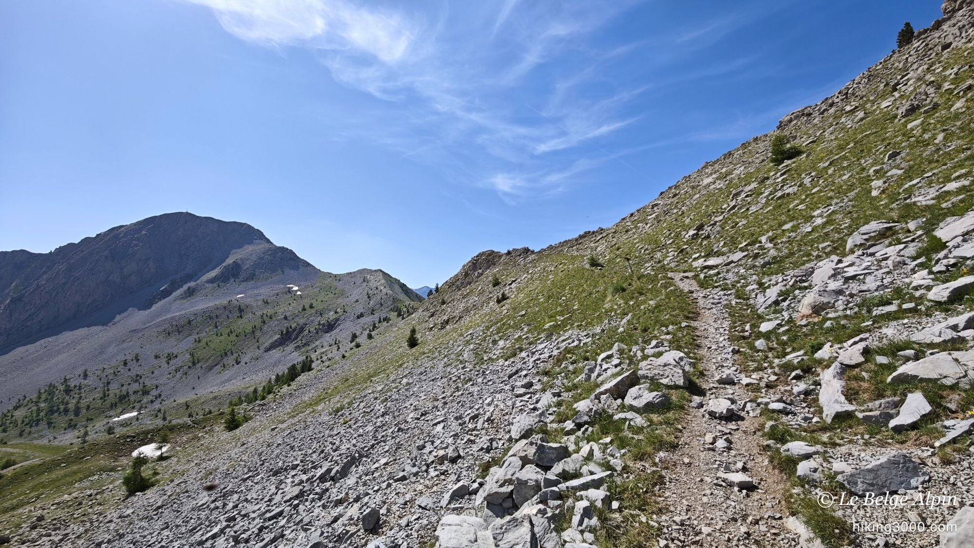
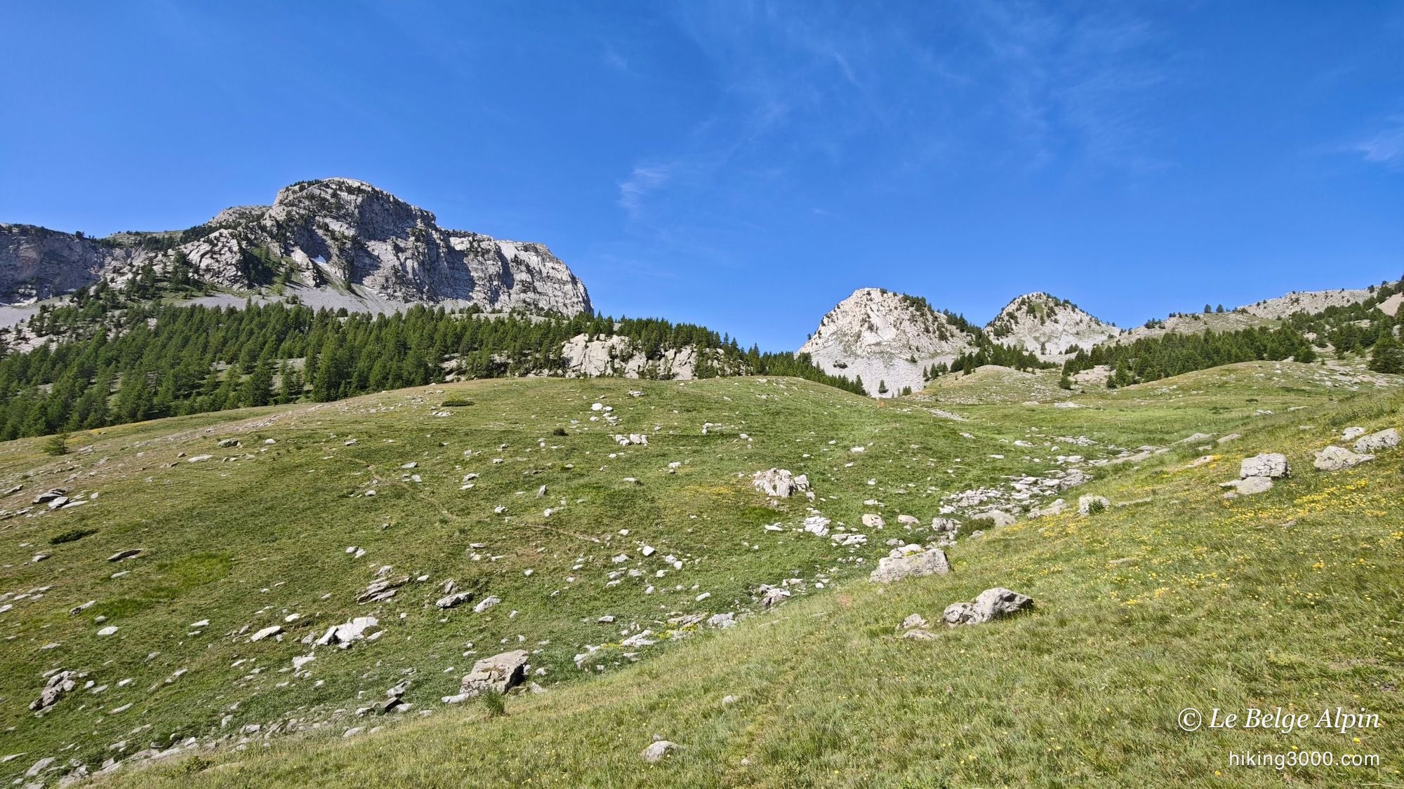
The climb crosses larch woods, then comes out onto the alpine pastures. The ground steepens, the rock bands draw closer, and a first col finally opens the view onto what is coming. That is where the real work begins.
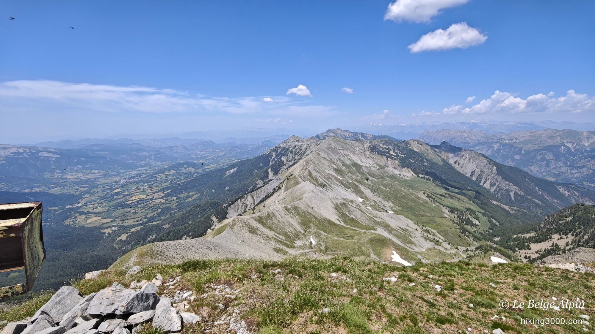
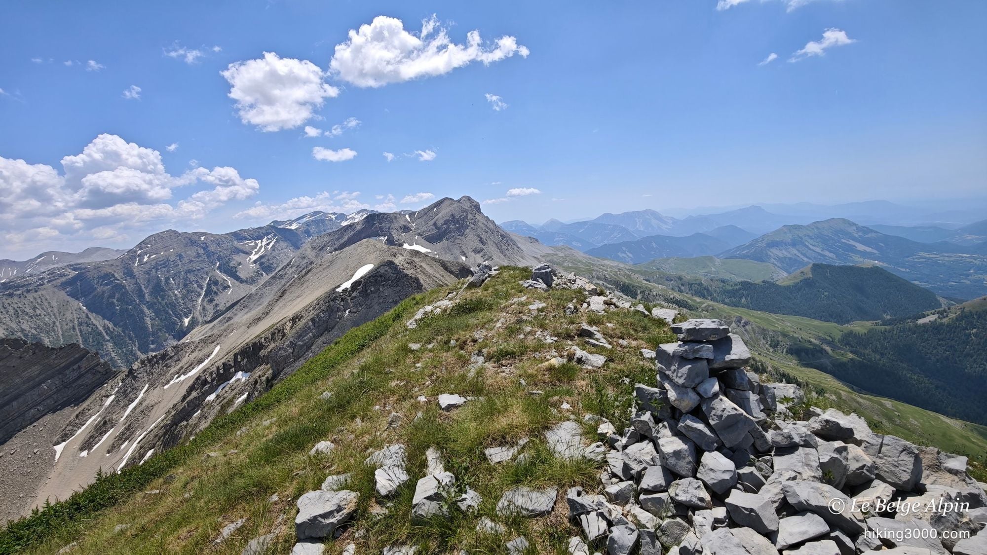
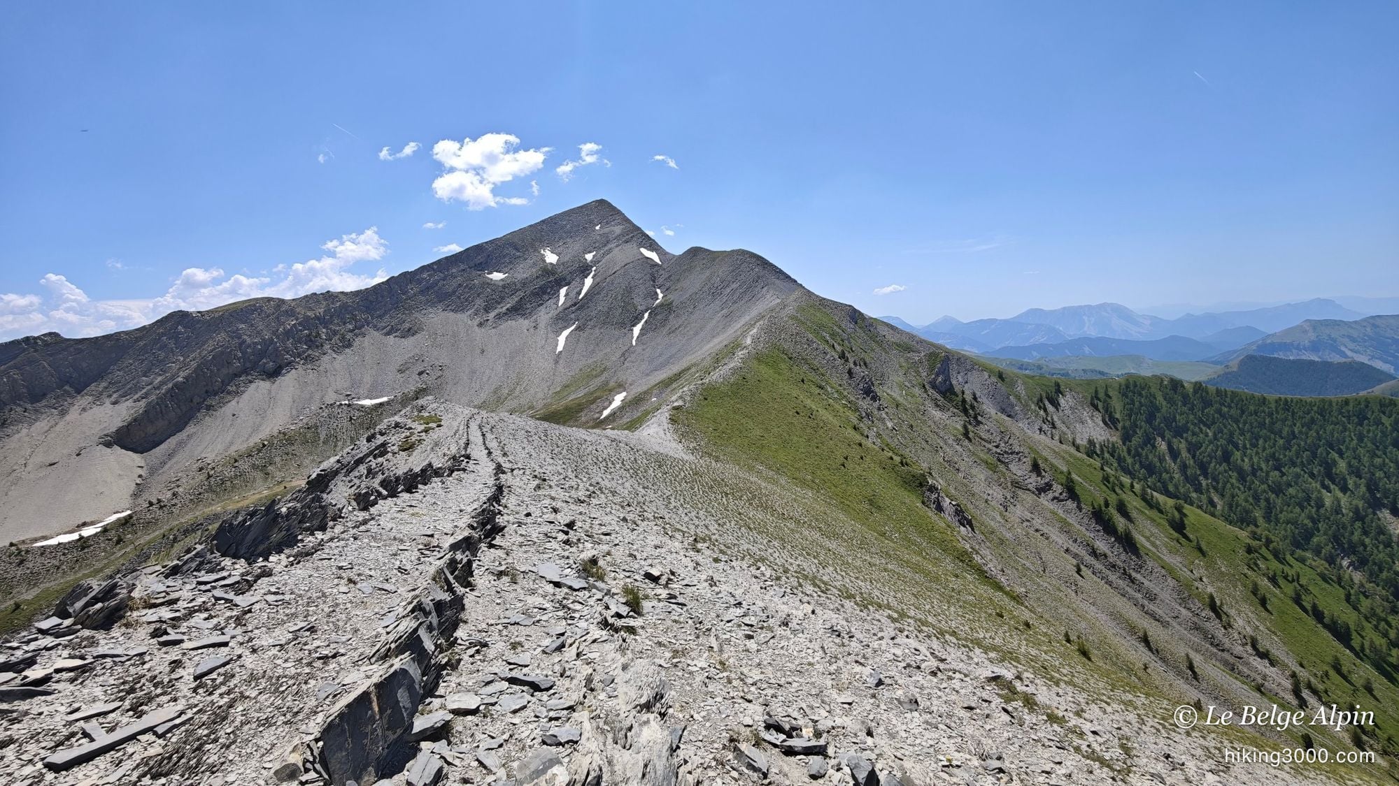
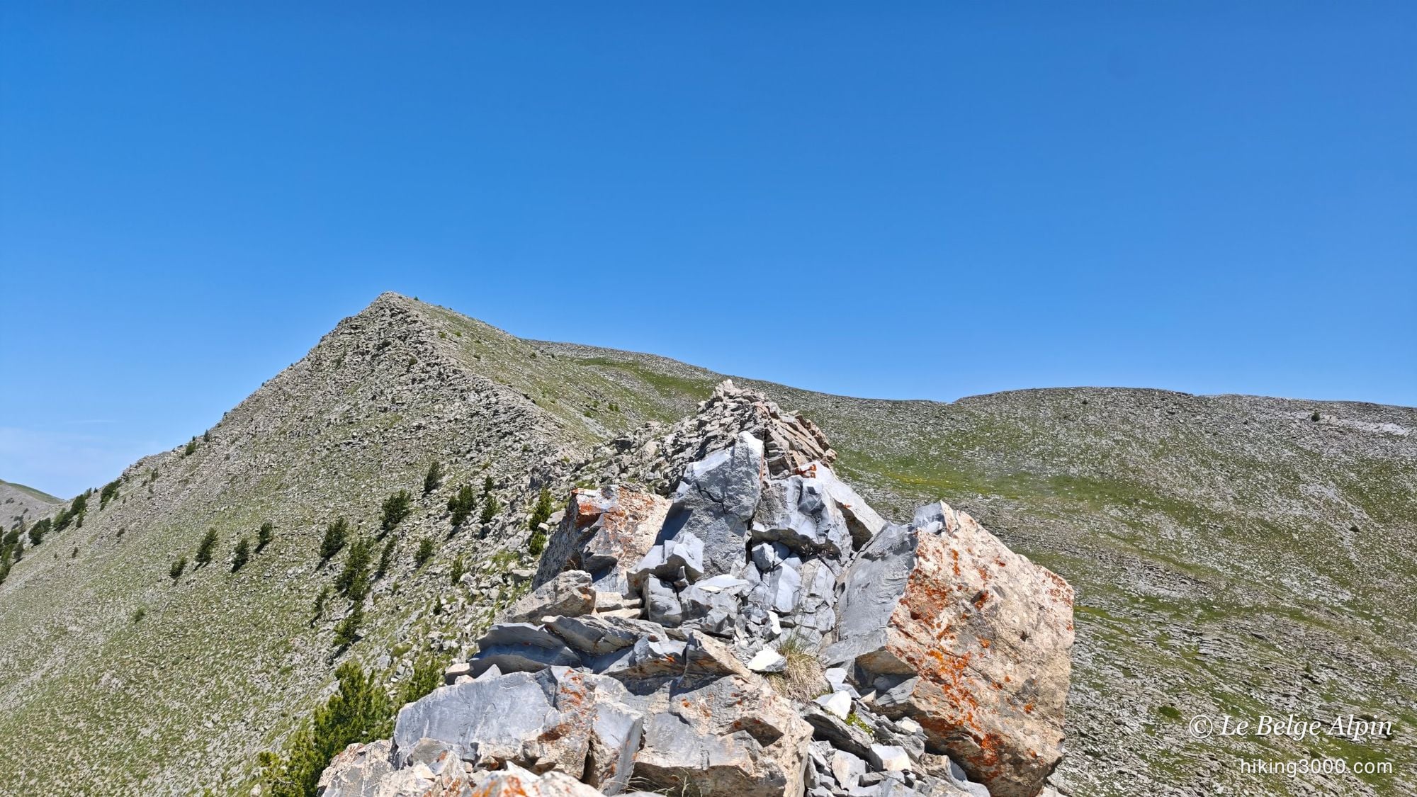
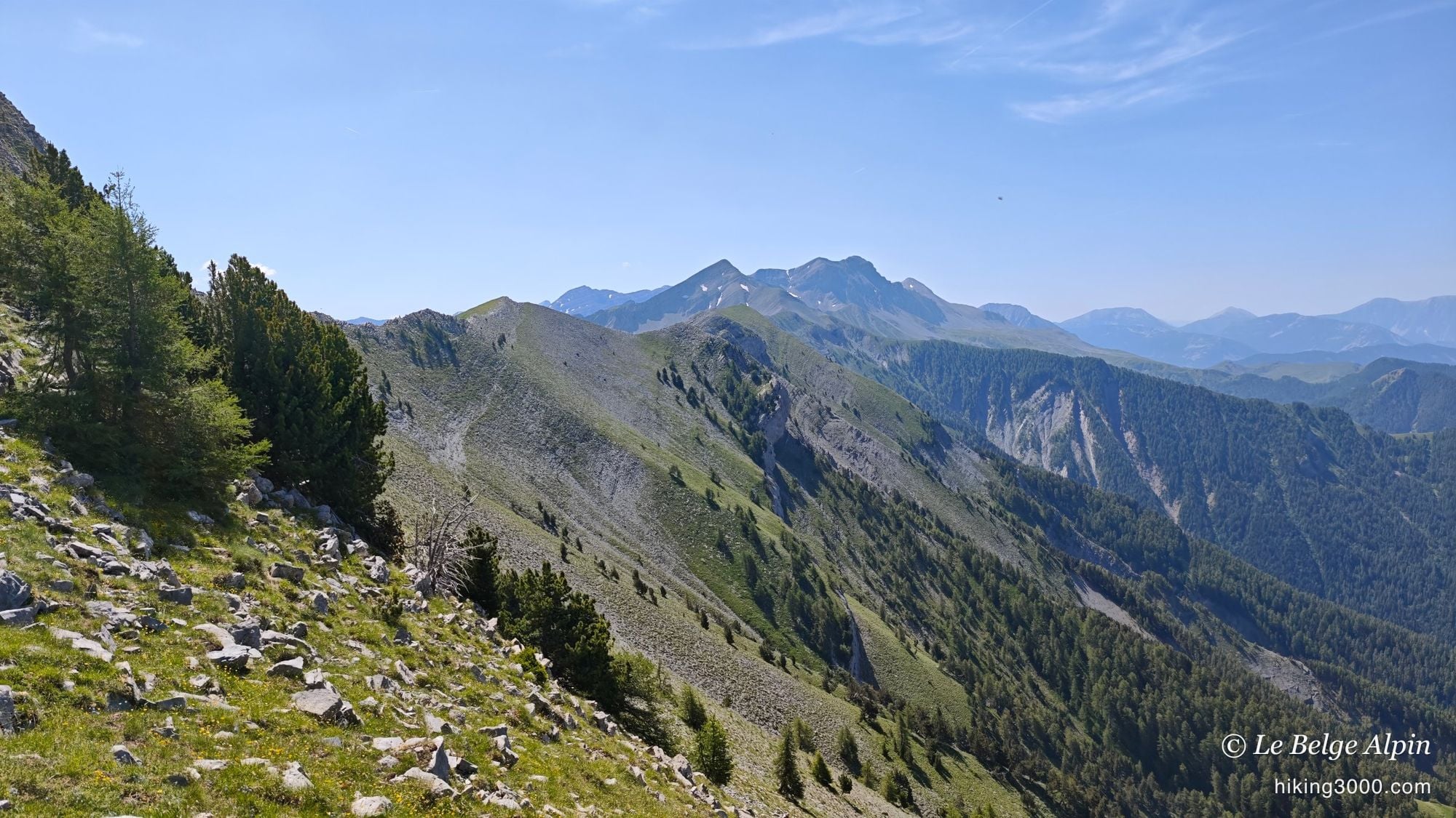
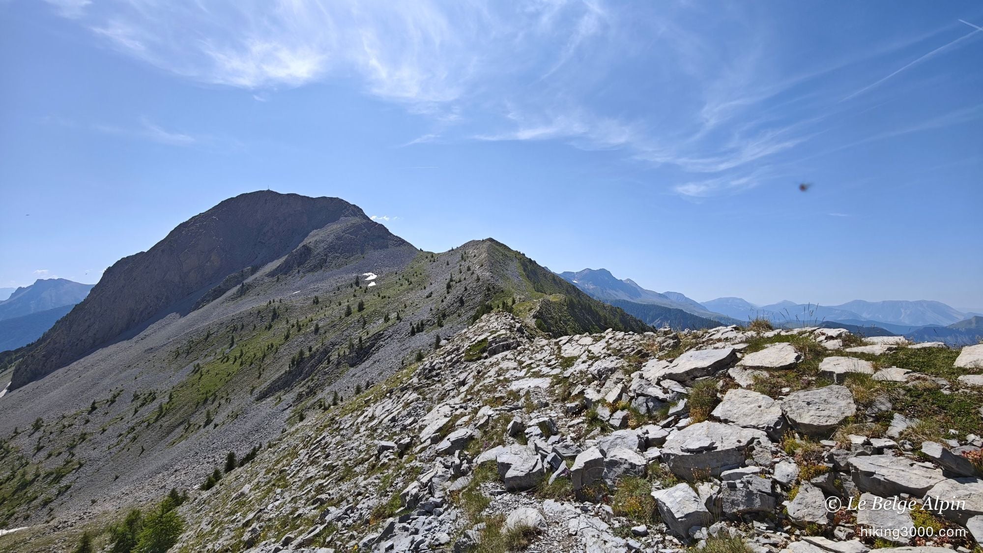
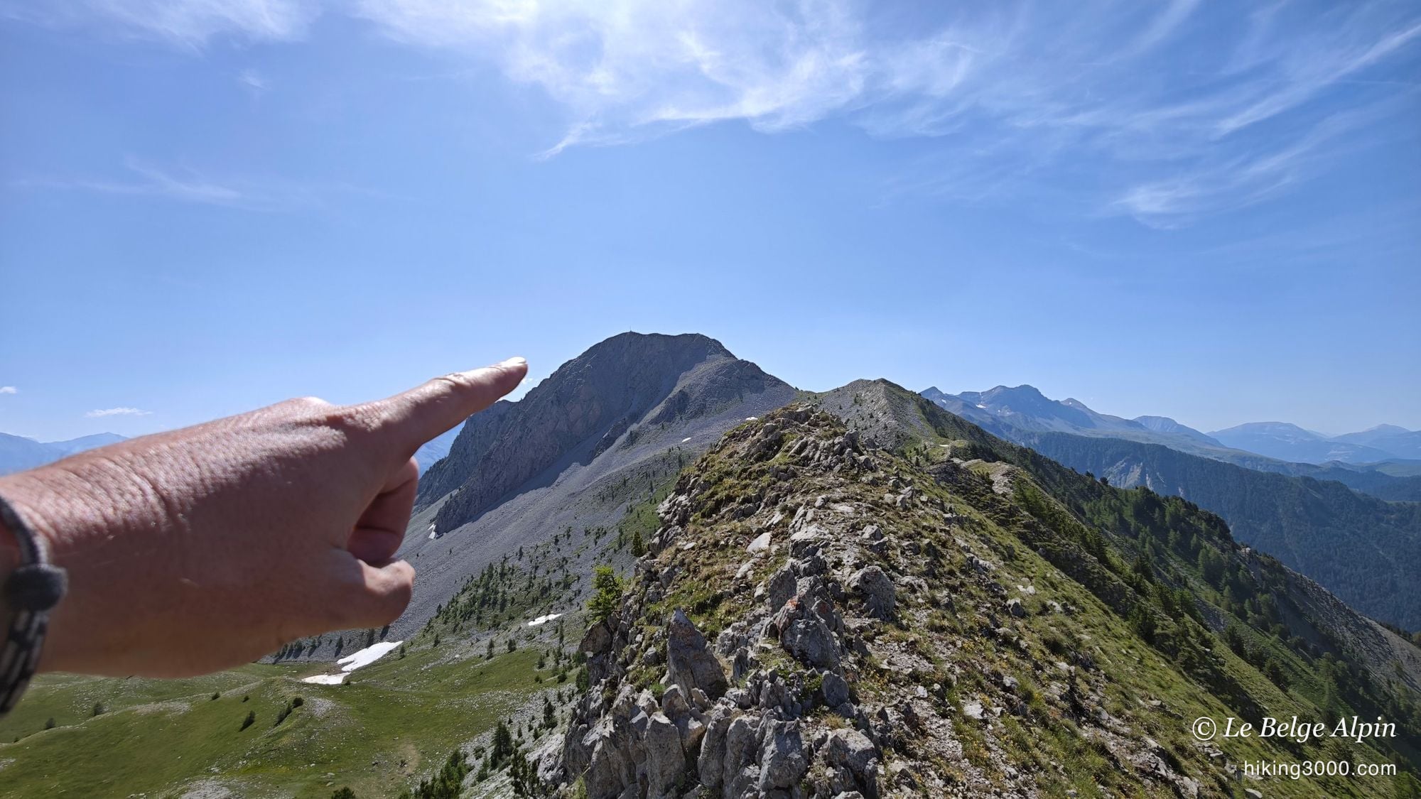
Five kilometres of sharp ridges

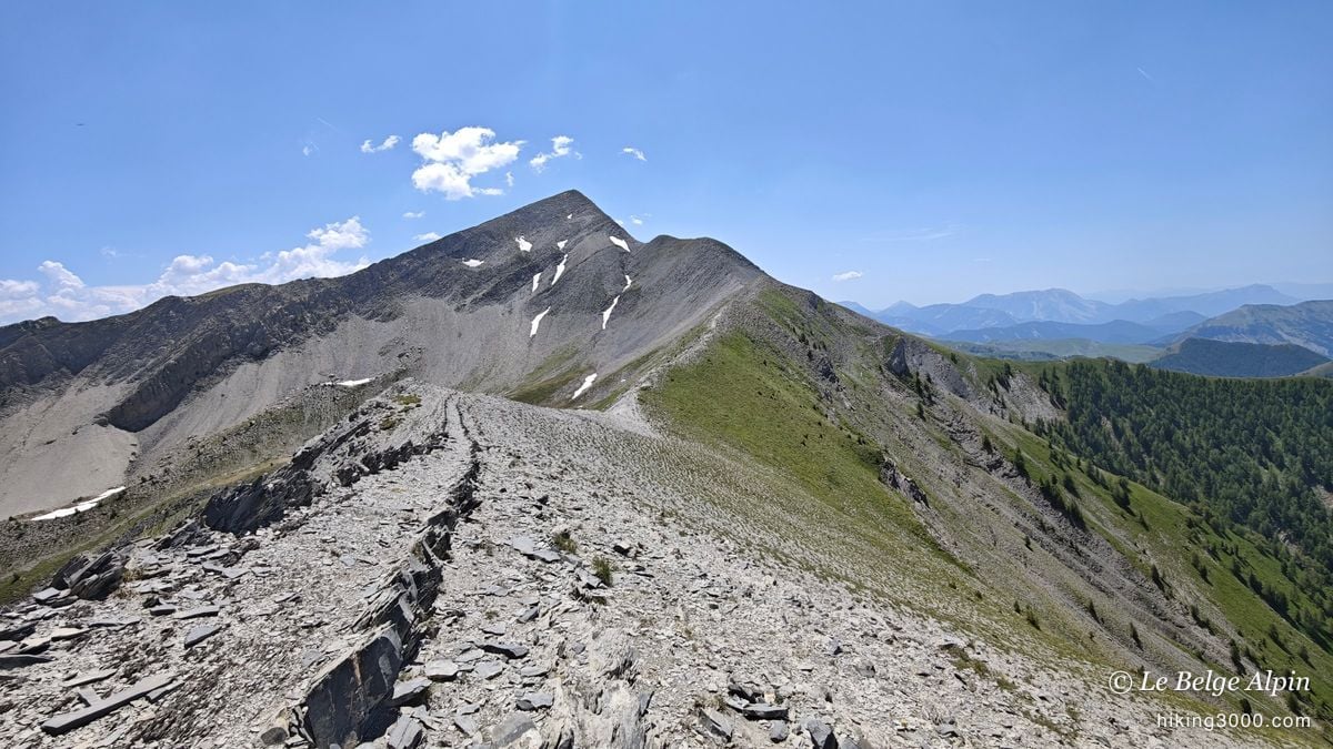
And here it is simply outstanding. You link nearly 5 km of ridges and pinnacles, on truly sharp ground, with drops to the left and right. The path is not always there: you follow the cairns, read the rock, and find good lines to avoid the steepest steps. In places it rears up and you have to put your hands down. It stays doable, but it is airy, and there is plenty of air below: no joking around.
Add to that a crushing heat, with not a drop of water on the crest, and you understand why I say to set off with full tanks. This is the kind of ground where you mostly need a good mountain sense: know where you put your feet, stay clear-headed, and never force a badly committed line.
Keep this in mind: these ridges are no stroll. The line is faint, the exposure real, and a slip in the wrong place can be serious. No vertigo, boots that grip, and margin in your head. If you have any doubt about the weather or your form, the normal route from Seyne is far wiser.
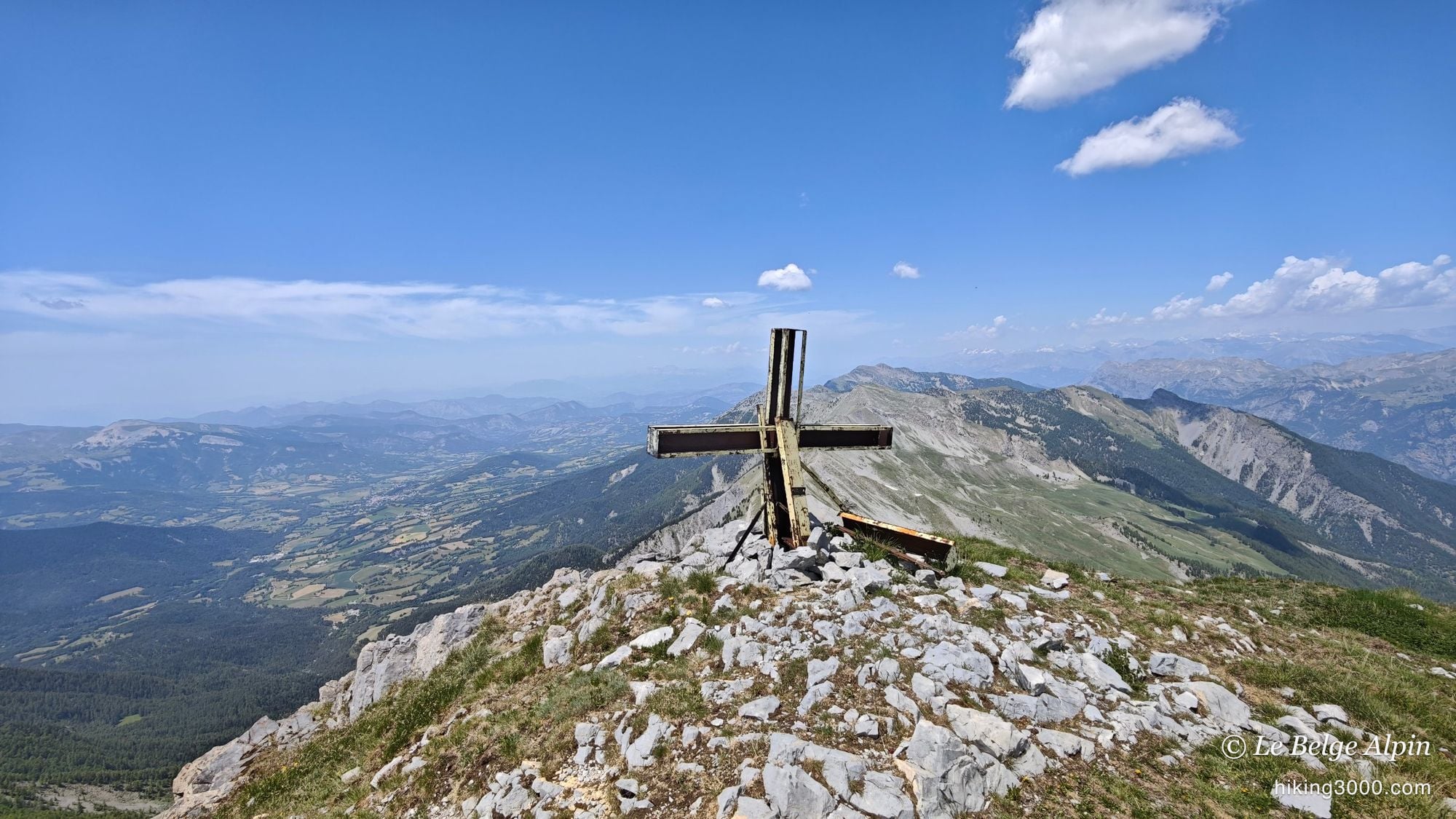
The final push to L’Aiguillette, 2610 m
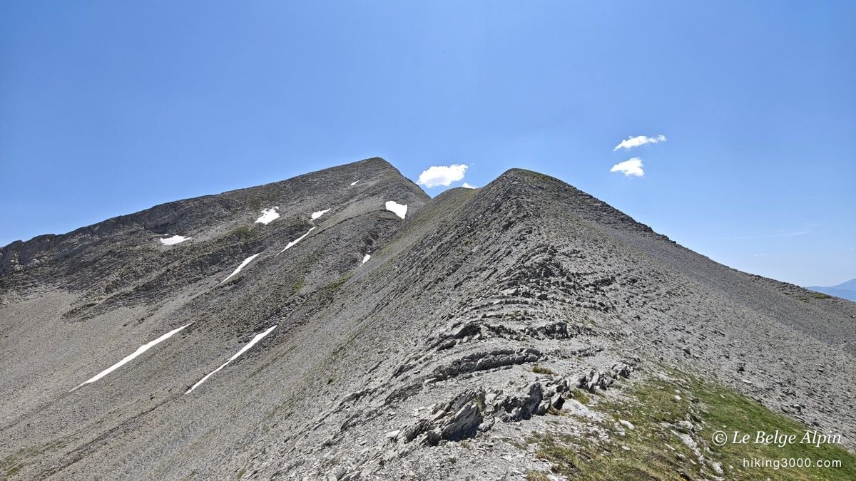

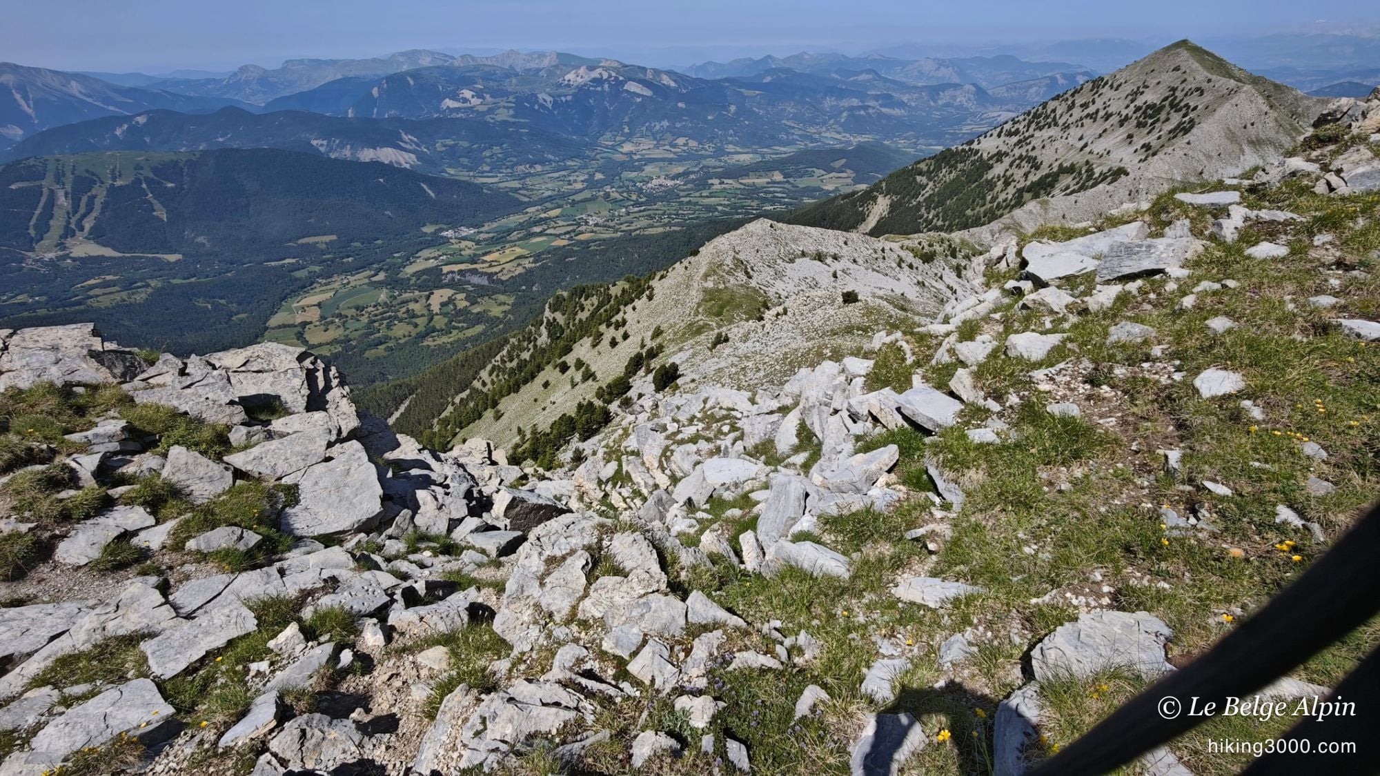
At the end of the ridges, the summit still has to be earned: the final climb picks up over the last 150 to 200 metres, on frankly technical ground. There it is a bit dicey, you have to know what you are doing, because you will come back down the same kind of steps, and the descent is harder than the climb. I had a few moments not quite on my backside, but close.
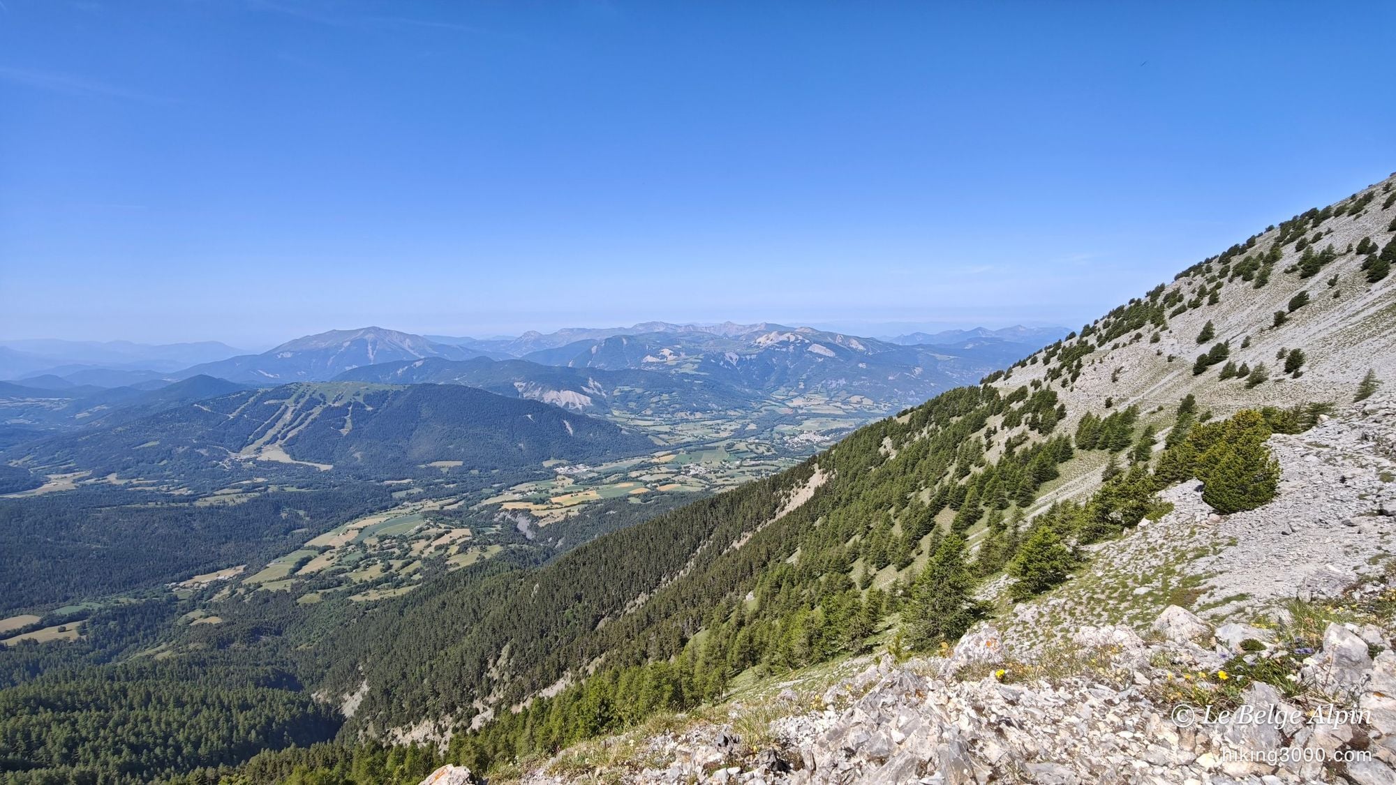
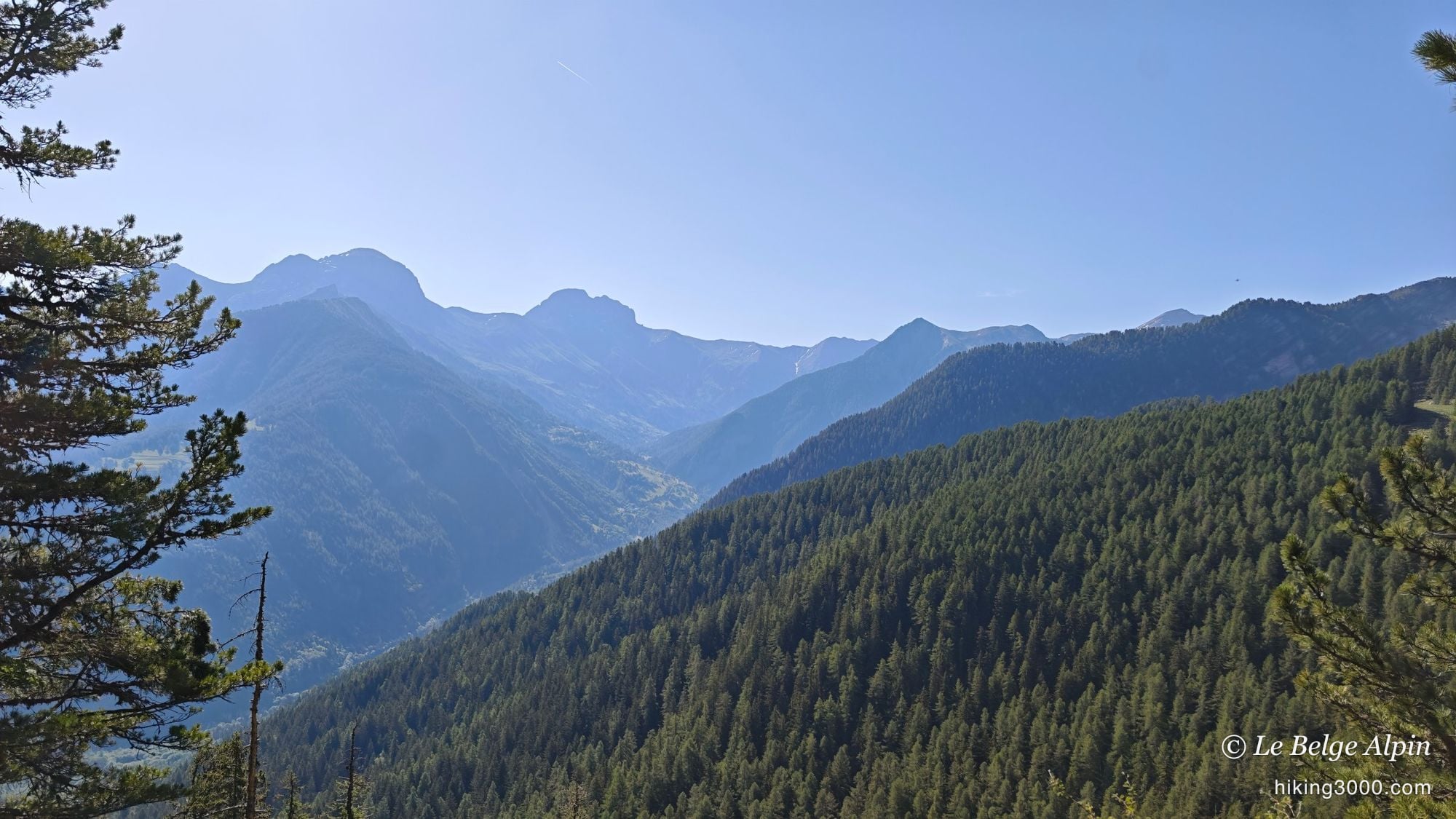
Then the cross appears, set on the rock. L’Aiguillette tops out at 2610 m, and from up there the panorama is breathtaking: all the Ubaye on one side, the Préalpes de Digne on the other, a 360-degree view over an ocean of crests. You quickly forget the sweat of the climb.
The descent drops back onto the crest, then into the forest, legs well worn by the 2046 m of ascent. A superb day, demanding from start to finish, exactly the kind of wild outing I like to seek out. In the same spirit, two days earlier, it was the Pic de Bure via the Combe d’Aurouze, not far from here.
Practical information
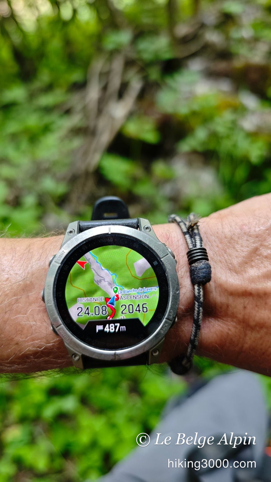
24.23 km, 2046 m of ascent, summit at 2610 m, done in 9h04 (my real time on the track, start to finish). The main course is the 5 km of ridges: airy off-trail ground, with hands-on steps and navigation by cairns. Pace it to your own legs, it is not a race.
Gear: good mountain boots and poles, no rope needed on this line, but sure feet and zero vertigo. Plenty of water (2.5 to 3 litres), the crest is in full sun with no water source. Start early in hot weather. On the E/T/R rating, I put my variant at high effort, notable technicality and risk: this is not the family outing to the summit, it is its committing version.
And if you would rather take it easy, L’Aiguillette is readily climbed from the Seyne-les-Alpes side, by the Crête des Gliérettes or the Col de Bernardez. Same summit, same panorama, far less commitment.
Practical info
Starting point
You reach Méolans-Revel along the Ubaye valley, between Le Lauzet and Barcelonnette. Note that this is the Ubaye-side start, which is not the usual approach to L'Aiguillette: the normal route goes up from the Seyne-les-Alpes side, via the Crête des Gliérettes or the Col de Bernardez, which is far more straightforward. On the Ubaye side, you start low and string the ridges together.
GPX track
Import the GPS track into your watch or app (Garmin Connect, Komoot, Gaia GPS, Iphigenie...).
Sign in to downloadGarmin track
Gallery
21 photos, click to enlarge


Weather, Méolans-Revel
Conditions and forecasts for the itinerary
In the mountains, conditions change fast. A thunderstorm can become dangerous, fog disorients, residual snow slows every step. Before leaving, check the bulletins, plan a stable weather window, and when in doubt, call the tourist office or the local guides office.
Learn to read mountain weather →Questions fréquentes
Is L'Aiguillette a hard hike?
+
It depends entirely on the route. From the Seyne-les-Alpes side (Crête des Gliérettes or Col de Bernardez), it is a moderate effort, fine for a fit walker. By my variant from Méolans-Revel, on the Ubaye side, it is another story: 24 km, 2046 m of ascent and nearly 5 km of sharp ridges with airy sections. That one calls for sure feet and a habit of exposure.
Do you need climbing gear for the ridges?
+
No, no rope or harness on the line I followed: it stays walking and easy rock, with hands down now and then. But it is airy, the path is often gone, and a slip in the wrong spot does not forgive. Good mountain boots, poles, and no fear of heights. If you are not comfortable off-trail, take the normal route from Seyne.
How much water should you carry?
+
A lot. The ridges sit in full sun with no water source, and it was scorching hot the day I did it. On a day like that I would carry at least 2.5 to 3 litres per person, and start early to avoid the hottest hours on the crest.
How do you navigate on the ridge?
+
By feel and by cairns. The route is unmarked and the path often vanishes along the crest. You read the terrain, spot the cairns and pick good lines to avoid the steepest steps. A GPS track helps, but it does not replace mountain sense. That is also what makes this traverse so good.
Can you combine it with paragliding at Serre-Ponçon?
+
The area is perfect for it, and that is exactly how I ended up here: the day before, I had flown a long paragliding flight over the lake of Serre-Ponçon, right nearby. Between the lake, the Ubaye summits and La Blanche, there is plenty for a fine weekend, in the air and on foot.