
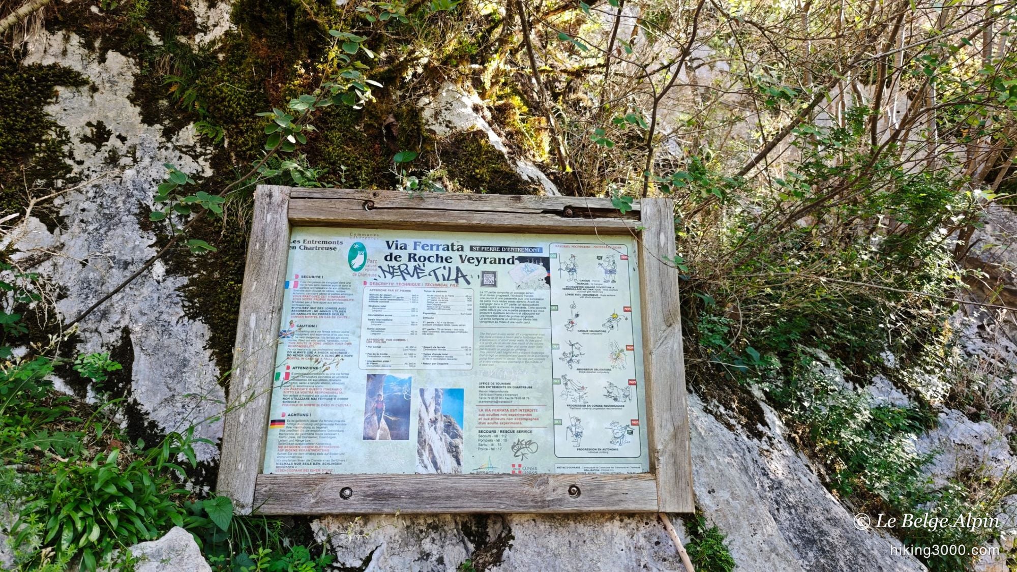
Above Saint-Pierre-d'Entremont, the Roche Veyrand via ferrata (1303 m) comes with a trail that reaches the summit while skipping the hardest section. 6.9 km, about 665 m of ascent, Chartreuse limestone and a few airy moves on the cabled part. Harness and energy-absorbing lanyard mandatory on the via.
That weekend was all about via ferrata. The day before, I had introduced two friends who were just starting out to the Échelles de la Mort, and this Monday I was heading to the Dévoluy to meet another friend for a hike. Roche Veyrand, above Saint-Pierre-d’Entremont, sat right on my way: a chance for a little via ferrata in passing, in Chartreuse limestone.
The thing is, I did not feel fit enough to take on the second part, graded TD and decidedly airy. And Roche Veyrand has a handy quirk: the via splits in two, and a trail lets you reach the summit while skipping that hard section. So I did the first cabled part, then switched to the trail. The result: a true hike-ferrata combo, exactly the kind of hybrid route I like to document here.
First outing of the year, taking it easy

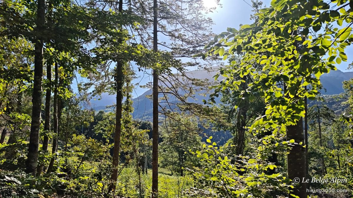
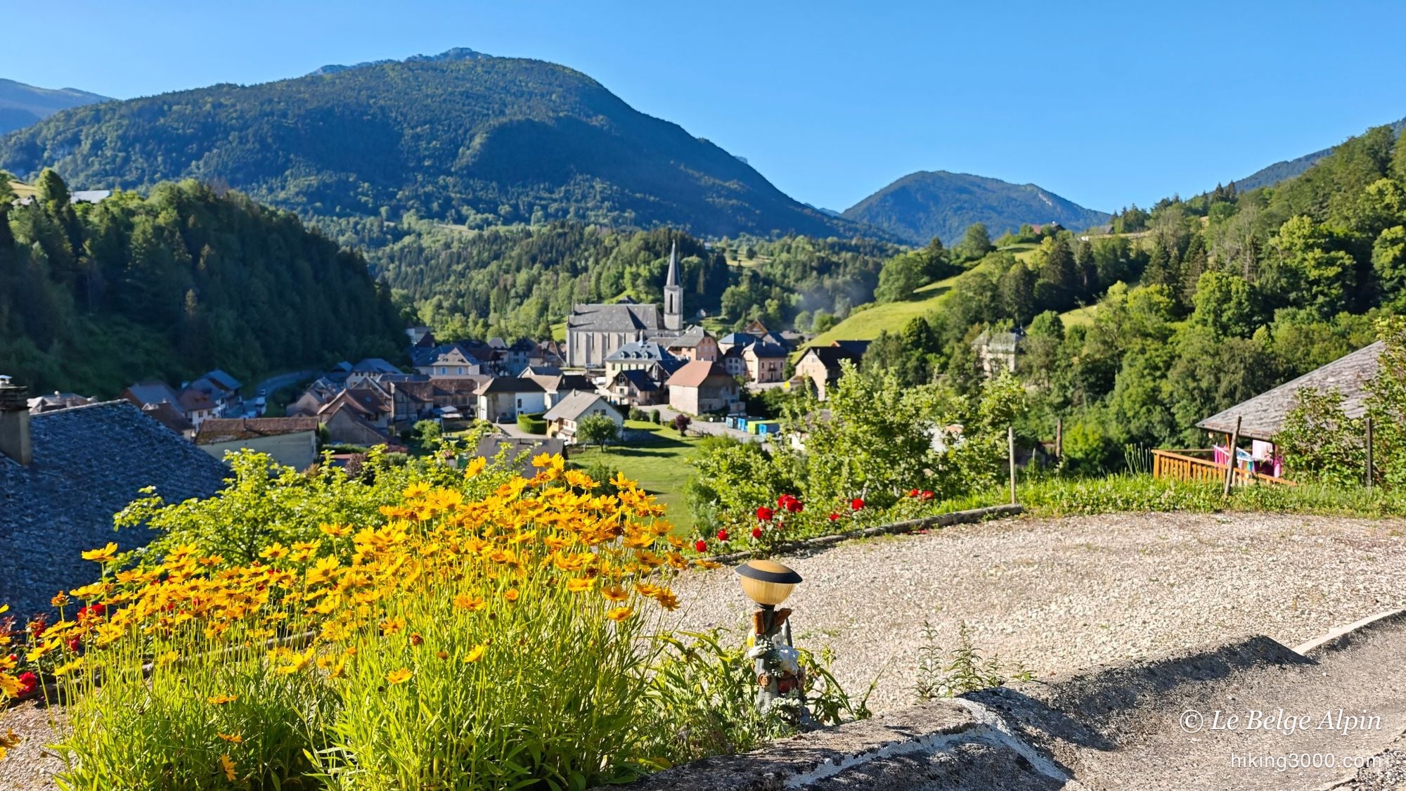
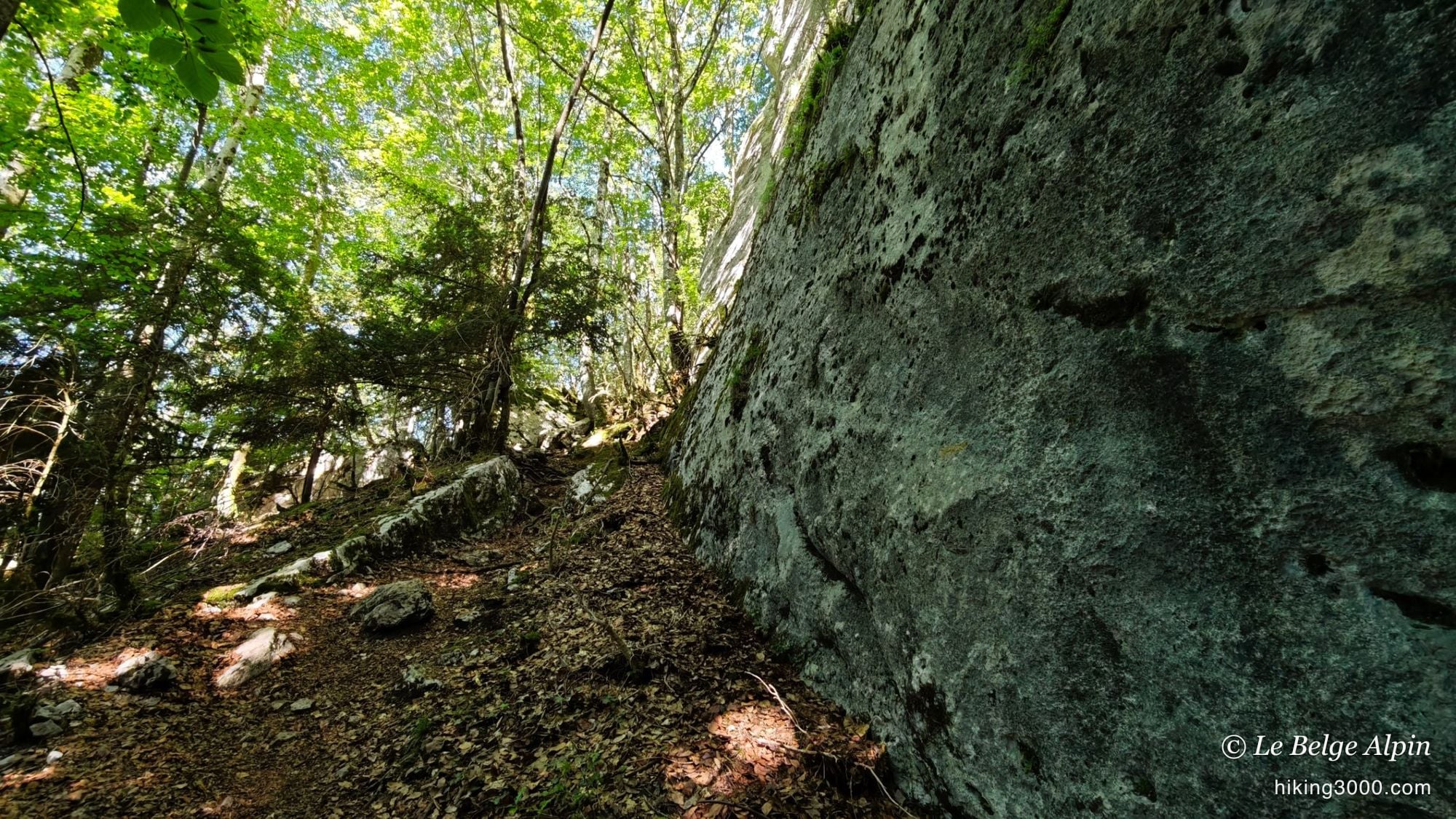
The start is from the village of Saint-Pierre-d’Entremont, a small town straddling Savoie and Isère, set among meadows and steep-roofed bell towers. The approach first climbs through the forest, gently, just enough to warm the legs and find the rhythm again after a winter away from the Alps.
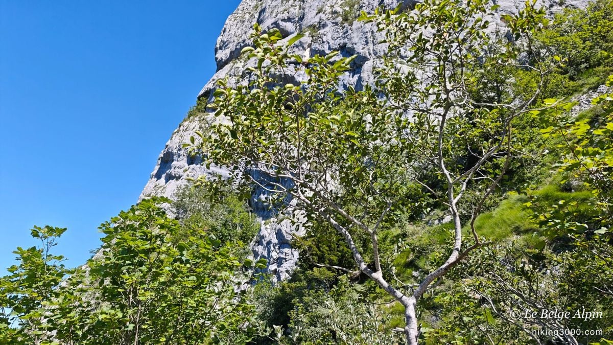
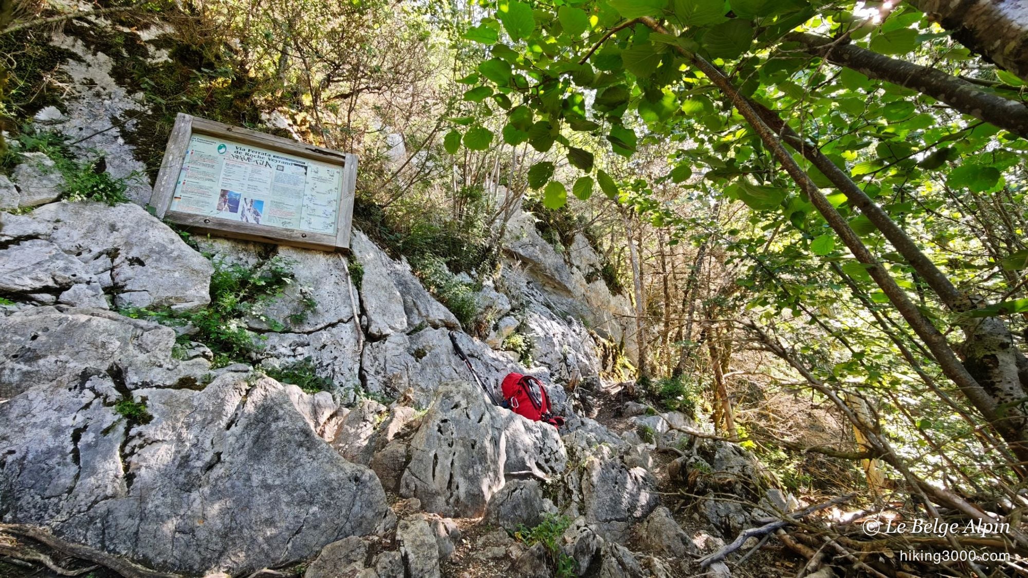
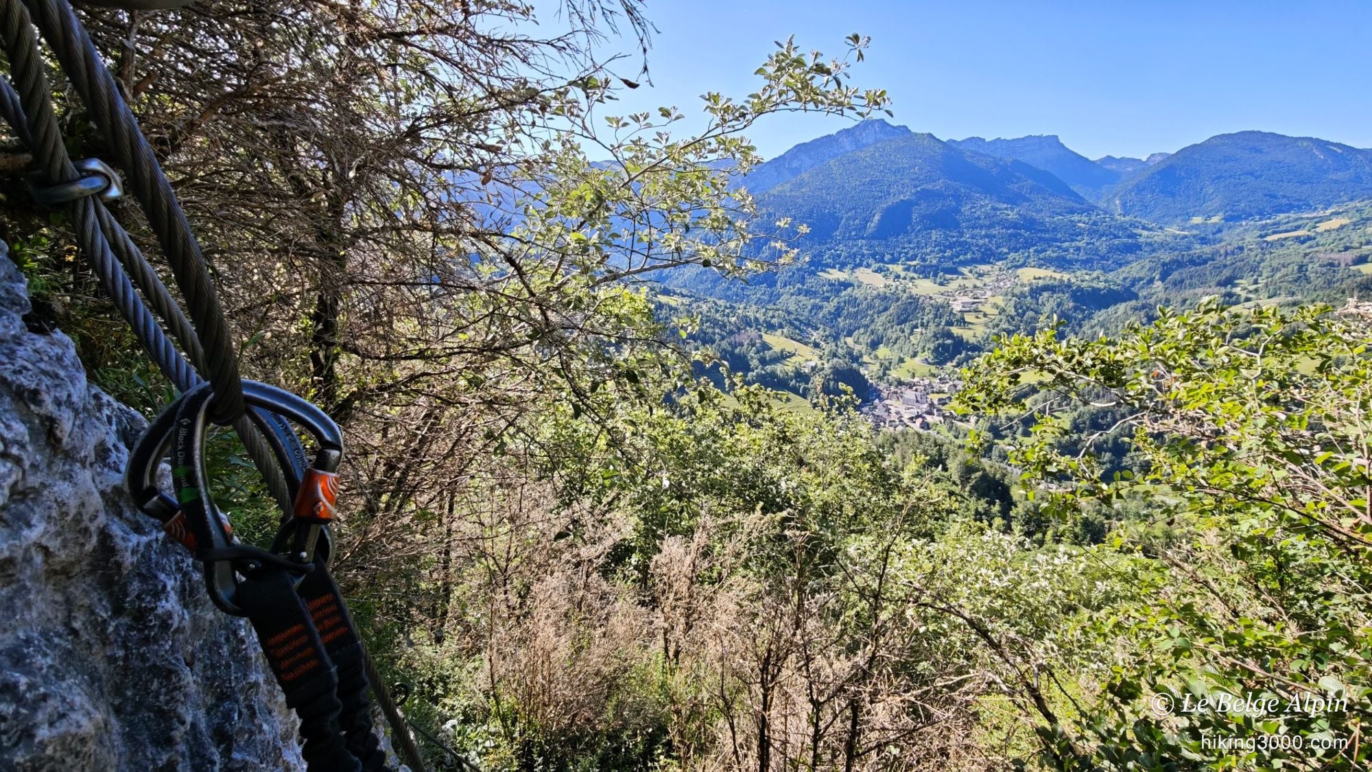
You soon reach the foot of the limestone wall. The via’s information board is there, you drop the pack and pull out the harness. My favourite moment is that one, just before, when the rock is still above you and you know it is about to go up.
The via ferrata: cables and the first drops


The first part is not the hardest of the route, but make no mistake: it still has a few airy, exposed moves, the kind that quickly remind you this is not a footpath. The grey limestone is compact, the fixed gear is in good shape, and the valley opens up fast beneath your feet. That was exactly the dose I was after to get going again: enough for the thrill, not too much to stay relaxed.
Then comes the fork. The second part, more committing, heads off to the right. Me, I take the trail that breaks away toward the summit. Not out of resignation, but because it makes for a fuller, more varied route to tell.
A via ferrata is not a hike. Harness, lanyard with an energy absorber and helmet are mandatory on the cabled part, and you must know how to use them. A slip without a lanyard does not forgive.
The trail to the summit, more technical than it looks

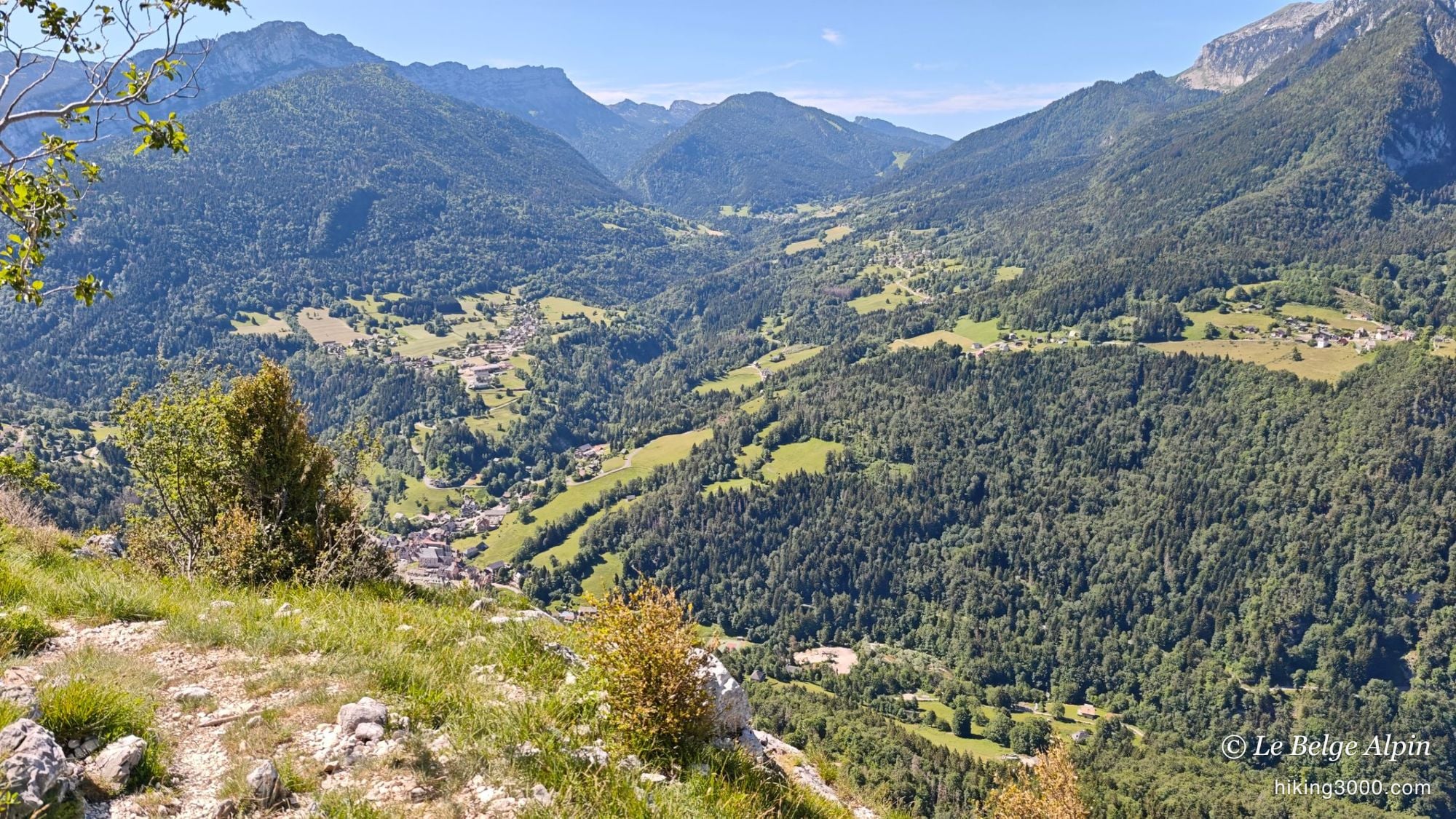
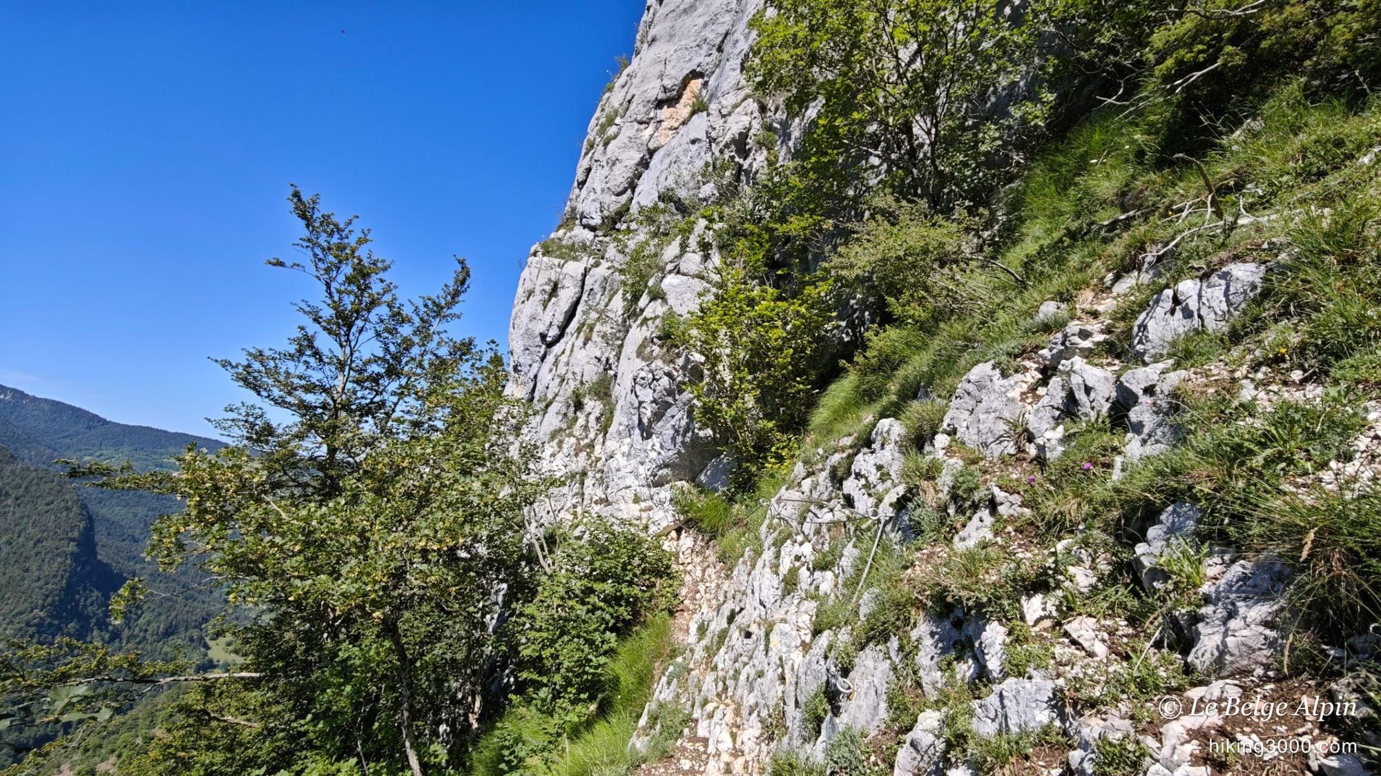
I expected a mellow way back. Wrong. This trail climbs very hard, over rocky, technical ground. No need to put your hands down, it stays walking, but it is steep and sustained, a real little mountain approach, very much in the spirit of what I document on Hiking 3000.
One more thing: it is not always easy to follow. I think fairly few people walk up that way, the path sometimes fades into the slope and the brush, so much so that I had to backtrack at one point and re-climb. You need a good foot and a bit of instinct not to just charge straight up anywhere. This trail is also the all-hiking bypass for anyone wanting to avoid the via entirely: start from the bottom and reach the summit without touching a cable. It stays steep and a bit strenuous, but without any marked technical difficulty.
At the summit, the Chartreuse as far as you can see
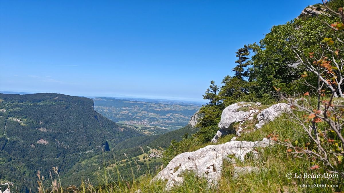

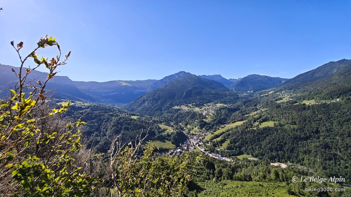
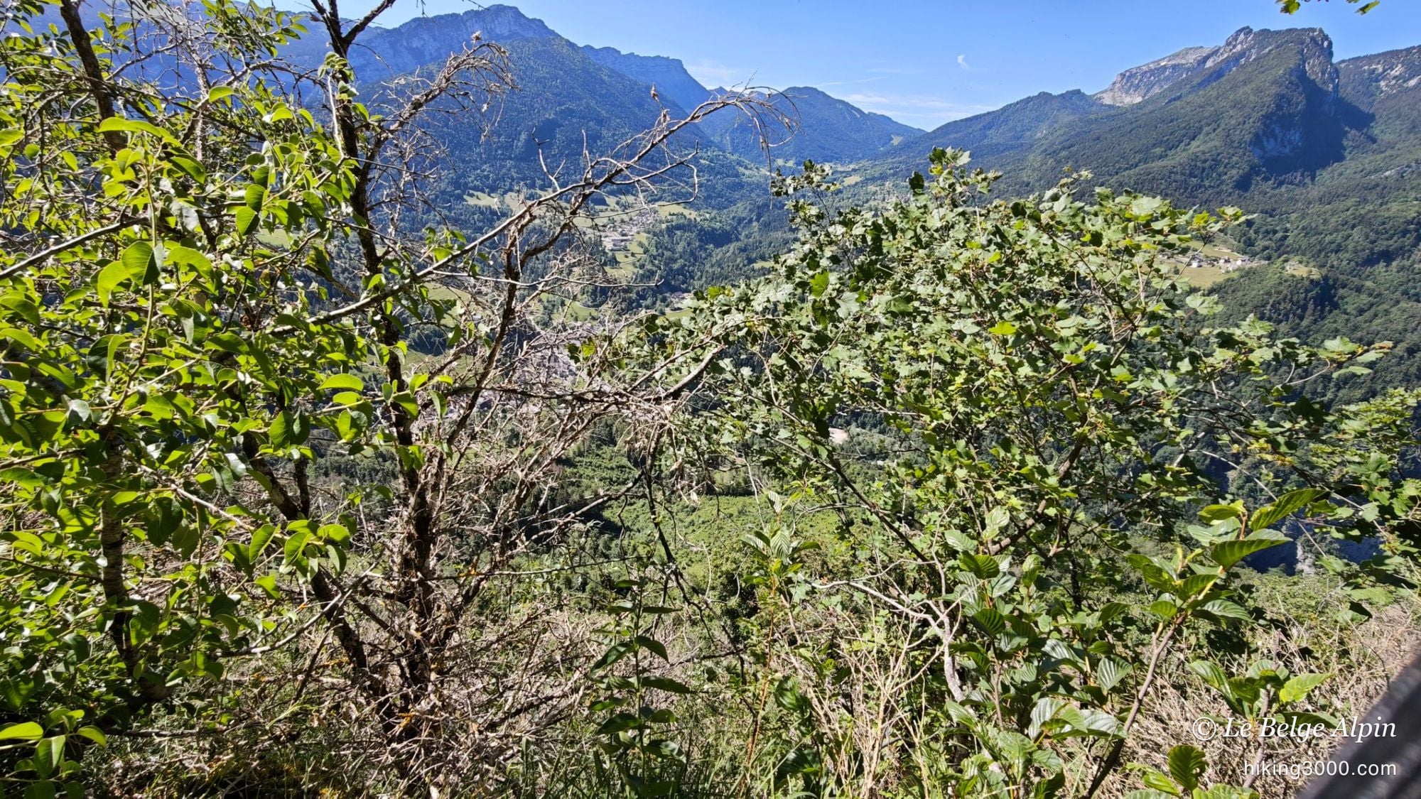
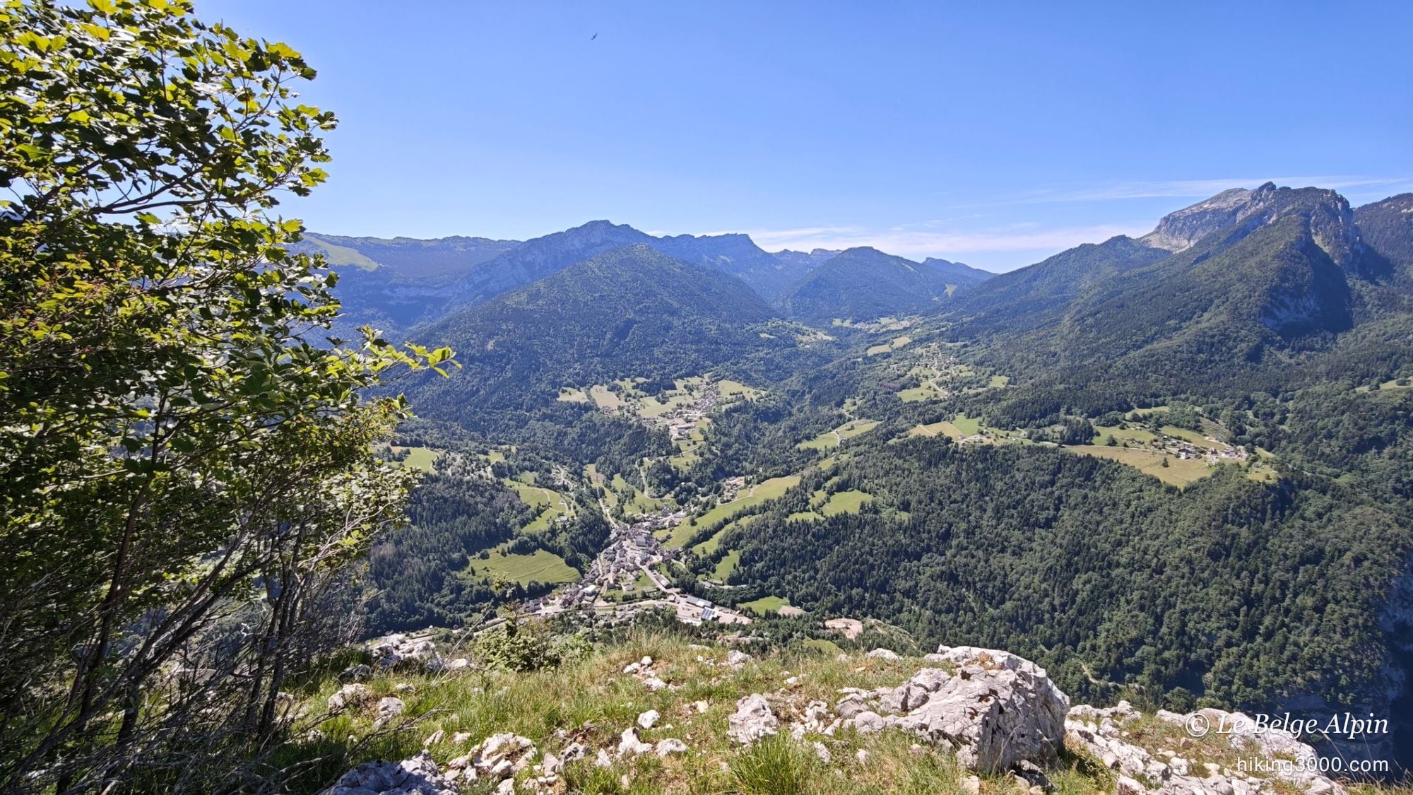
At the top, the payoff is wide. On one side, the limestone ridge with its clinging pines and the plain stretching into the distance. On the other, the tiny village below and the Chartreuse peaks closing the horizon. For a summit at just 1303 m, the panorama is surprisingly generous, and the contrast between the short effort and the open view is the whole charm of the outing.
It is also when you realise how far you have come: about 665 m of ascent on the route, but swallowed fast, between cables and steep trail. A short, complete outing.
A shared descent, and a beer at the van

A Monday, off-season, I thought I would not meet anyone on that side. And then I ran into Cécile. We did the descent together, talking mountains and side trails, and we ended on a small beer at the van once back down. Those encounters are what make a “quiet” outing stick in your memory for a long time. Thanks for the company, Cécile, it was a fine season opener.
Practical info
6.9 km, about 665 m of ascent (my watch read 810 m with a there-and-back, see the note under the track), summit at 1303 m. Plan around 4h if you take your time with the via, the photos and the descent (my track lasted nearly 4h40, breaks included). Mandatory gear for the cabled part: harness, via ferrata lanyard with an energy absorber, helmet. Solid hiking shoes for the trail, which climbs hard over rocky ground.
The via ferrata splits in two, the second part being clearly harder. The bypass trail lets you skip that second section, or the whole via if you start from the bottom, but it stays steep and faintly marked. If in doubt about conditions or difficulty, the Cœur de Chartreuse Tourist Office can fill you in.
Practical info
Starting point
From Chambéry or Les Échelles, head to Saint-Pierre-d'Entremont, straddling Savoie and Isère. The via ferrata start is signposted from the village, with a parking area at the foot of the approach (637 m). A small mountain road, fine for any car.
GPX track
Import the GPS track into your watch or app (Garmin Connect, Komoot, Gaia GPS, Iphigenie...).
Sign in to downloadGarmin track
Partial GPS track
My watch recorded 810 m of ascent, but that includes a there-and-back: at one point the trail fades, I went the wrong way and had to re-climb a good hundred metres. The real ascent of the route is about 665 m (from the start at 637 m to the summit at 1303 m). Yours will depend on how well you follow the path.
Gallery
14 photos, click to enlarge


Video
A few shots from the outing
Weather, Saint-Pierre-d'Entremont
Conditions and forecasts for the itinerary
In the mountains, conditions change fast. A thunderstorm can become dangerous, fog disorients, residual snow slows every step. Before leaving, check the bulletins, plan a stable weather window, and when in doubt, call the tourist office or the local guides office.
Learn to read mountain weather →Questions fréquentes
Do you have to do the via ferrata to reach the summit?
+
No. A trail starts from the bottom and reaches the summit of Roche Veyrand while avoiding the cables entirely. It is the option for those without gear or who would rather skip the via ferrata. Be warned though, this trail stays steep and technical, it is no stroll.
What gear is mandatory for the via ferrata?
+
Harness, via ferrata lanyard with an energy absorber, and helmet. This is non-negotiable: a via ferrata is not hiking, and a fall without a lanyard can be fatal. You also need to know how to handle your lanyards properly before committing.
Is it more of a via ferrata or a hike?
+
Both. The first part is a genuine cabled via ferrata, with a few airy moves. Then you leave the cables for a trail that climbs hard to the summit. That mix is exactly what I like, an accessible hike-ferrata combo once you have the basic technique.
Can you do the whole via ferrata up to the top?
+
The via has a first part (sustained but doable) then a second part that is clearly harder. I only did the first one, then the trail. If you are aiming for the full cabled route, bring the fitness and technique it demands, and ask locally about conditions.