
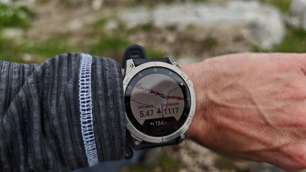
From the Tiocan parking lot (600 m) above Thoiry, ascent of Le Reculet (1717 m), second-highest summit of the Jura. Short and intense, 5.5 km of climbing for nearly 1200 m of gain, Mont Blanc / Lake Geneva / Alps panorama on a clear day, and at the summit a 10 m iron cross raised in 1892 by the priest of Thoiry.
Late May 2025, back on the road with my little van, heading for the Jura. I’m getting seriously back into shape after winter. The high mountains are still snow-covered at this time of year, so I’m looking for mid-altitude routes that still pack a punch. And I come across Le Reculet: second-highest summit of the Jura (1717 m), 1100 m of gain from Tiocan, and a short, intense track, just 5.5 km to get up. A real climb.
Climb from Tiocan, steep from the very first steps
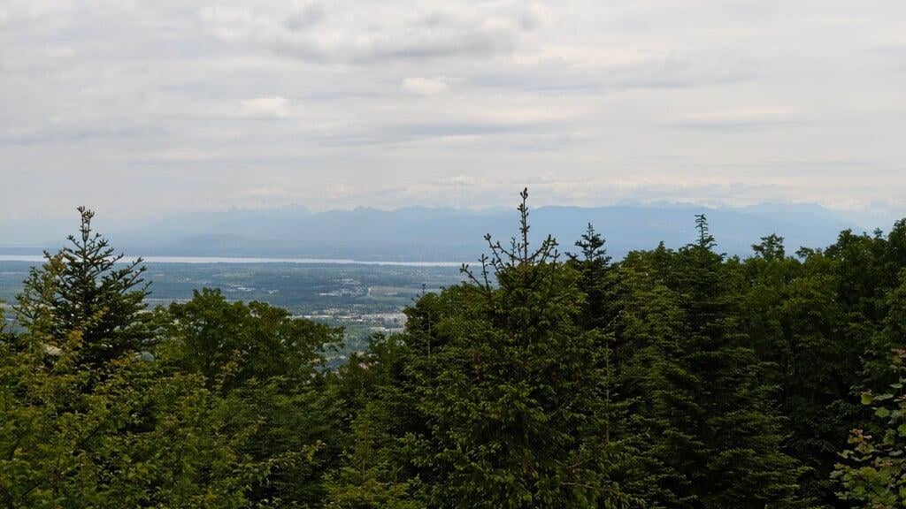
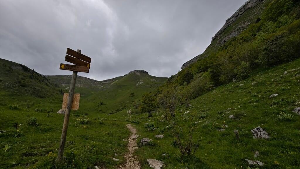
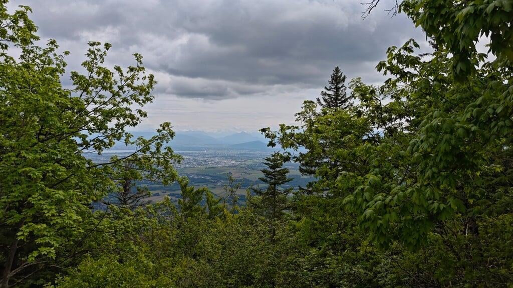
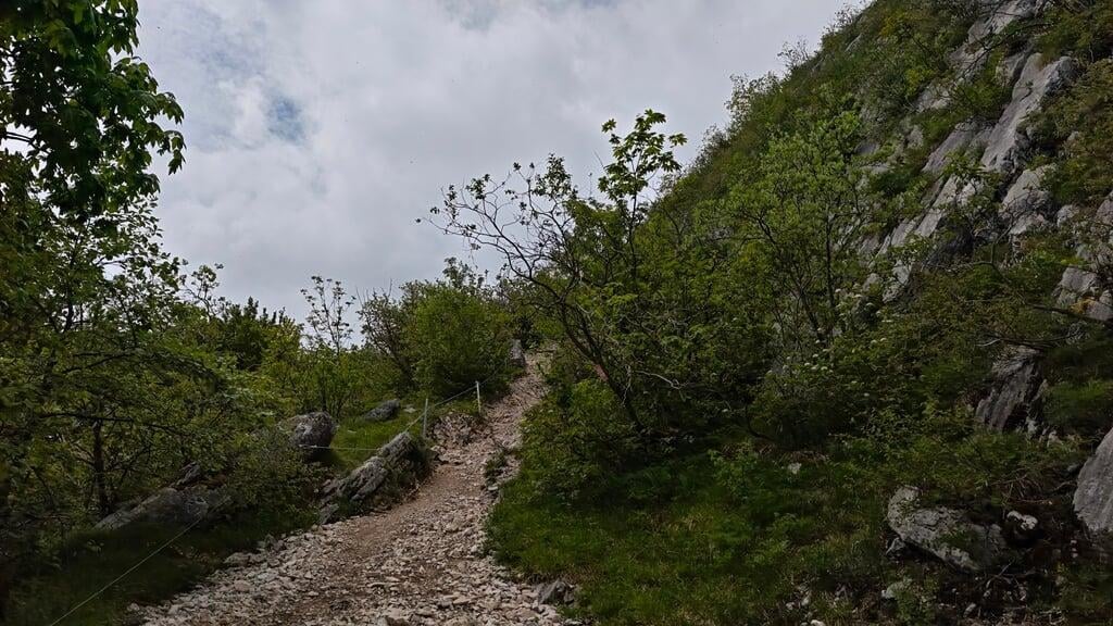
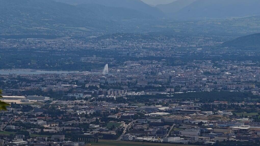
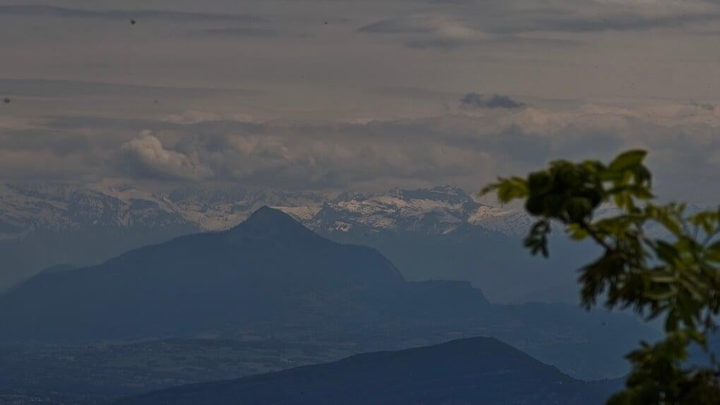
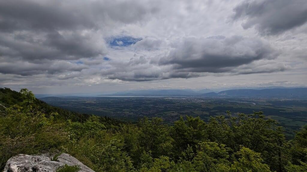
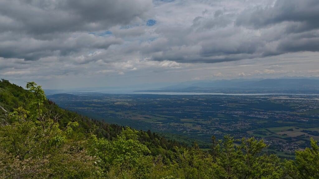
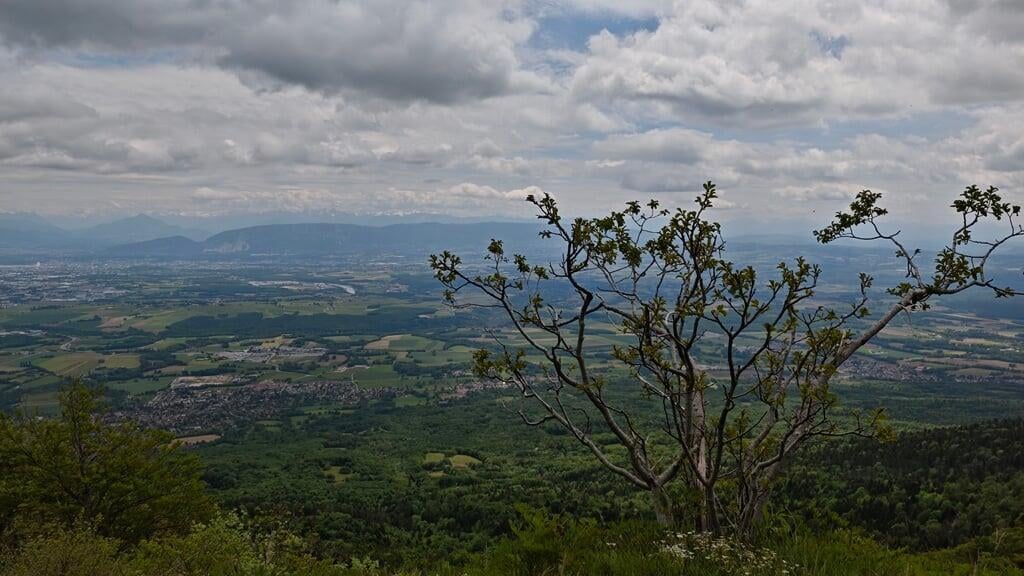
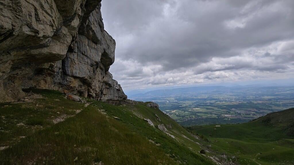
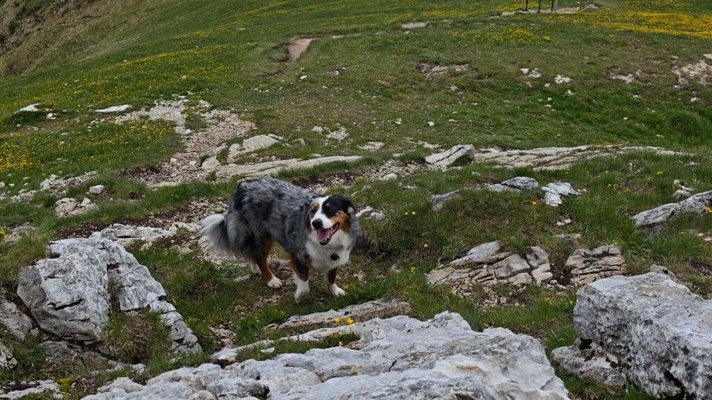
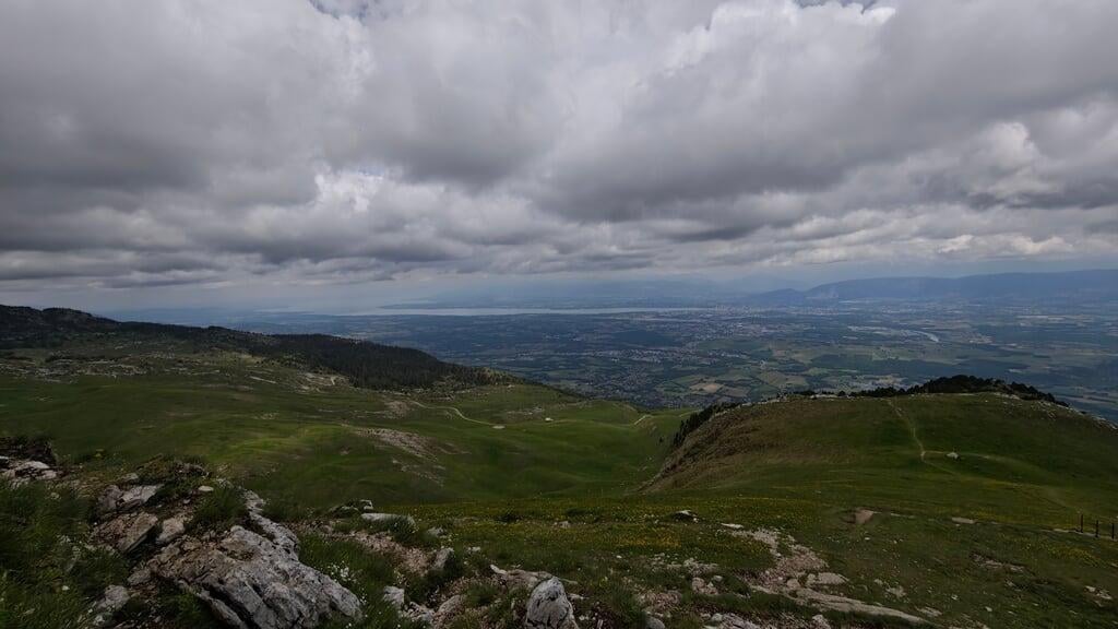
So I decide to go for it. The slope is steep right from the start, it pulls on the calves fast. Luckily, the forest is beautiful, and the higher you climb, the more the landscapes open up. Unfortunately, no Mont Blanc view that day: too overcast. But the view over Geneva and the Lake Geneva basin was already well worth the effort.
And then there’s that famous cross at the summit, iconic, visible from far away. It isn’t just a religious marker dropped there to bless the hikers, no: it has a real story, and even a slightly trollish dimension.
An iron troll from 1892


Back to 1892. At the time, France is still digesting the defeat of 1870, the Republic is becoming firmly secular, and that doesn’t sit well with everyone, especially in the countryside. In Thoiry, a small village in the Ain, the priest of the time, Father Monnet, decides to send a message: to publicly assert attachment to the Catholic faith (and to provoke the secular republicans, let’s be honest), he launches the idea of planting a massive cross right at the top of Le Reculet.
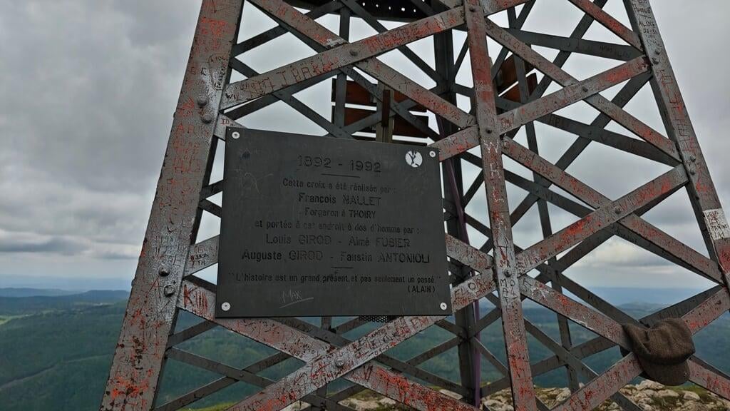
Not a small wooden cross, no. A ten-meter-tall iron cross with 2,800 rivets. A 1,600 kilo piece, forged by Francois Nallet, blacksmith in Thoiry, then carried on men’s shoulders to the summit. Four tough locals took up the challenge: Louis Girod, Aime Fusier, Auguste Girod and Faustin Antonioli. Eternal respect to these guys, their names are engraved for eternity on the memorial plaque you can still see at the foot of the cross.
The cross was raised on August 4, 1892, and blessed in great pomp two days later, during a ceremony bringing nearly 3,000 people to the summit. Yes, you read that right. 3,000 people at the top of a mountain for a mass. The full-scale troll was a success.
Since then, it watches over the Jura, and it was even restored for its centenary in 1992. A memorial plaque was installed and festivities organized, a meal, brass band, mass, and even a special postmark on letters sent from Thoiry for three months. Full-on.
In short
The elevation gain is serious, the descent really hammers the thighs, and you need decent fitness. But for lovers of history, sweeping landscapes (when the sky clears) and hikes with character, it’s a gem.
And honestly, climbing a mountain to discover an 1892 religious troll is pretty unusual.
Before you go
For current conditions (residual snow in May, Tiocan track access, Haut-Jura weather), a visit to Pays de Gex Tourisme or a look at the webcam of the nearby Col de la Faucille will give you the state of the terrain.
Bring trekking poles for the descent, the steep slope on limestone and dead leaves surprises the thighs if you come down too fast. And plenty of water: there’s no spring along the way.
To go further
- Understanding FFRandonnee E/T/R ratings
- Choosing the right hiking boots
- Le Reculet is part of the Jura range, within the Haut-Jura Regional Natural Park. Its immediate northern neighbor, the Cret de la Neige (1720 m), claims the title of highest summit of the French Jura by a hair.
Practical info
Starting point
From Geneva or Bellegarde, reach Thoiry (Ain, 01710). Cross the village and climb the narrow winding road to the large Tiocan parking lot (600 m). The last kilometers are twisty, a low car is fine. Free, fairly large parking lot, direct start on the waymarked trail.
GPX track
Import the GPS track into your watch or app (Garmin Connect, Komoot, Gaia GPS, Iphigenie...).
Sign in to downloadTourist office (current conditions)
Pays de Gex Tourisme, Thoiry branch
Allee du Levant, 01630 Saint-Genis-Pouilly
Garmin track
Gallery
15 photos, click to enlarge


Weather, Thoiry
Conditions and forecasts for the itinerary
In the mountains, conditions change fast. A thunderstorm can become dangerous, fog disorients, residual snow slows every step. Before leaving, check the bulletins, plan a stable weather window, and when in doubt, call the tourist office or the local guides office.
Learn to read mountain weather →Questions fréquentes
Is Le Reculet suitable for beginners?
+
Not strictly speaking, 1200 m of gain over 11.7 km, steep slope right from the start, a descent that hammers the thighs. You need decent fitness. That said, the trail is well waymarked and has no technical section, so it's accessible to regular hikers who accept the effort.
When is the best time to climb Le Reculet?
+
From May to October. Snow can linger on the summit ridge in spring and arrive early in autumn. Check conditions before early May or late October outings. Summer is ideal but afternoon storms are common in the Haut-Jura, leave early.
Can you really see Mont Blanc from the summit?
+
On a clear day, yes, spectacular, Mont Blanc sits due south-east, the Lake Geneva basin stretches below, and you see the whole Alps chain from Lake Geneva to the Aravis massif. On cloudy days you settle for Geneva and the lake, which is already well worth the trip.
What is the iron cross at the summit?
+
A 10-meter, 1600 kg cross, forged in 1892 by Francois Nallet (blacksmith in Thoiry) on commission from Father Monnet. It was carried on men's shoulders to the summit by four tough locals: Louis Girod, Aime Fusier, Auguste Girod and Faustin Antonioli. Raised on August 4, 1892, restored for its centenary in 1992.
Is there a hut on the route?
+
No staffed hut directly on the Tiocan-Reculet route. The hike is done round trip in a day. For a stop, a few unstaffed cabins on the ridge but not counted for an organized bivouac.