
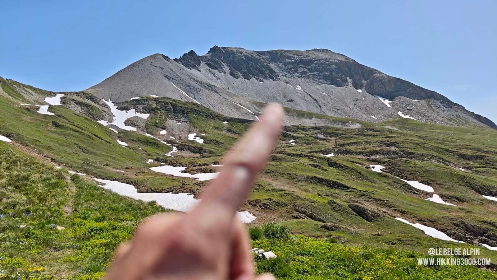
From the Cormet de Roselend (1950 m), 900 m of elevation gain to reach the Pointe de la Terrasse (2881 m). Passeur de Pralognan, steep dirt slope, unstable scree and a few grade II climbing moves for an unobstructed view of Mont Blanc's Italian side. For experienced mountaineers only.
In this particularly hot late June 2025, I decided to gain some altitude with my van to escape the furnace of the valleys. Nothing like a night at 2000 metres, in the cool, while others gasp at 25 degrees at nightfall. I went back towards Lake Roselend and the Cormet, an area I had discovered last year while doing the Roc du Vent via ferrata, a gem of the Alps, which I actually redid the day before.
Now I needed a summit for the site, something not too long (I had just come back to the Alps), but with a bit of commitment. Digging through the maps, I come across the Pointe de la Terrasse. A few minutes of research later, I’m convinced: 900 m of elevation gain, technical ground, lightly trafficked, exactly what I’m looking for.
Be warned: this hike is not trivial. It is for experienced, equipped hikers with a real mountain foot.
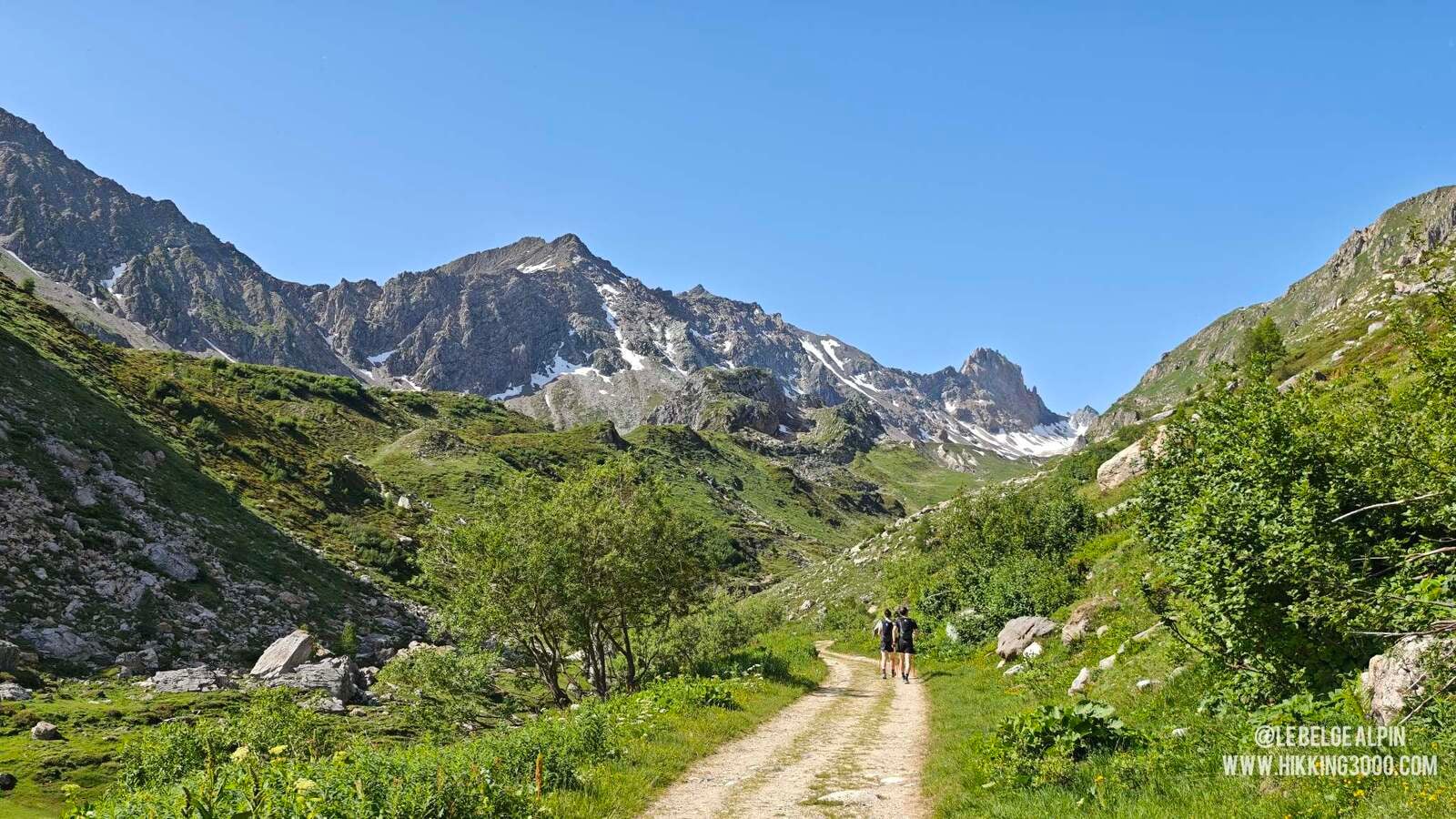
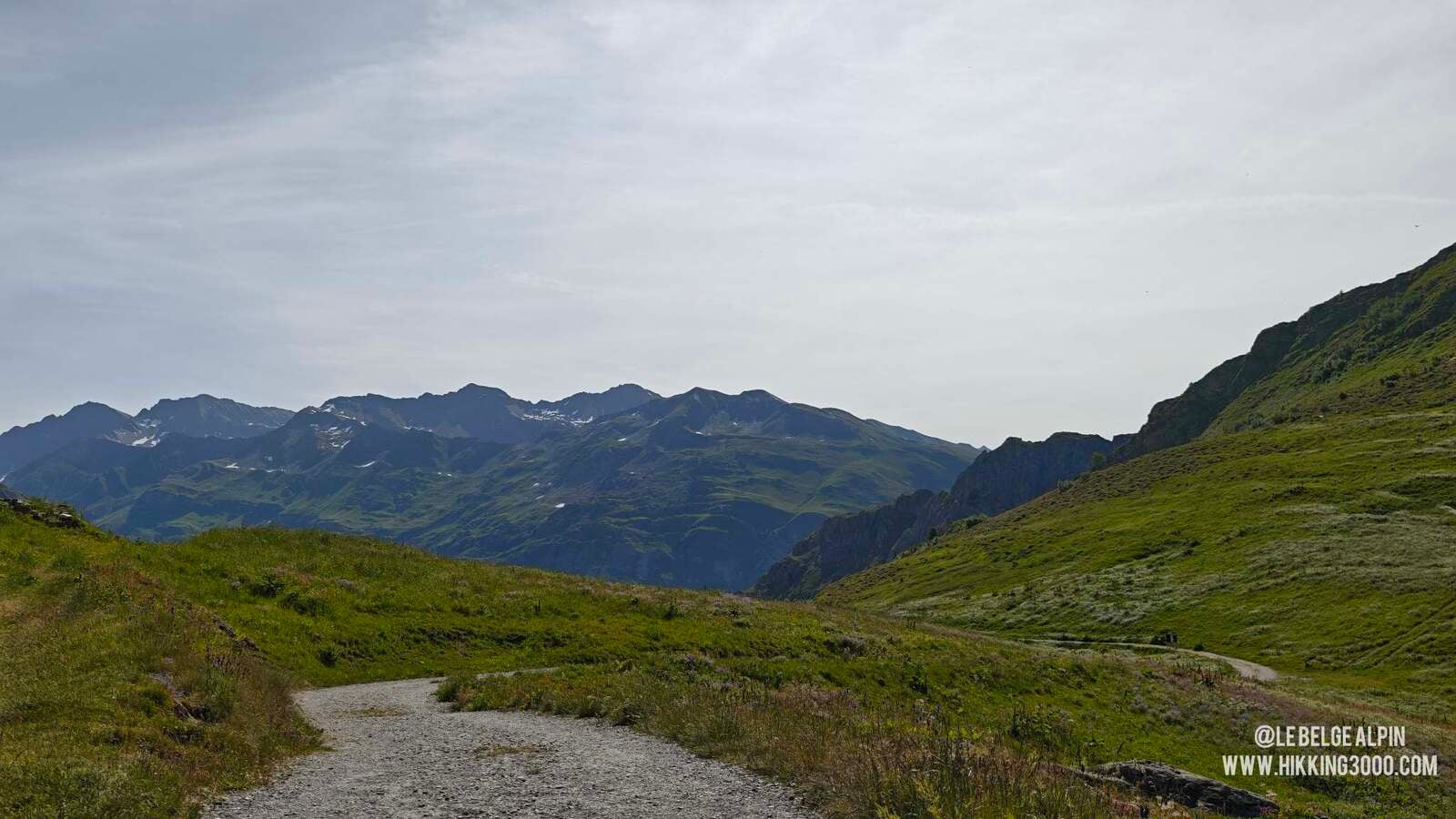
Approach via the Cormet, easy going
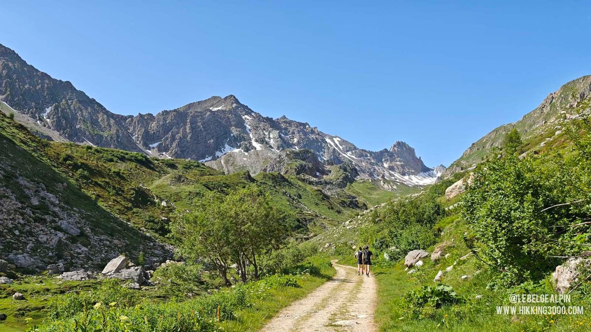
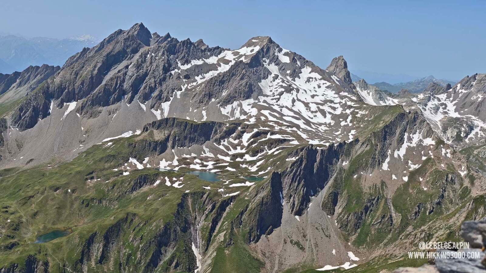
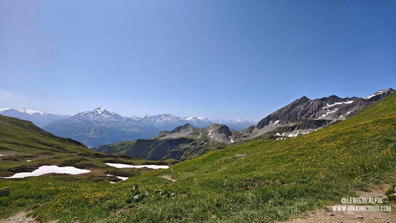
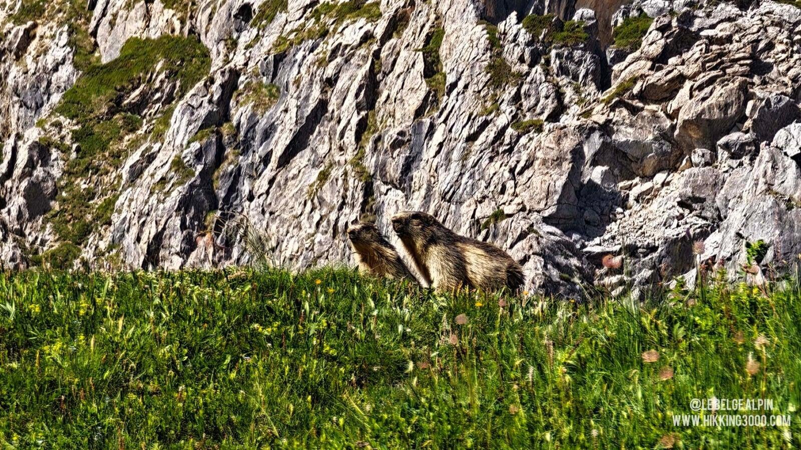
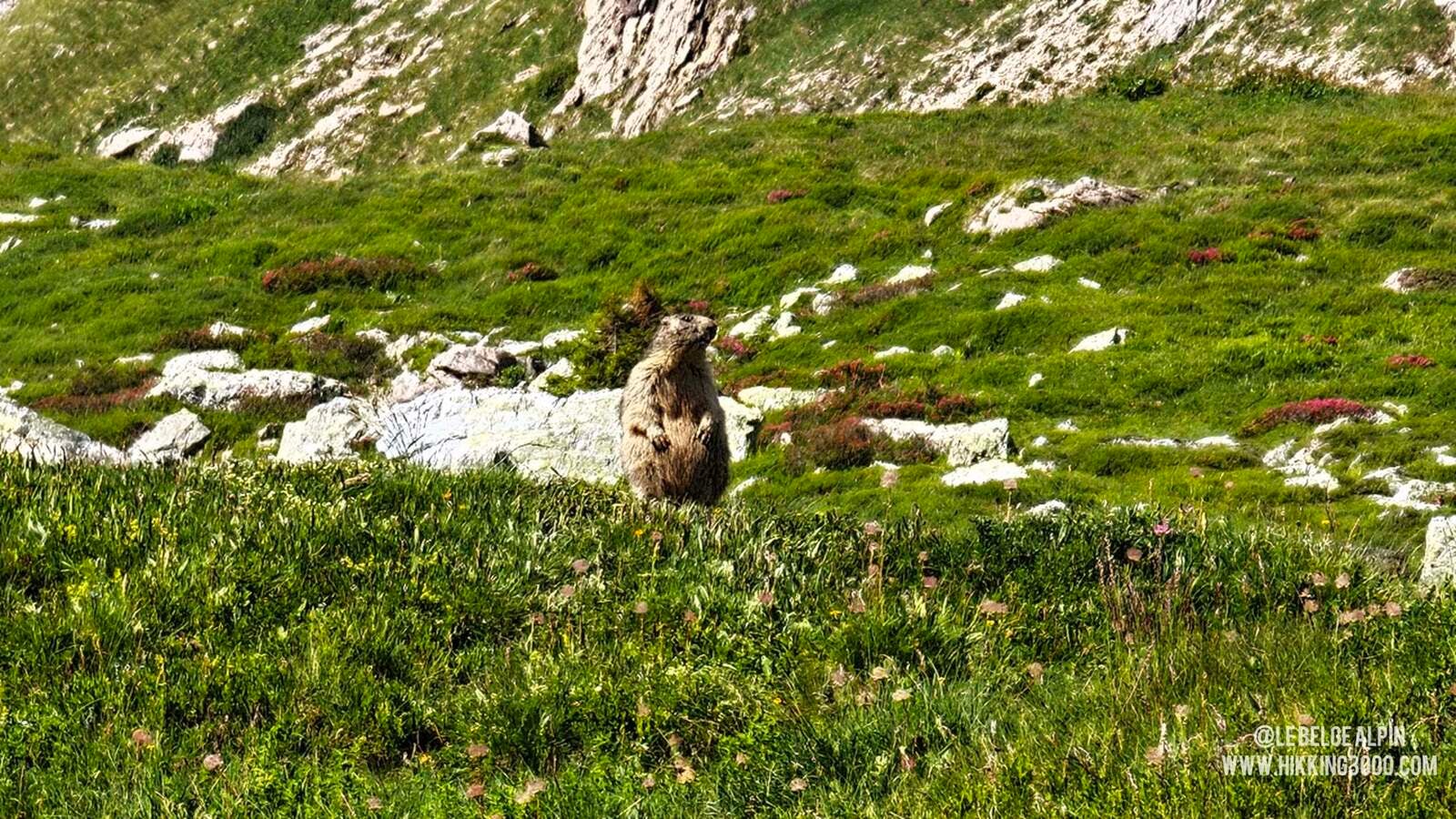
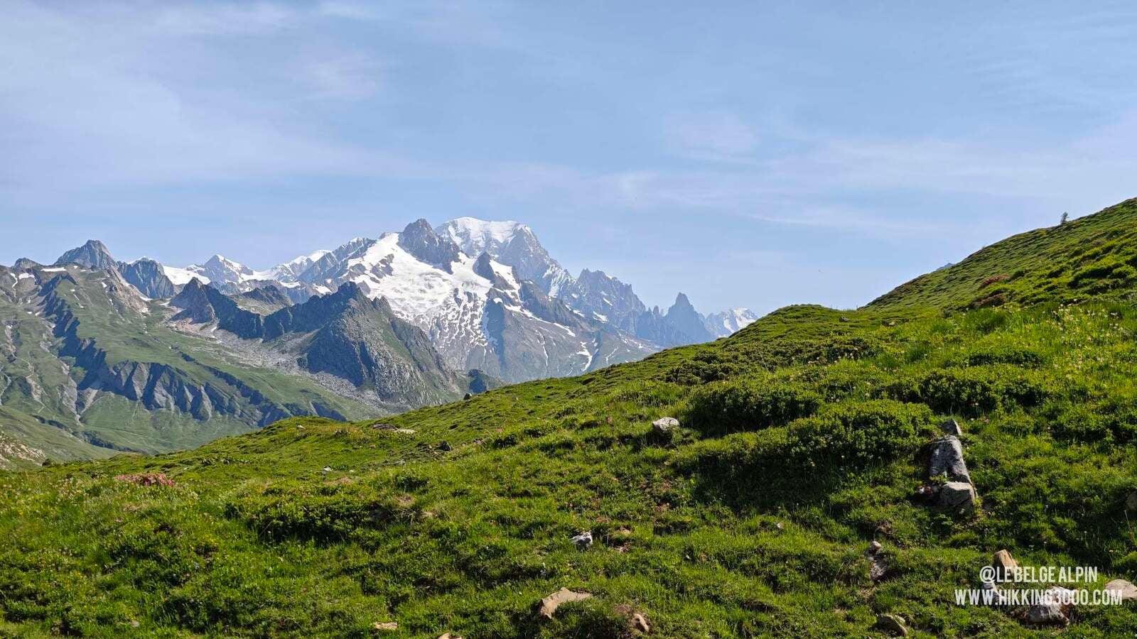
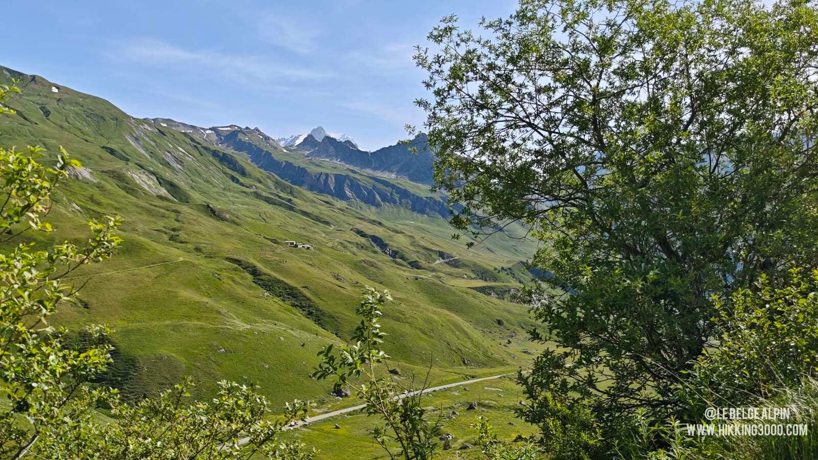
The first two thirds are almost a holiday: wide track, Beaufortain alpine pastures, marmots whistling at every turn. Mont Blanc shows up in the background and stays with you for the rest of the day. You reach the approach plateau effortlessly, the kind of section that makes you think you’ll have a quiet day.
The Passeur de Pralognan, things start to heat up


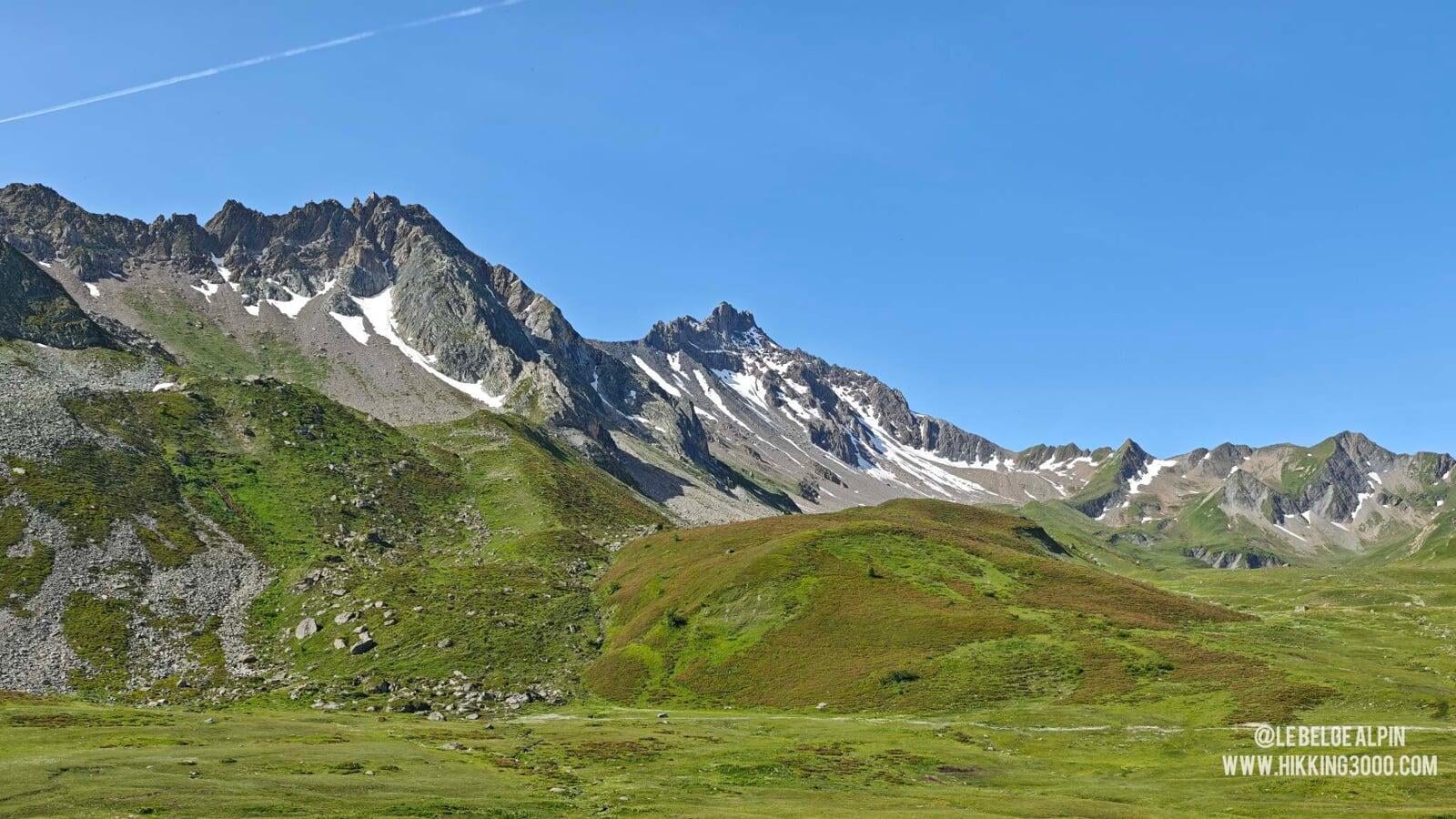
The climb to the Passeur de Pralognan, a pass that marks the start of serious business, takes place on a steep and rocky slope. When there’s snow, this passage becomes potentially dangerous. That day, the heatwave had cleared everything, but if snow remains, you need crampons and ice axe at minimum, and even then, I’m not sure it’s doable. It’s steep, it’s no longer hiking.
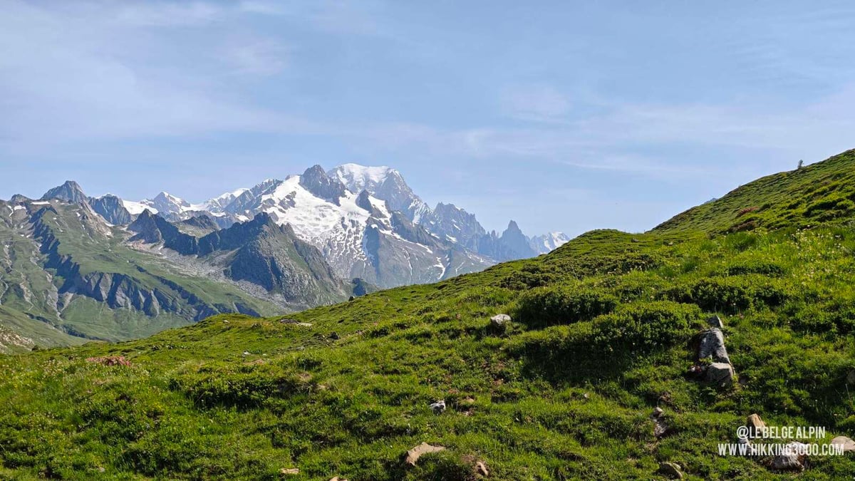
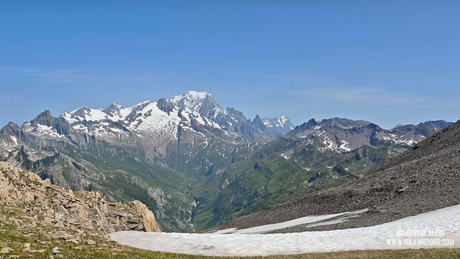
At the pass, the magic happens: Mont Blanc appears full frame, dantesque. It’s one of the most beautiful views I have of this massif, and I understand then why we put in so much effort.
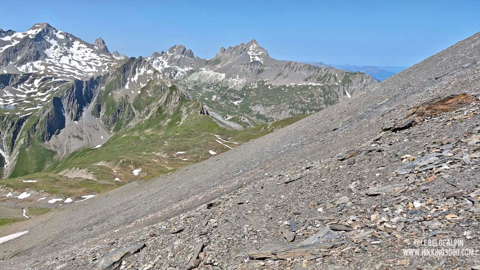
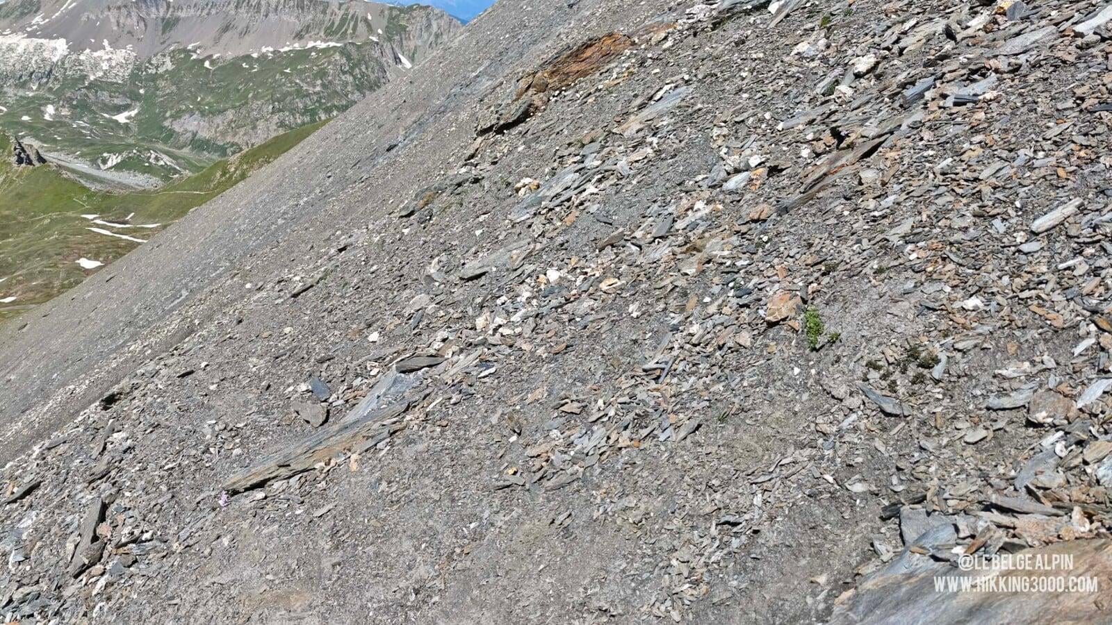
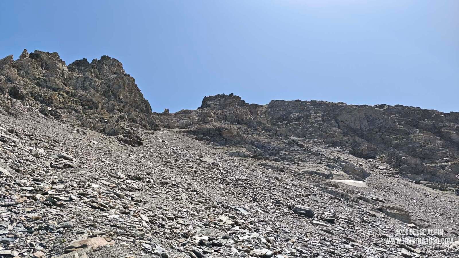
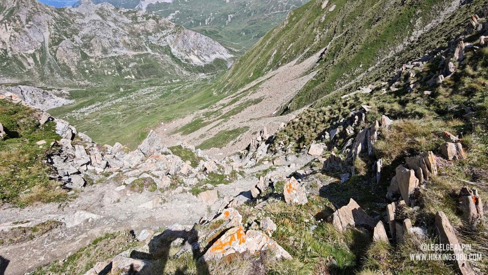
Unstable scree and downclimbing ahead
After the pass, the mood becomes more committed. The trail disappears in places, replaced by steep dirt slopes, on which I had to carve small steps to place my feet on certain passages. Then comes a very unstable scree, not too hard going up, but far trickier on the way down. You need a sure foot, real terrain reading, and the ability to improvise: no cairns here (they wouldn’t hold), it’s up to you to trace your line and anticipate the stability of each step.
I had taken an ice axe, which helped me a lot on the descent. Poles are no help if you slip, that’s useful info to have before leaving, not mid-slide.
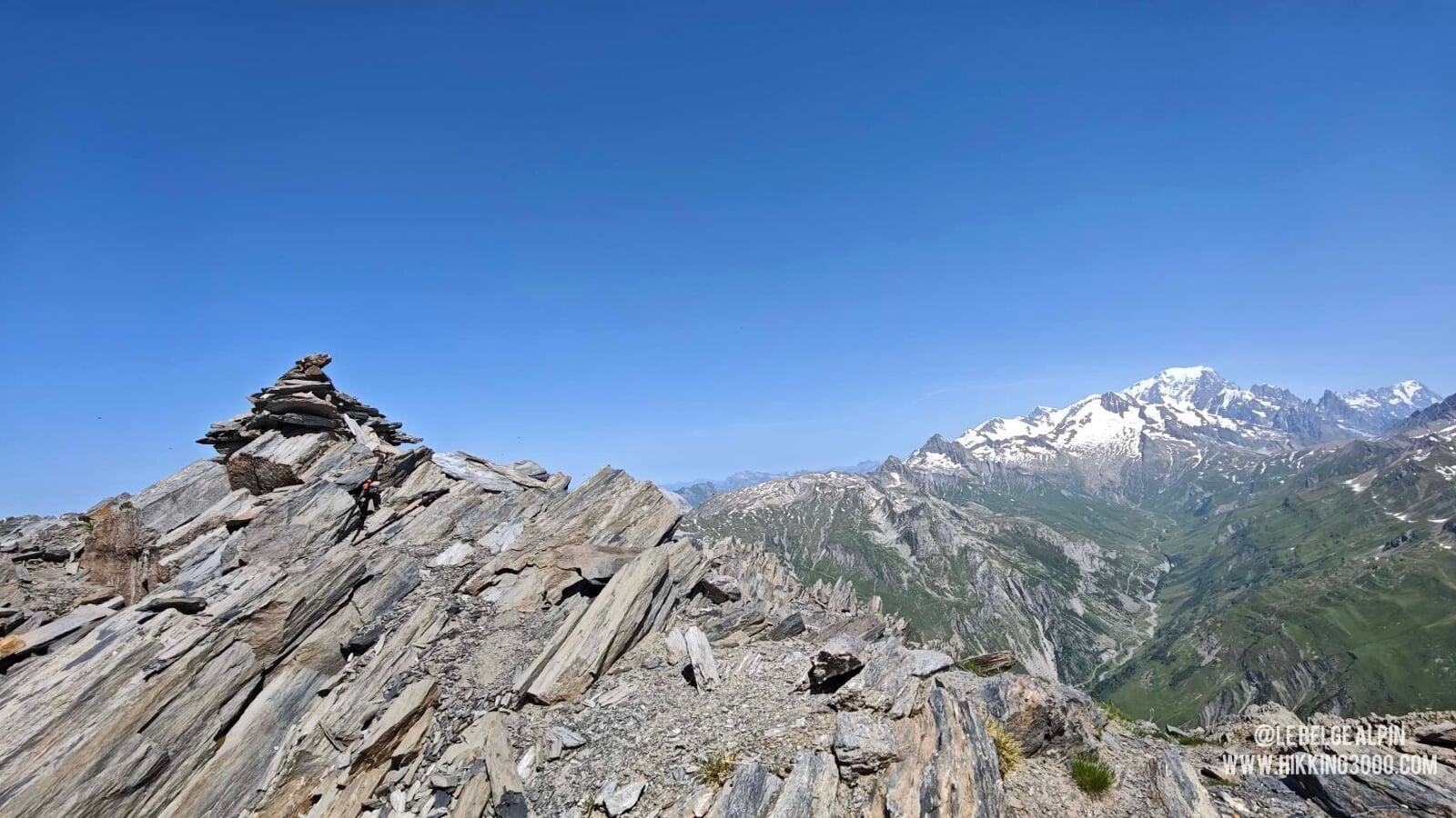
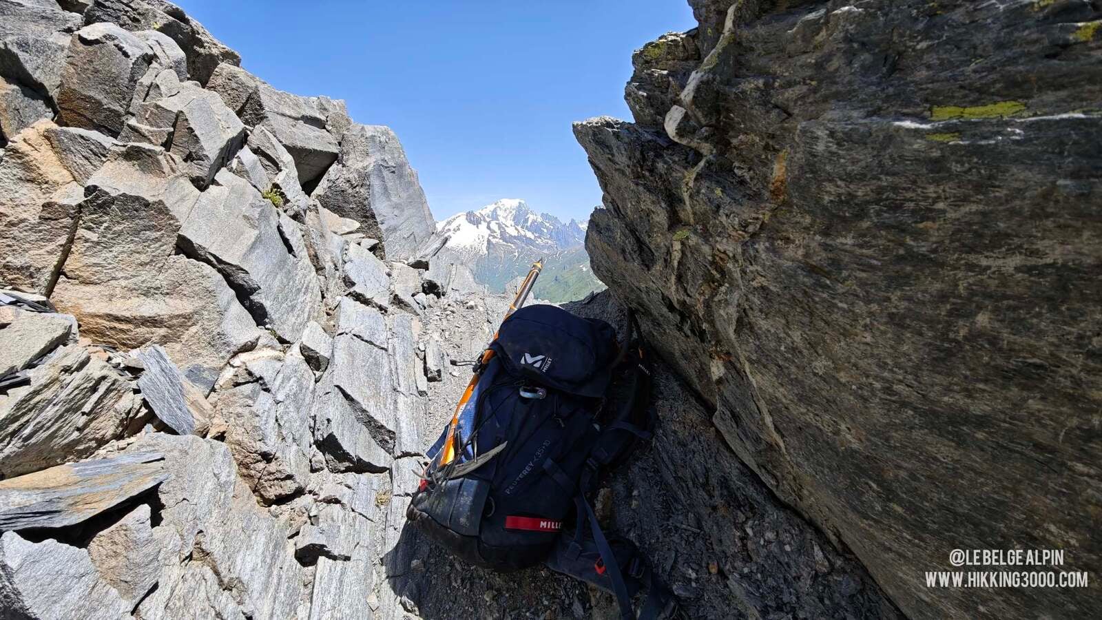
The last 50 metres, some climbing


The last 50 metres require putting your hands on the rock. It’s easy climbing, grade II, but it’s still climbing in an alpine setting, with a real sense of exposure. Nothing technical in the harness-and-rope sense, but you need to be comfortable with the idea of switching hand and foot holds.
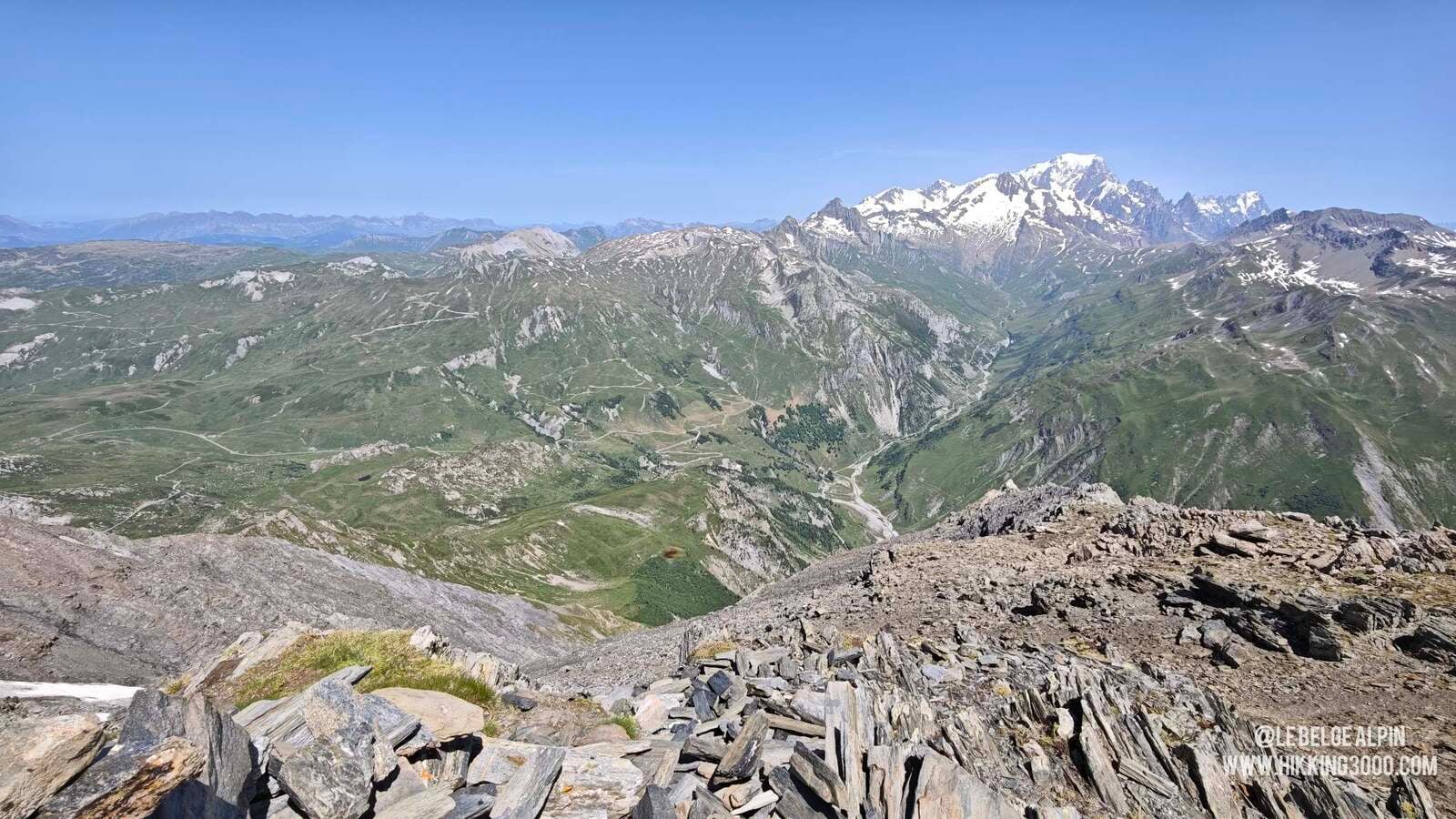
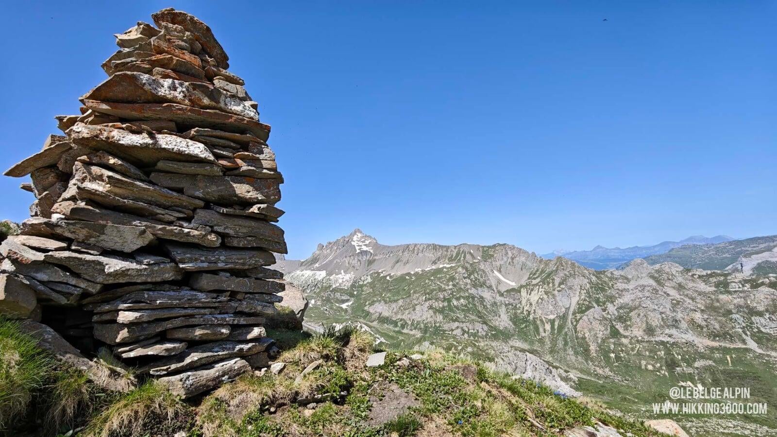
And what a reward! At the summit, the view unfolds over the Aravis and neighbouring massifs, the Vanoise, Italy, a breathtaking view of the Italian side of the Mont Blanc massif, the Ecrins far off, all in an almost mineral atmosphere. You’d think you were in the middle of an alpine route, much higher than you really are. It’s the kind of summit that doesn’t look like much on the map, but leaves a real memory.
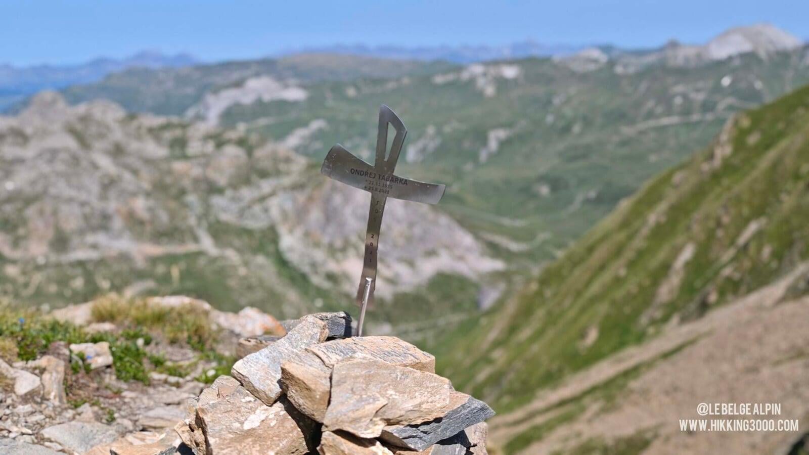
At the top, one detail struck me: a memorial cross engraved with the name of Ondrej Tabarka (25.8.2021). A reminder that this terrain, even in dry summer, stays demanding. A moment of thought, and we head down with a bit more concentration.
Anecdote, the Passeur de Pralognan
The pass we reach is called le Passeur de Pralognan, and this name didn’t come from nowhere: in the old days, the shepherds and hunters of the region used this passage to discreetly cross the ridge, often loaded with smuggled goods. The term passeur refers to those who guided men or merchandise through the steepest passes, away from prying eyes. Even today, when you climb in this steep and wild setting, you understand why only seasoned mountain folk took the risk.
Practical info
930 m of gain, 10 km, count 5 to 6 hours if you’re at ease on the terrain, more if you take your time in the scree. Not for beginners, even well-meaning ones: the Passeur plus the scree plus the summit climbing are three technical points that stack up. If you doubt on even one, this isn’t your summer hike.
For conditions (especially lingering snow at the Passeur), a phone call to the Beaufortain tourist office is essential in early season. And if you’re looking for an easier plan B the same day, the tour of Lake Roselend via the dam offers a beautiful contemplative walk with no technicality.
Practical info
Starting point
From Beaufort or Bourg-Saint-Maurice, climb up to the Cormet de Roselend via the D925 (superb road overlooking the dam). Park at the Cormet parking (1950 m). Warning: parking limited in peak season, arrive early or have a plan B. I slept on site in my van the night before, very quiet.
GPX track
Import the GPS track into your watch or app (Garmin Connect, Komoot, Gaia GPS, Iphigenie...).
Sign in to downloadTourist office (current conditions)
Office de Tourisme du Beaufortain, Beaufort
Grande Rue, 73270 Beaufort
Garmin track
Gallery
20 photos, click to enlarge
Weather, Beaufort-sur-Doron
Conditions and forecasts for the itinerary
In the mountains, conditions change fast. A thunderstorm can become dangerous, fog disorients, residual snow slows every step. Before leaving, check the bulletins, plan a stable weather window, and when in doubt, call the tourist office or the local guides office.
Learn to read mountain weather →Questions fréquentes
Can the hike be done without specific gear?
+
In dry summer, yes: good hiking shoes, poles useful, and maybe an ice axe for the scree descent. If a bit of snow lingers at the Passeur de Pralognan, you need crampons plus ice axe plus technique, or turn back. It's no longer hiking in that case.
What climbing level at the summit?
+
The last 50 metres are grade II (easy climbing), with real exposure. No rope technique needed, but you must be comfortable on rock and able to downclimb. If you hesitate on grade II, stop before the last section.
Why is this hike so lightly trafficked?
+
It's not trivial: 900 m of gain on steep ground, technical passage at the passeur, tricky scree on the descent, then climbing at the summit. Many hikers look at it on the map and pick something else. Those who do it find a wild and genuinely silent Beaufortain.