
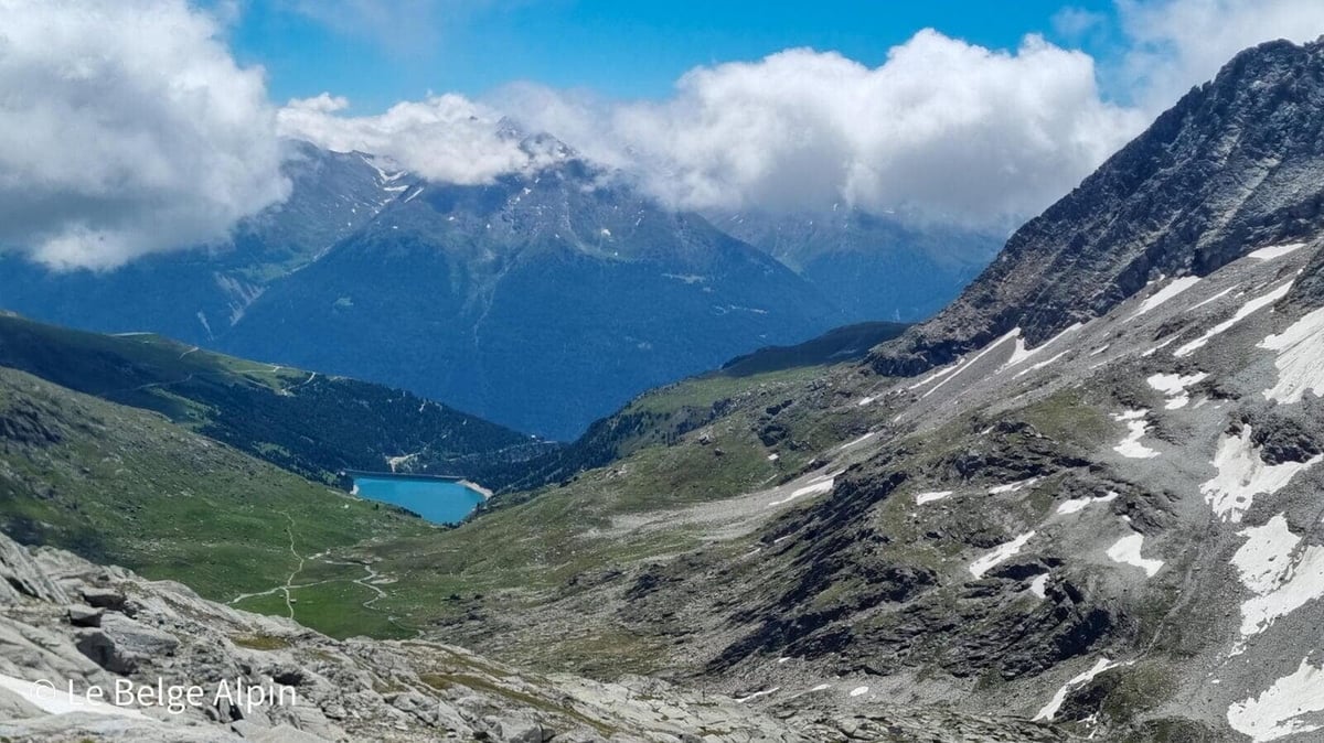
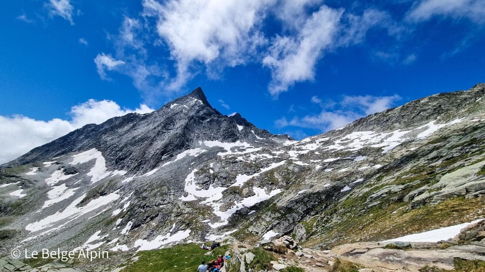
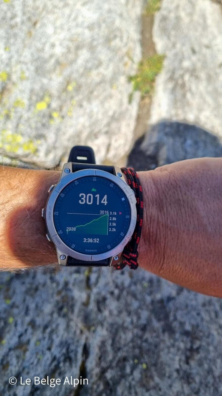
From the second Aussois lake (2059 m), climb to the Refuge du Fond d'Aussois and then to the pass, aiming for the Pointe de l'Observatoire (3015 m). Turquoise reservoir lakes, airy summit and Vanoise-Ecrins panorama on the Maurienne side, less busy than the Pralognan approach.
The Vanoise, a national park dear to my heart. It is practically where I discovered the mountains. When I was younger I spent a lot of time in the village of Pralognan, which has always been my second home. It is in Pralognan and in the Vanoise that I had my first experiences: first in hiking, then in climbing, and finally in glacier hiking (beginner mountaineering).
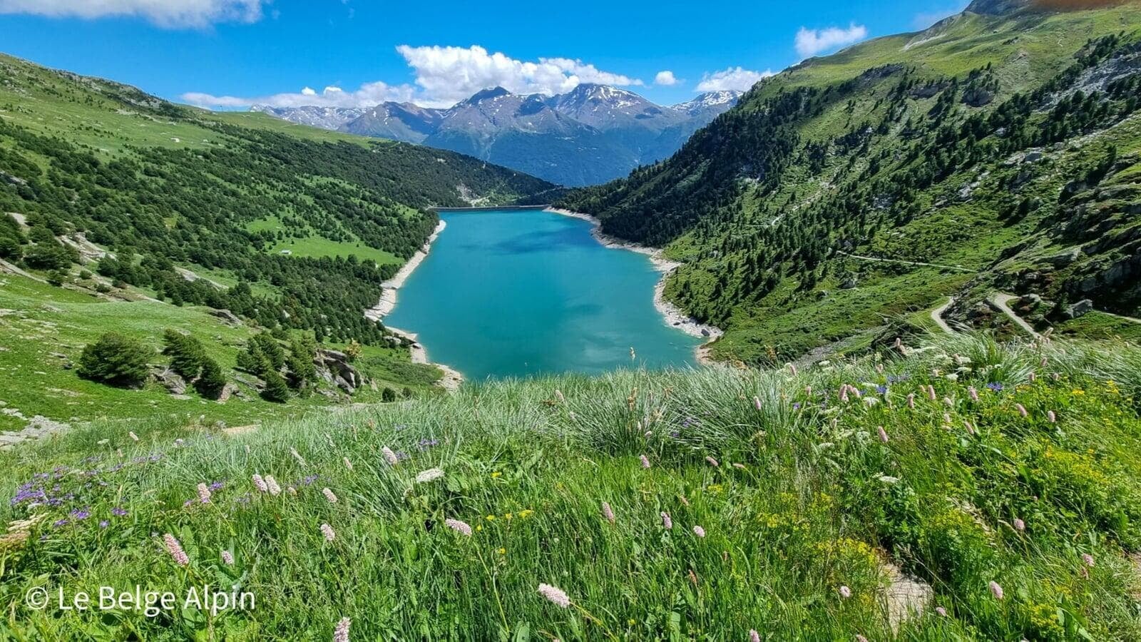
The Pointe de l’Observatoire is the first committed hike that took me past 3000 m in this park. An exhilarating feeling at the time, and still today every time I come back. Sadly, mass tourism has done its work on the Pralognan side. That is why I am suggesting here the Aussois route, on the Maurienne side: the beauty of the turquoise lakes is intact, and the foot traffic stays reasonable.
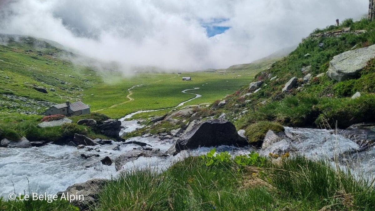
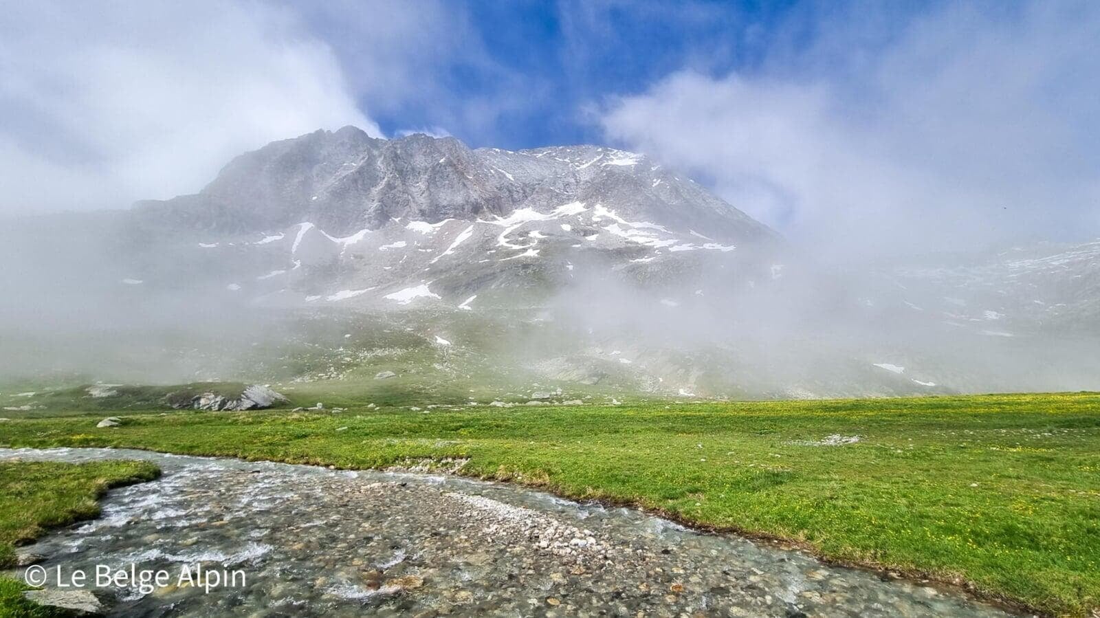
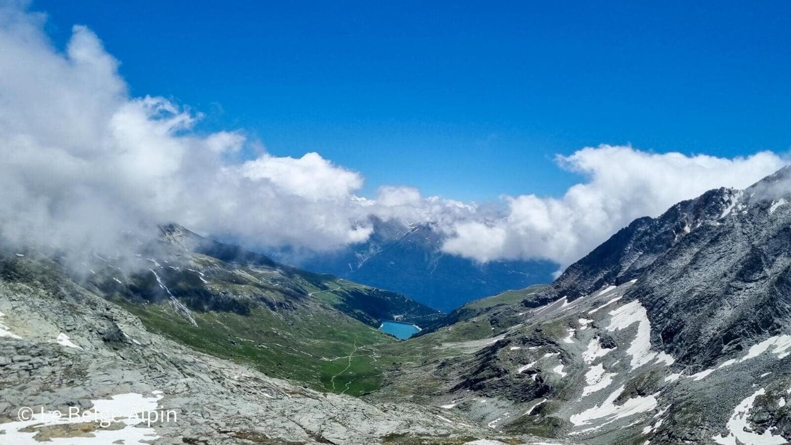
Start in the clouds, the Aussois alpine pastures


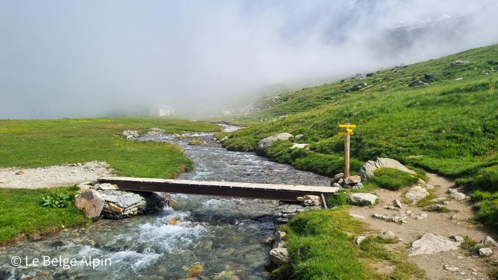
We set off from the Plan d’Amont parking (2059 m). I slept there the night before in my mini-van, quiet, with a view of the lakes. The first third is almost flat, in a broad valley with a torrent, wooden footbridges and typical alpine chapels. The day I did it, low fog clung to the bottom of the valley: we walked in an unreal atmosphere, muffled voices, summits appearing and disappearing on the wind.
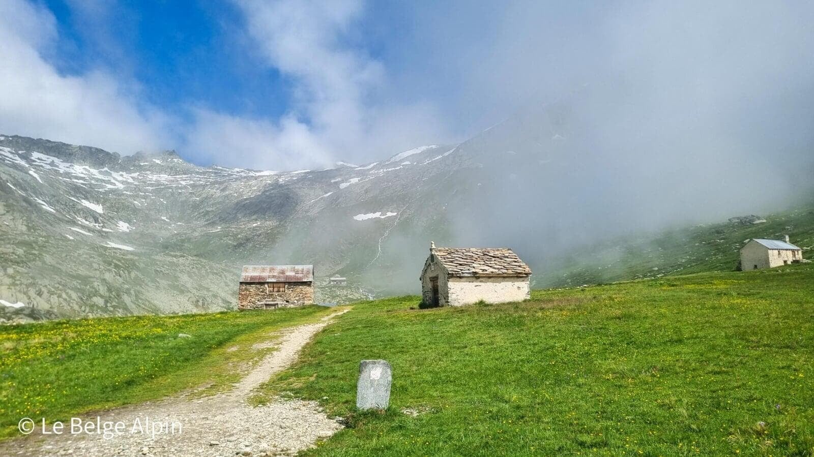
The Refuge du Fond d’Aussois, obligatory stop
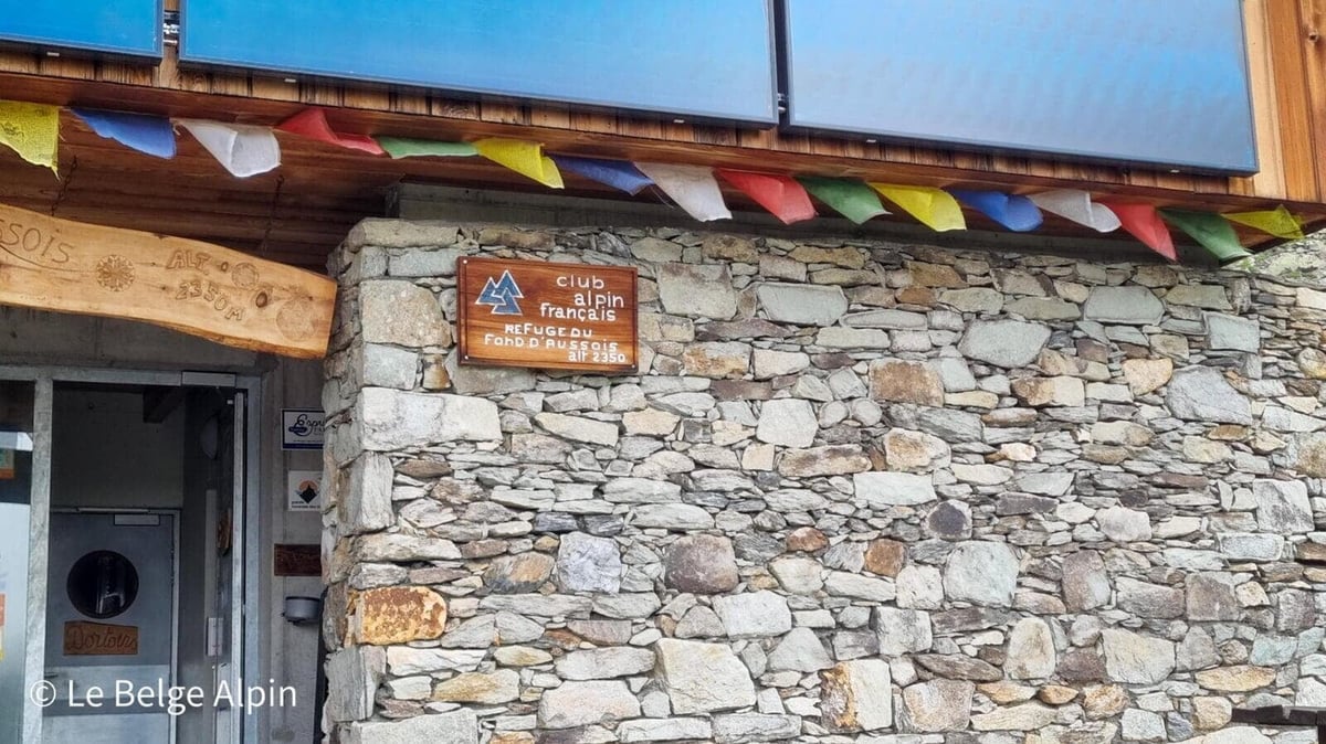
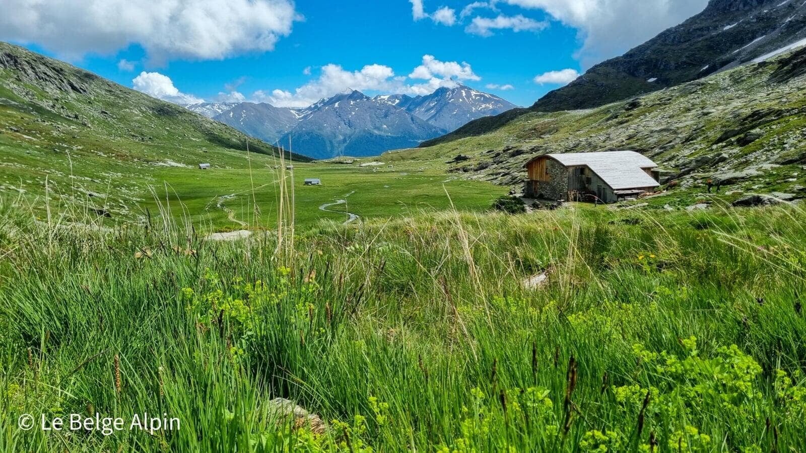
After a good hour and a half, we reach the Refuge du Fond d’Aussois (2350 m), a classic stage on the Vanoise glaciers tour. French Alpine Club, Tibetan prayer flags at the entrance, a carved wooden sign. The welcome is good, we had a coffee, topped up water, and got back on the trail. It is also a sound plan B if the weather turns: you can cut your day short here without regret.
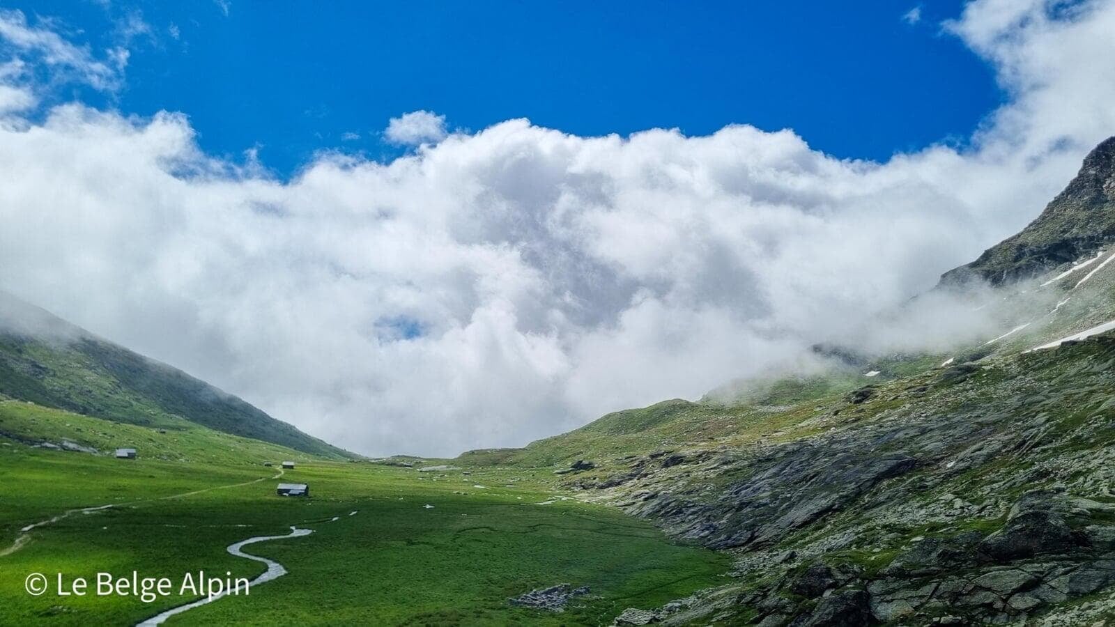
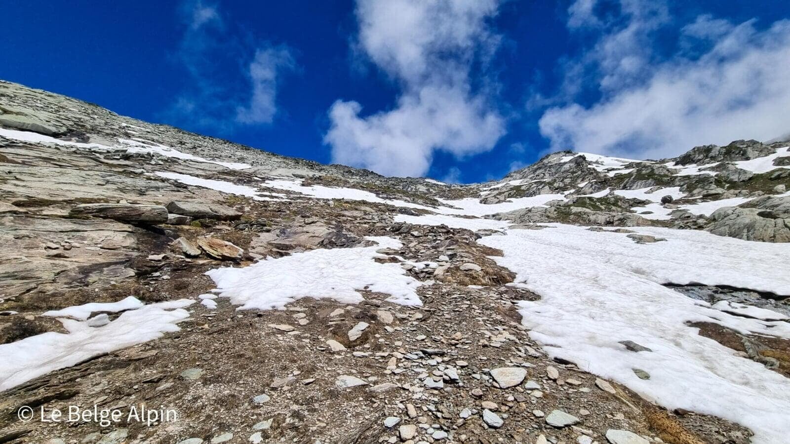
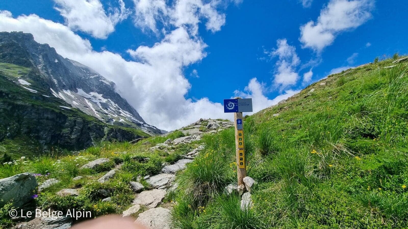
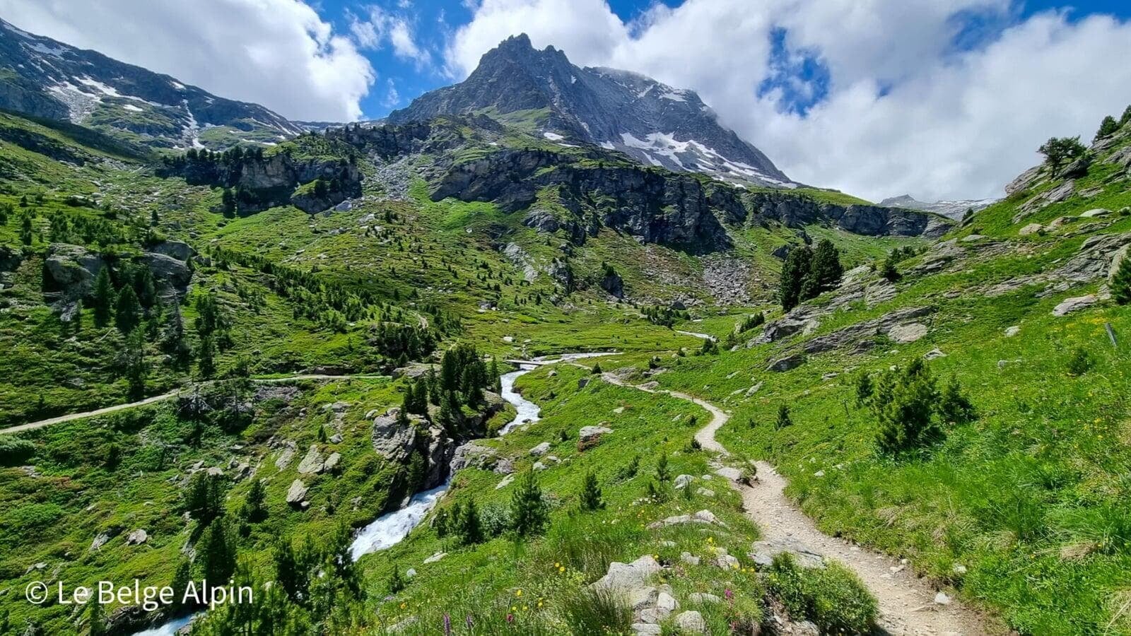
Climb to the pass, scree and snowfields
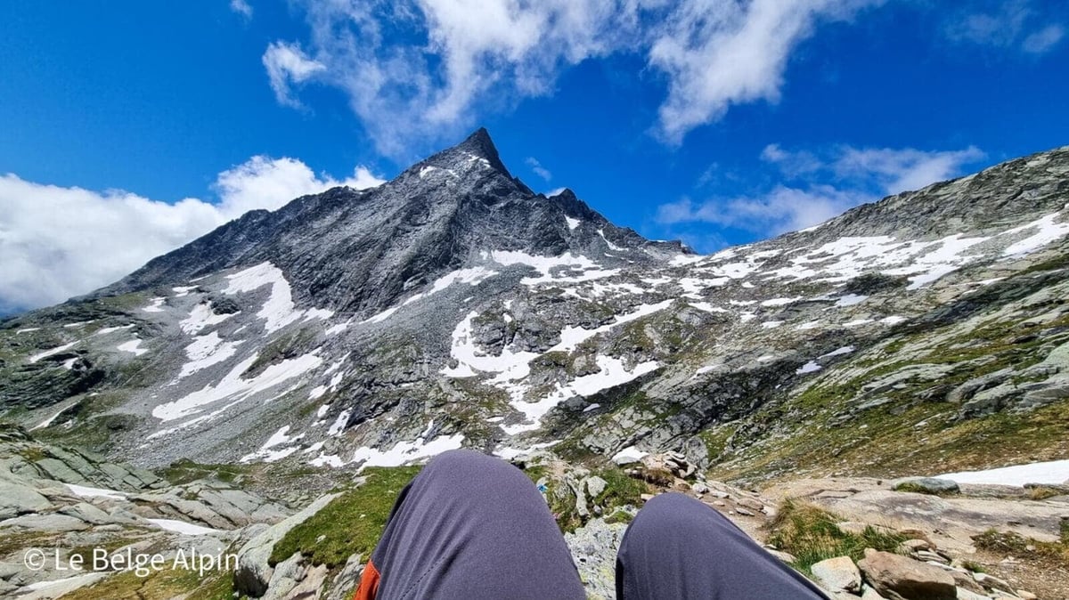
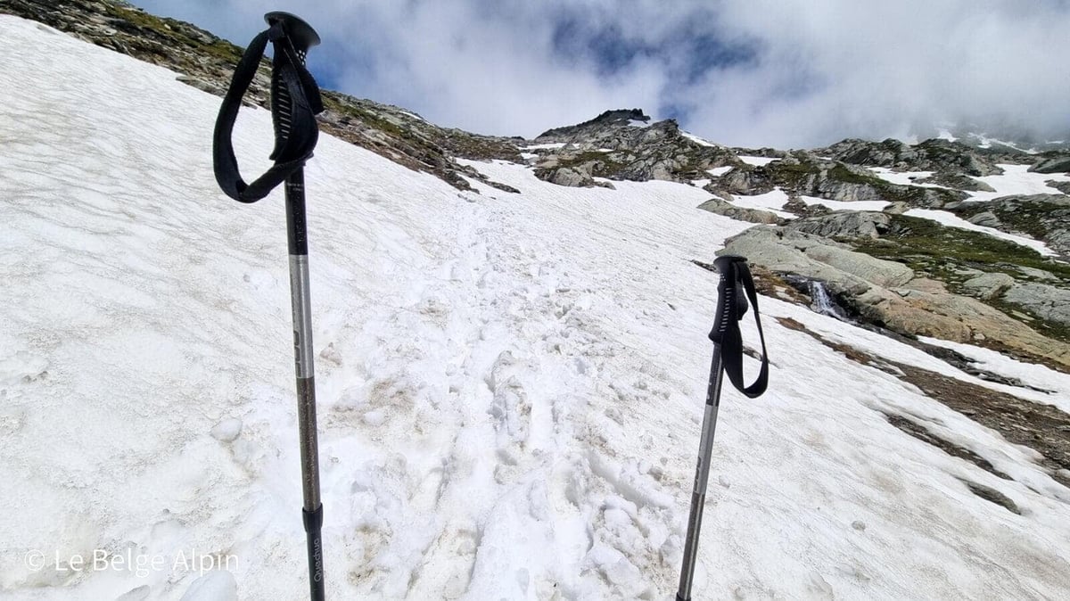
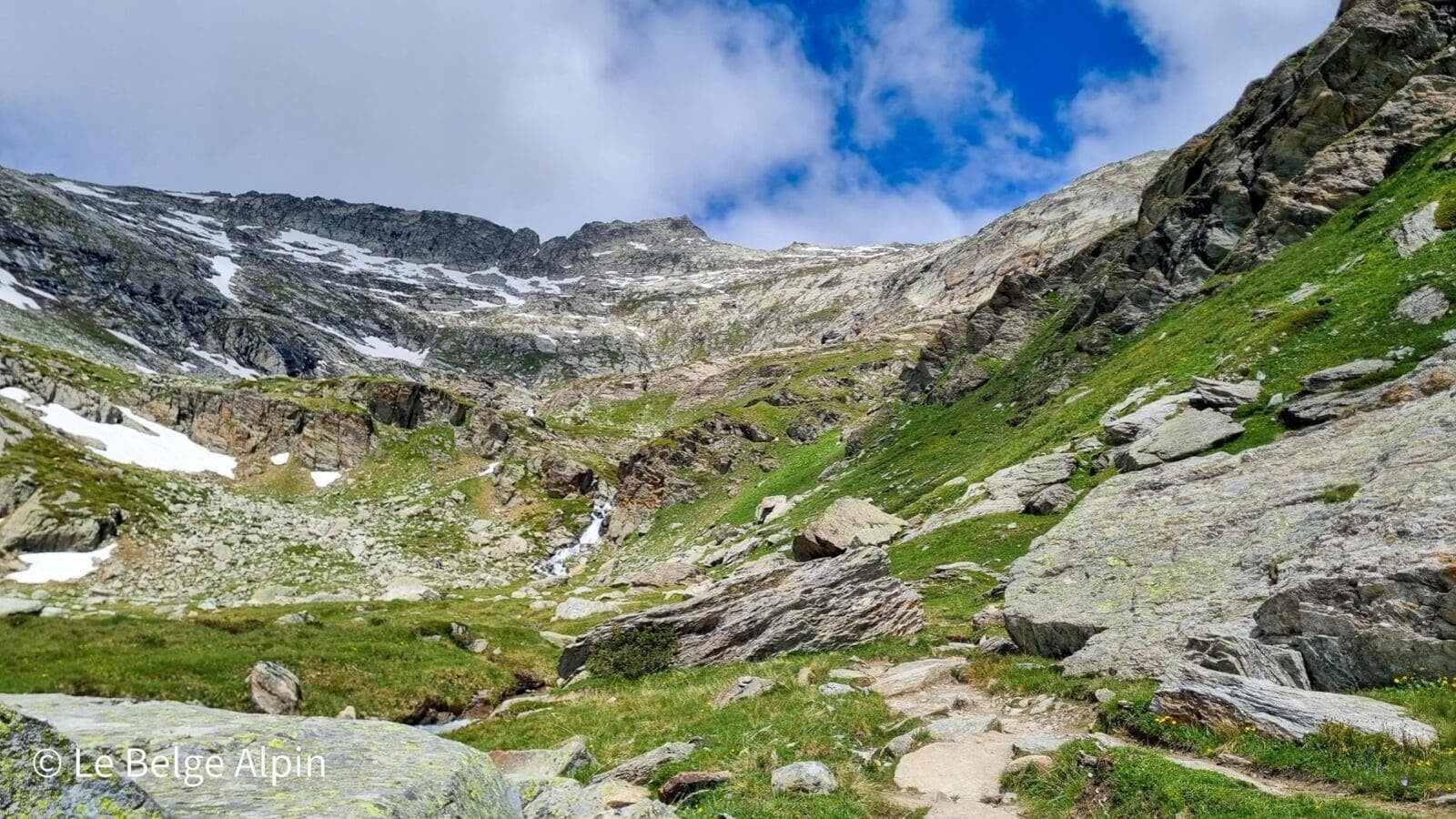
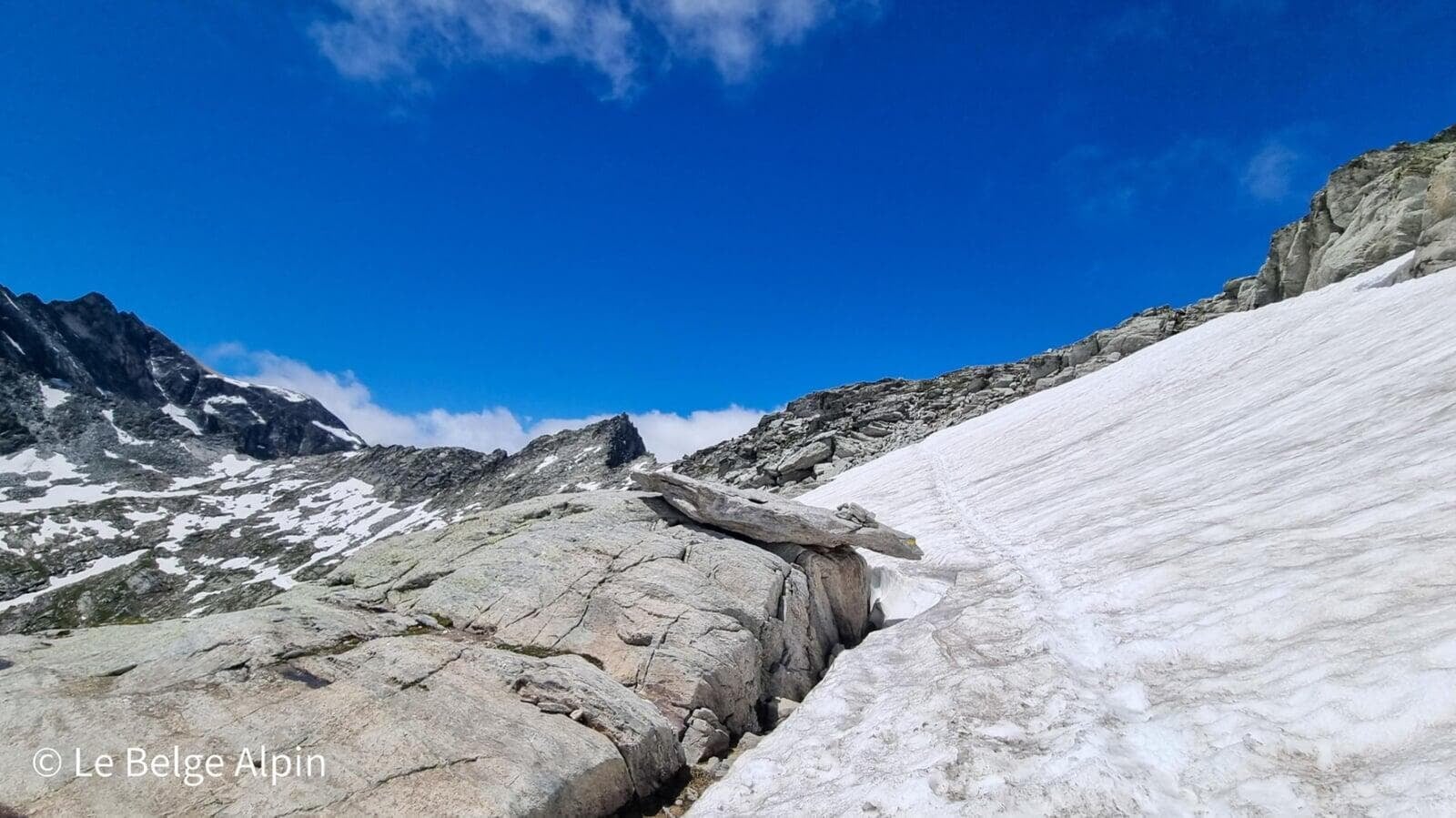
After the hut the scenery changes: the alpine pastures end, the mineral zone begins. The climb to the Col d’Aussois runs through unstable scree with a few sections on residual snowfields, even well into July. It is not technical in the mountaineering sense, but watch your footing.
At the pass it is always a great moment: the magic works, you see the other side of the ridge, you imagine what was hiding behind. At every bend of the climb we thought we were nearly there, and the mountain always held another ridge in reserve. Is it not worth it?
The summit, adrenaline and serenity
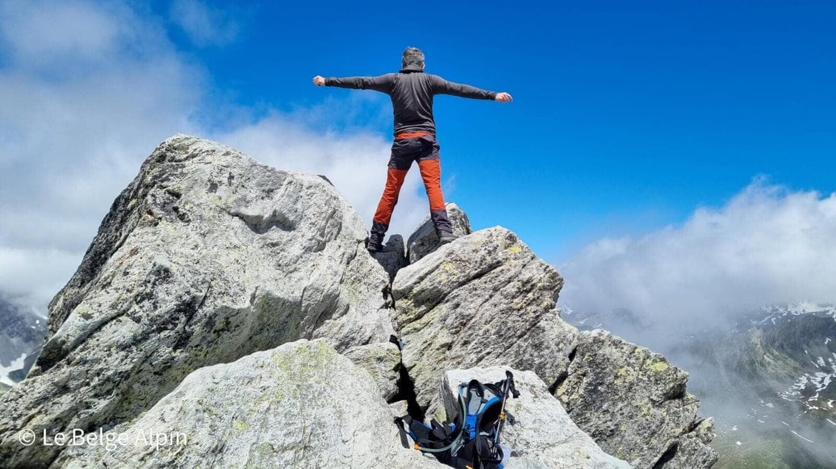
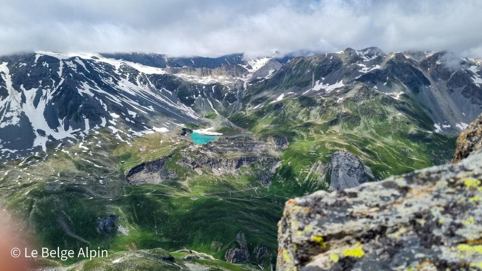
From the pass, you can tackle the peak. If you suffer from vertigo, I would advise against going all the way to the summit. The final ridge is narrow, exposed, and it quickly becomes impressive. If that is not your case, do not miss the chance: the sweeping view over the Vanoise glaciers, the Chaviere valley with Pralognan at the far end, the Dome de Polset, the Aiguille de Peclet with its impressive glacier (a superb introduction to mountaineering, a route I have done three times), at the foot of which sit the hut of the same name and Lac Blanc. Pure joy.
The sensation of standing on the peak is indescribable: a blend of serenity and adrenaline. You are high, razor-thin, and the wind only reminds you where you are.
Descent with chamois, return to the lakes
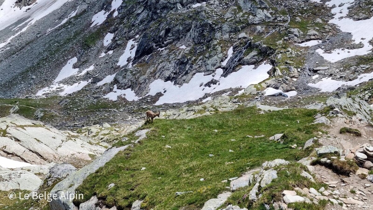

The descent follows the same route. We crossed a curious chamois that was grazing at a respectful distance, a little high-season bonus. Down below, the Aussois lakes are waiting, the turquoise water intact, summer flowers all around. A dip is tempting, but the water is 9-10 degrees, so at your own risk.
Practical info
1020 m of gain over 17 km, plan on 6h30 to 7h30 depending on pace and breaks. Gentle alternative: sleep at the Refuge du Fond d’Aussois. That splits the day in two and lets you leave early on firm snow. The other route, from Pralognan-la-Vanoise, also exists, shorter but busier.
For conditions, a phone call to the Aussois tourist office or to the warden of the Refuge du Fond d’Aussois will give you the real state of the snowfield and the pass. Early in the season (before mid-July), it will be more committing.
Practical info
Starting point
From Modane, drive up to Aussois via the D215. Cross the village and continue up to the reservoir lakes. The road turns stony toward the end, accessible in a low car with care. Park at the second lake (Plan d'Amont, 2059 m). I slept there the night before in my mini-van, undisturbed.
GPX track
Import the GPS track into your watch or app (Garmin Connect, Komoot, Gaia GPS, Iphigenie...).
Sign in to downloadMountain huts
Refuge du Fond d'Aussois (FFCAM), 2350m
Classic stage of the Vanoise glaciers tour. Staffed from June to mid-September. Perfect for a mid-route refill or a night before an early start.
Tourist office (current conditions)
Office de Tourisme Haute-Maurienne Vanoise, Aussois
Place de la Gare, 73500 Aussois
Garmin track
Gallery
22 photos, click to enlarge


Video
A few shots from the outing
Weather, Aussois
Conditions and forecasts for the itinerary
In the mountains, conditions change fast. A thunderstorm can become dangerous, fog disorients, residual snow slows every step. Before leaving, check the bulletins, plan a stable weather window, and when in doubt, call the tourist office or the local guides office.
Learn to read mountain weather →Questions fréquentes
Why climb the Observatoire via Aussois rather than Pralognan?
+
The Pralognan side has become very crowded. Aussois, on the Maurienne side, offers the same summit with far more peace, plus turquoise lakes and a historic alpine-club hut along the way. Both routes have roughly the same difficulty.
Is the summit exposed?
+
Yes, the final peak is narrow and exposed. If you suffer from vertigo, you can stop at the pass where the view is already magnificent. At the summit, staying seated or bracing yourself is wiser than standing with arms outstretched.
Can you sleep at the Refuge du Fond d'Aussois?
+
Yes, it is staffed in season and even recommended if you want to tackle the pass at sunrise. Booking is mandatory in summer via the FFCAM website.