
From the Maison du Valier (951 m) in the Ariege, 1-day ascent of Mont Valier (2838 m), the most iconic summit of the Couserans. 2000 m of gain over 25 km, Refuge des Estagnous midway (2-day option strongly recommended), turquoise Etang d'Ayes, Col de Faustin and the final climb through the rocks. My favourite Pyrenean peak.
Mont Valier, nicknamed the Matterhorn of the Ariege, is an iconic and majestic summit. With a friend, we had planned to close our 2023 trip on top, but the weather had other ideas. The mountain had pushed us back, so we came back in 2024 to finally claim this long-coveted summit. Payback, one year later.
Back to the Ariege, the 2024 comeback
The Ariege is a French department in the Pyrenees. Although the summits are not very high in absolute terms, elevation gains are serious because road access is limited. That contributes to the wild beauty of this region, which is less affected by mass tourism. Even in peak summer season, you cross paths with few hikers. Mont Valier is an exception, one of the most popular summits in the area, and you shouldn’t have trouble finding your way, which isn’t always the case in the Couserans.
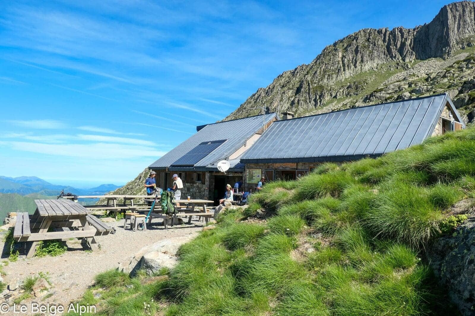
With 2000 metres of elevation gain, this is a substantial ascent. I’d recommend splitting it into two stages with a night at the Refuge des Estagnous (2245 m): it breaks the effort into two 1000 m portions and makes the climb far more manageable. For our part, we chose to do it all in one day, being two strong walkers driven by the urge to settle the score with this summit that had slipped away the year before.
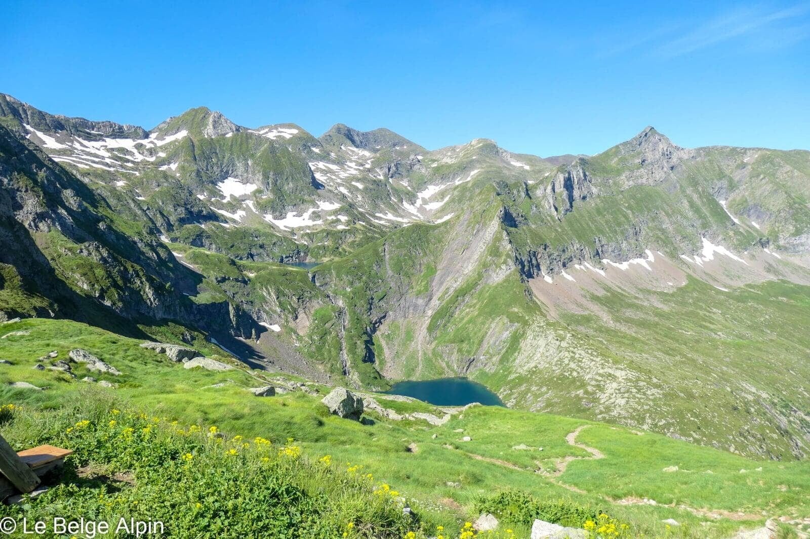
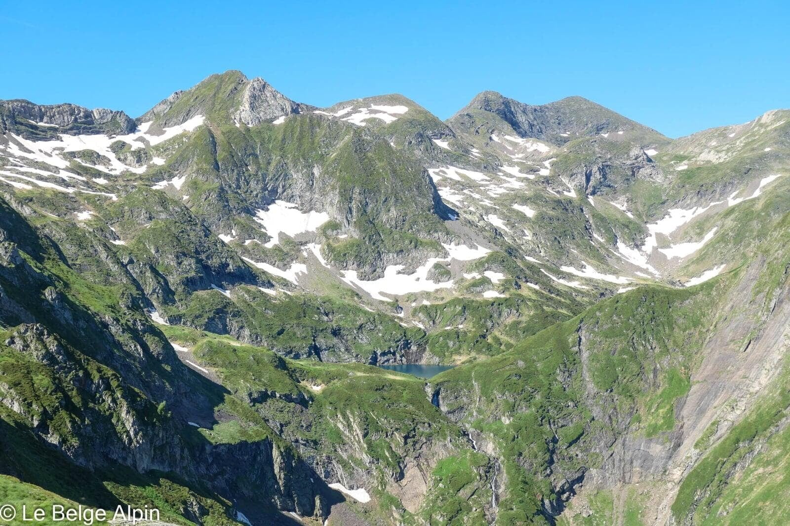
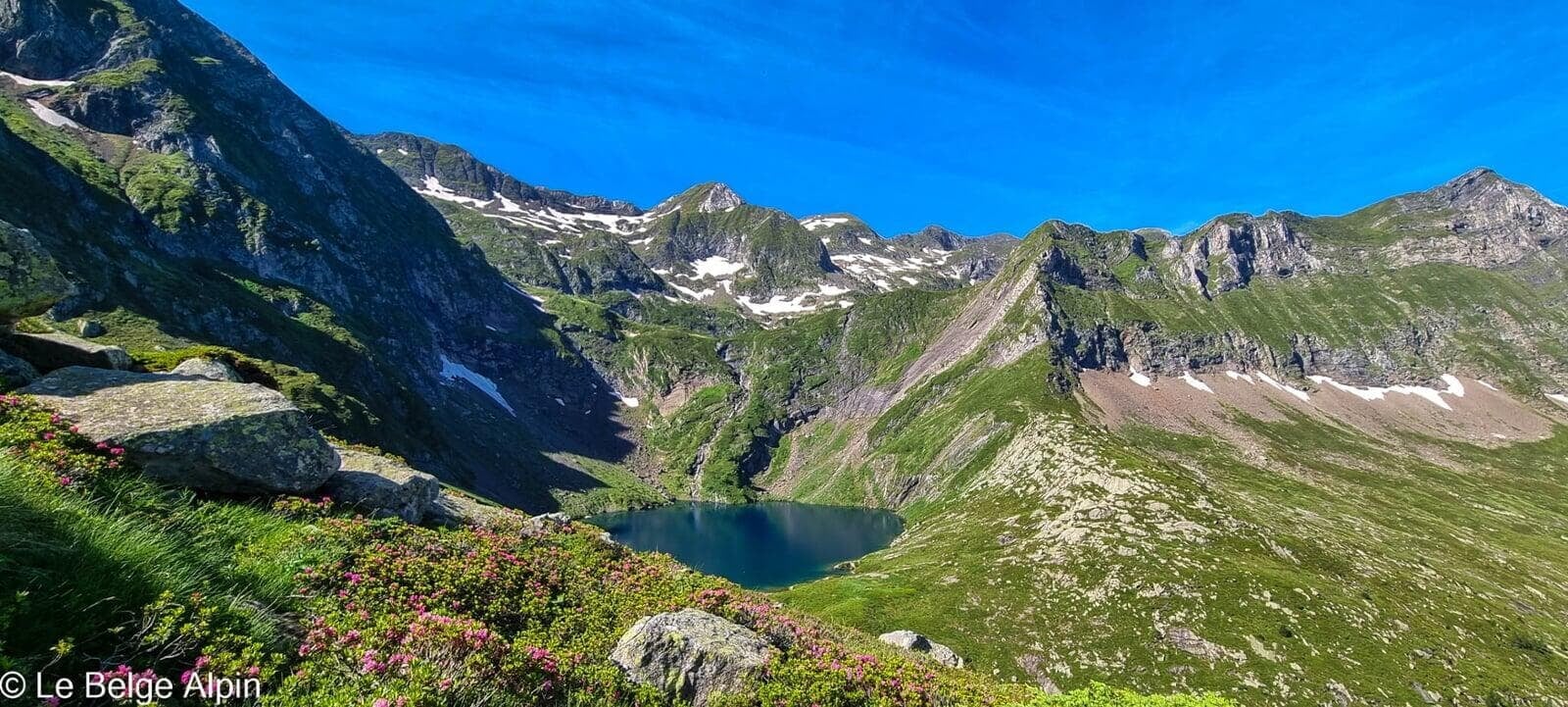
Etang d’Ayes and Refuge des Estagnous


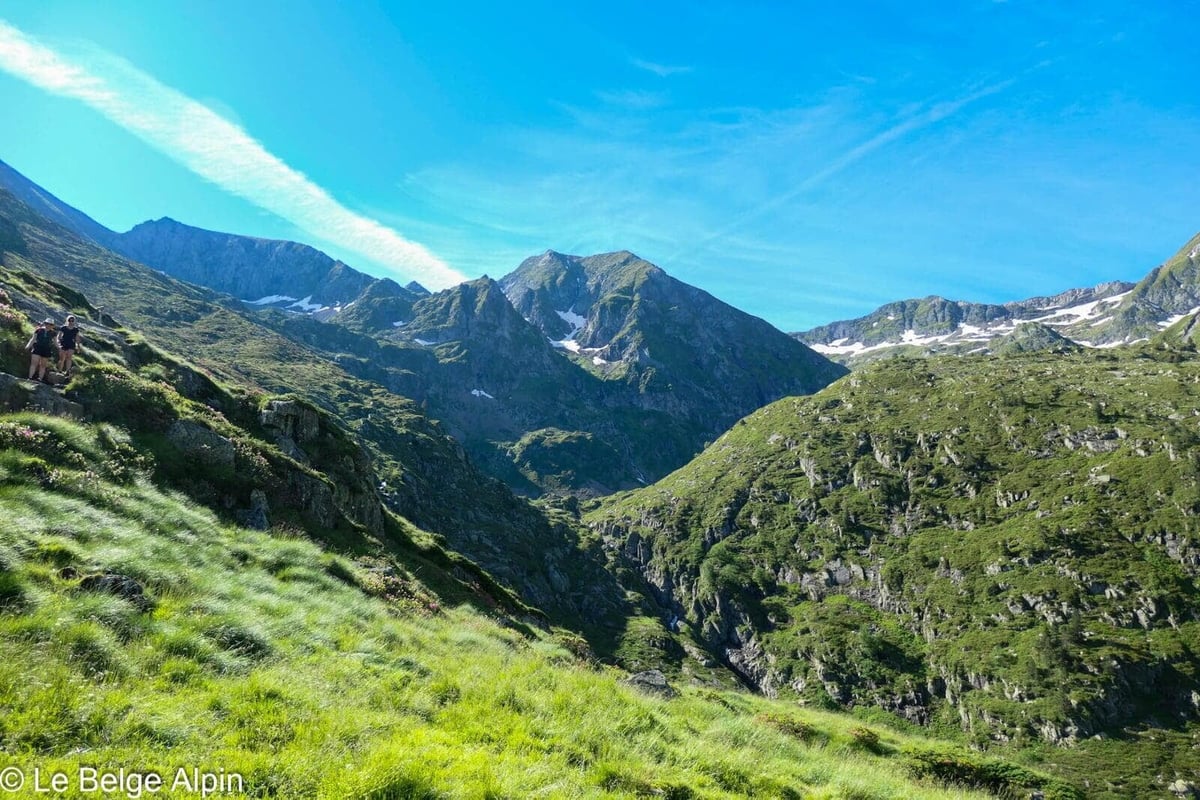
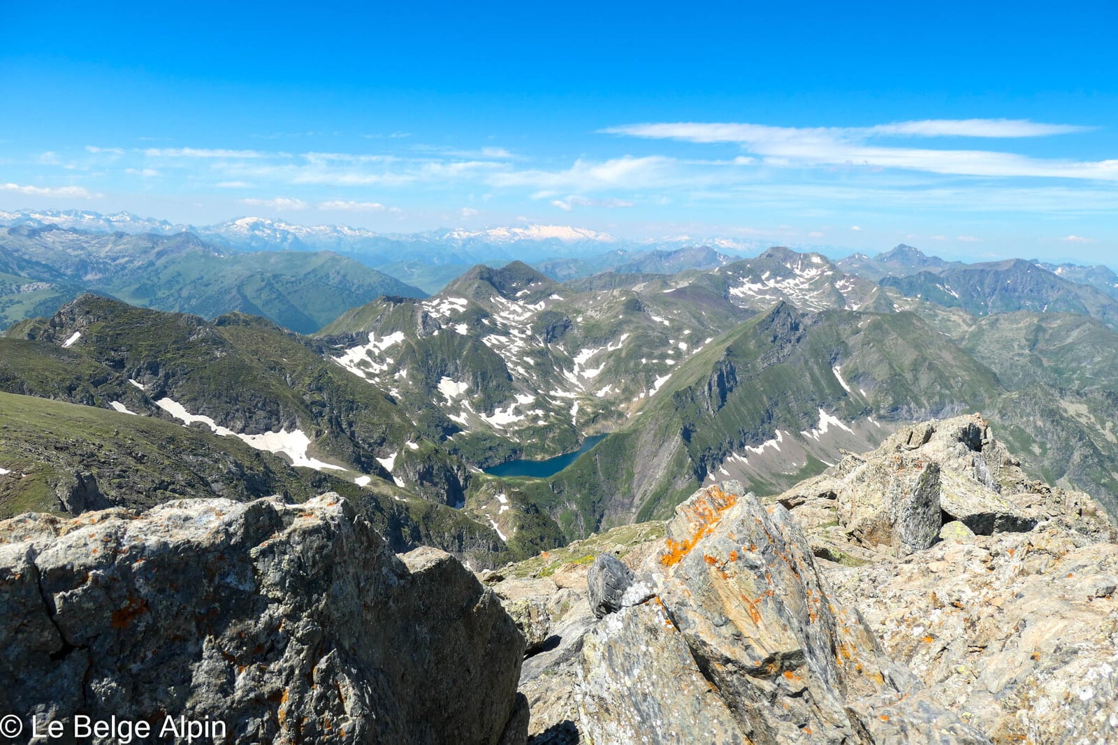
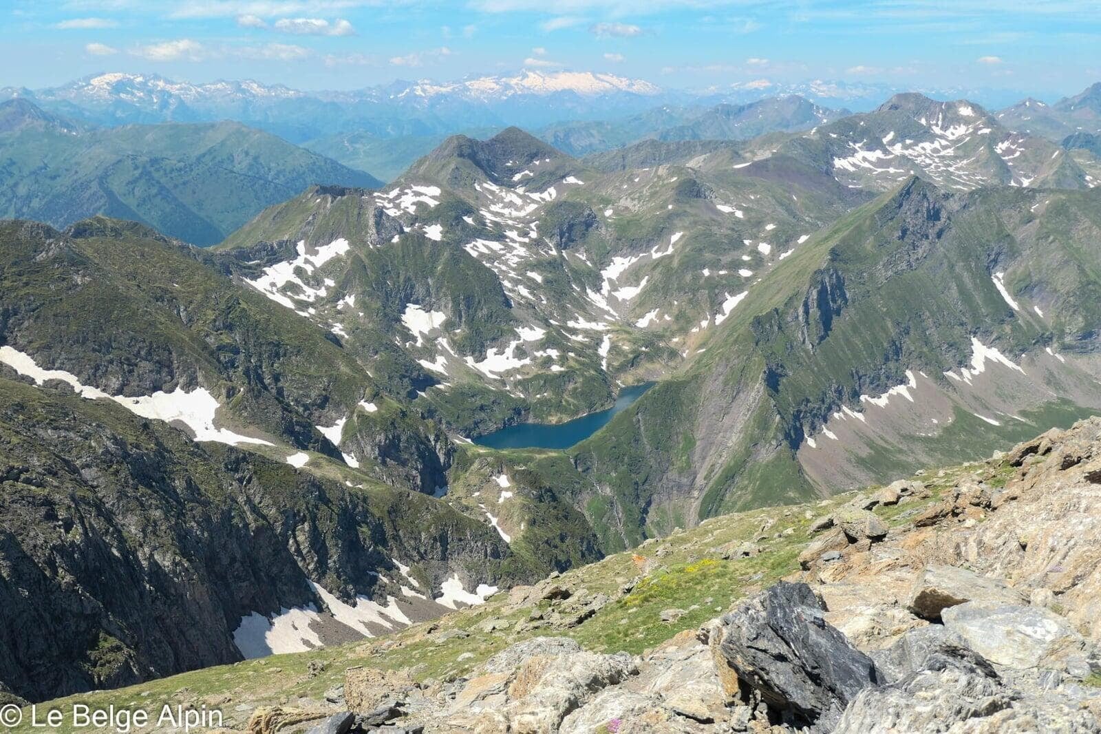
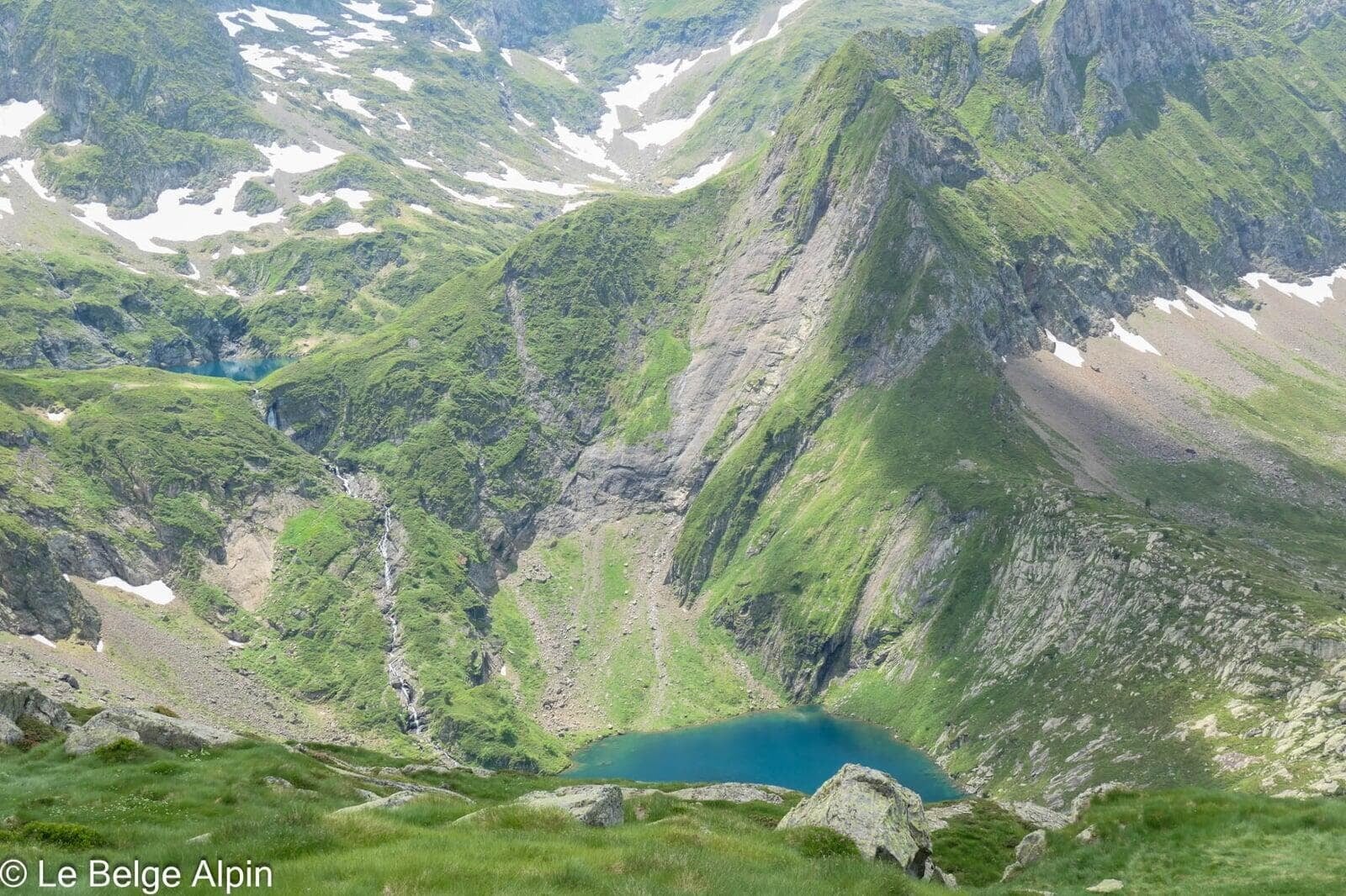
The hike is well worth the detour. During this long ascent, you have time to take in the valley, the forest, and the alpine pasture, with scenery that shifts almost magically. Approaching the refuge, you discover the Etang d’Ayes, a stunning turquoise pool at the foot of the neighbouring summit. The kind of lake that makes you want to drop everything and just soak it in.
The Refuge des Estagnous is a Couserans classic. Staffed by a welcoming team, it’s the historic base camp for ascents of the Valier and nearby summits (Pic de la Pale de Crabere, Pic de Barlonguere), hosting hikers and mountaineers for generations. We take a short break, we won’t be sleeping there this time.
Col de Faustin, the final climb through rocks
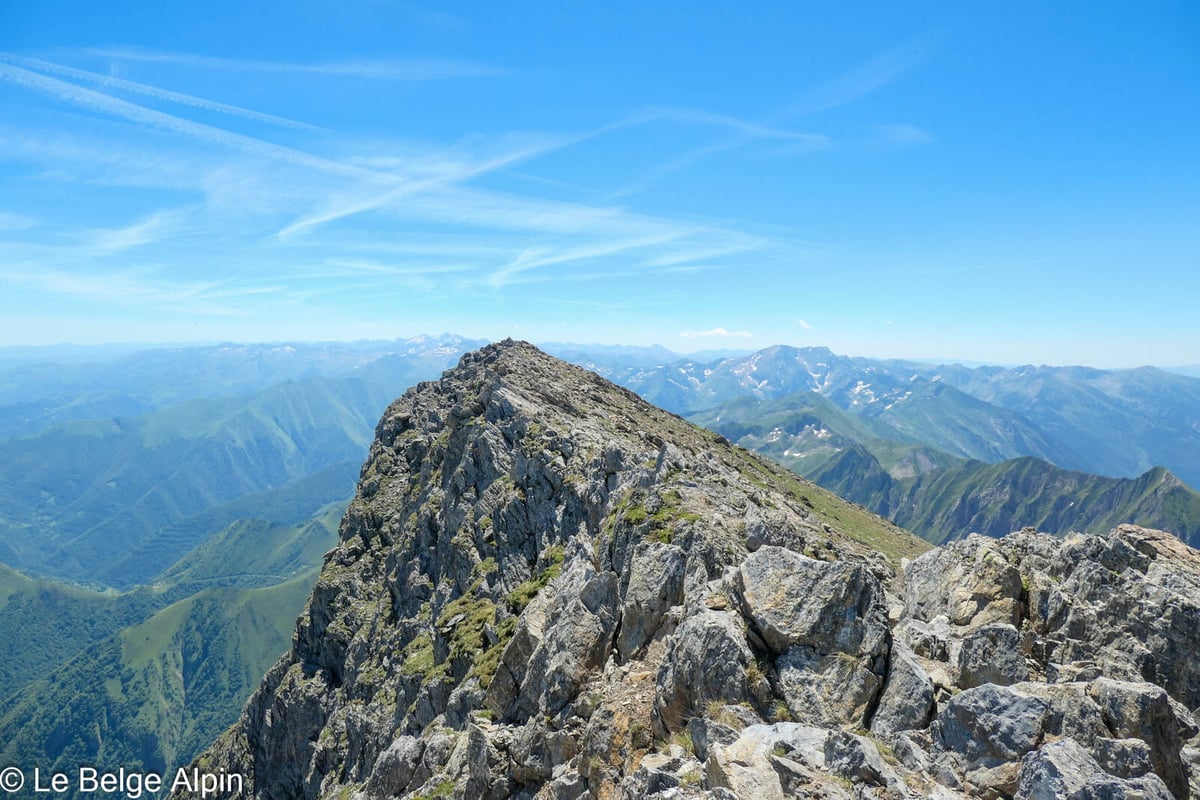
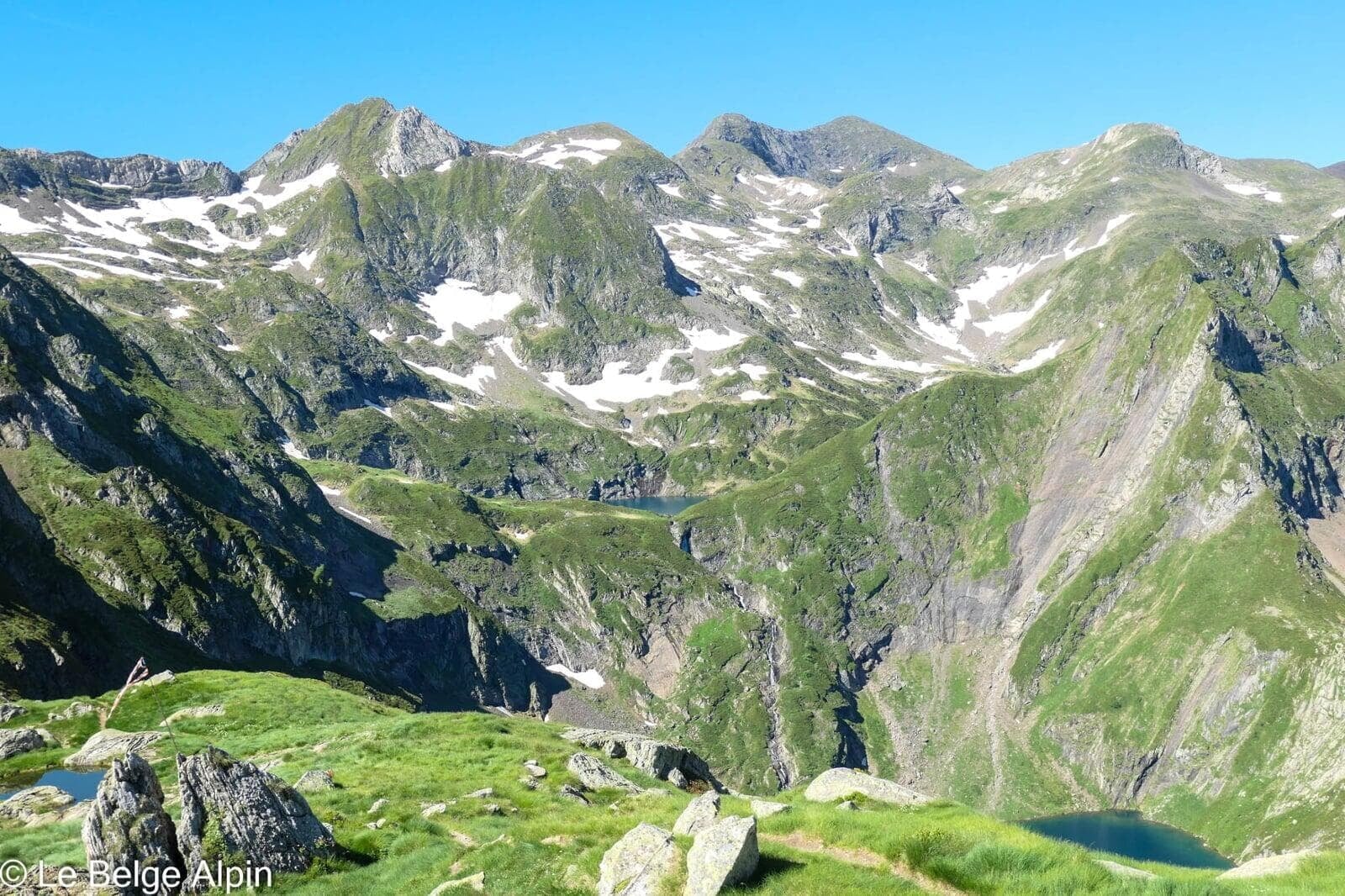
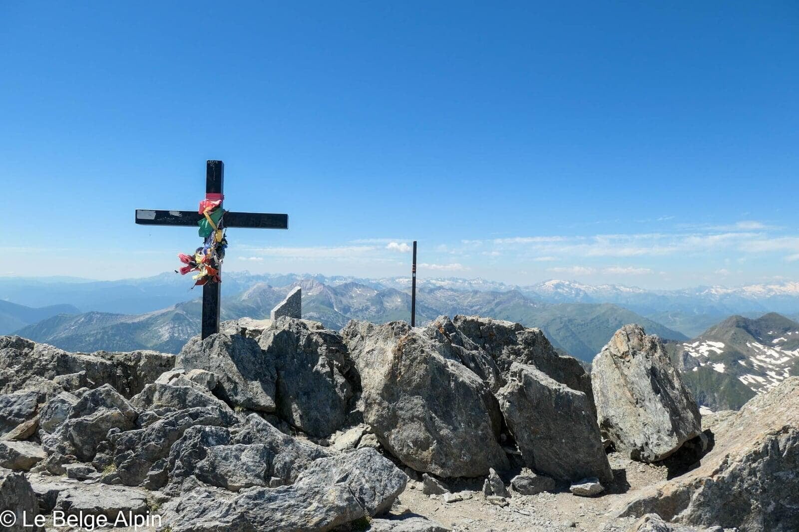
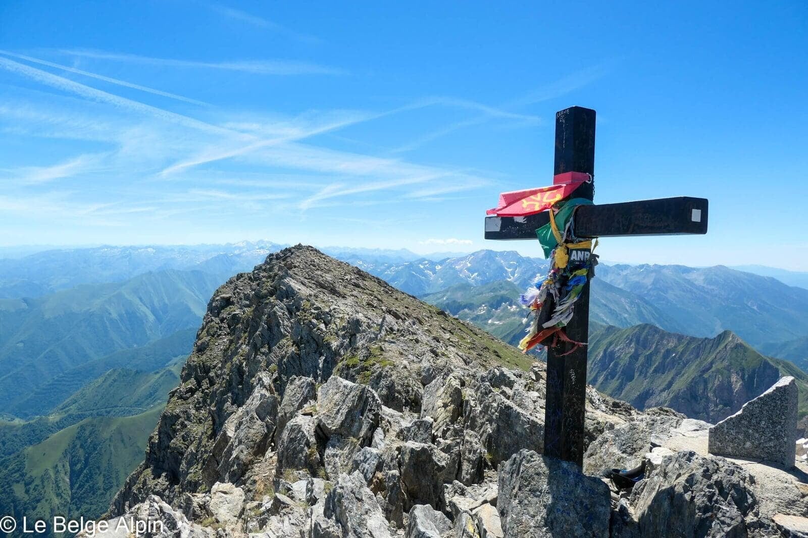
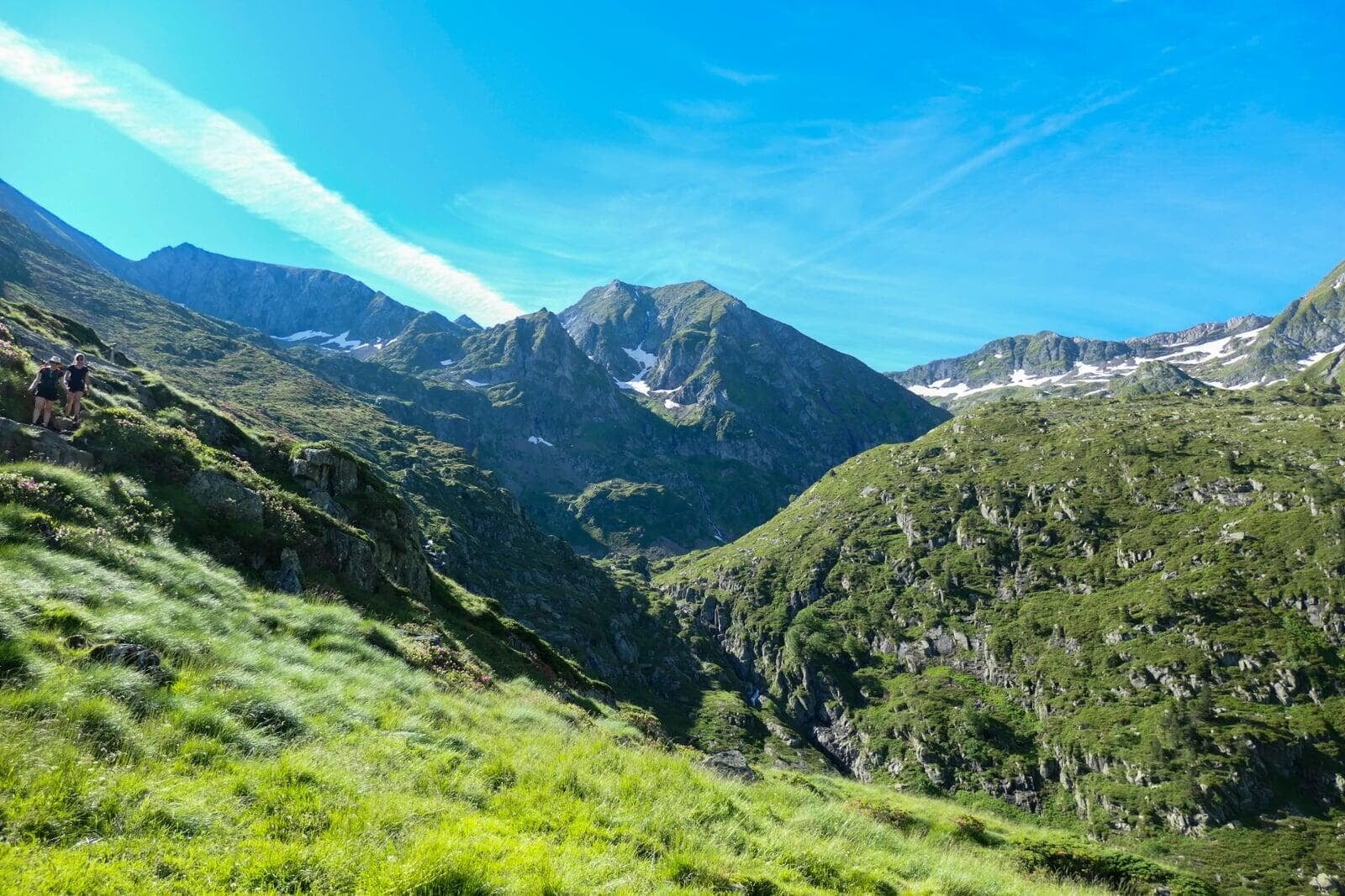
After the refuge, we tackle the second-to-last section, which leads us first to the Col de Faustin. From there, the opposite side opens up in front of us, and to our left Mont Valier still towers 300 metres above. All that’s left is a final push to climb this Ariege icon, a steep haul through rocks that finally lands us on the long-awaited summit.
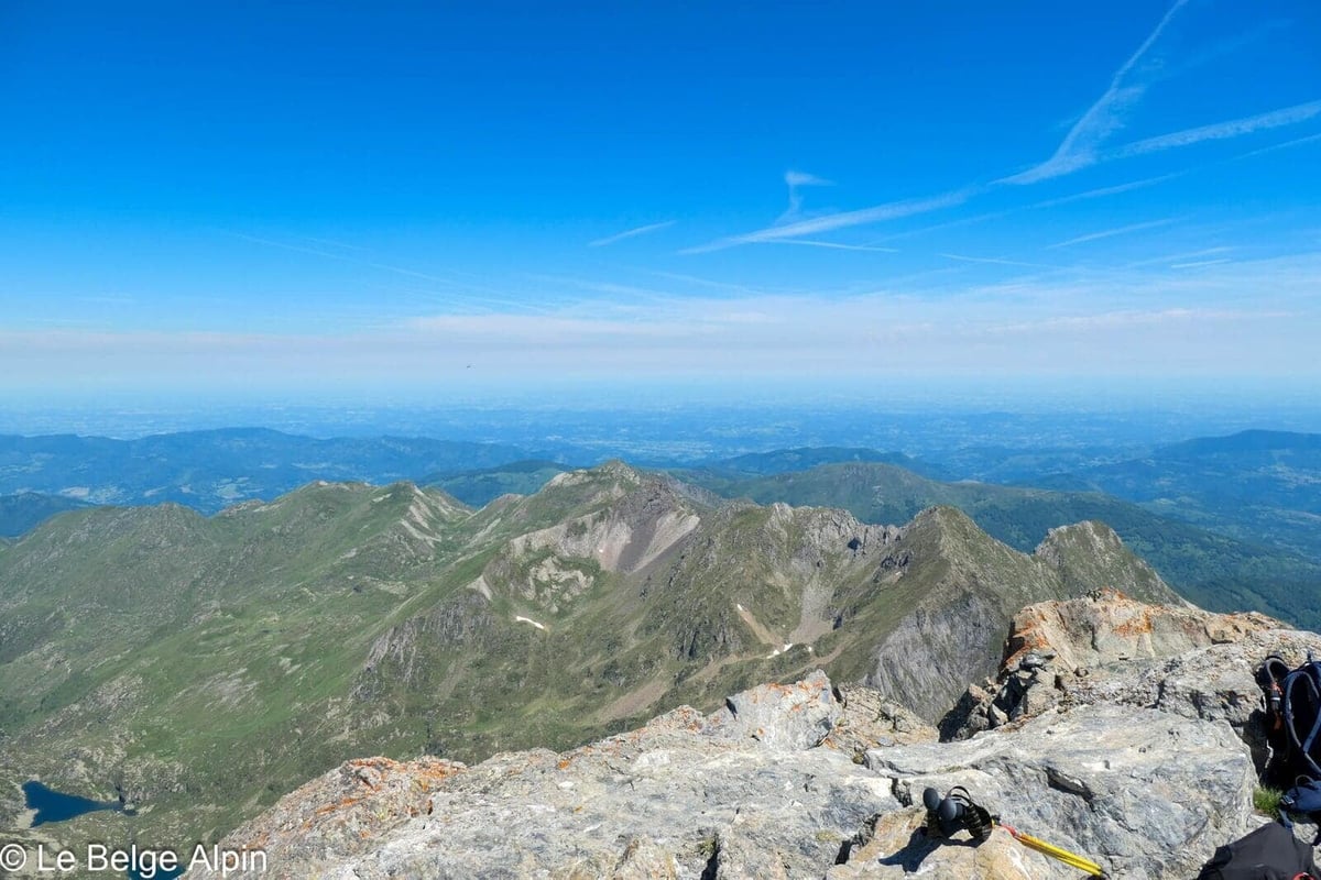
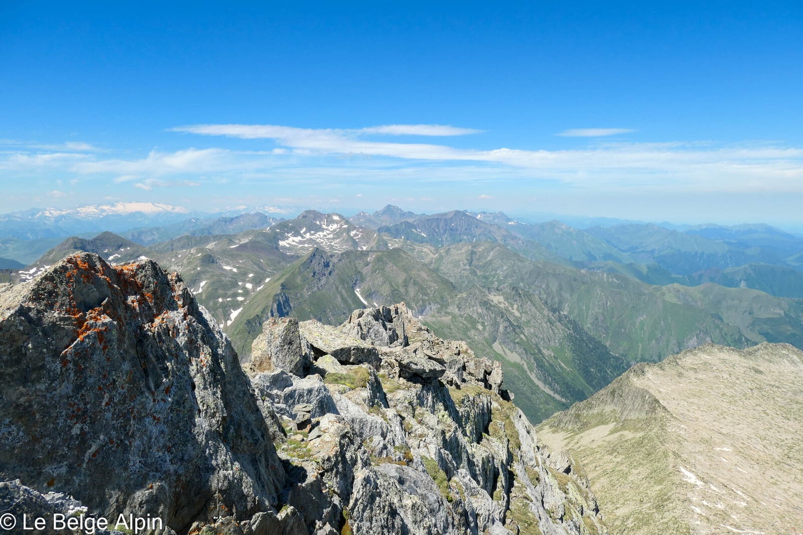
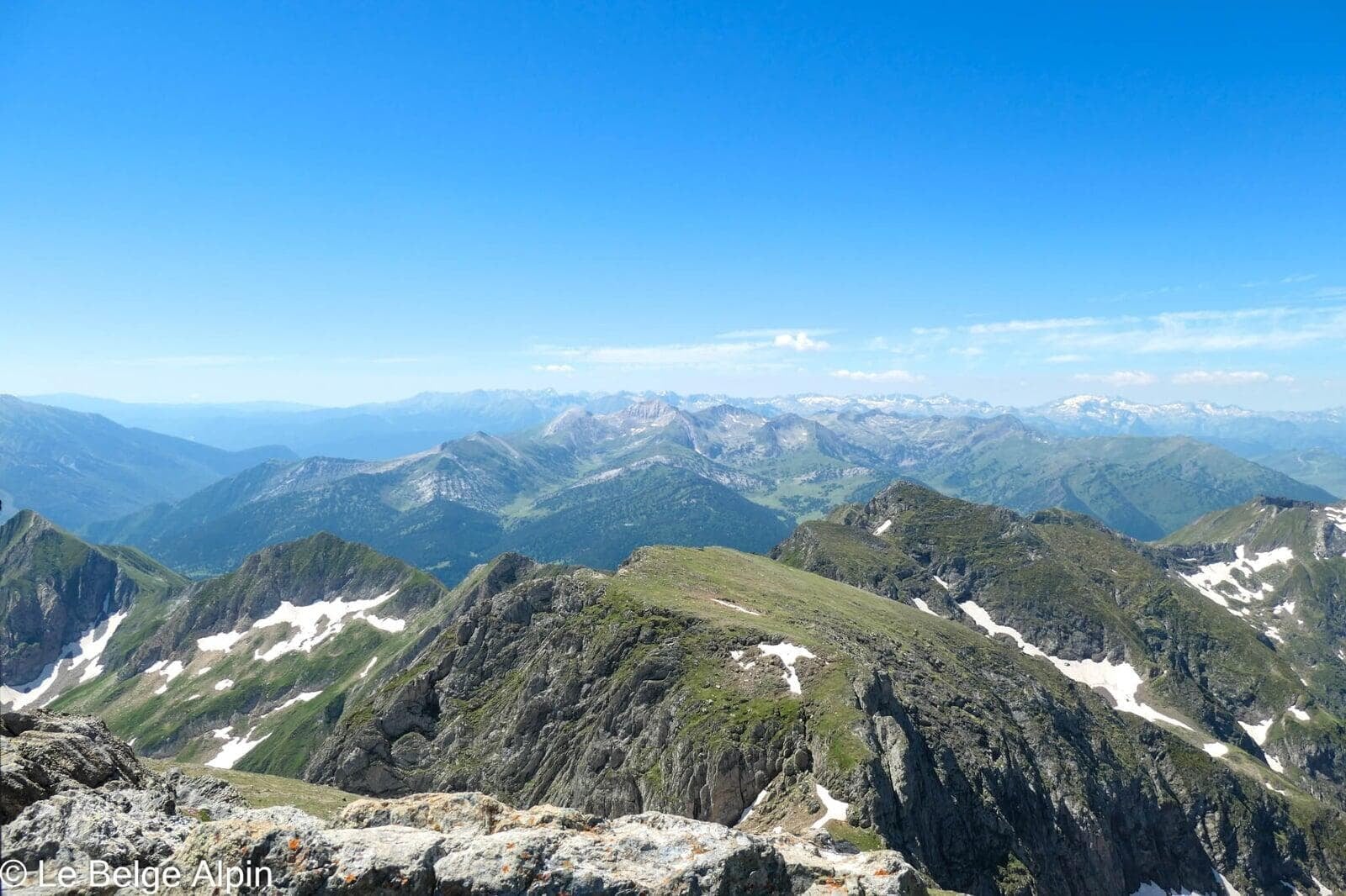
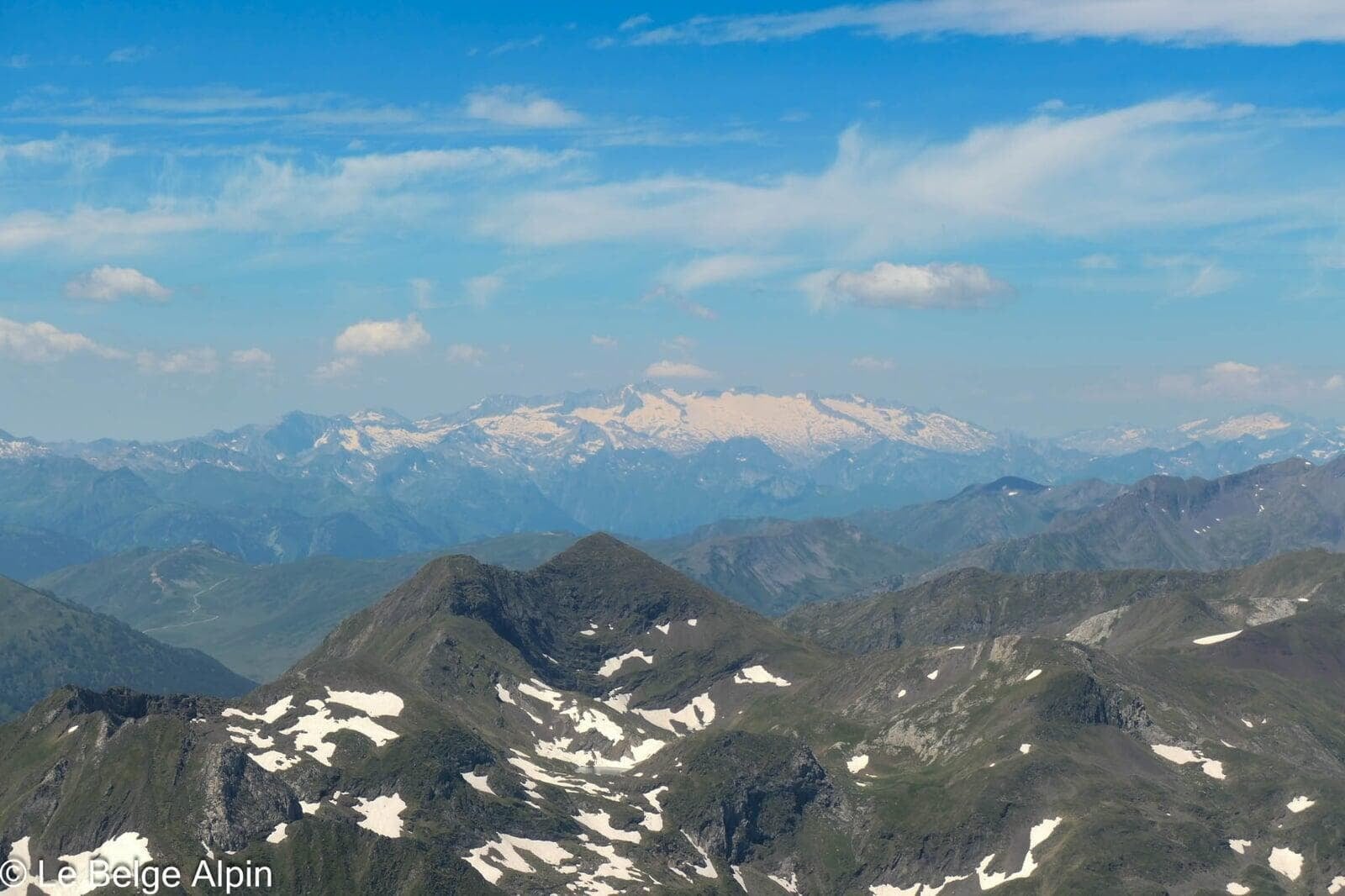
Once on top, you catch your breath and take in a breathtaking panorama. Out of all the Pyrenean summits I’ve climbed, this is probably my favourite. The view is simply extraordinary, you feel like you’re looking down over the whole region. I don’t know the names of enough peaks to detail everything, but the photos speak for themselves.
A summit not to miss


If I had to recommend a single Ariege summit to someone discovering the Couserans, it would be this one. The Matterhorn of the Ariege has it all: the pyramid silhouette visible from afar, the varied route (forest, pasture, lake, pass, rocks), the staging refuge that allows a real break, and that summit panorama that easily justifies the 2000 m of gain.
Before you go
For up-to-date conditions (lingering snow in June, Riberot track access, refuge availability), the Maison du Valier or the Refuge des Estagnous are the best sources. They know the ground and pass on info accurately.
For the 1-day option: start before 6am in summer, to be on top around noon and back down before the afternoon storms. Carry at least 4 litres of water, the climb between the valley and the refuge is fully exposed to the sun with no shade. Poles strongly recommended for the 2000 m descent, the quads give up.
For the 2-day option: book the refuge, sleep there, set off early the next morning to cover the last 1000 metres to the summit, then descend at a relaxed pace during the day. The relaxed option, and the one that really lets you enjoy the place.
To go further
- Understand FFRandonnee E/T/R ratings
- Bivouac kit in a refuge
- Mont Valier belongs to the Couserans range, in the Ariege Pyrenees. Its pyramid silhouette earns it the nickname Matterhorn of the Ariege, by analogy with the Alpine Matterhorn. See also Pic de Crabere, another nearby 2630 in the same range.
Practical info
Starting point
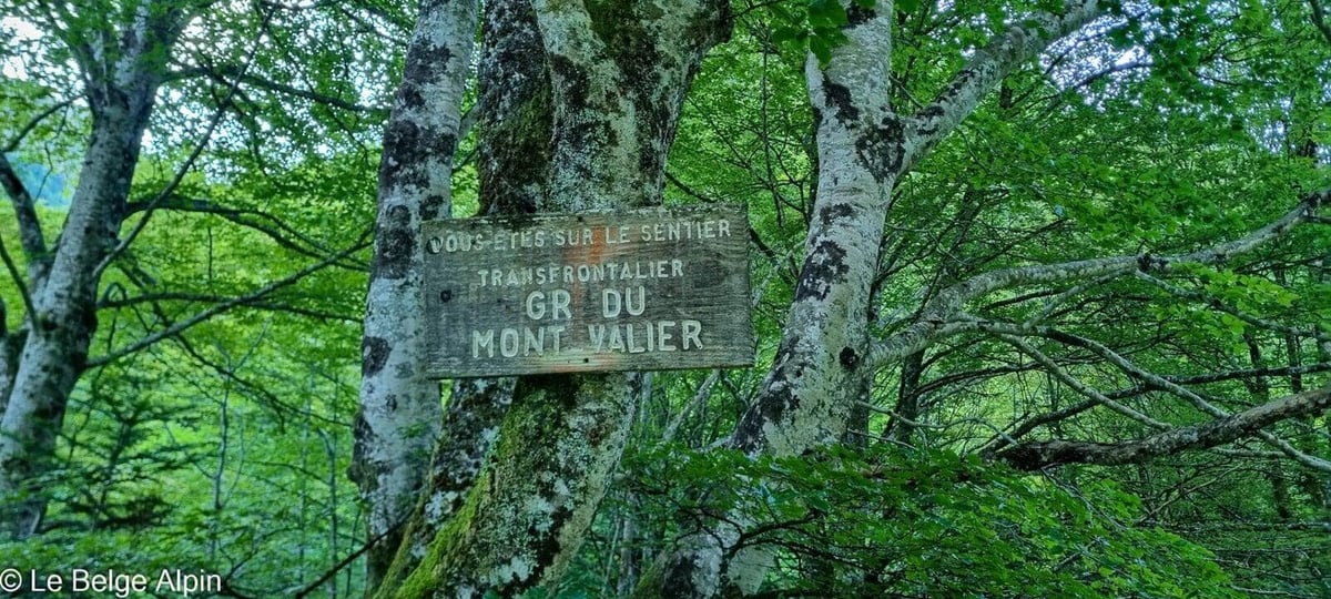
From Saint-Girons, reach Castillon-en-Couserans and then Bordes-Uchentein via the D4. Continue to the Maison du Valier parking (951 m), free and spacious, at the end of the paved road. The trail starts just behind the inn, GR waymarking, no ambiguity.
GPX track
Import the GPS track into your watch or app (Garmin Connect, Komoot, Gaia GPS, Iphigenie...).
Sign in to downloadMountain huts
Refuge des Estagnous (FFCAM), 2245m
Ideal midway halt to split the 2000 m of gain into two 1000 m stages. Staffed from mid-June to mid-September. Reservation strongly recommended in peak season. Historic base camp for Mont Valier.
Tourist office (current conditions)
Maison du Valier
Le Riberot, 09800 Bordes-Uchentein
Garmin track
Gallery
19 photos, click to enlarge


Weather, Les Bordes-sur-Lez
Conditions and forecasts for the itinerary
In the mountains, conditions change fast. A thunderstorm can become dangerous, fog disorients, residual snow slows every step. Before leaving, check the bulletins, plan a stable weather window, and when in doubt, call the tourist office or the local guides office.
Learn to read mountain weather →Questions fréquentes
Mont Valier in 1 or 2 days?
+
Recommendation: 2 days with a night at the Refuge des Estagnous (2245 m), which splits the 2000 m of gain into two manageable 1000 m stages. In 1 day you need to be fit, 25 km and 2000 m of gain in one go, departure before 6am is non-negotiable, return at end of day.
Why is it called the Matterhorn of the Ariege?
+
Its pyramid silhouette, visible from much of the Ariege, recalls the Alpine Matterhorn. It's the most iconic summit of the Couserans, the one you spot first when entering the region, and the one you climb when you want a real goal in the Ariege.
What is the real difficulty?
+
A long and sustained alpine hike, but with no major technical section. Well-marked trail up to the Col de Faustin, then the final climb through rocks, no exposed passage. The 2000 m of gain is the real filter, not the technicality. Still carry an IGN map, in the Ariege navigation can get tricky in mist.
What is the best season?
+
Mid-June to mid-September. Before that, lingering snowfields on the final ridge and the refuge not yet open. After, the refuge closes and early snow is possible above 2500 m. To avoid the frequent summer afternoon storms, start early and ideally be back down by early afternoon.
What can you see from the summit?
+
A spectacular 360 degrees panorama, the entire Spanish border chain to the south, the Ariege Couserans to the north, and in clear weather Andorra to the south-west. Looking back over the years and all the 3000-metre peaks climbed, it's probably my favourite Pyrenean summit. The effort-to-reward ratio is unbeatable in this range.
Is the Refuge des Estagnous still open?
+
Yes, it is an active FFCAM refuge, staffed from mid-June to mid-September. Phone: +33 5 61 96 76 22. Reservation strongly recommended in peak season (July-August). Reduced rate for FFCAM members. Shared dinner, classic mountain hut atmosphere.