
From the Chenalette parking at Valmeinier, 1570 m of gain to reach the Mont Thabor (3178 m). Gentle valley, then a long steep snowfield before the pass, and finally an epic panorama over the Ecrins, the Vanoise and the Queyras.
I had been eyeing this summit for a while, for lack of opportunities in previous years. In July 2024 the calendar finally lined up: a week in haute Maurienne to explore the area’s via ferratas with a friend, the chance to bring along my mountain partner and a friend passing through the region. We took the opportunity to slot in this Mont Thabor, nestled between the Vanoise and the Ecrins.
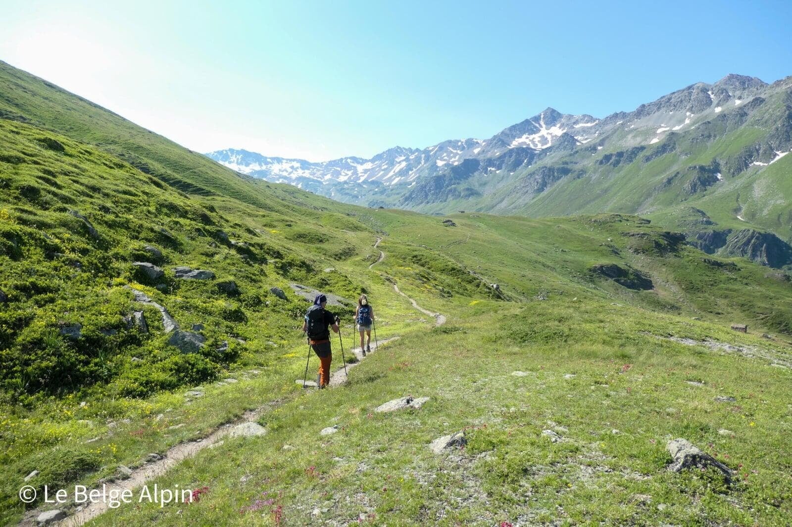
We set off from the Chenalette parking above Valmeinier (1747 m). On paper the elevation is tough, 1570 m, but spread over 24 km the gradient is fairly gentle for most of the route. A few days earlier I was still in the Pyrenees, and the difference in setup is clear: here, the climb is earned mostly through distance and altitude, less through incline.
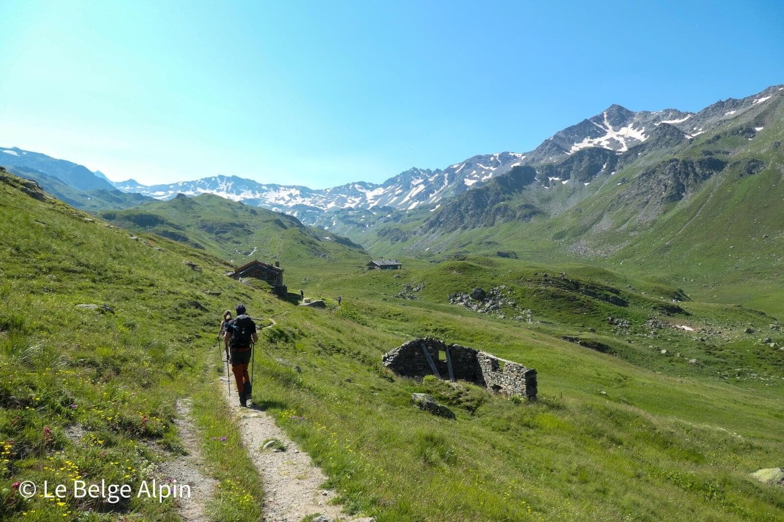
The gentle valley, first half

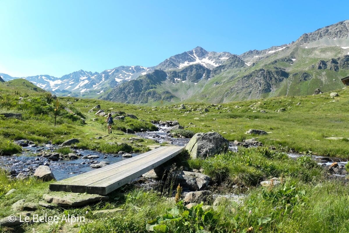
The first hours are almost restful: a beautiful alpine valley, stone shepherd’s huts, 19th-century ruins, a torrent crossed on a wooden footbridge. The snowy summits you can just make out at the far end still look distant. We walk at a good pace, the kind of stretch where you resist checking your watch because the scenery does the job on its own.
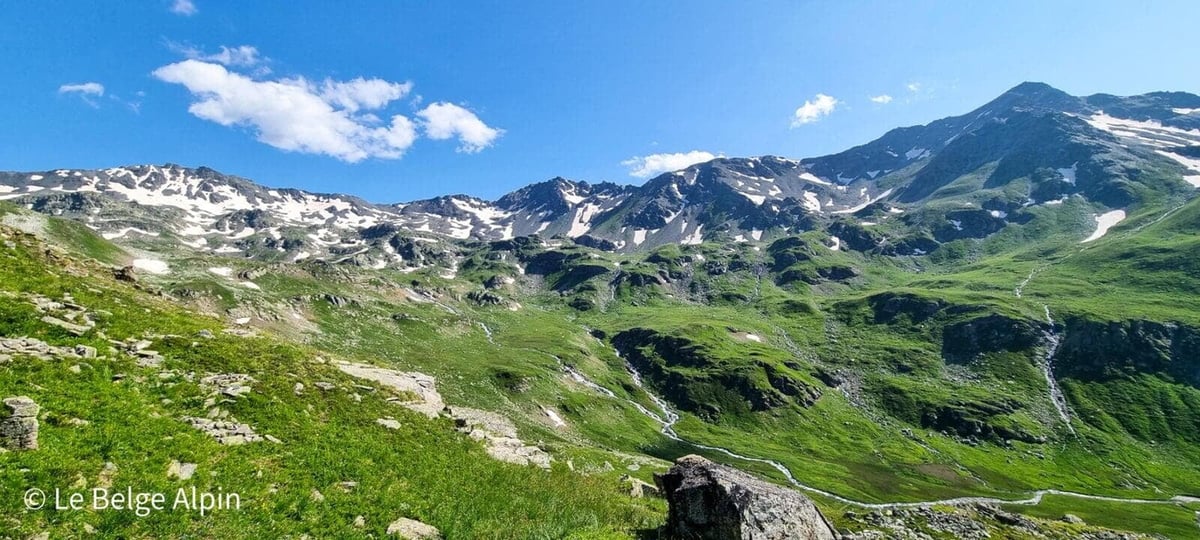
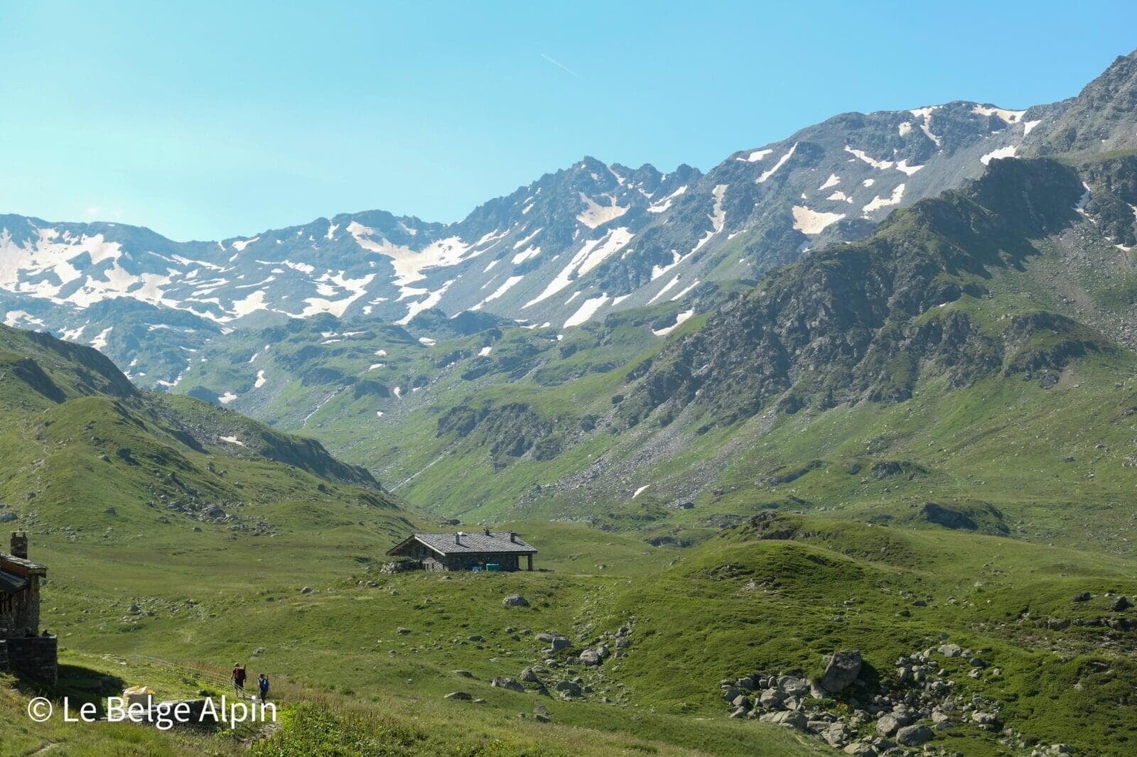
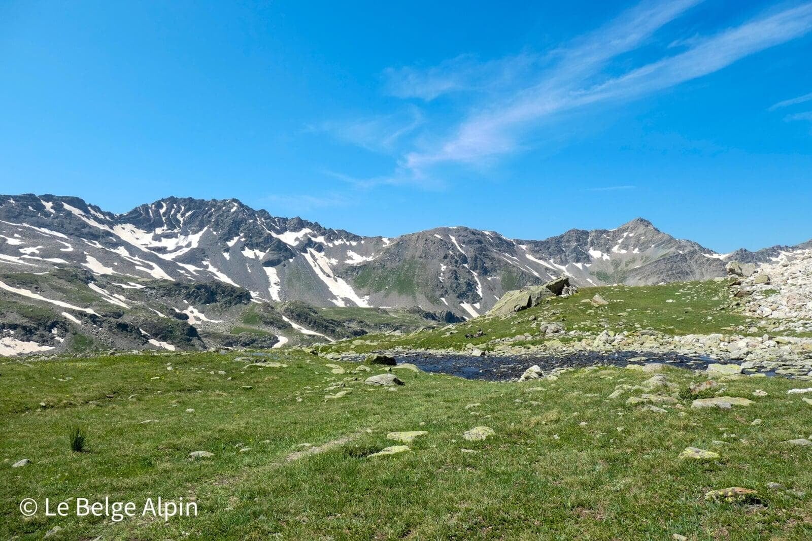
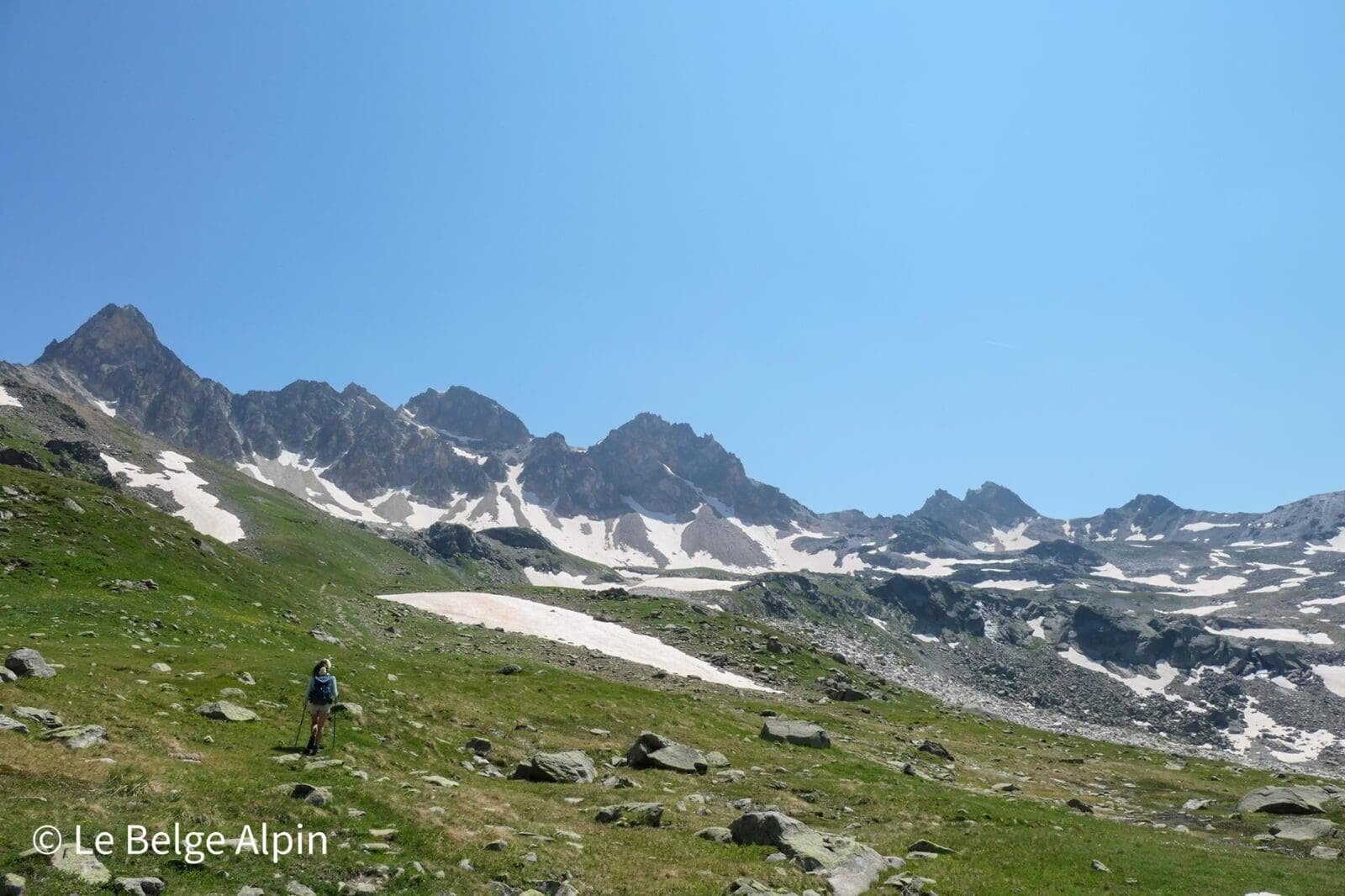
Plateau and high-altitude lakes
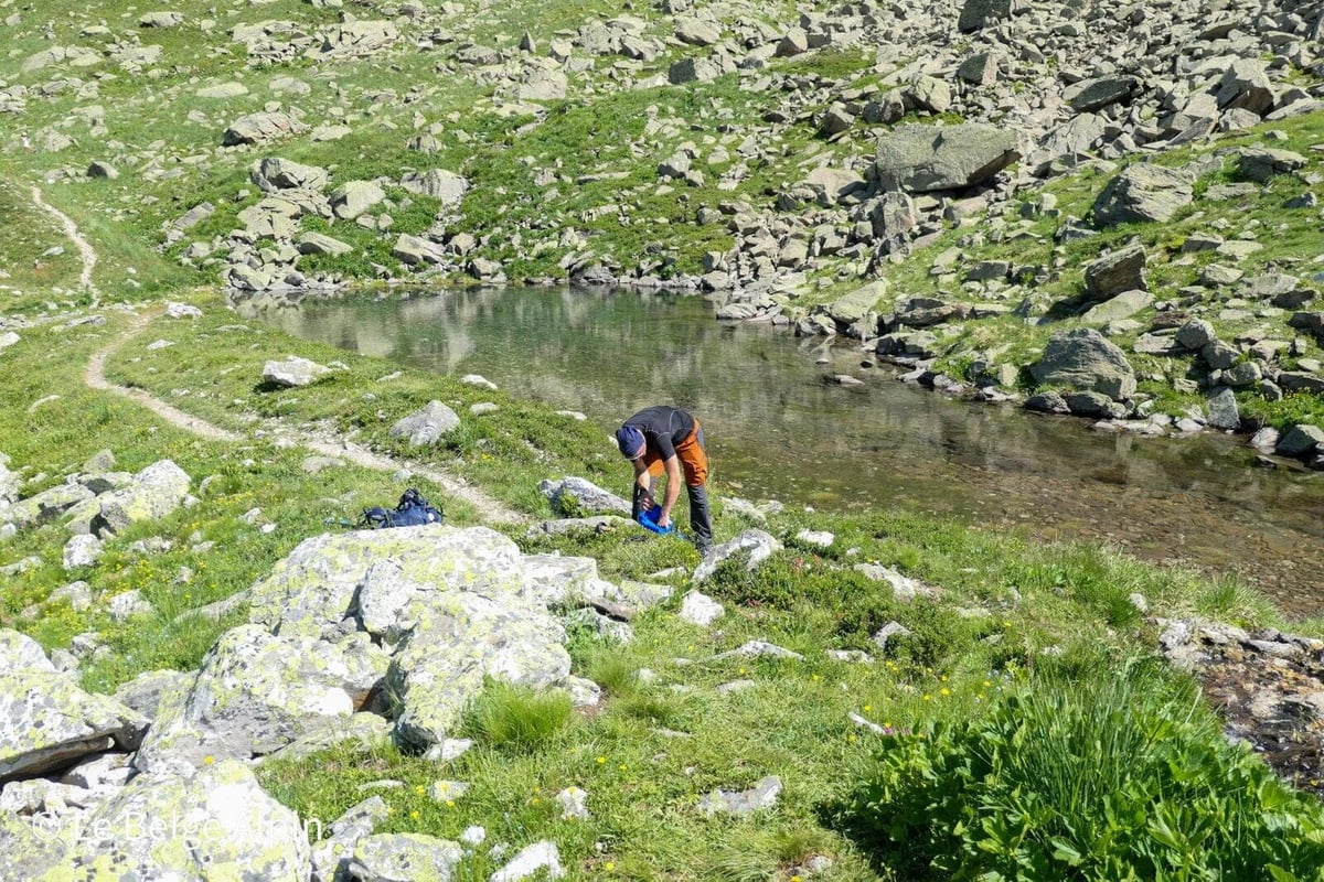
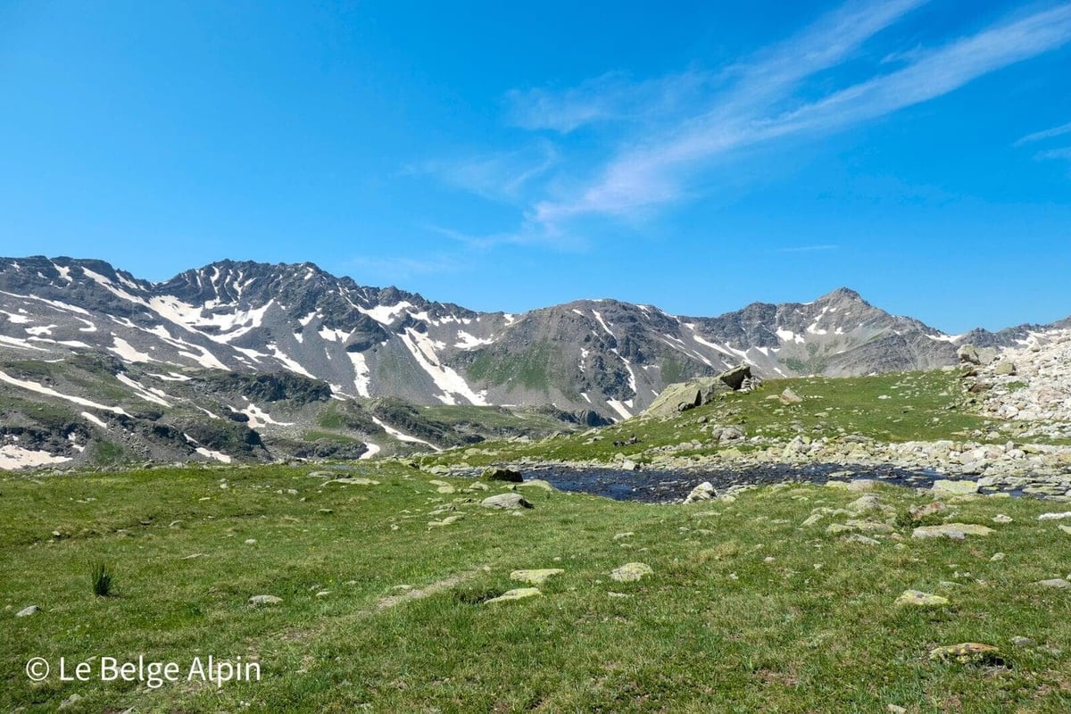
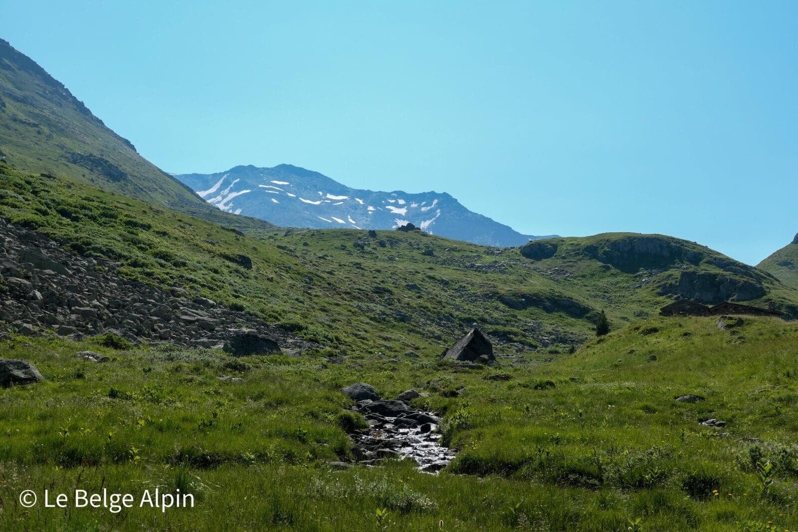
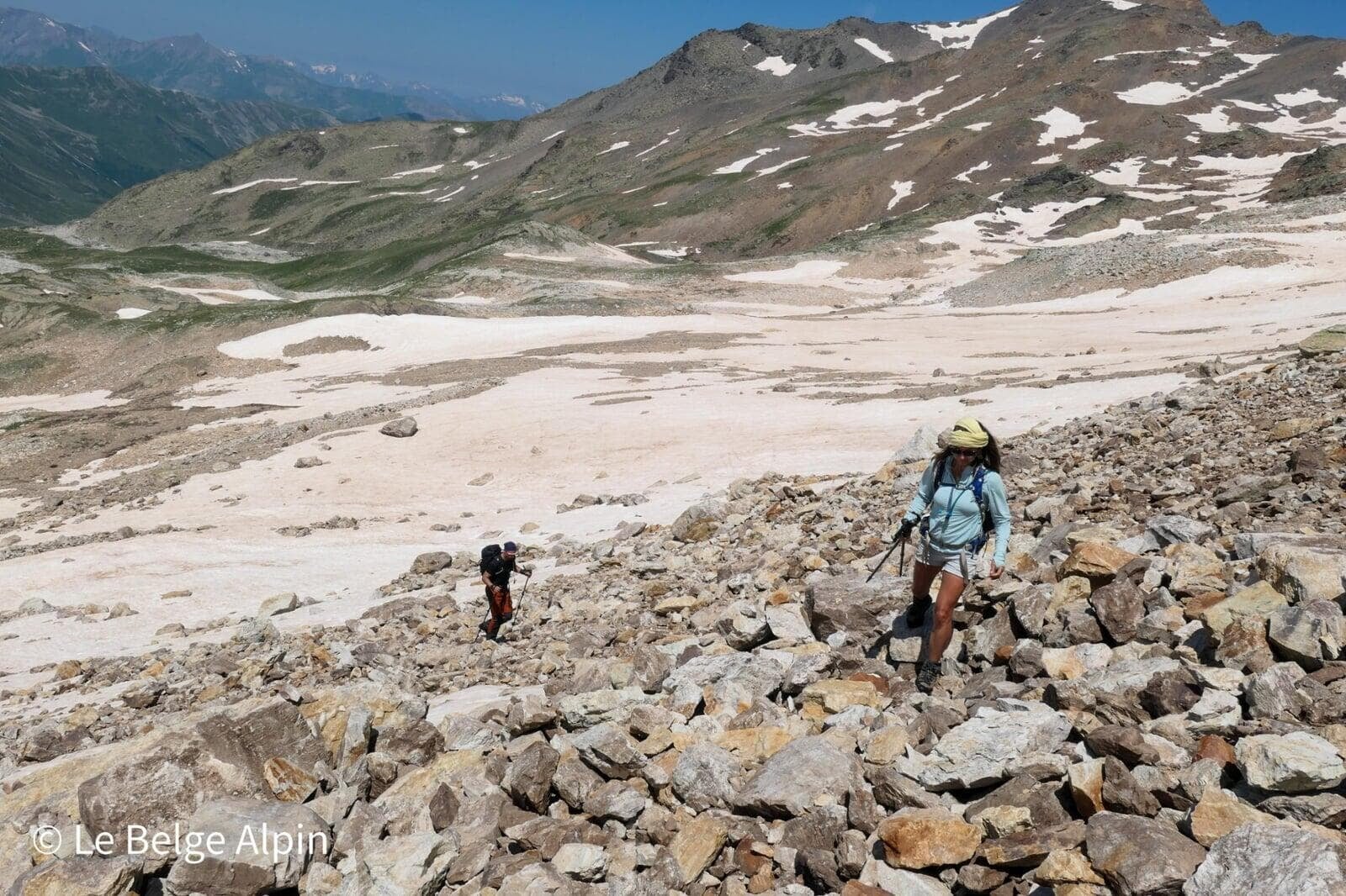
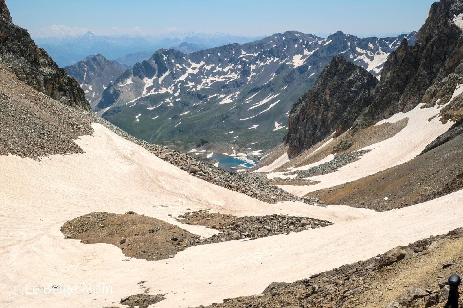
Around 2500 m, the scenery changes character. A small intermediate lake acts as a natural landmark, we stop, drink, look around. Behind, the plateau rises, stone replaces grass, and you can already see the rocky wall before the pass. This is the moment when the Refuge du Mont Thabor becomes an option worth considering for those who want to split the day. You reach it at roughly midday.
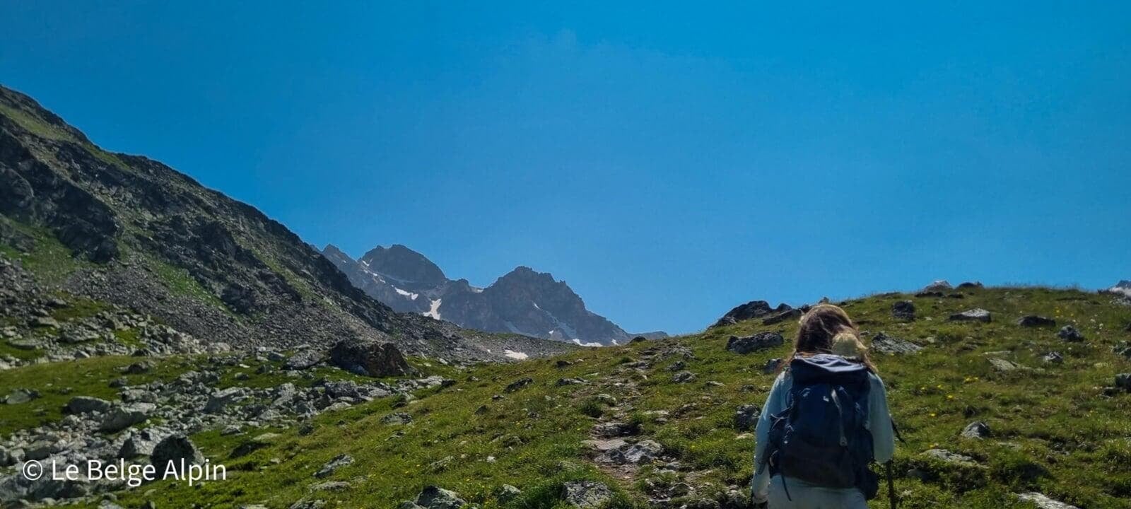
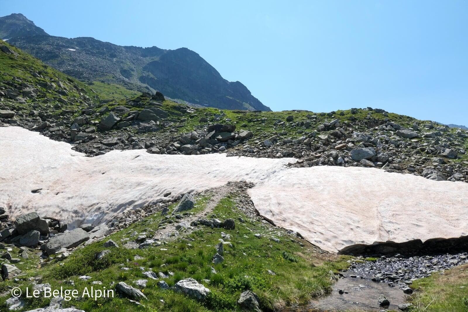
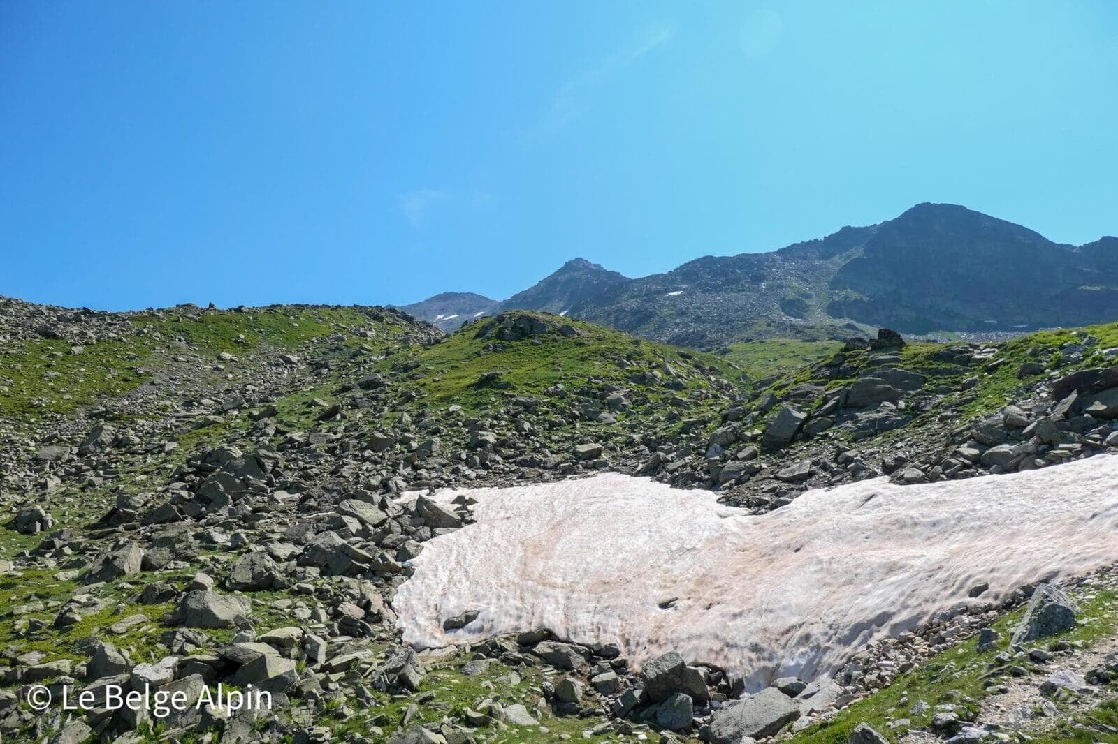
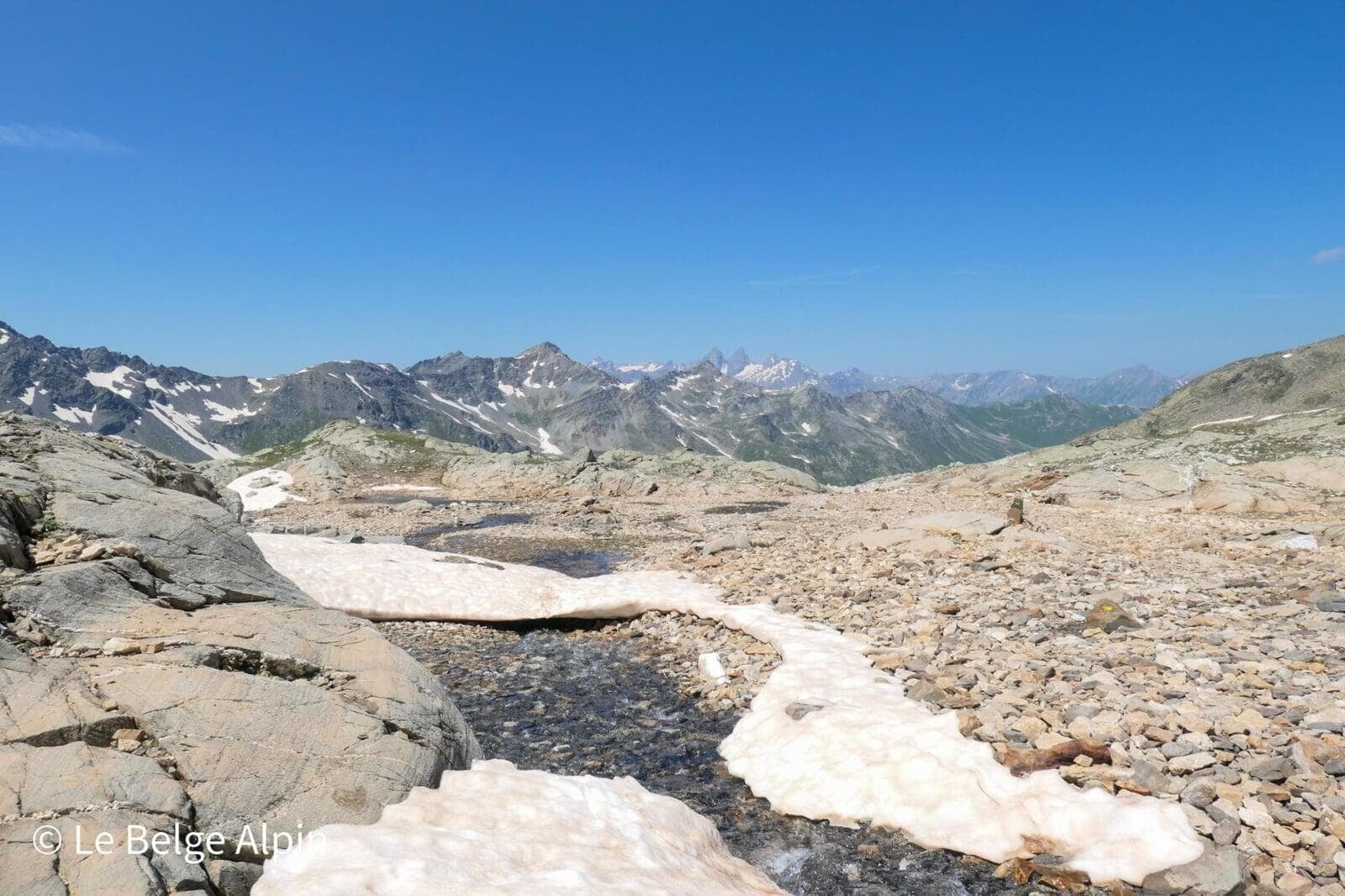
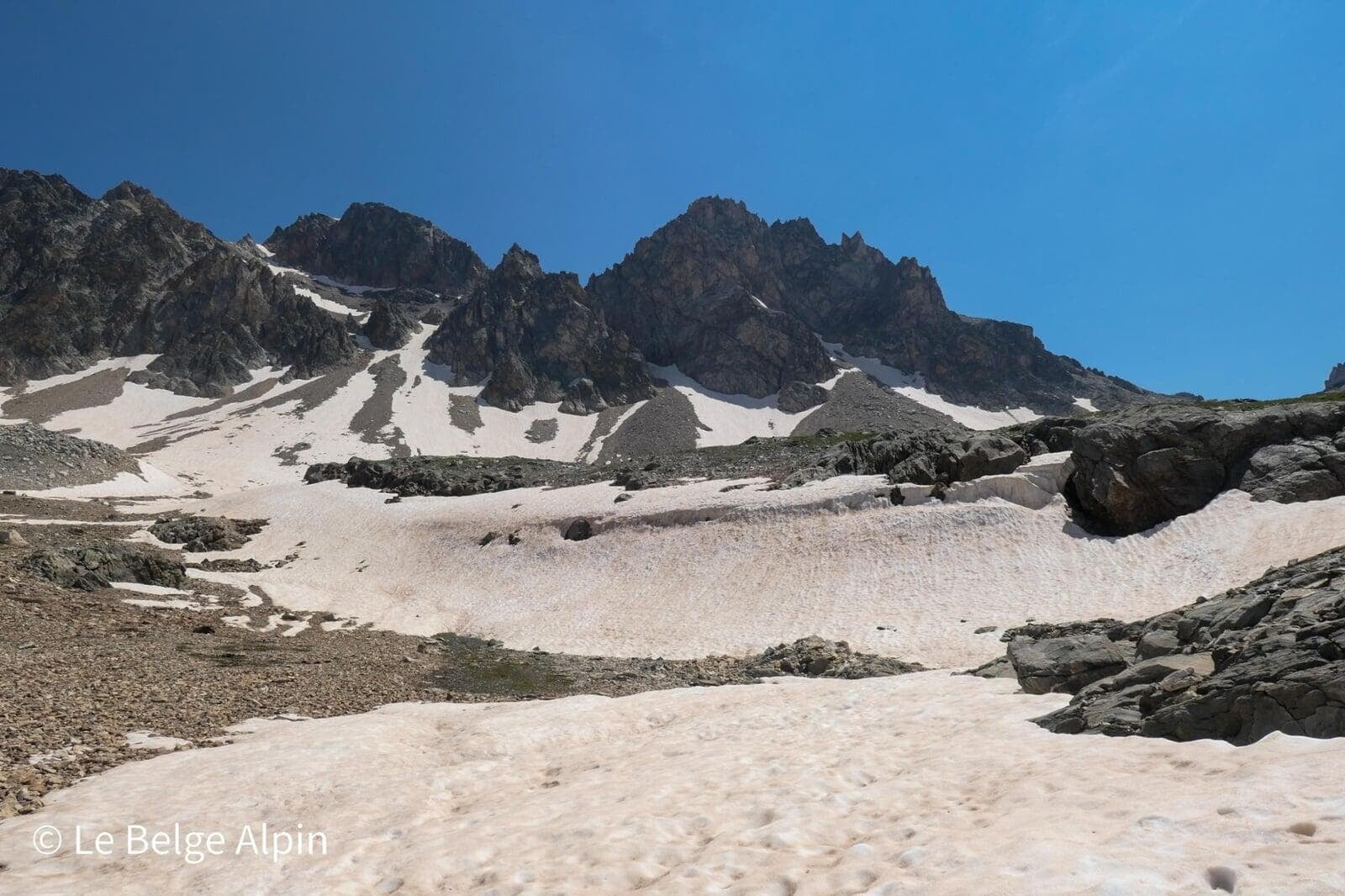
The big snowfield, key section
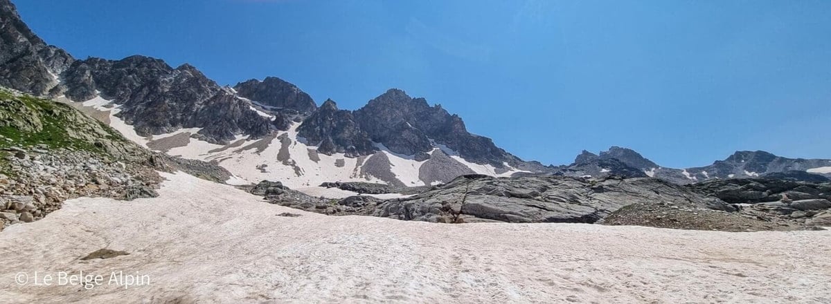
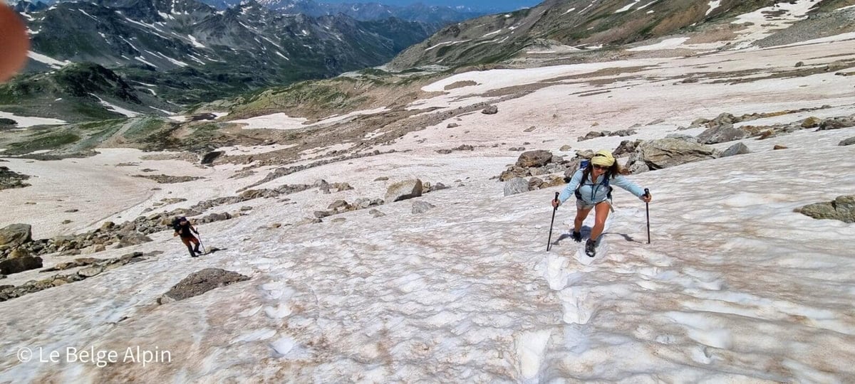
Before reaching the pass, a very long slanted snowfield is a real challenge. We were there on July 18, and a large section still remained. You just follow the track of earlier hikers and plant your feet well, but a misstep can quickly turn into a fall. With no rock to stop the slide, it would be like a toboggan run, but with potentially serious consequences, helicopter and PGHM at the end.
I can only advise you to check the snowfield conditions carefully, wait until late season, or bring an ice axe (provided you know how to use it). We did it without gear, but I was with two people who have the mountain foot and the snow-walking technique. Without that, the atmosphere turns uncomfortable fast.
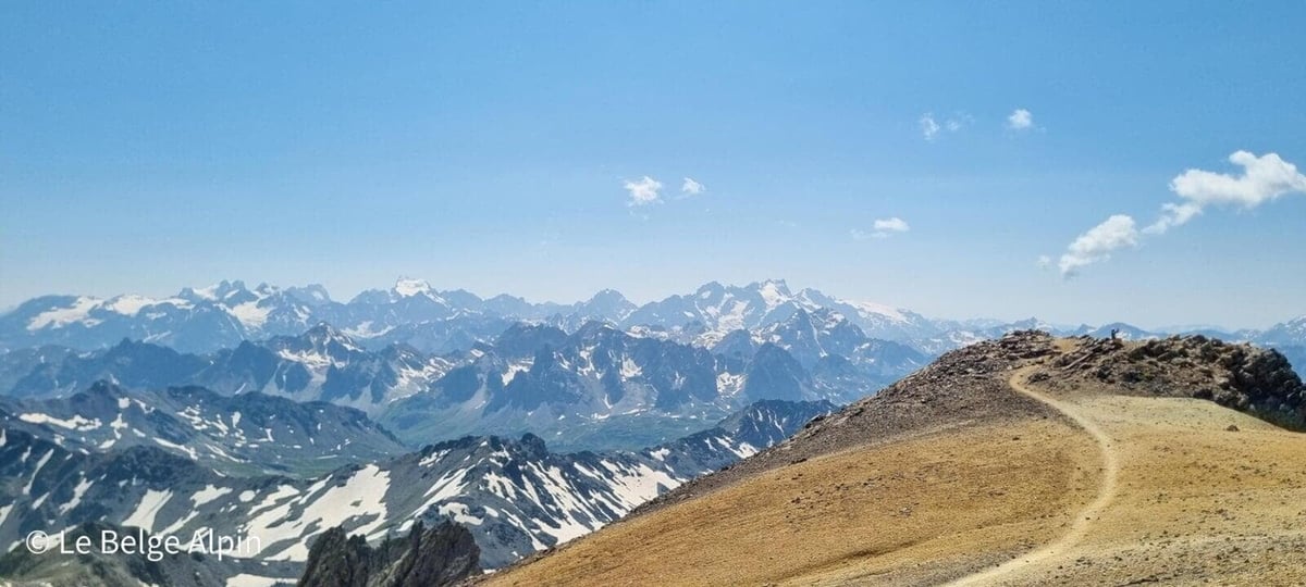
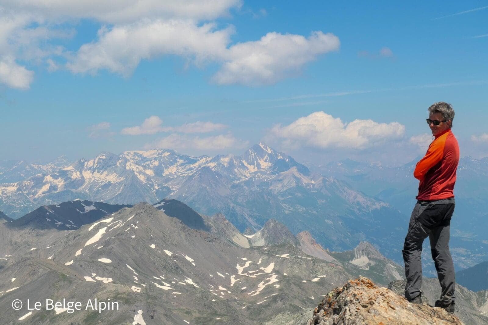
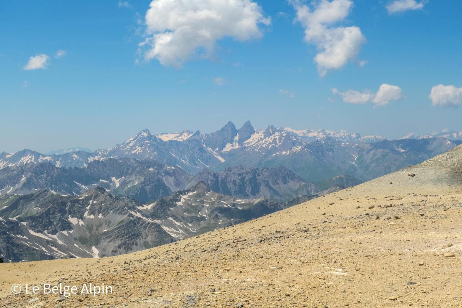
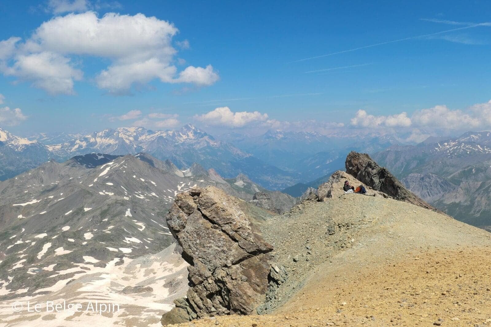
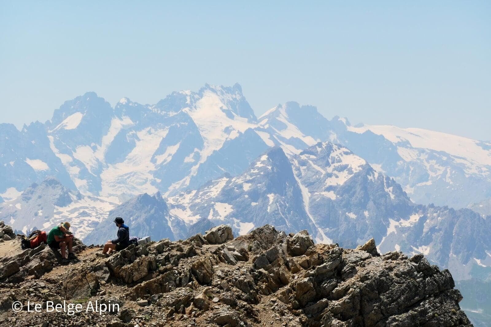
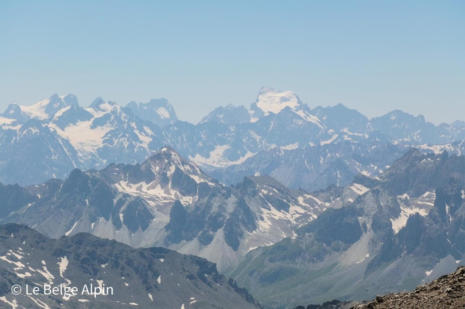
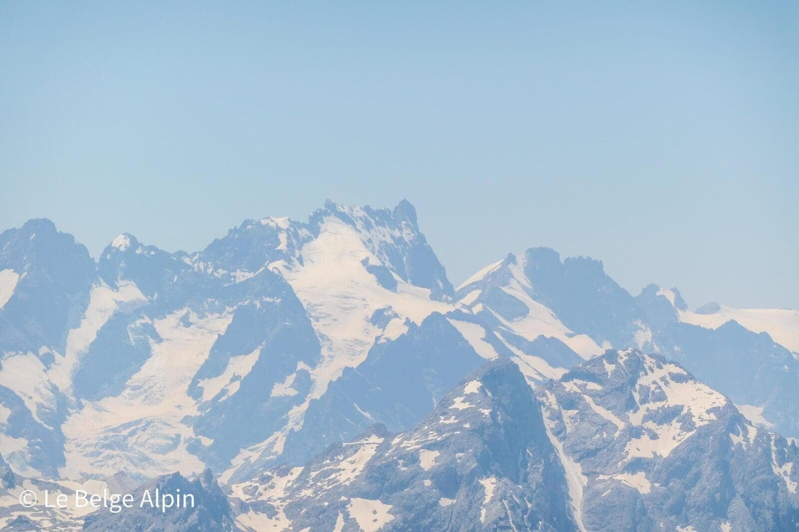
At the summit, epic panorama
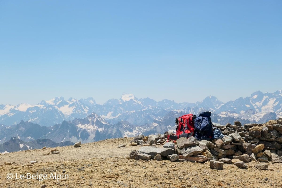
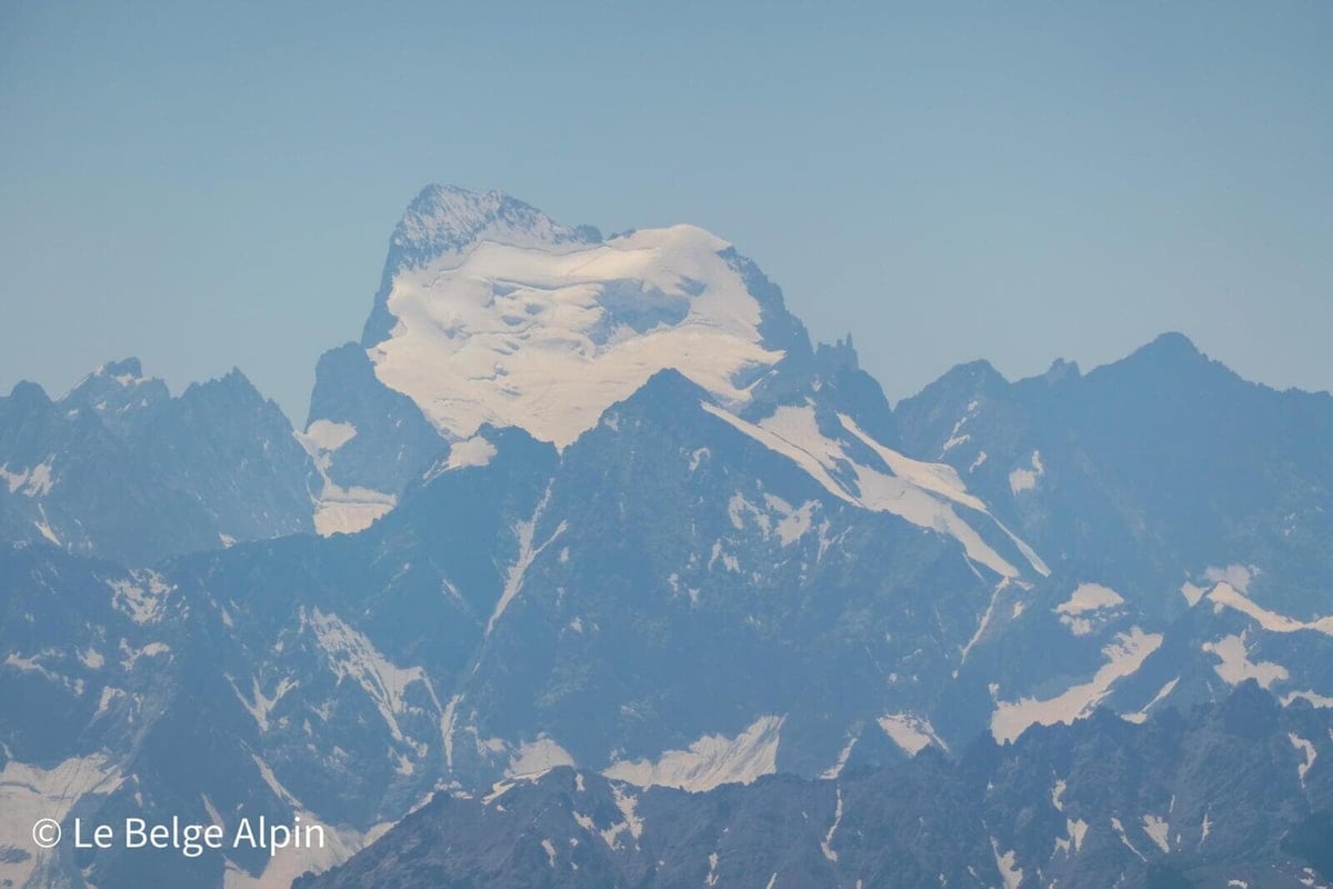
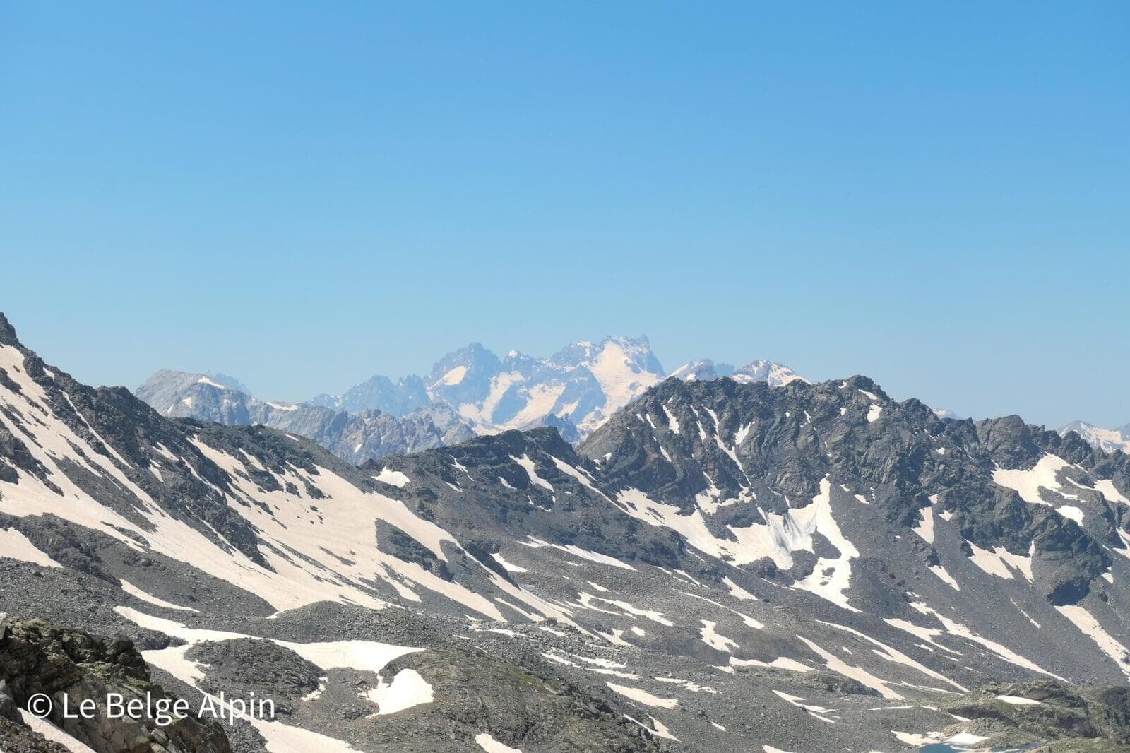
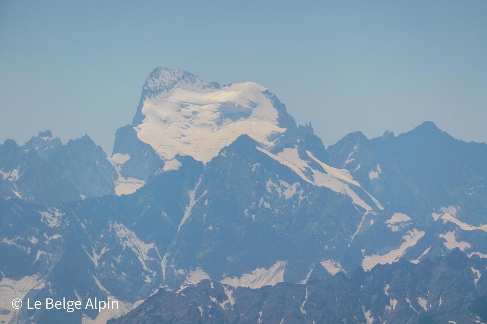
But what a reward. The view is simply extraordinary. The panorama over the Ecrins range is staggering, as I had never seen it before. Turning around, the Vanoise reveals itself with the magnificent Dent Parrachee, the Dome and Aiguille de Peclet-Polset a bit to the left, and further right the Queyras with the Pic de Rochebrune, magical like a stalagmite defying the surrounding summits. Italy also opens up in front of our eyes.
We were lucky to pick one of the hottest days of summer, which let us stay in t-shirts at the summit for a good hour and a half. Do not take this as a promise: I still recommend planning for the three-layer system. At nearly 3200 m, in more typical weather, it is cutting cold.
Descent and return to the valley
The descent is on the same route, with two precautions: the snowfield is more of a trap on the way down than on the way up (you move faster, attention drops, and the slide hits on tired calves), and the length. Managing your quads on the 1570 m unfolding in reverse takes some discipline if you do not want to end up walking on locked quads.
We rejoin the green valley in the late afternoon, with the last low rays grazing the slopes, the kind of atmosphere that closes a big day well.
Practical info and safety
This is not a beginner outing. 1570 m of gain, 24 km, altitude 3178 m, and one key section on snowfield that changes radically with the season. Plan on 9 to 10 hours with breaks, plan an early start (before 7am in summer, to finish the snowfield before it softens in the afternoon).
For conditions (state of the snowfield, track, late snow cover), a phone call to the Valmeinier tourist office or to the warden of the Refuge du Mont Thabor is more reliable than any online weather forecast. If you hesitate, sleeping at the hut and tackling the pass at sunrise on still-frozen snow remains the cleanest solution technically.
Practical info
Starting point
From Saint-Michel-de-Maurienne, take the D1006 then the D902 toward Valloire, then the D1Bis toward Valmeinier. Follow Valmeinier 1800, then the track climbing up to the Chenalette parking (1747 m, sometimes called Mottets parking). The last kilometre is driveable track, possible in a low car if you take it carefully.
GPX track
Import the GPS track into your watch or app (Garmin Connect, Komoot, Gaia GPS, Iphigenie...).
Sign in to downloadMountain huts
Refuge du Mont Thabor (FFCAM), 2502m
Ideal to split the ascent over two days. Staffed from mid-June to mid-September. Lets you tackle the summit at sunrise, safer on snowfields early in the season.
Tourist office (current conditions)
Office de Tourisme de Valmeinier
Chef-Lieu, 73450 Valmeinier
Garmin track
Gallery
30 photos, click to enlarge


Weather, Valmeinier
Conditions and forecasts for the itinerary
In the mountains, conditions change fast. A thunderstorm can become dangerous, fog disorients, residual snow slows every step. Before leaving, check the bulletins, plan a stable weather window, and when in doubt, call the tourist office or the local guides office.
Learn to read mountain weather →Questions fréquentes
Can Mont Thabor via Valmeinier be done in a day?
+
Yes, but it is a big day: 1570 m of gain, 24 km, 9 to 10 hours on average. You need to be seasoned at this format. The gentler alternative is to split it in two and sleep at the Refuge du Mont Thabor (2502 m).
Do you need an ice axe for the Thabor?
+
It depends on the season. Before late July, a long steep snowfield precedes the pass: an ice axe plus the technique to use it are strongly recommended to stop a fall. Late August and September, the snow has melted and hiking boots are enough. Check with the hut or the tourist office before leaving.
Where does Mont Thabor's reputation for its panorama come from?
+
The summit sits between two national parks, the Vanoise and the Ecrins. At 3178 m, you see 360 degrees: Ecrins (Meije, Barre, Pelvoux), Vanoise (Dent Parrachee, Dome and Aiguille de Peclet-Polset), Queyras (Pic de Rochebrune) and all the way to Italy. One of the most complete panoramas in the area.