
From the Laus parking (2047 m), climb to Lake Allos then to Mont Pelat (3050 m). 1000 m of gain, Europe's highest natural lake, Mont Viso-Ecrins-Mercantour panorama, ever-present wildlife (marmots, chamois).
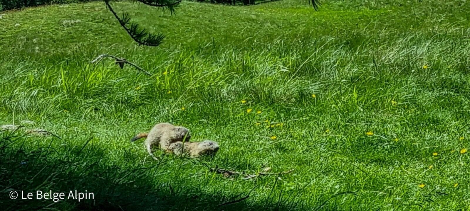
Welcome to the Mercantour, a magnificent park, wilder than its counterparts. It’s here that I’ve encountered the most wildlife, especially outside peak season. We’re in the realm of chamois and marmots, the latter sometimes less shy, probably due to mass tourism, but it’s all to the benefit of the hiker who pulls out a telephoto lens.
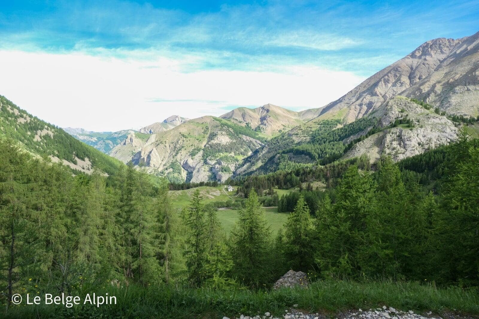
Today, heading for the highest point of the upper Verdon valley: Mont Pelat, 3050 m. The ascent starts from the Laus parking at 2047 m, which makes the hike fairly accessible in terms of elevation gain. A shorter route exists, but I recommend the detour via Lake Allos and the refuge of the same name. It doesn’t add much, and it’s genuinely worth it.
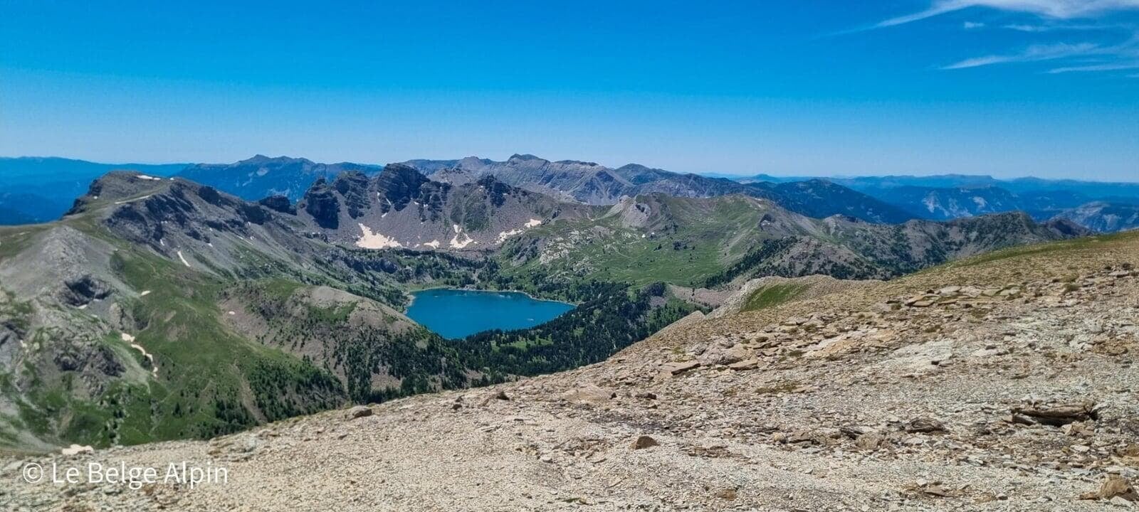
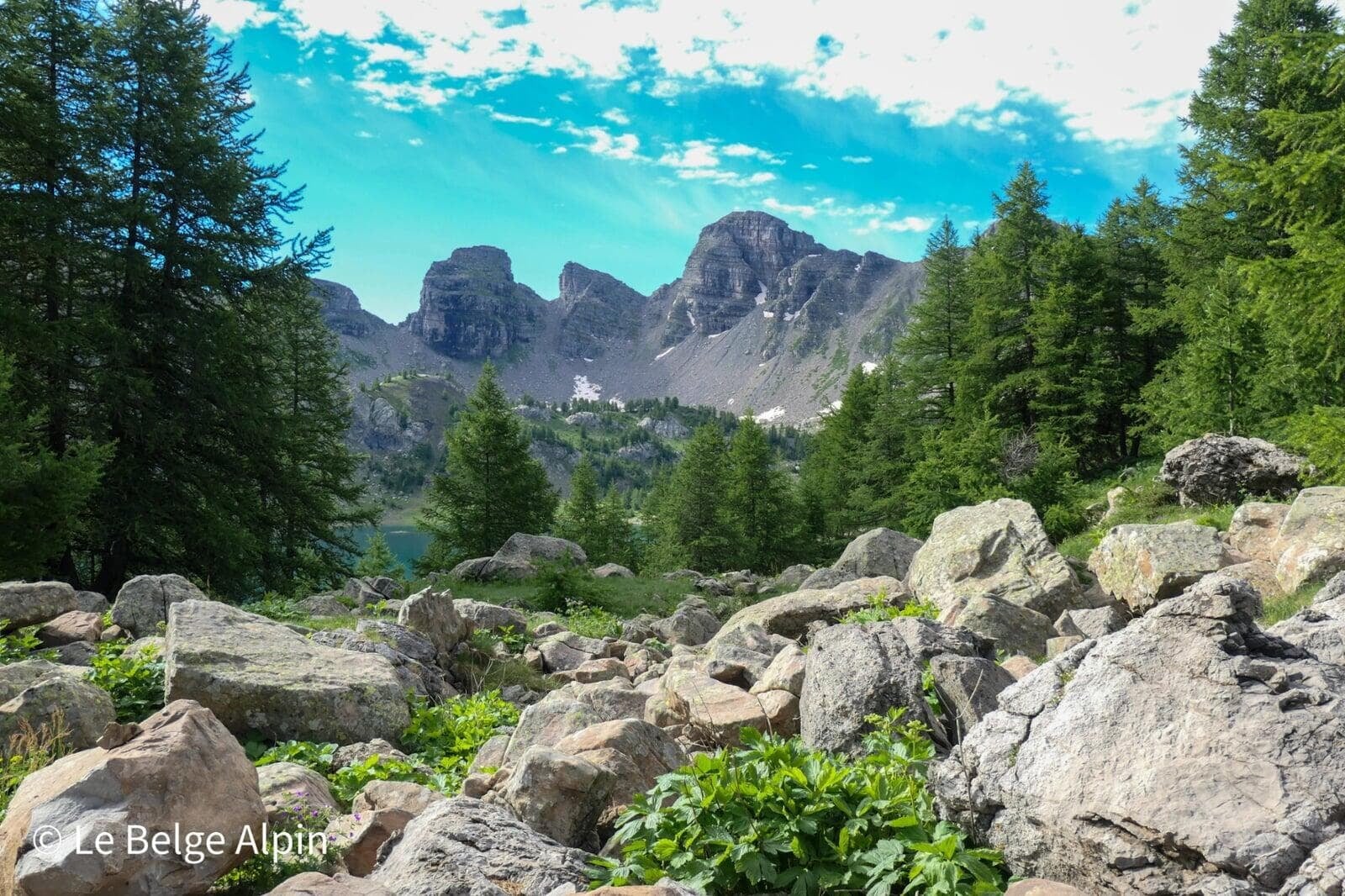
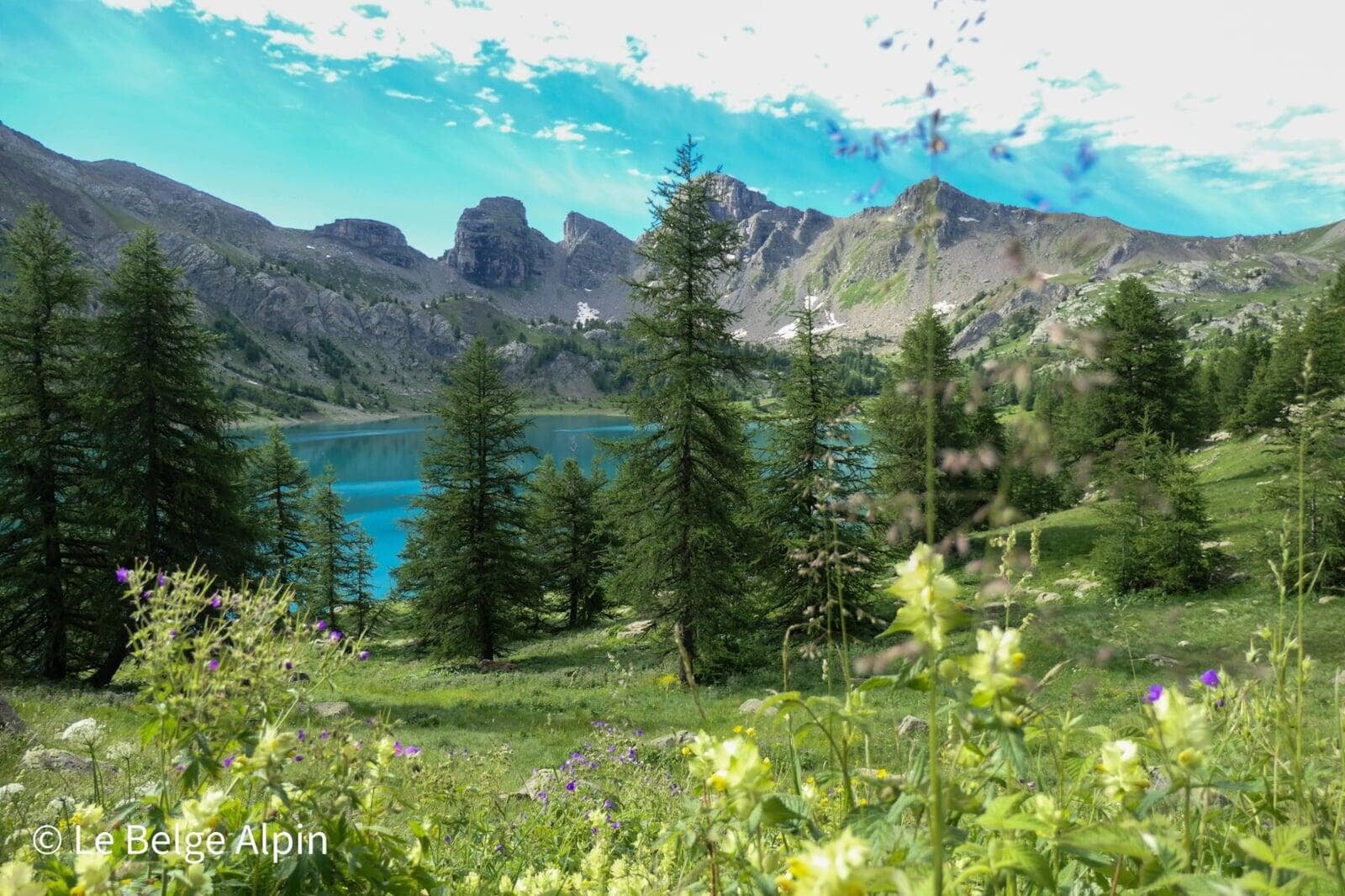
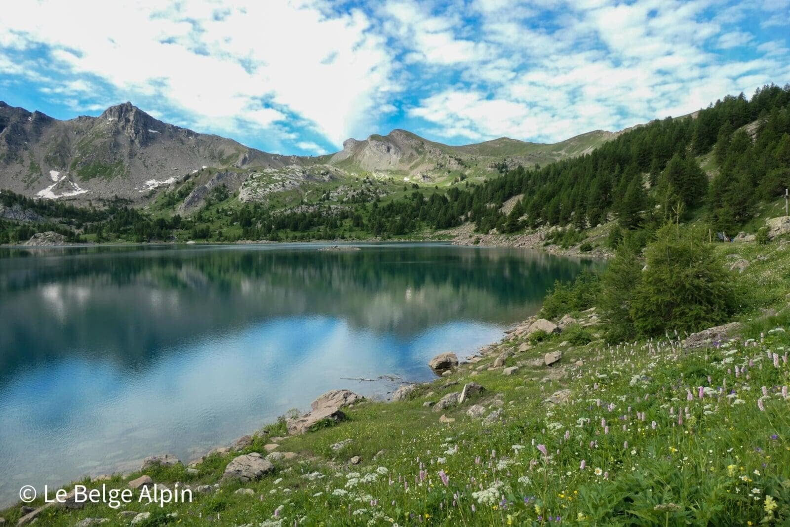
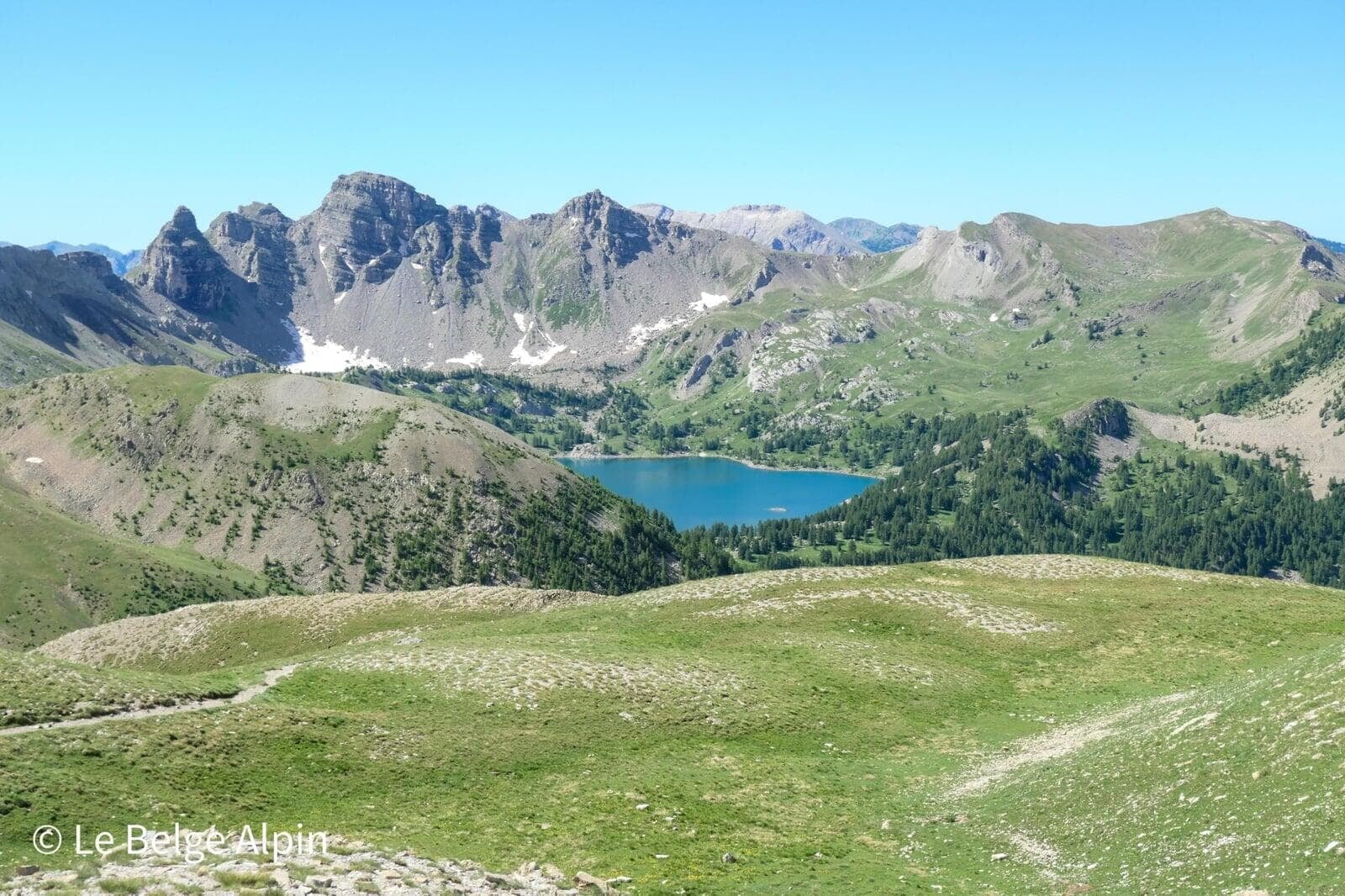
Lake Allos, Europe’s highest natural lake
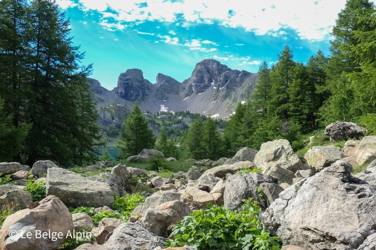

Lake Allos is one of the jewels of the Mercantour. Early in the season, when snow still caps the three peaks bordering it, the sight is grandiose. To catch it at that stage, aim for late May or early June depending on the melt.
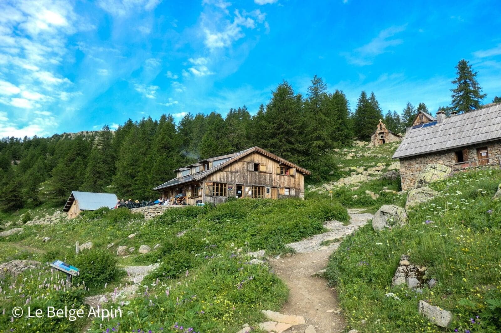
The Refuge du Lac d’Allos nestles just above, small wooden chalets, stone chapel, flags snapping in the wind. It’s the ideal spot to fill up on water, grab a snack, and move on.
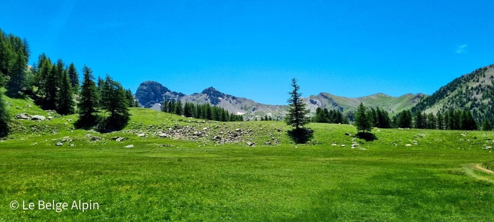
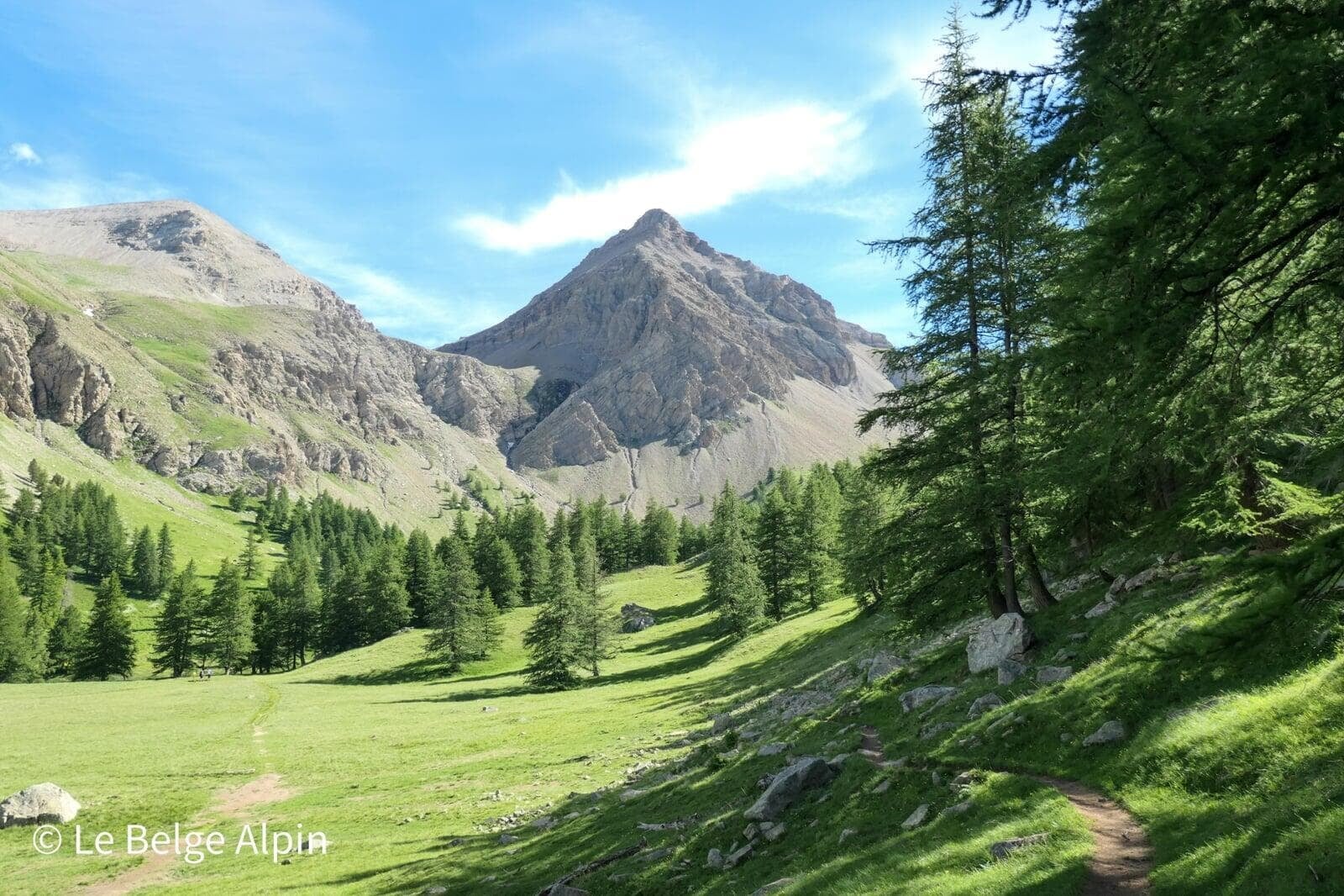
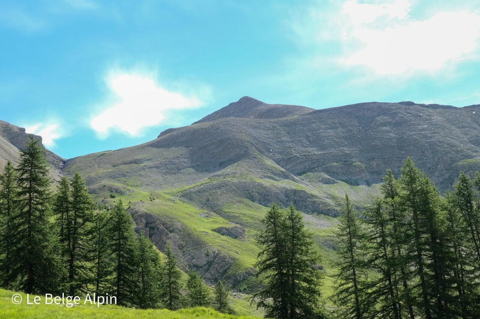
Crossing the plateau and approaching the Pelat


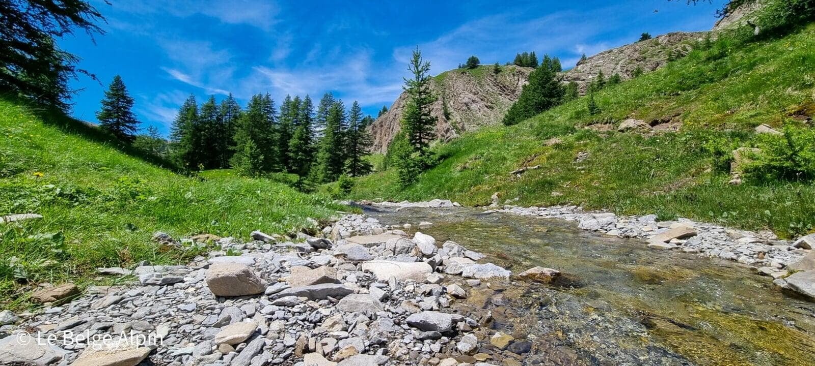
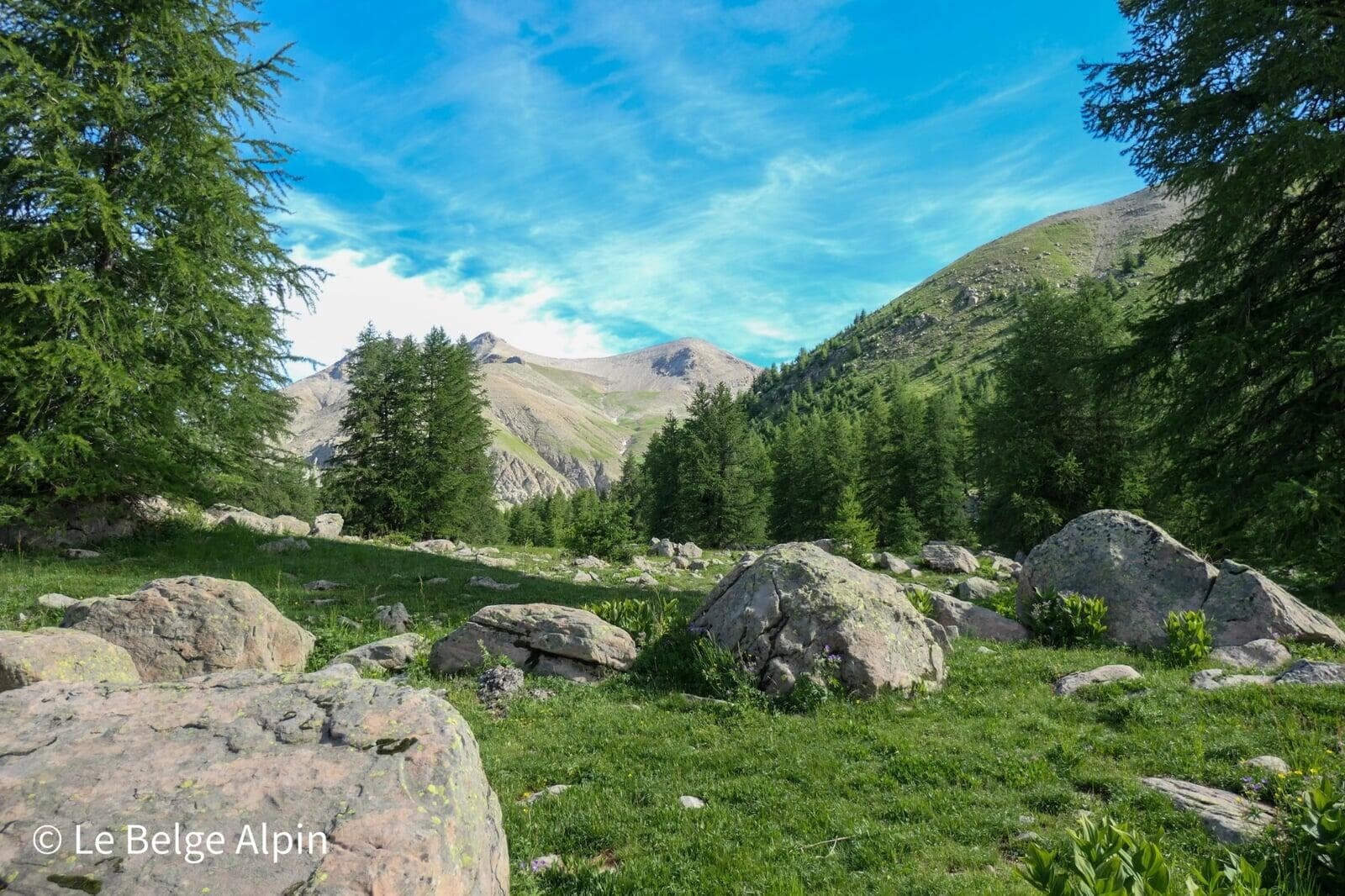
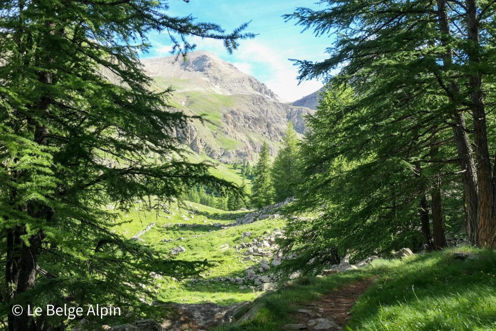
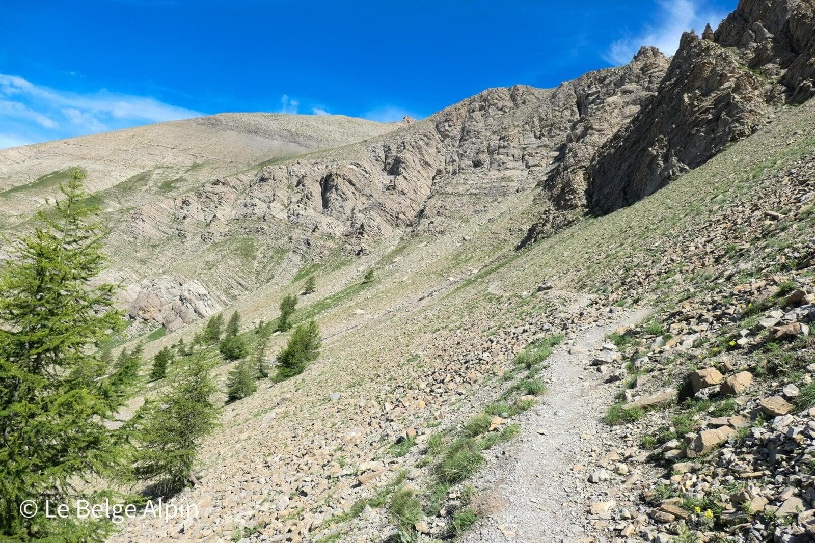
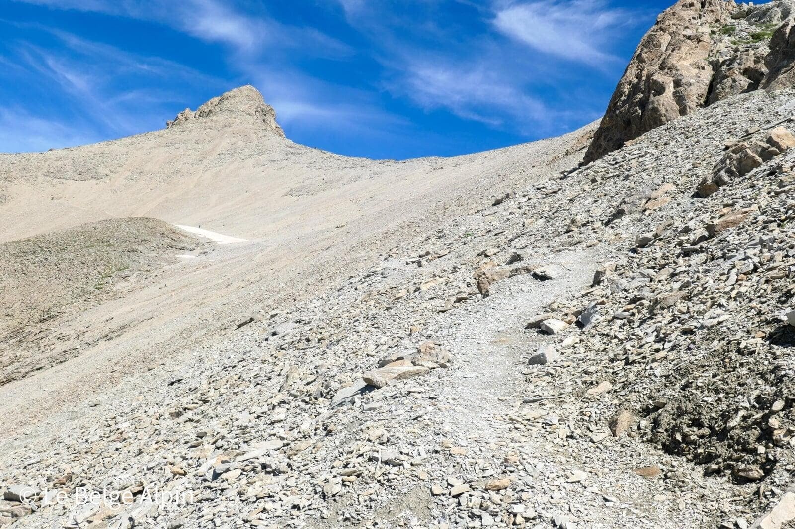
After the lake, we follow a relatively flat forest path that gently joins the alpine pasture in a splendid setting. Larches, erratic boulders, clearings, the atmosphere changes every 10 minutes. Then we tackle the climb through a slightly surreal scree. The ground is dry, not the most visually flattering atmosphere, but it takes nothing away from the splendour: the lake gradually shrinks in the background, and we gain height at a good pace.
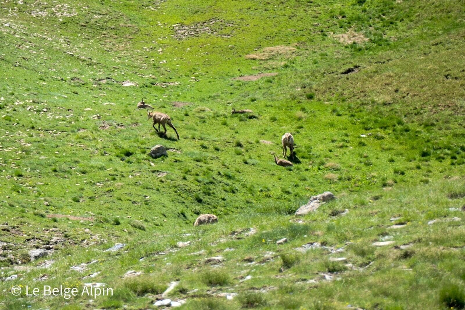
Marmots, chamois and ibex
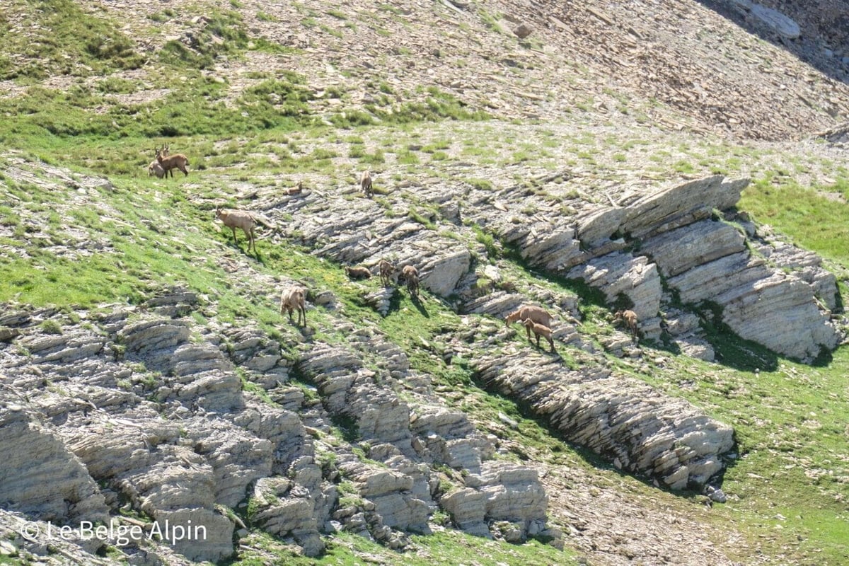
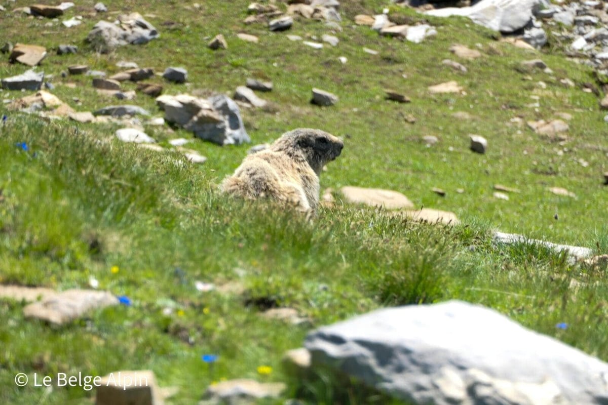
This is where the Mercantour delivers on its promises. We crossed paths with a small chamois herd resting on rock slabs, watching us with that calm curiosity of animals that aren’t afraid. Higher up, the marmots whistle at every turn, and at the summit, we even glimpse a few ibex holding court on the ridges.
Take your time. It’s part of the hike.
The last 50 metres, a bit more committed
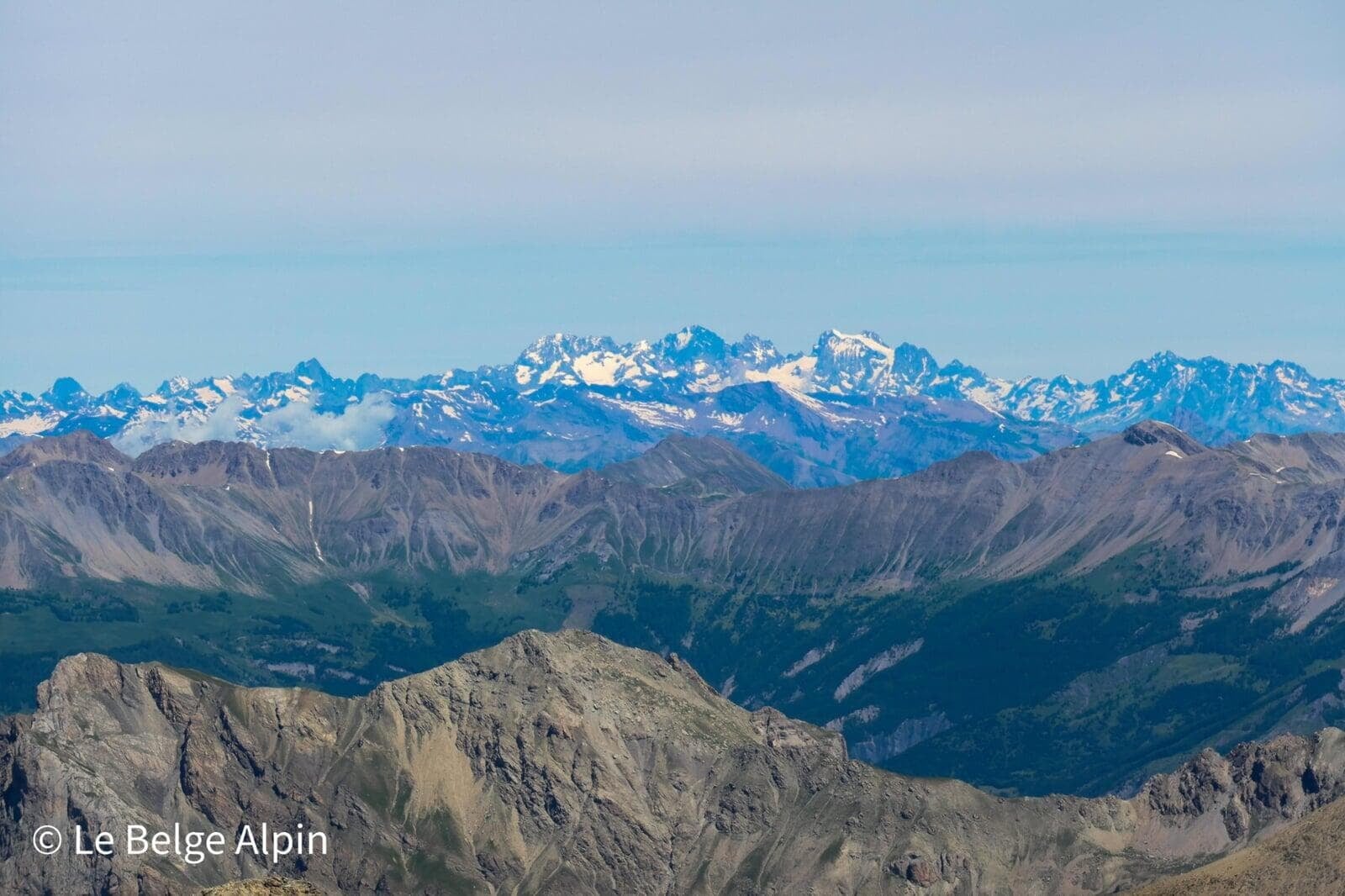
Before tackling the final section, we reach a pass where the view opens up: vista over the Italian Alps, Mont Viso and the Queyras. That’s when you understand why you put in so much effort.
After a well-earned stop to admire the panorama, we tackle the last 50 metres of gain to the peak. This section is harder: steep, a bit airy, very rocky. I’ve seen plenty of people stop at the pass, which is understandable, it demands a minimum of experience and ease on this type of terrain. It’s not alpinism, but it’s no longer leisurely hiking either.
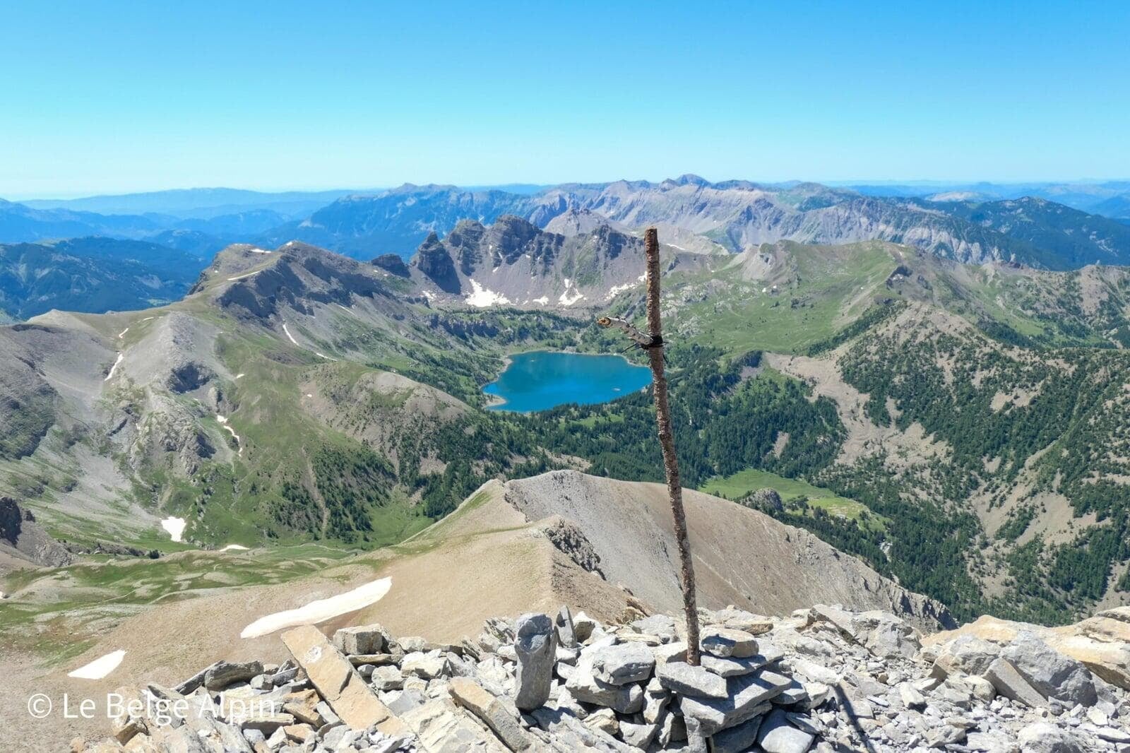
At the summit, 360 degrees panorama

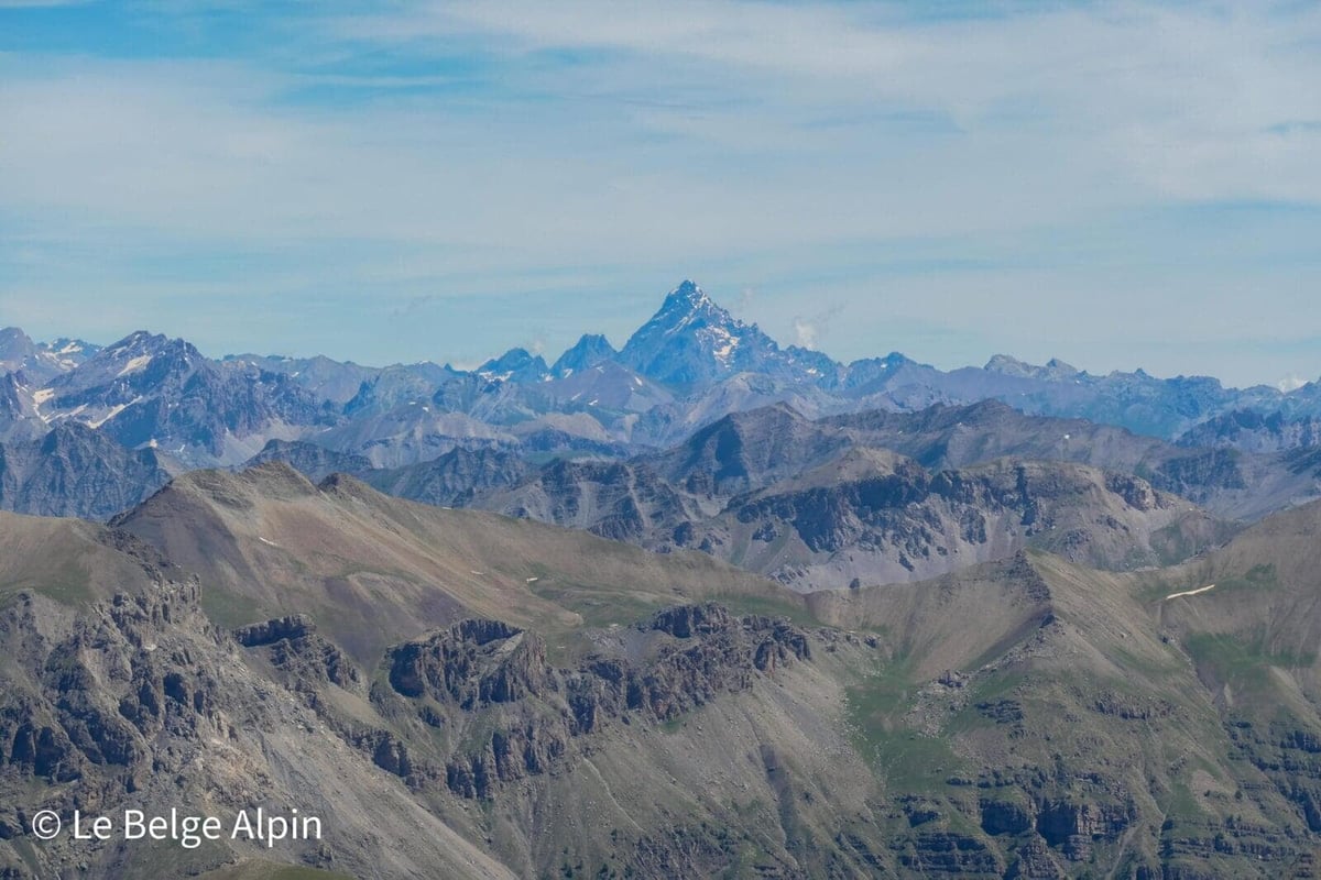
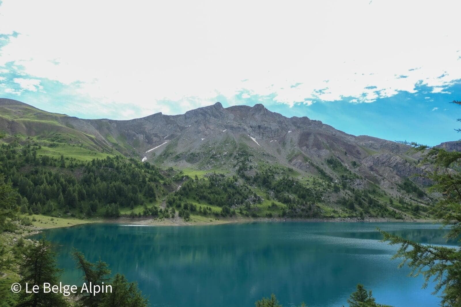
At the summit, the 360 degrees view is what we came for. On top of Italy and Mont Viso, we glimpse the Ecrins national park and its summits over 4000 m. On clear days, you can even spot Mont Ventoux. Turning around, the Mercantour park unfolds, with Lake Allos now looking much smaller than when we set off.
The return is mostly via the same route. For those who want to vary, there’s a fork on the right that rejoins the parking without going back past the lake.
Practical info
1000 m of gain over 18 km, count 6 to 7 hours depending on pace and breaks (and wildlife stops, of which there are many). It’s one of the most beautiful hikes in the Mercantour, accessible without being soft. The Laus parking is paid in season (10 EUR) and reservation is recommended in July and August, otherwise, come early.
The ideal season runs from mid-June to mid-September. Off-season, snowfields can complicate the last 50 metres, and the refuge is closed. A phone call to the Allos tourist office to confirm conditions is always worth it before starting.
Practical info
Starting point
From Barcelonnette or Saint-Martin-d'Entraunes, reach the Val d'Allos then continue to the Laus parking (2047 m). Narrow and stony road near the end. Paid parking in season (10 EUR), reservation recommended on the tourist office site or come early. Alternative: start from lower down with no fee, adds 300 m of gain and 4 km.
GPX track
Import the GPS track into your watch or app (Garmin Connect, Komoot, Gaia GPS, Iphigenie...).
Sign in to downloadMountain huts
Refuge du Lac d'Allos, 2226m
Private mountain hut perched on the lakeshore, open from June to September. Ideal for a break by the water or an overnight before tackling the Pelat at dawn.
Tourist office (current conditions)
Office de Tourisme du Val d'Allos
Place de la Coopérative, 04260 Allos
Garmin track
Gallery
23 photos, click to enlarge


Video
A few shots from the outing
Weather, Allos
Conditions and forecasts for the itinerary
In the mountains, conditions change fast. A thunderstorm can become dangerous, fog disorients, residual snow slows every step. Before leaving, check the bulletins, plan a stable weather window, and when in doubt, call the tourist office or the local guides office.
Learn to read mountain weather →Questions fréquentes
What is the technical level of the last 50 metres?
+
Steep, airy, rocky: you scramble a bit between blocks. No alpinism difficulty, but you need to be comfortable on this terrain. Many hikers stop at the pass, the view from there is already superb.
Can Mont Pelat be done without going via Lake Allos?
+
Yes, there is a shorter route that avoids the lake. Too bad: Lake Allos is Europe's highest natural lake and worth the detour, especially in late May or early June when the surrounding summits still hold snow.
Is there a lot of wildlife to spot?
+
Yes, it's one of France's wildest national parks. Marmots (sometimes unshy), chamois, ibex, bearded vultures. Outside peak season (July and August), sightings are even more frequent.