
From Ustou (1036 m), 2-day traverse in the Ariege Pyrenees: Pic de Couillac, Pic de Soune, and a night in a bivouac cabin. 22 km total, 2000 m of elevation gain, some off-trail sections, bears in the area. A rare adventure, not for beginners.
In 2023, we were on a van trip through the Pyrenees with my mountain partner. We had already knocked off several ascents in the previous days, from the eastern Pyrenees to the Ariege. My friend had spotted the route on a blog written by two experienced hikers. It turned out to be probably the toughest adventure of our 2023 trip.
I had redrawn the track on my watch, but after a stop at the tourist office, we were pointed to a slightly safer route. We set off with heavily loaded packs, a night at altitude in a bivouac cabin was non-negotiable.
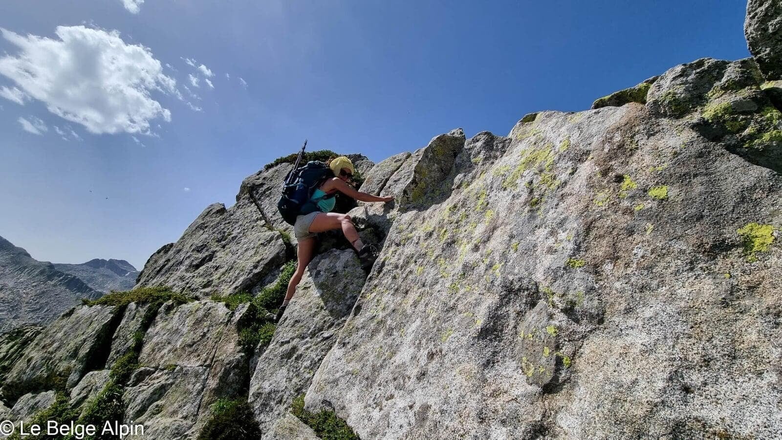
Climbing to the Port de Couillac, a tough start

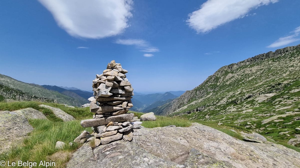
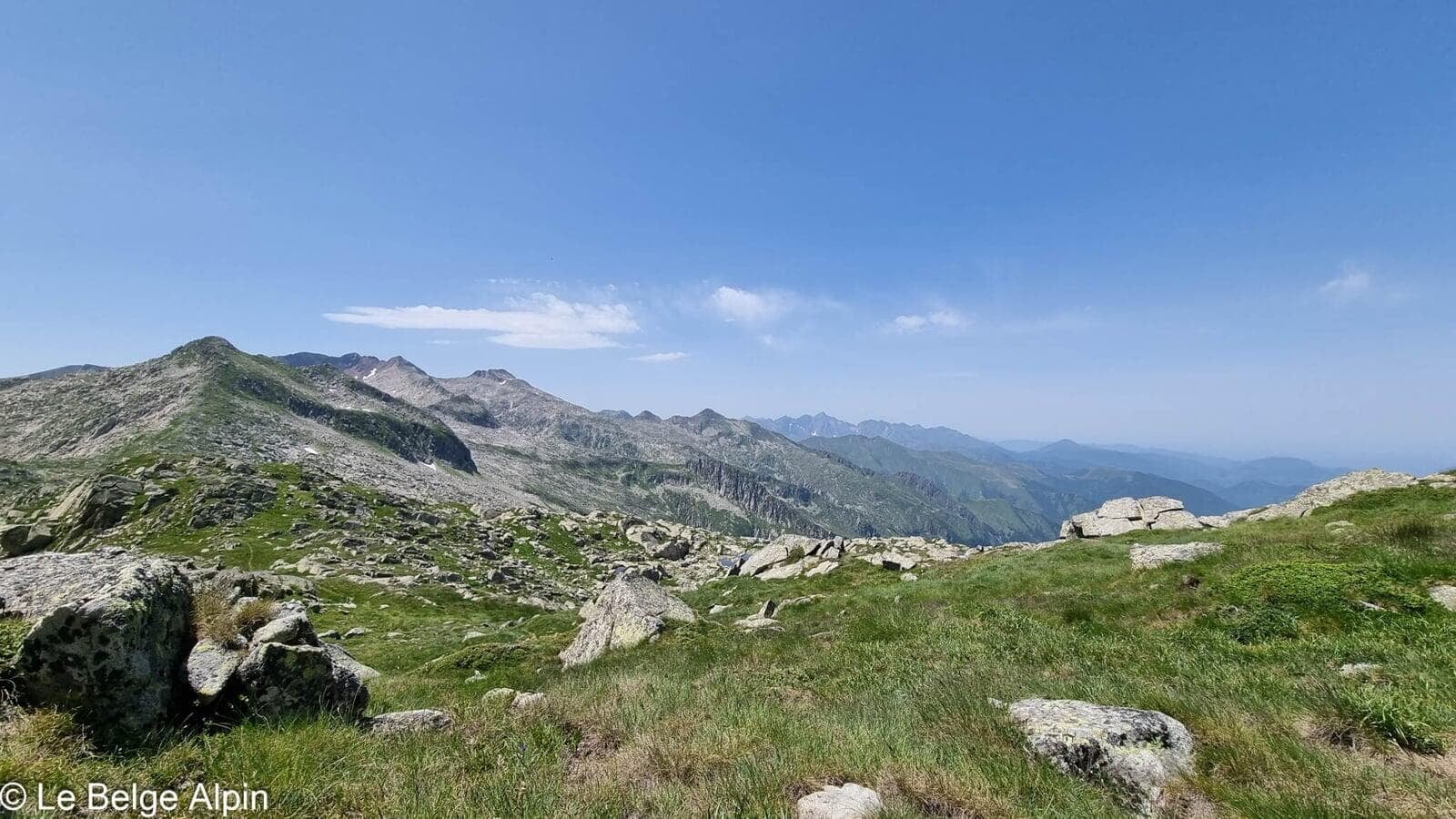
The first few hours are tough. As often in this area, the trails are awkward: rocks, tall grass, and steep slopes. We slowly gain altitude before finally reaching the foot of the Pic de Couillac. We arrive at a pass, known here as the Port de Couillac. With nearly 1500 metres of gain already in the legs, we start up the climb to the peak that shares its name.
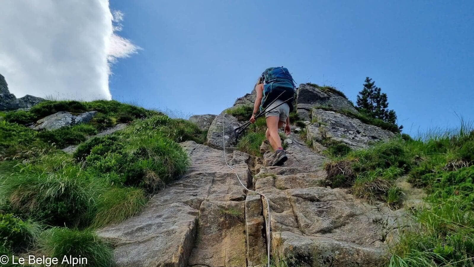
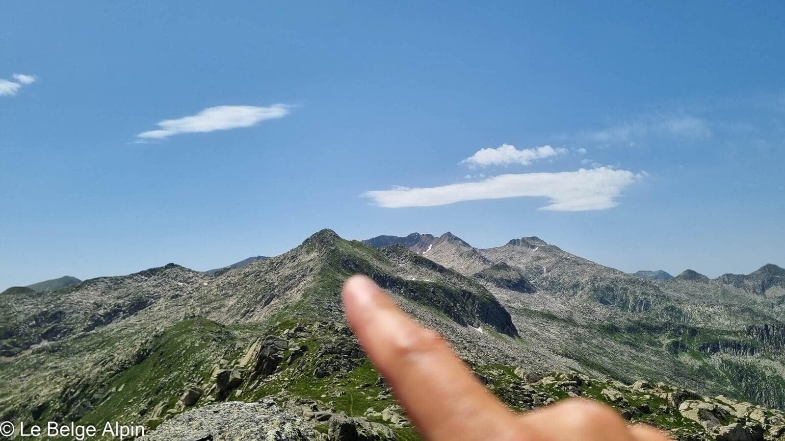
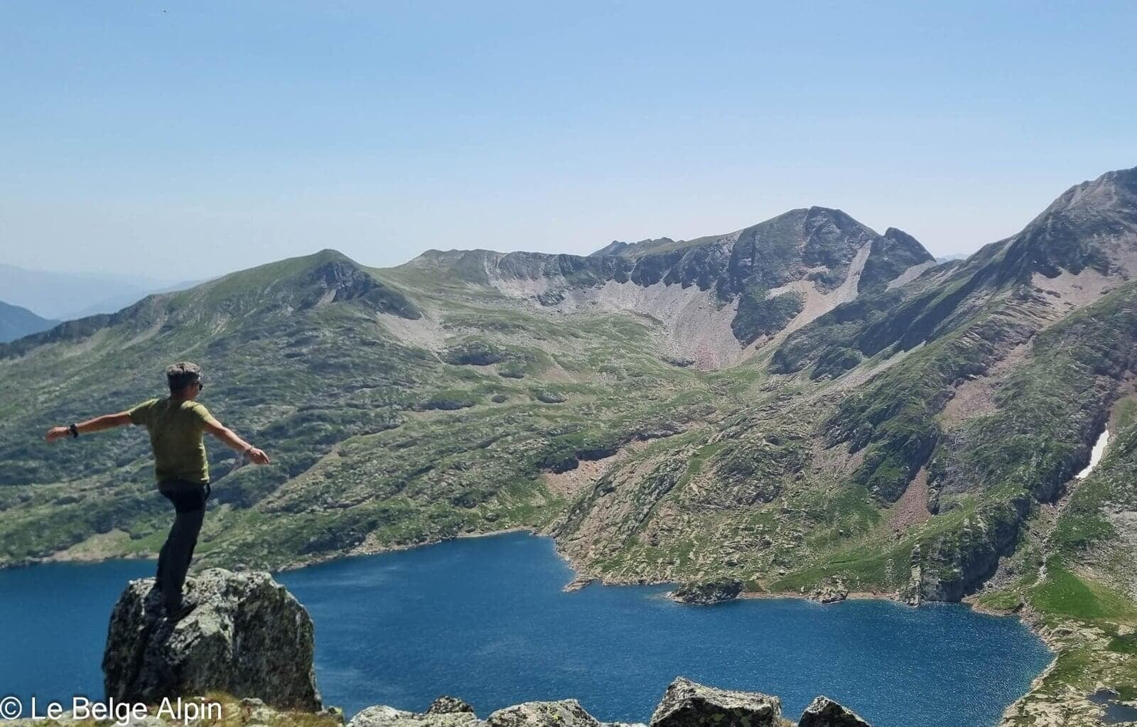
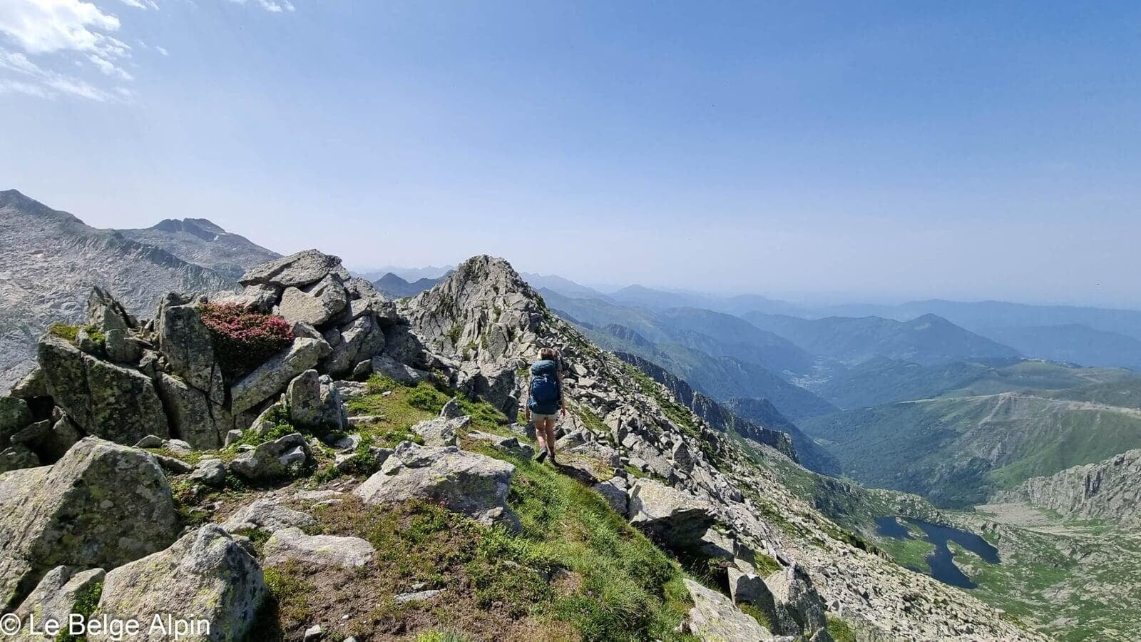
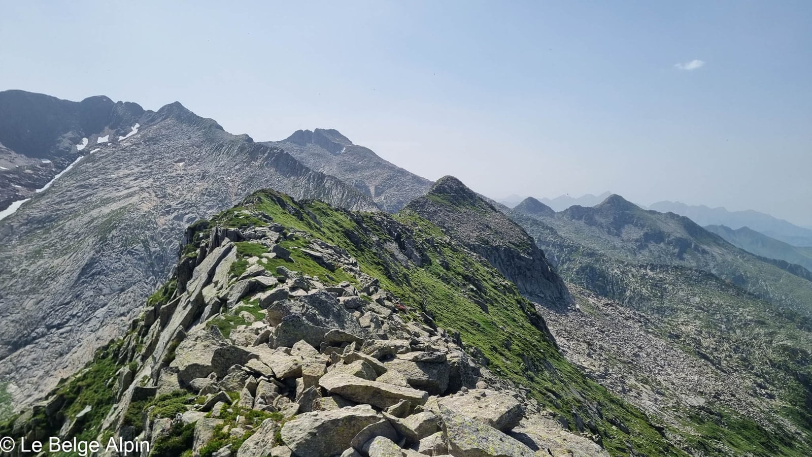
Couillac then Soune, a committed ridge

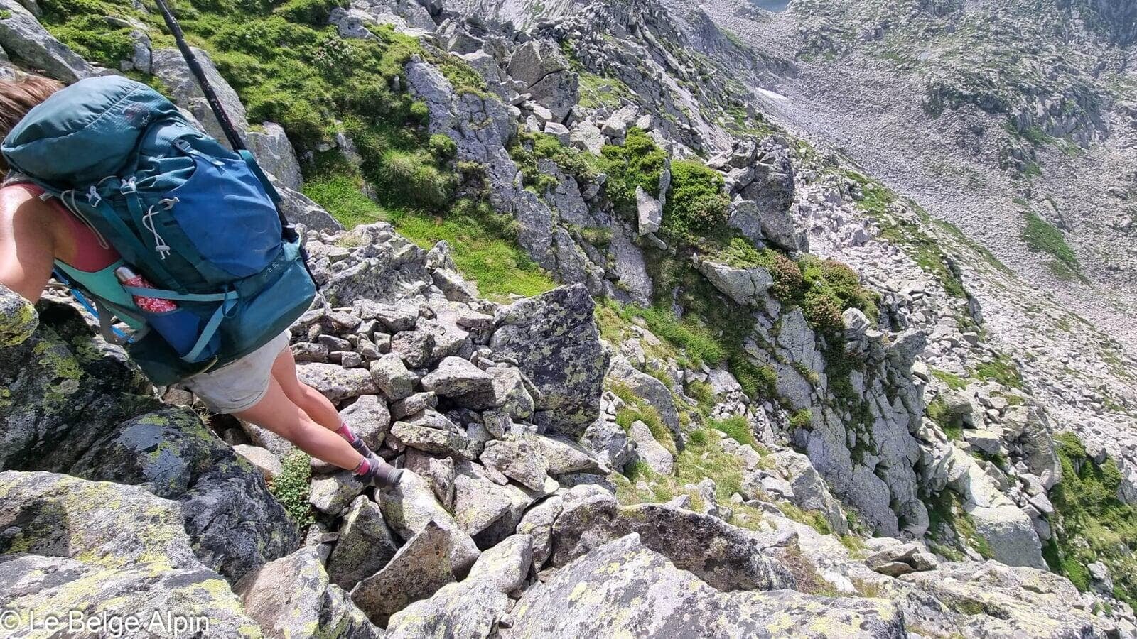
After the Pic de Soune, we lose the path despite the GPS. These places are not heavily travelled, and even the cairns have vanished. We have to downclimb rock bands without any gear, taking real risks. We need to reach the cabin before nightfall, and the afternoon is slipping by.
After the rock bands, we reach the alpine pasture, but the lush vegetation slows us down, making it nearly impossible to see where we’re placing our feet. The weight of the packs compounds it all. We decide to play tightrope on the piles of boulders that have tumbled down the slopes over the years.
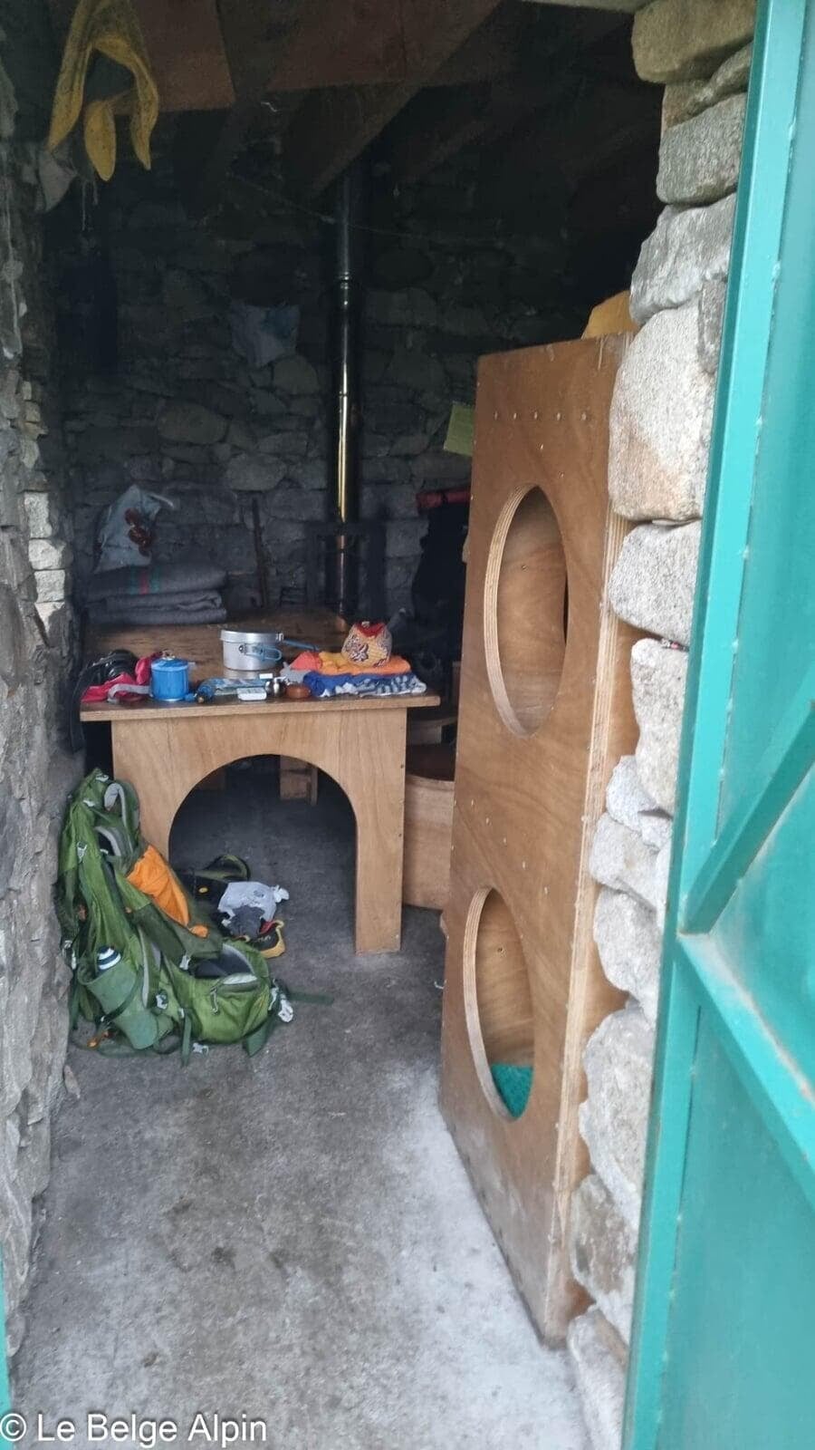
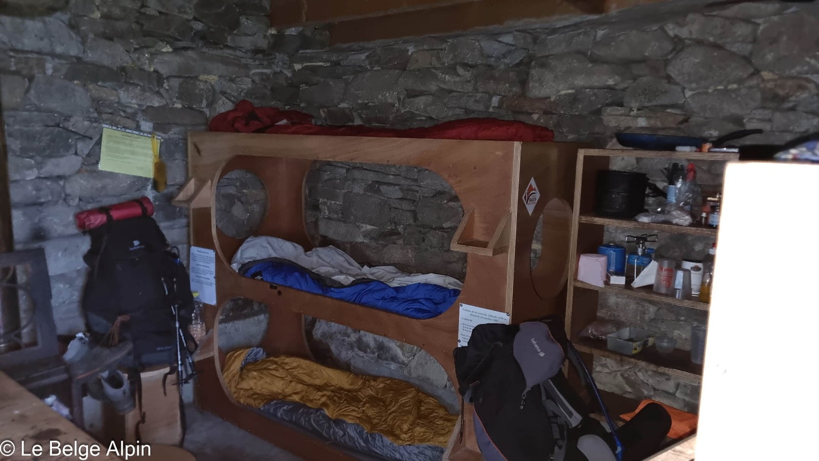
The cabin at 9pm, exhausted but safe


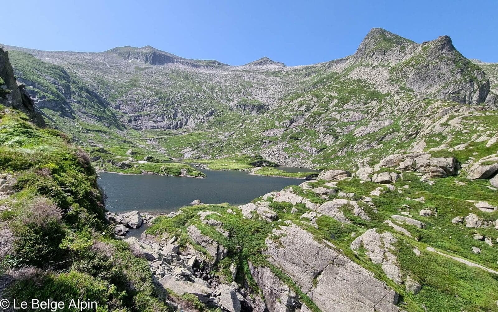
Dusk is near and night falls fast. We are not equipped to bivouac without a tent, and bears roam the area (this is the Couserans). Finally, around 9pm, we find the cabin. Night falls, we are exhausted.
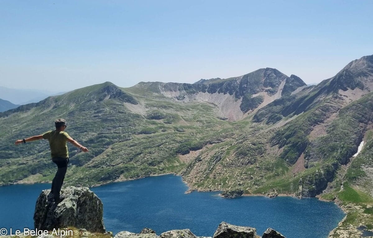
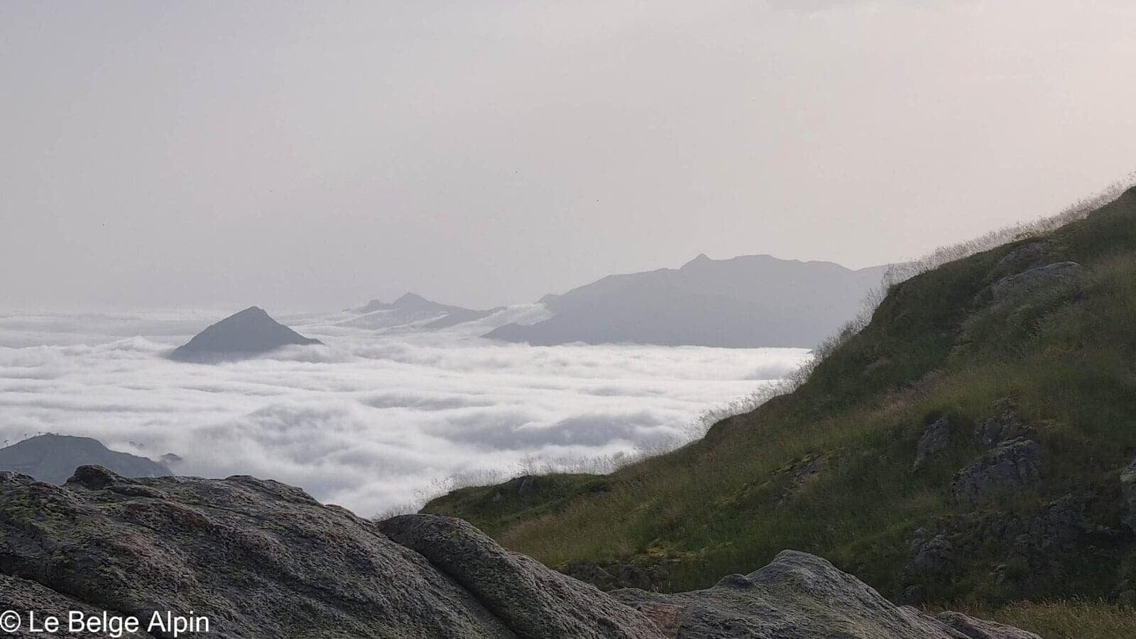
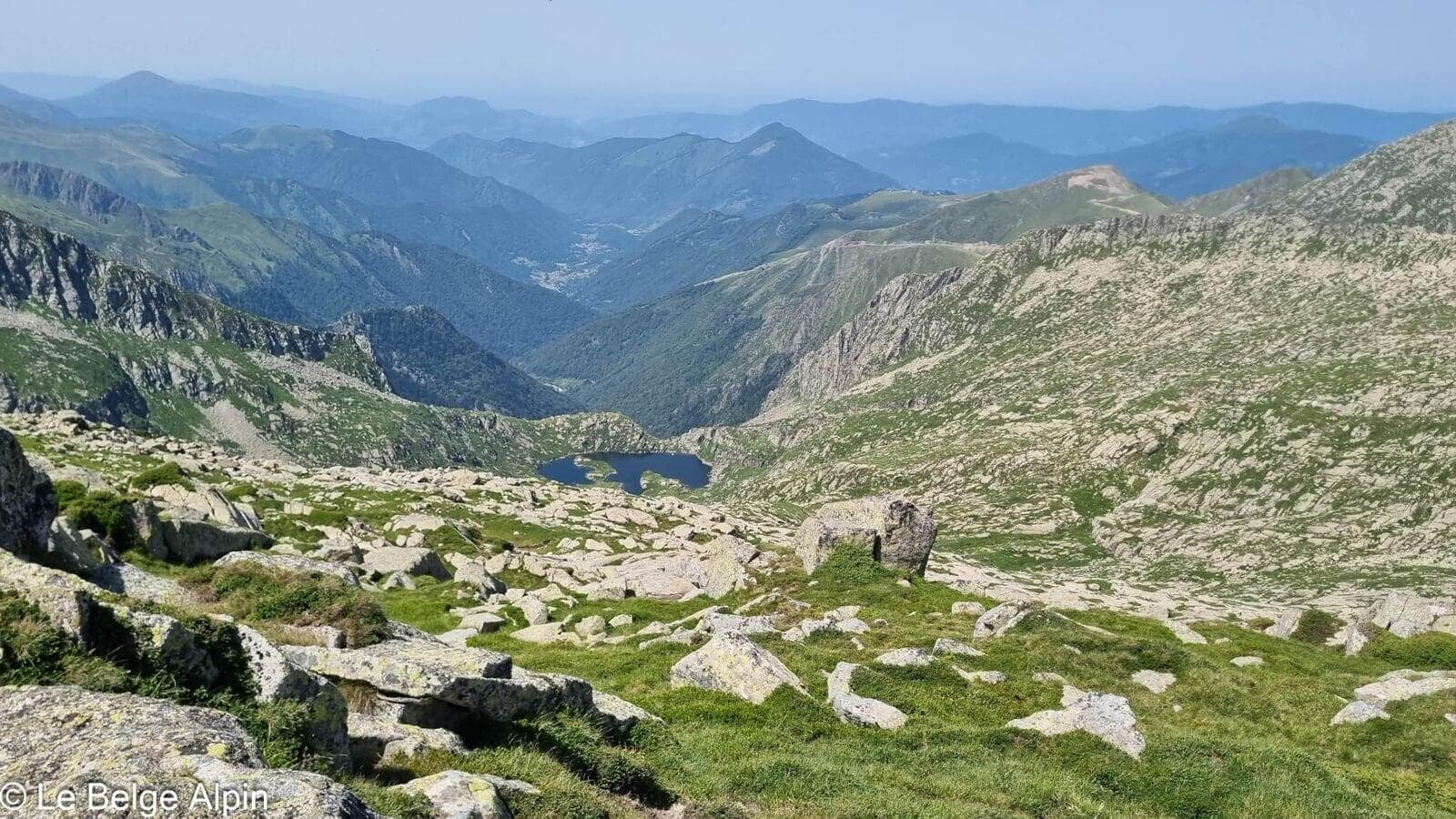
After a quick dip in the nearby lake, my friend heads to bed. I stay outside to watch the sunset, a privileged moment that reminds me of the impermanence of all things. A warm, very strong wind is blowing, a sign that the weather is about to turn.
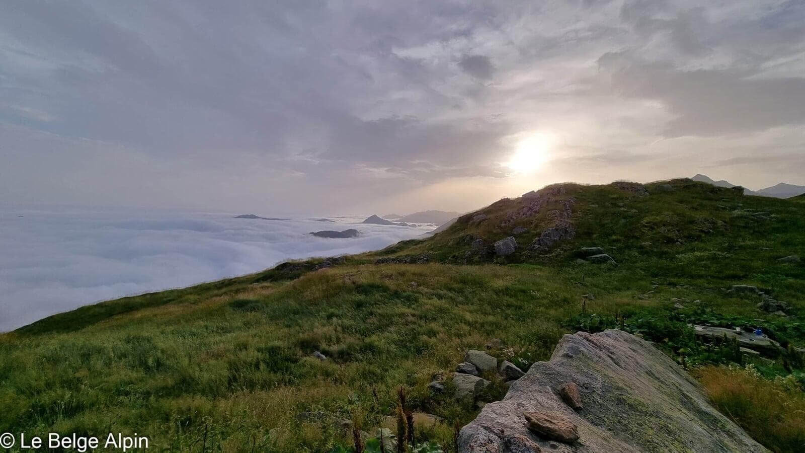
Sunset, the gift of the day

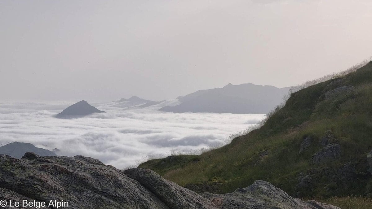
This is the moment that redeems everything. The sea of clouds stretches out below, the surrounding summits emerge like islands, the sun slowly sets. You forget the fatigue, the packs that were too heavy, the navigation lost on the slabs. This is what we came for, really, even if we didn’t know it.
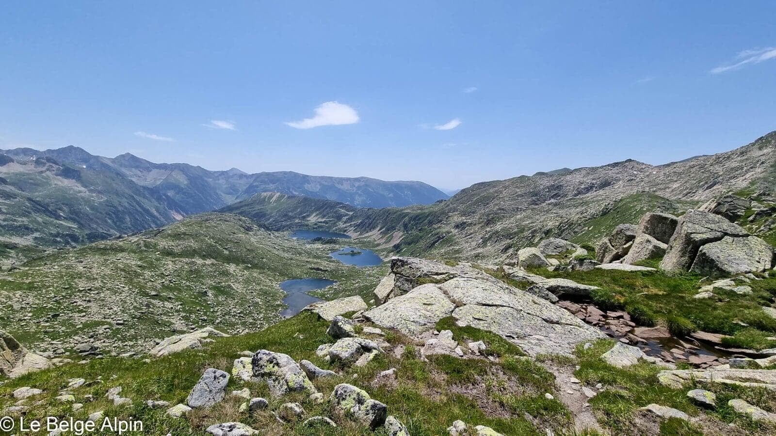
Day 2, descent in the rain
The next morning we drop back down to the valley in the rain, but with our heads full of memories. The weather has turned as the warm wind had promised the night before. We read the timing, pack up early, make it back dry to the van.
Quite an adventure, and well worth it.
Practical info
22 km and 2000 m of gain over two days, pack loaded for the bivouac. Do not take this on without solid experience: off-trail sections, downclimbing, navigation, and the solitude of the Couserans (few hikers, slow rescue response). Carry GPS, paper map, stove, water with filter, first-aid kit, and share your plan with someone who can raise the alarm.
For conditions, a call to the Office de Tourisme du Haut-Couserans is essential. They will tell you the state of the route, how busy the cabin is, and visibility conditions in the downclimb zone.
Practical info
Starting point
From Saint-Girons, head to Seix and then Ustou. At the end of the road, park at the Cirque de Cagateille (1036 m). The last section is a stony track, accessible to a low car in dry weather. Shade is rare, start early in summer.
GPX track
Import the GPS track into your watch or app (Garmin Connect, Komoot, Gaia GPS, Iphigenie...). Two-day hike, two separate tracks.
Sign in to download (2 GPX files)Tourist office (current conditions)
Office de Tourisme du Haut-Couserans, Seix
Place de l'Allée, 09140 Seix
Garmin track
Gallery
19 photos, click to enlarge

Weather, Ustou
Conditions and forecasts for the itinerary
In the mountains, conditions change fast. A thunderstorm can become dangerous, fog disorients, residual snow slows every step. Before leaving, check the bulletins, plan a stable weather window, and when in doubt, call the tourist office or the local guides office.
Learn to read mountain weather →Questions fréquentes
Is the bivouac cabin open year-round?
+
Yes, it's an unstaffed cabin, open on a first-come, first-served basis. Bring a sleeping mat, sleeping bag, stove, and water (fetch it from the nearby lake, filtration recommended). Only a few spots, on a sunny summer weekend it is wise to carry a tent as backup.
What technical level is required?
+
High: several off-trail sections, downclimbing rock bands (no gear in place), navigation is essential (cairns missing in places). Not for beginners. Bring GPS and map, start early, and know when to turn back if the weather changes.
Are there bears in the area?
+
Yes, the Couserans is part of the Pyrenean brown bear zone. Encounters are rare but possible. At the cabin, store all food inside and keep food waste away from the outside. Normal human noise is enough to avoid 99% of encounters.