
I have a consistency problem. On Hiking3000, I publish tutorials. And in several of those tutorials, I explain how to use AllTrails or Komoot to plan your outings. Except I can’t do it with a clear conscience any more.
I’ll tell you why, and I’ll show you what I use instead. With the real things I found, the real mistakes I made along the way, and the honest limits of each option.
Who I am, with two hats
You know me under the Le Belge Alpin pseudonym. You mostly see my GPX tracks, my via ferrata photos, my routes in the Alps or the Ardennes. What you don’t know, or only half know, is that next to the rope and the hiking boots, I also have a keyboard.
I run Digitis, a Belgian company that does cloud telephony and managed IT services for SMBs. Fifteen years tapping into infrastructure, networks, servers. We took the AI turn early, but in a particular way: our services run on European servers, our providers are in Belgium, France, Germany. Not for the optics. Because it’s more solid in the long run, and because I don’t like depending on a vendor who can change the rules overnight.
That’s exactly what happened with AllTrails and Komoot. The logic is the same as the one I apply at work. That’s what makes this piece possible.
The mechanism, no jargon
You’ve definitely lived this. An app you loved three years ago. Simple, clean, did its job. Today, it’s a nightmare. Ads everywhere. Pop-ups asking you to upgrade. Features you used to get free, locked behind a paywall. The interface lagging because it’s stuffed with features nobody asked for. And impossible to leave, because all your data is trapped inside.
This phenomenon has a name. A Canadian writer, Cory Doctorow, called it enshittification. Literally: the transformation into shit. The word is crude. The phenomenon is worse.
The mechanism goes in three steps. First, the app is free and excellent. It attracts millions of users. Then, once those users are captive with all their tracks, habits and data inside, the app degrades. Ads, paywalls and friction appear. Finally, when people can’t take it any more, leaving costs too much in time and lost data. Nobody leaves. The trap is shut.
It’s exactly as if a free mountain refuge had been set up for you over the years. You go up every weekend. You store your gear there. You know the warden. One day, the refuge is bought out. Your gear is now charged for. Access goes up to fifty euros a night. And you find out that your gear, actually, you can’t take back without paying for that too. Surely you’re not going to abandon it all?
AllTrails and Komoot, the concrete case
AllTrails was bought in 2023 by Permira, an investment fund. Since then, paid features keep multiplying. The interface is slow, stuffed with promotions, and the “Send to Garmin” button that used to push a track to my watch has become a premium selling point. I’m a paying subscriber, and my experience has degraded despite the subscription. That raises a simple question: if paying isn’t enough to stop the drift, what is?
Komoot is worse and more recent. Bought in March 2025 by Bending Spoons, an Italian tech investment company. In the weeks that followed, 80 to 85% of Komoot’s employees were laid off. And since 27 February 2025, the “Send to Device” function that pushes a track to a Garmin, a Wahoo or any wrist GPS moved behind a 59.99 euros per year Premium subscription for every new account. Before that, you could unlock the function with a one-off map purchase starting at 3.99 euros. Now, it’s the subscription or nothing. The app will follow AllTrails’ trajectory, that’s a certainty.
Bending Spoons has a documented playbook. They buy mature and stable products: Evernote, WeTransfer, Brightcove, Meetup, AOL, and now Komoot. They lay off heavily, then they raise prices. Doctorow wrote it word for word: they don’t innovate, they extract.
And here I am, on Hiking3000, with tutorials that mostly rely on AllTrails, and may have mentioned Komoot once or twice in passing.
I’m going to have to redo the tutorials where I use AllTrails as a planning tool. Not because they were bad at the time. Because the tool I was recommending in them is no longer worth your time or your money.
My alternative workflow, in two tiers
I’m going to walk you through two versions of leaving AllTrails. One for those who just want a simple replacement, accessible to everyone. One for those who accept a bit more tinkering in exchange for the best tool I’ve found. Pick the level that fits you.
To plan on a computer, in both cases: Bikerouter
It’s a web tool built on the open BRouter engine, maintained by a German developer, Marcus Jaschen. No account, no ads. Route calculation accounts for elevation, and the elevation data comes from the Sonny LIDAR model, more accurate than AllTrails’ in the Alps.
You stack the layers you want: OpenTopoMap base for contours, hillshading for shaded relief, waymarked trails for marked hiking paths. Honestly, the rendering is better than what you see on AllTrails or Komoot.
Export is GPX. On a smartphone, you download the file, you tap it, and Android offers to open it with the app of your choice: Garmin Connect, CoMaps, OsmAnd, just about everything except AllTrails. Special case for Ascend Maps, more on that below. Bikerouter also offers a FIT export, Garmin’s native format, but depending on your watch model the behaviour can be imperfect. Stick with GPX, it’s safer.
To transfer the track directly from PC to phone, Bikerouter generates a QR code that you scan. Thirty seconds, no cloud, no account.
Bikerouter isn’t perfect. At heart, it’s a tool designed for cycling, and the interface has a small learning curve. It’s not click-click-done. Once you’ve got the hang of it, it’s fast. Before that, not. There’s a dedicated page at /en/planner with the right layers preset and a quick walkthrough to get started.
For the watch: Garmin without a Komoot or AllTrails Pro subscription
You take the GPX from Bikerouter, send it to your smartphone (QR code or direct download), and Android offers Garmin Connect in the app list. The track lands on the watch in seconds. No Komoot cloud, no AllTrails paywall. Garmin Connect stays useful for the rest, but it becomes optional for navigation.
For the smartphone, the choice between simplicity and excellence
This is where I need to be more precise than an easy shortcut. Three real options exist, with their real trade-offs.
Option 1, the simplest: CoMaps
Free app, open source, no ads, no tracking. Installable from the Play Store and the App Store like any normal app. Worldwide topographic maps downloaded offline, GPX import in two taps, GPS position on the track. It’s exactly what you expect from a hiking app to follow a route in the field.
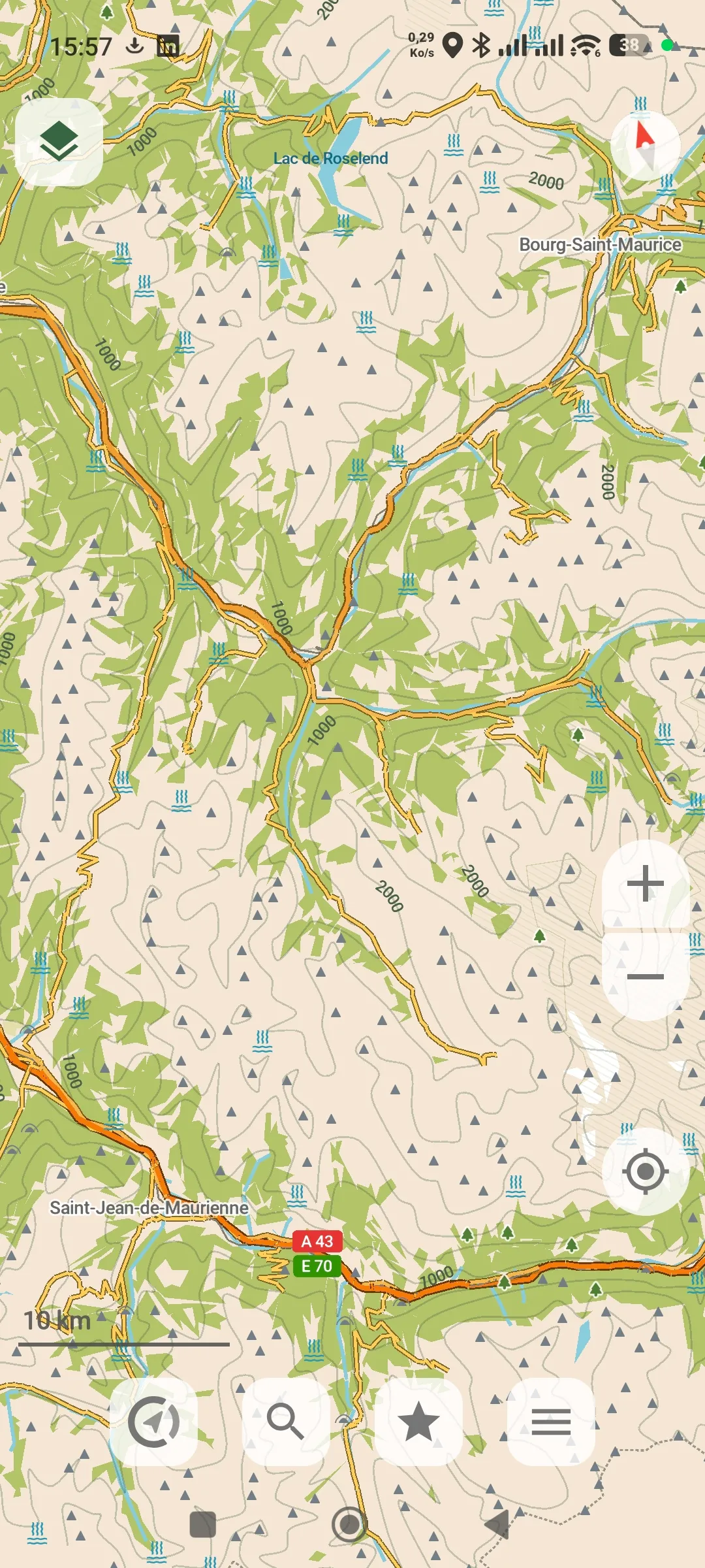
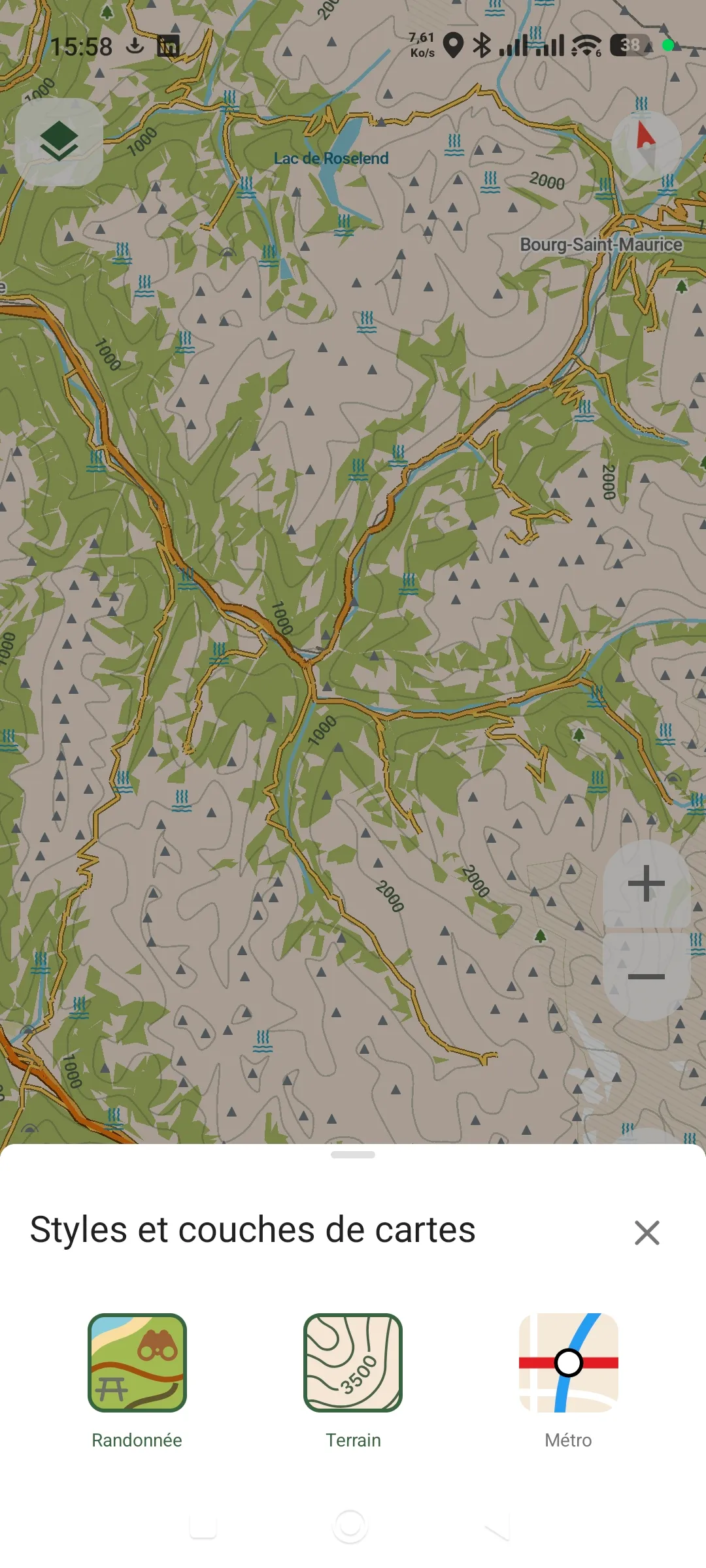
Known limit: the map rendering is simpler than AllTrails. No real 3D, basic hillshading. For everyday hiking on trails you know, that’s plenty. To scout unknown high-alpine terrain, it falls short.
Option 2, the paid but fair one: OsmAnd
It’s the most complete open source app on the market. A cooperative team based in Andorra, sustainable project, GPL-3 code on GitHub. The free version covers the basics. For contour lines and offline hillshading, you need OsmAnd Maps+, around seventy euros as a one-time purchase. For 3D Relief, it’s OsmAnd Pro at six euros per month on subscription.
I’ll be honest: seventy euros isn’t cheap. And the Pro subscription for 3D is the same mechanic I criticise in AllTrails. OsmAnd isn’t free of that flaw. The difference is that there’s no predatory investment fund behind it, the code is open, and the Maps+ one-time purchase is an option that barely exists elsewhere. If the app drifts one day, anyone can fork it.
Option 3, the best technically but not for everyone: Ascend Maps
Here I have to speak frankly. I discovered this app while preparing this article, looking for a real open-source equivalent to AllTrails’ 3D. The answer is yes, and it’s even better. Real tiltable 3D, real-time hillshading computed on the phone, contour lines, slope angle for pitches, stackable map sources, Sentinel-2 satellite imagery, NASA Worldview data. All free, genuinely, no paywall.
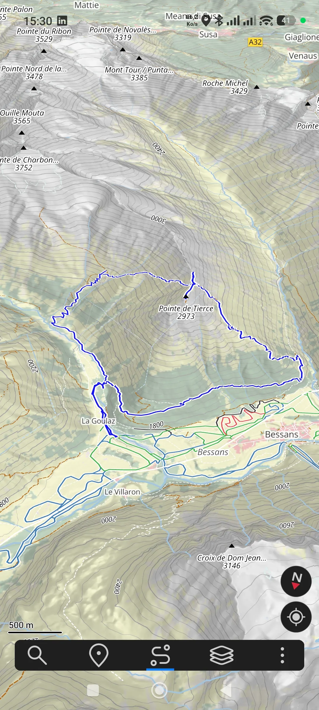
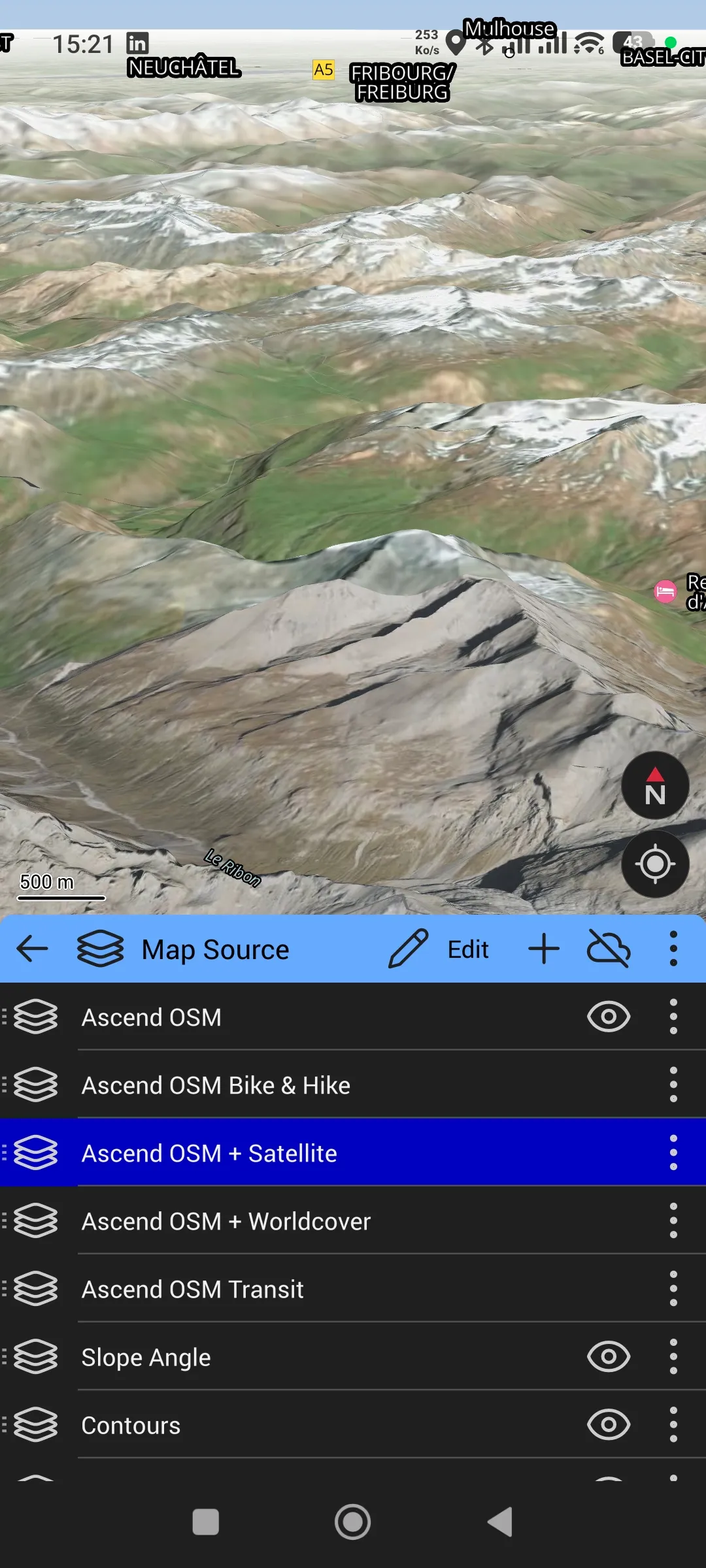
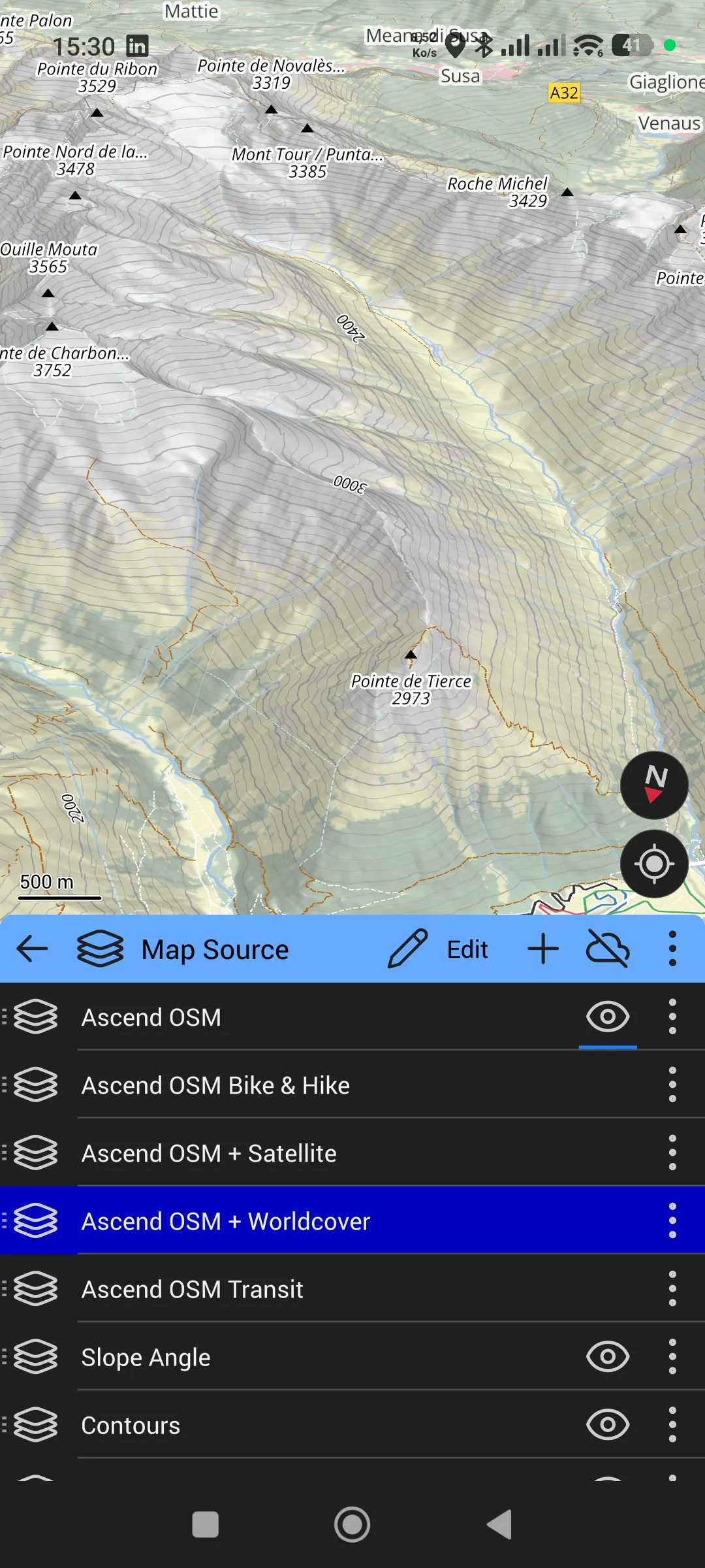
To give you a concrete idea of the layers available: seven stackable map sources, including standard OSM, OSM Bike & Hike, OSM + Satellite, OSM + Worldcover, Slope Angle and Contours. You enable what you want, you disable the rest, you combine.
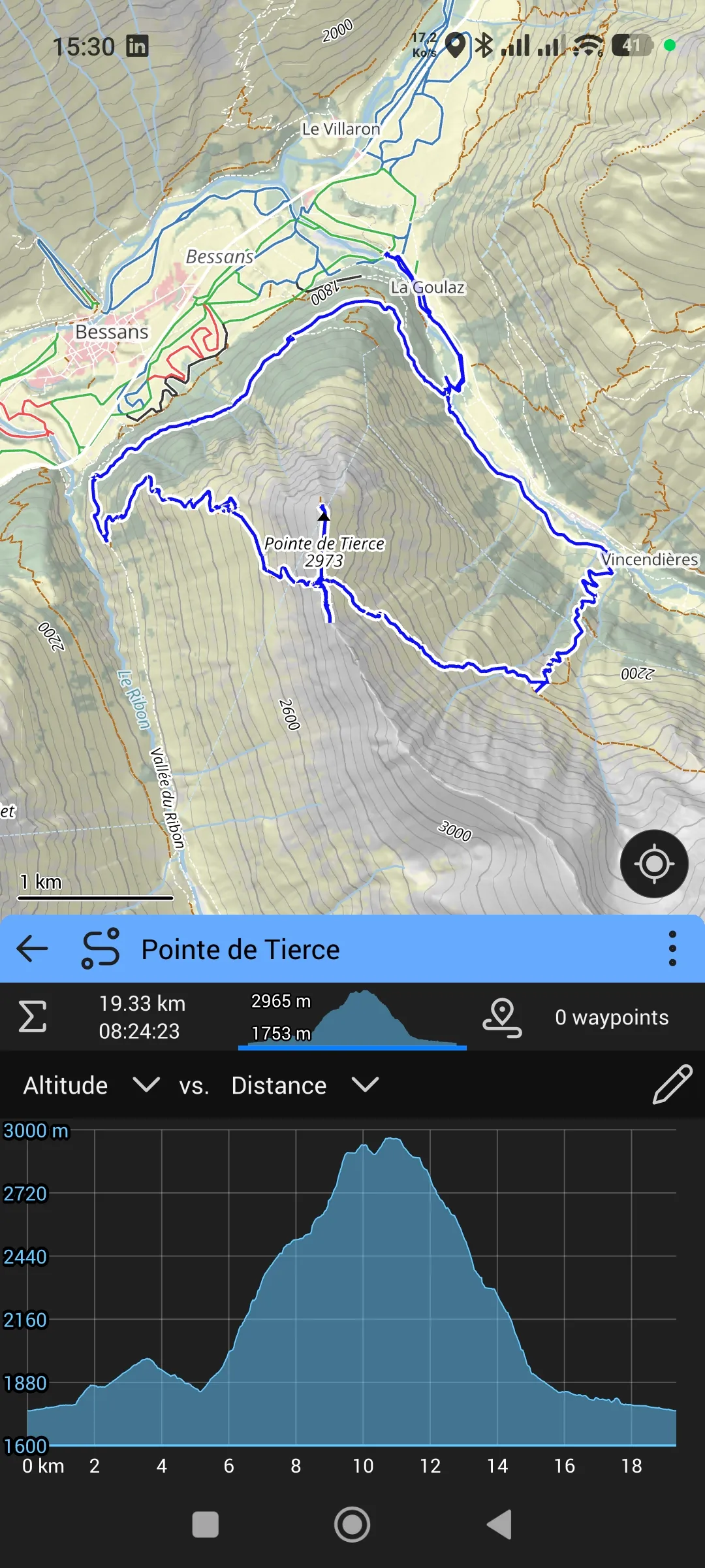
GPX import gives access to a detailed elevation profile, with automatic stats (distance, positive elevation, negative elevation, waypoints).
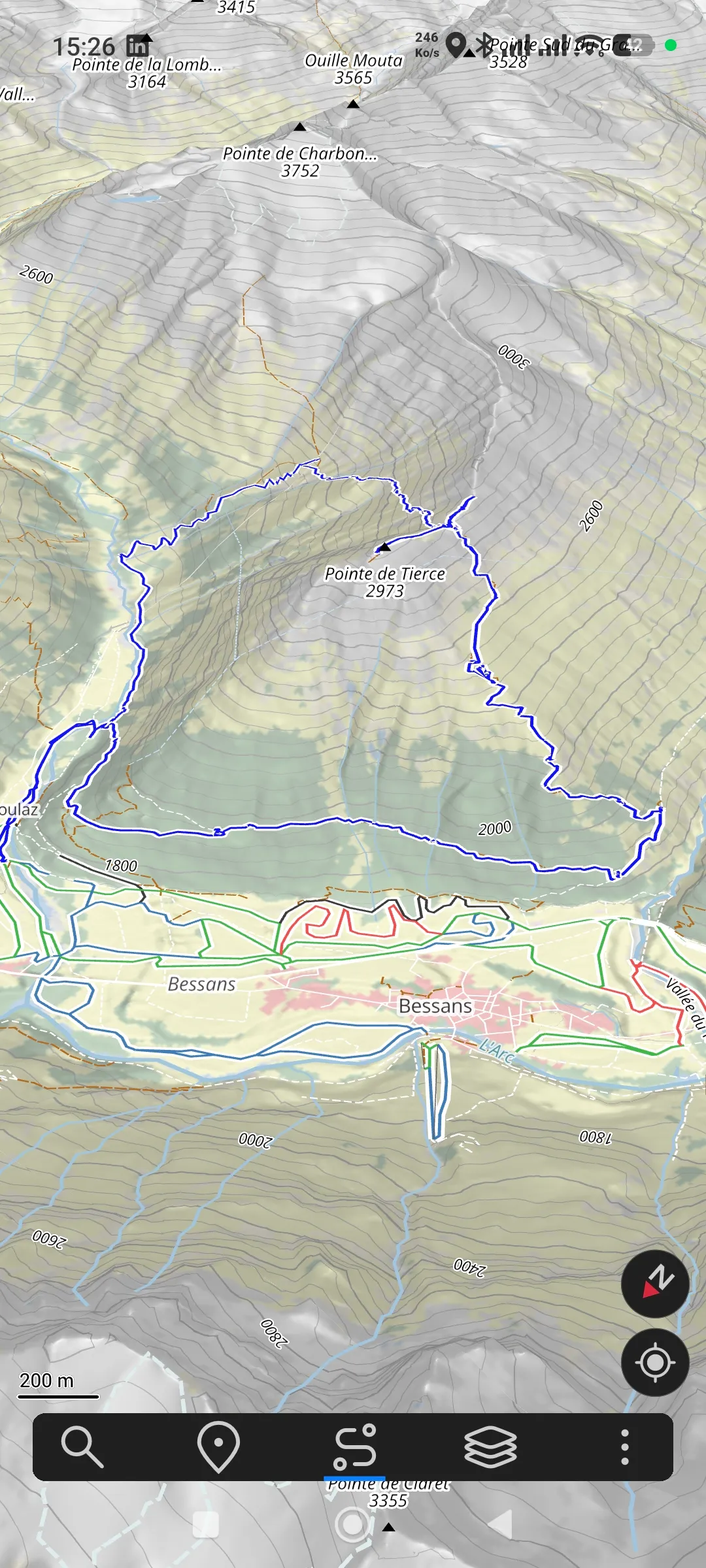
The catch: Ascend Maps isn’t on the Play Store. It’s a solo-developer project by Matthew White that you install via an APK file from GitHub. If you know what that means, it’s three minutes. If you don’t, I have to warn you: you’ll need to go into Android settings, allow installation from unknown sources, download the APK file, install it manually, and accept that there will be no automatic updates. That’s a step that takes some technical comfort. Not reserved for developers, but reserved for those who accept stepping off the Play Store beaten path.
A nice surprise: Ascend Maps is also on the App Store for iOS, as a normal download. So if you’re on iPhone, you’ve got no tinkering to do. It’s the standard install.
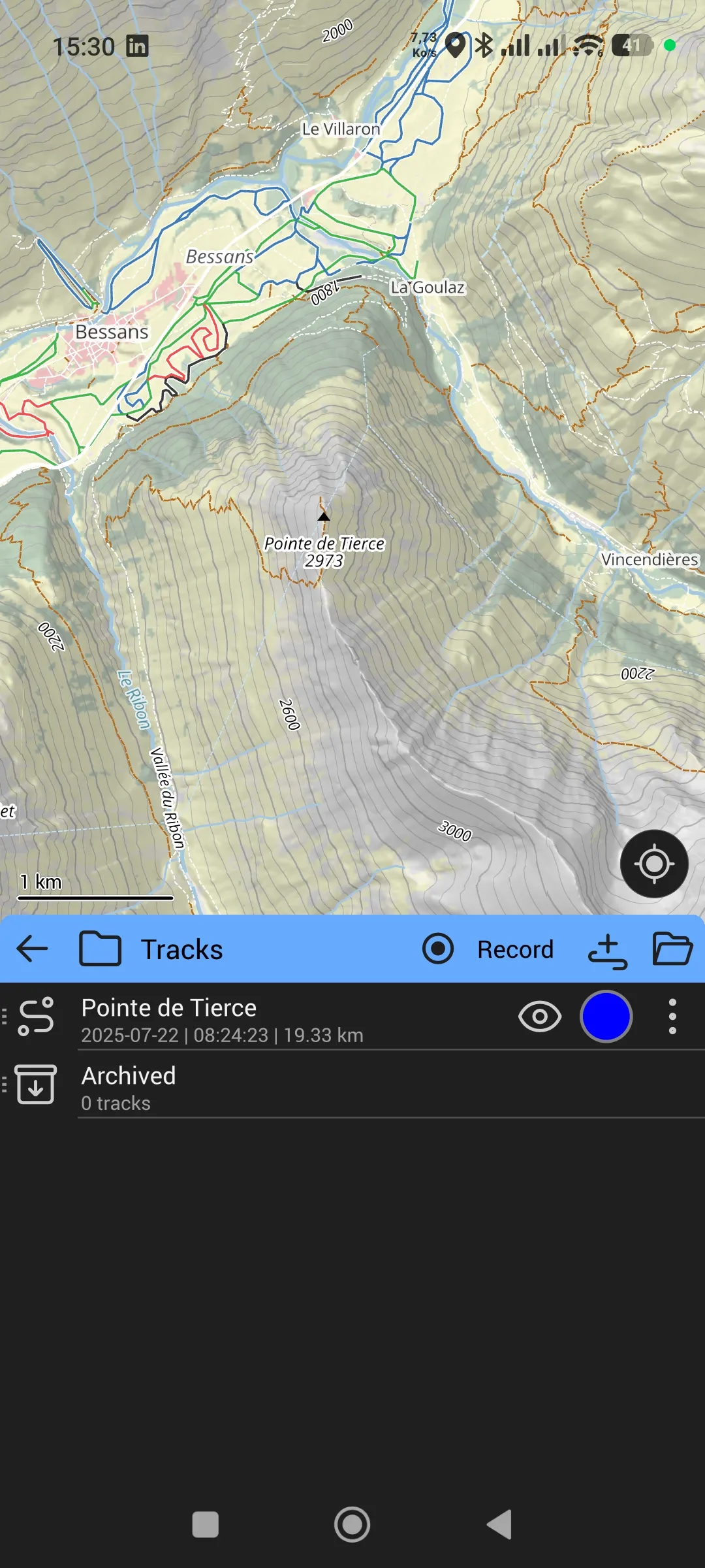
GPX import in Ascend Maps works differently than the other apps. Because the app isn’t installed via the Play Store on Android, it isn’t in the system’s GPX handlers. You download the file into a folder, you open Ascend Maps, and you import the GPX from the app itself. Once imported, you see the track listed under Tracks, ready to be shown on the map.
The other limit, more fundamental: it’s a project maintained by a single person. If Matthew White stops tomorrow, the app will keep running on phones where it’s already installed, but it won’t progress any further. The code being GPL-3 on GitHub, anyone can pick up the torch. But it’s a fragility to know before getting attached.
To help you install Ascend Maps on Android, I’ve put together a step-by-step tutorial. Everything is on the Ascend Maps install tutorial.
Total cost summary
| Tier | Smartphone tool | Total cost |
|---|---|---|
| Simple, accessible | CoMaps | 0 € |
| Comfort, willing to pay | OsmAnd Maps+ | 70 € once |
| Technical excellence | Ascend Maps | 0 € + manual install |
Up to you to pick where you set the cursor. In every case, Bikerouter for planning and GPX to the Garmin stay identical.
Why it matters, beyond hiking
This isn’t just about money. It’s about independence. When your hiking tool belongs to an investment fund that doesn’t have your interests at heart, you’re their product, not their customer. The price tells you what they charge you. It doesn’t tell you what they actually earn from your data, your attention, your habits.
European tech exists. Bikerouter is maintained in Germany. The Sonny model comes from an Austrian contributor. OpenStreetMap, which serves as the geographical base for this whole workflow, is a worldwide community resource that no company can claim. These bricks are today of a quality higher than many American apps. No ads, no tracking, no surprise acquisition.
I want to insist on one point that the conversation around these alternatives often forgets. Leaving AllTrails doesn’t mean accepting a downgrade. On some measurable criteria, the sovereign tools are better. Bikerouter’s topo rendering with OpenTopoMap and hillshading is more readable than AllTrails’. Ascend Maps’ 3D on alpine terrain is on par with, or above, what AllTrails Pro offers. The difference isn’t only ethical. It’s also technical.
Choosing your tools is a political act every day. No need to march. Uninstalling AllTrails and installing CoMaps is already voting with your fingers. Multiplied by a hundred thousand, it shifts a market. Doctorow writes it: users aren’t powerless, they’re just poorly informed about their alternatives.
AI isn’t the enemy of sovereignty, by the way. Used poorly, yes, it becomes an extraction tool. Used well, it’s a lever for independents and small teams. At Digitis, we use it every day to serve a hundred and thirty B2B customers with a small team. Technology can serve humans when you choose how it’s deployed, and by whom.
What comes next on the site
By the time I publish this piece, you already have a new link in the menu: /en/planner. It’s the entry point to Bikerouter, preset for hiking, with the right layers already enabled. Trace, export, done. The page also explains how to use it without detours, and as time allows, a video will show the full workflow on a real outing.
Alongside, a dedicated tutorial walks you through installing Ascend Maps on Android for those who want to step up. On iPhone, Ascend Maps is a normal App Store download, nothing to explain there.
The older tutorials that mention AllTrails will stay online for now, with a note at the top explaining the change of direction. They’ll be updated over time.
Longer term, I’d like to integrate a planner directly on Hiking3000, running on my own servers with my own map tiles. I mention it as a project, not as a promise. The coming month in the mountains will mostly be a month of fieldwork. Technical work comes after.
In closing, the analogy that struck me
When I was fifteen, I climbed without a shock absorber in an ED-rated cliff. I’d jury-rigged my lanyards too short with bits of rope. I got out by luck, and with a rope that was sleeping in my bag. A few years later, I understood what I’d done, and I came back with the right gear.
It’s exactly the same move I’m making today with my digital tools. I used what came along. I understood along the way. Today, I share what I know, while owning the fact that my older tutorials need a rewrite.
That’s the job. You learn, you correct, you share again.