
If you’ve read the AllTrails, Komoot, and me article, you know why Ascend Maps is in my daily toolkit. This shorter piece is a step-by-step tutorial to install it on Android, because the app isn’t distributed through the Play Store.
Why an APK and not the Play Store
Ascend Maps is an open source project maintained by a solo developer, Matthew White. The code lives on GitHub under GPL-3. The author chose to distribute the app via APK files published directly on the project’s Releases page, rather than going through the Play Store (which involves fees, a Google review and a certain loss of control over distribution).
For you, that changes two things:
- You need to enable an Android option to authorise installation from “unknown sources” (in reality: from somewhere other than the Play Store).
- You won’t receive automatic updates. When a new version is released, you go back to GitHub and install it manually.
That’s three minutes one time. And it’s also what keeps the app free and ad-free: no middleman to pay.
Special case: iOS and Windows
If you’re on iPhone, you don’t need this tutorial. Ascend Maps is available as a normal download on the iOS App Store. The install is standard.
If you’d rather plan your hike on a computer, Ascend Maps also exists as a Windows desktop version. Download the executable from the same GitHub Releases page. It’s a local alternative to Bikerouter for those who prefer installed software over a website.
The tutorial below is Android only.
Step 1: Allow installation from this source
On Android, open Chrome (or whichever browser you use to download the APK). Then:
- Open the phone Settings
- Go to Apps
- Find your browser (Chrome, Firefox, Brave, etc.) in the list
- Tap on Install unknown apps (or “Unknown sources” depending on the Android version)
- Enable Allow from this source
This permission is per-app. If you download the APK from Chrome, Chrome needs the right. Not Firefox, not Telegram, just the one you use.
If you’d rather not authorise it permanently, Android will still ask you to confirm at install time. But pre-authorising smooths the flow.
Step 2: Download the latest APK from GitHub
Head to the Ascend Maps releases page:
github.com/styluslabs/maps/releases
You’ll land on the list of published versions. Take the most recent one at the top (usually marked “Latest”). Expand the Assets section of that release.
You’ll see several files. The one you want for Android is named Ascend-X.Y.Z-android.apk (where X.Y.Z is the version number). That’s the one to download. Tap it, the download starts in your browser.
Skip files ending in .exe (that’s the Windows version) or .dmg / .zip Mac. For Android, it’s .apk and that’s all.
Step 3: Install the APK
Once the file is downloaded, open the download notification (top of screen) or go to the Files app on Android, Downloads folder.
Tap the Ascend-X.Y.Z-android.apk file. Android offers to install it. Confirm. If you didn’t enable the permission in Step 1, Android asks for it now. Accept.
The install takes a few seconds. Once finished, the Ascend Maps icon appears on your home screen or in the app drawer.
You can delete the APK file from the Downloads folder, the app is installed.
Step 4: First launch
Launch Ascend Maps. The app opens on a worldwide map view.
At this point, you have the basic OpenStreetMap layer. The enriched layers (satellite, contour lines, hillshading, slope angle) are map sources you activate on top.
Step 5: Activate the map sources useful for hiking
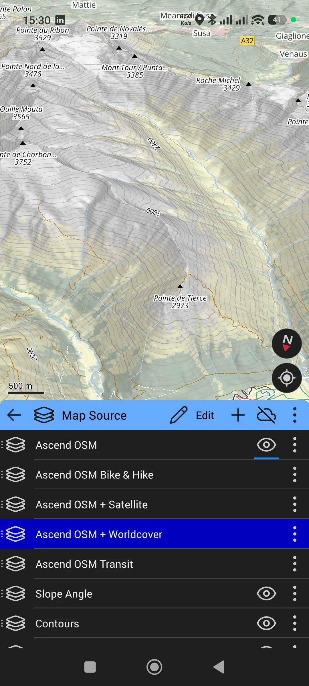
In Ascend Maps, open the Map Source menu (layer stack icon). You’ll see the list of available sources. The most useful ones for hiking:
- Ascend OSM: default OSM base, readable, light
- Ascend OSM Bike & Hike: variant with MTB and hiking trails highlighted
- Ascend OSM + Satellite: OSM overlaid on Sentinel-2 satellite imagery (useful in high mountains to see rocky areas)
- Ascend OSM + Worldcover: OSM overlaid on NASA Worldview land cover data
- Slope Angle: an overlay that colours slopes by inclination (green, yellow, orange, red). Very useful for winter assessment or on alpine terrain.
- Contours: contour lines, essential for reading relief
Enable Ascend OSM as base, then Slope Angle and Contours on top. You can also add Hillshading for shaded relief if available. That’s my baseline configuration.
To enable a source, tap the eye icon to the right of its name. Open eye = active, crossed eye = inactive. You can reorder the stack by dragging sources.
Step 6: Import a GPX
Ascend Maps doesn’t appear in Android’s “Open with” menu when you tap a downloaded GPX. That’s a consequence of the APK install: the app isn’t registered in Android’s native handlers.
The working method:
- Download your GPX in a known folder (Downloads for example)
- Open Ascend Maps
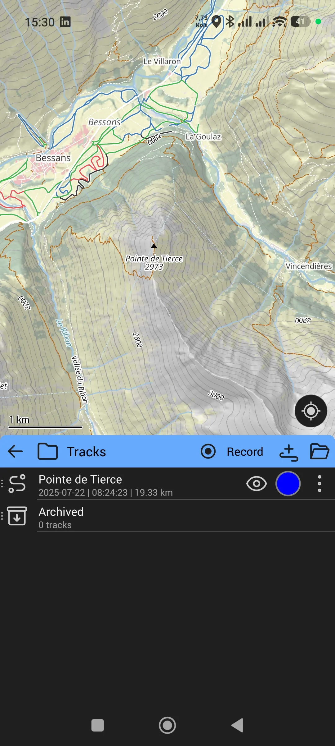
- Go to Tracks (folder icon or tab depending on the app version)
- Tap Import or the add icon
- Navigate to the GPX file and select it
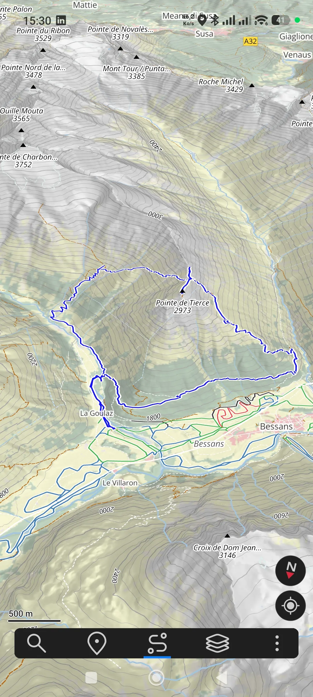
The track appears in the Tracks list. Tap it to display it on the map. Once shown, you see the altitude/distance profile in the track detail.
Step 7: Verify everything works
To check your install, here’s a small checklist:
- The map loads and pans fluidly
- You can zoom down to trail level (with place names appearing)
- 3D tilt works (two fingers sliding up on the screen tilts the view)
- GPS position shows up (blue target icon) once you authorise geolocation
- An imported GPX track shows up in colour on the map
If everything checks out, you’re set. You now have a complete hiking app, free, with 3D on par with AllTrails Pro, and not a single paywall.
Future updates
Ascend Maps doesn’t update automatically (no Play Store). When a new version is released on GitHub, the procedure is:
- Go back to github.com/styluslabs/maps/releases
- Download the new APK
- Tap the downloaded file to install over the previous version
- Your data (downloaded maps, imported tracks, activated sources) is preserved
Because Ascend Maps is maintained by a single person, releases are irregular. You can follow the project by starring it on GitHub or enabling release notifications.
Going further
- The reasoning behind it all, and the full workflow (Bikerouter + Garmin + smartphone): the AllTrails, Komoot, and me article
- The Bikerouter planner entry page: /en/planner
- The Ascend Maps source code: github.com/styluslabs/maps