
From a parking lot shared with livestock on the N320 (Cerdagne, 1965 m), ascent of Puig Pedros (2842 m), high point of the Campcardos massif and a natural border between Spain and France. 1125 m of gain over 14 km, panorama over the entire north-eastern Pyrenees.
Puig de Campcardos, also known as Puig Pedros, is a striking summit of the Pyrenees, located in the Cerdagne region. This majestic peak marks the border between Spain and France and is the high point of the Campcardos massif (or serra).
It’s the highest summit of the province of Girona, offering exceptional panoramas over the surrounding mountains and the Cerdagne plain. It forms a natural border between Spain and France, a symbol of the union and diversity of Pyrenean landscapes.
Approach via the pastoral track
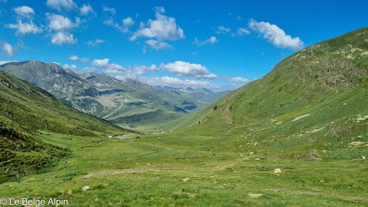
From the N320 on the Spanish side, you take a stony track that leads to a parking lot shared with local herds. We spent the night there in converted minivans, cows and horses as neighbors, rustic atmosphere guaranteed. For now, it smells of hay and time running slow.
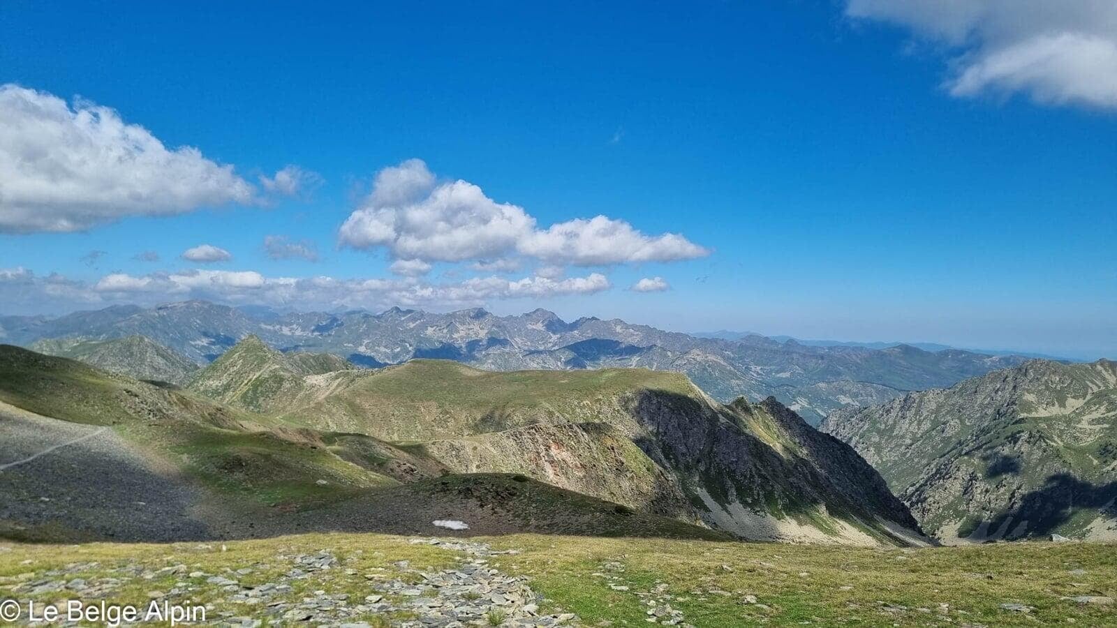
The approach follows an open valley, gentle aspect, gradual slope. The surrounding summits are green, rounded, granite sculpted by time and wind, not the dolomitic spires of Italy. The Pyrenean aesthetic in its most recognizable form.
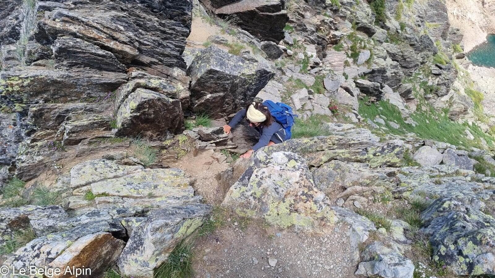
Climb and final ridge

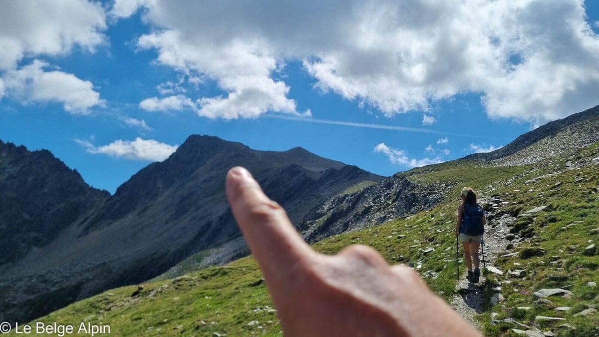
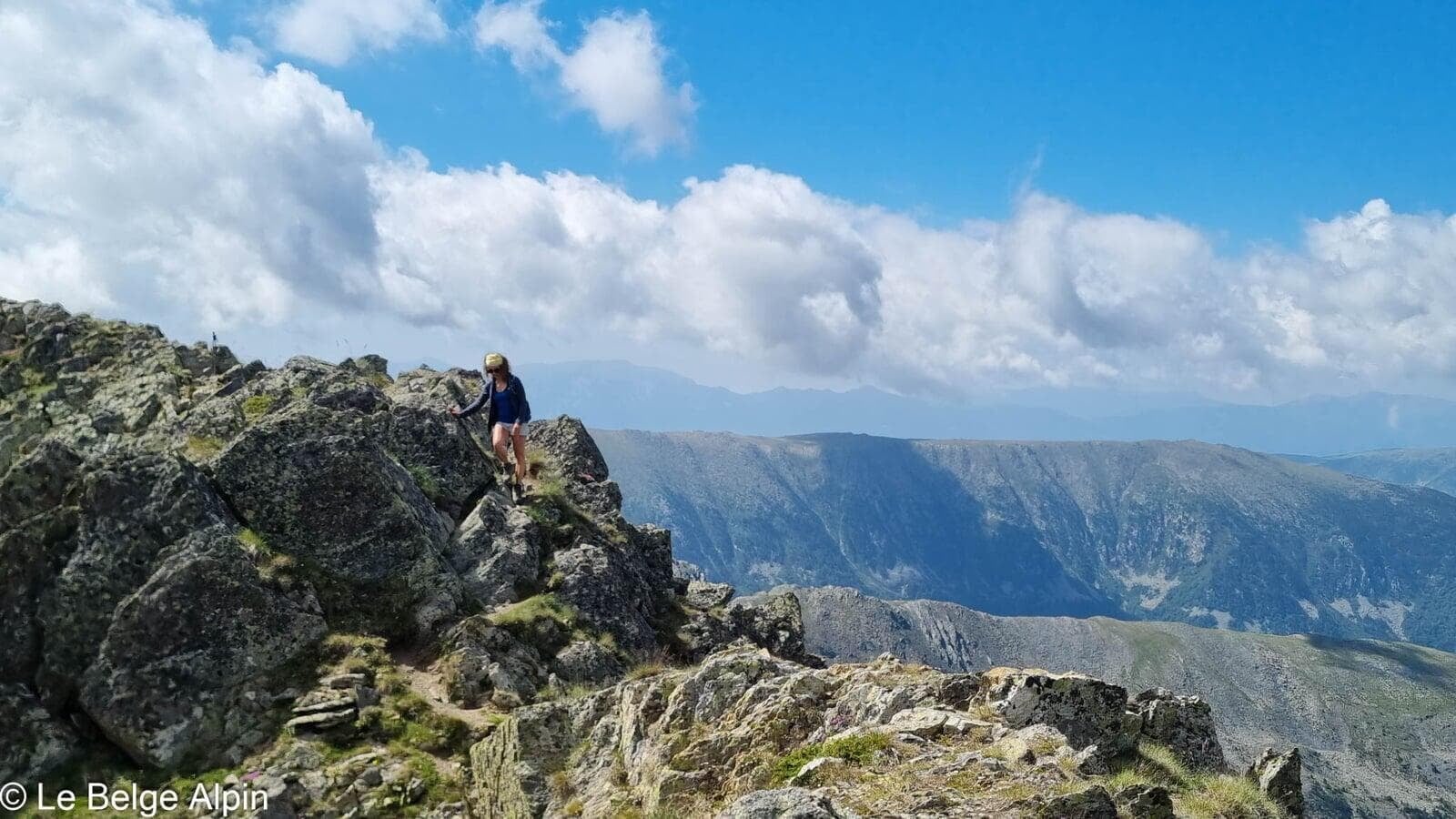
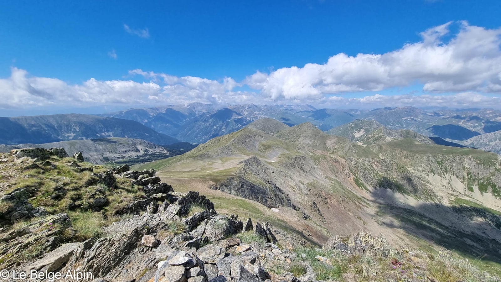
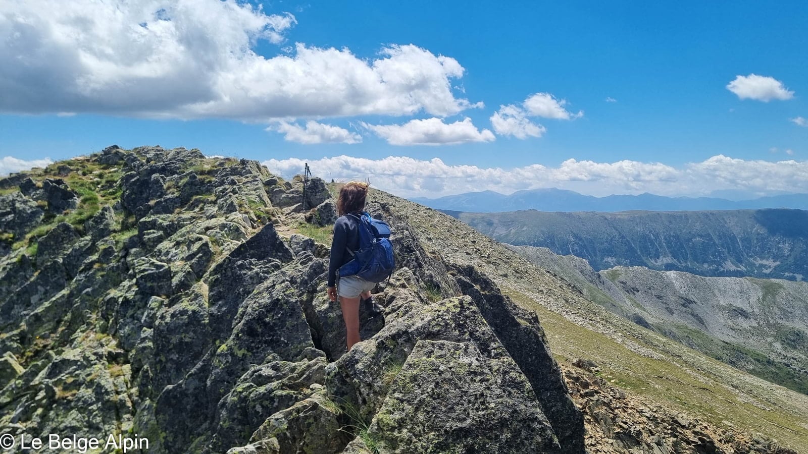
Around 2500 m, you leave the green for the mineral, and the view starts to open in every direction. No technical difficulty: the trail is clear, marked in places by cairns. The final ridge makes you breathe a bit, a bit of downclimbing, but nothing concerning for anyone with mountain footing.
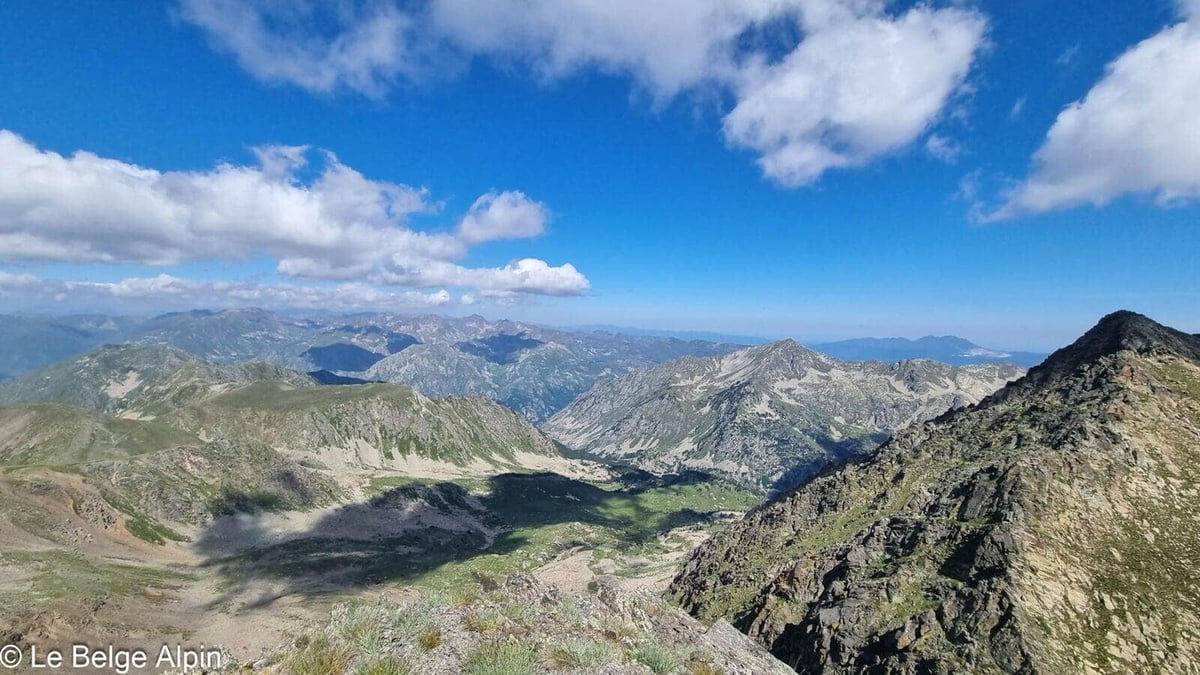
At the summit, Andorra and eastern Pyrenees panorama

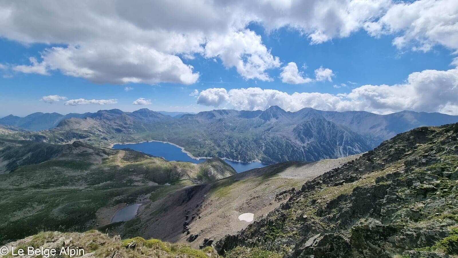
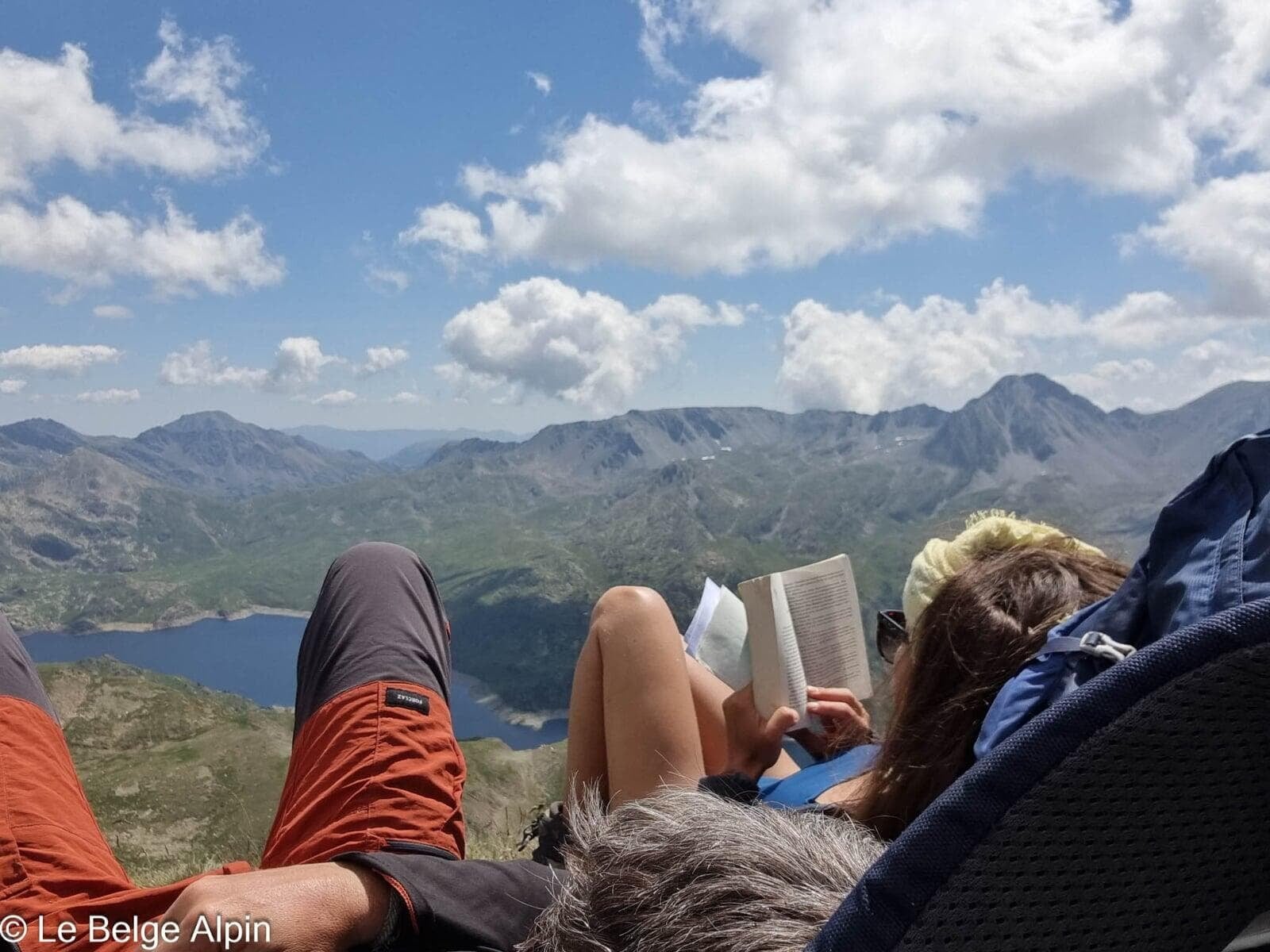
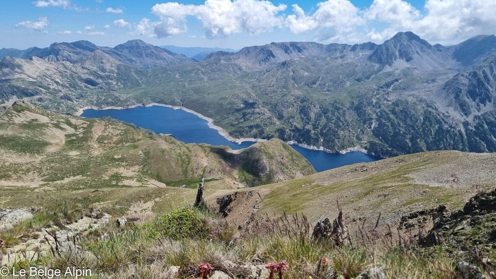
At the summit, the panorama is vast and peaceful. On the Andorran side, deep-blue estanys shimmer between two ridges. On the French side, the Ariege valley is just visible, with the summits around Ax-les-Thermes and beyond as a backdrop. On a clear day you even catch a glimpse of the highest summits of the central Pyrenees, far in the distance.
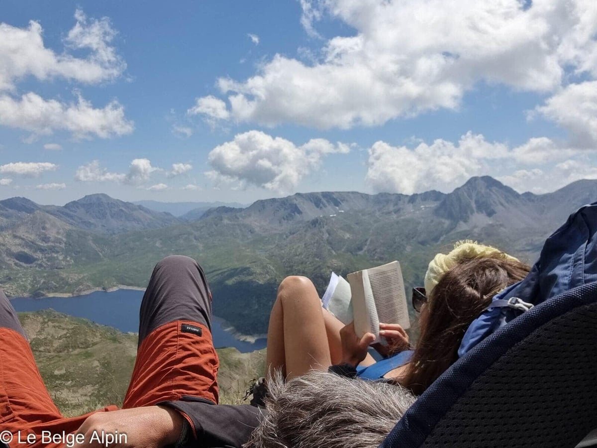
At 2842 m, the wind is bearable, the sun more punishing than you’d think. We took our time up there, pulling out a book at the top of a natural border has something deliciously contemplative about it.
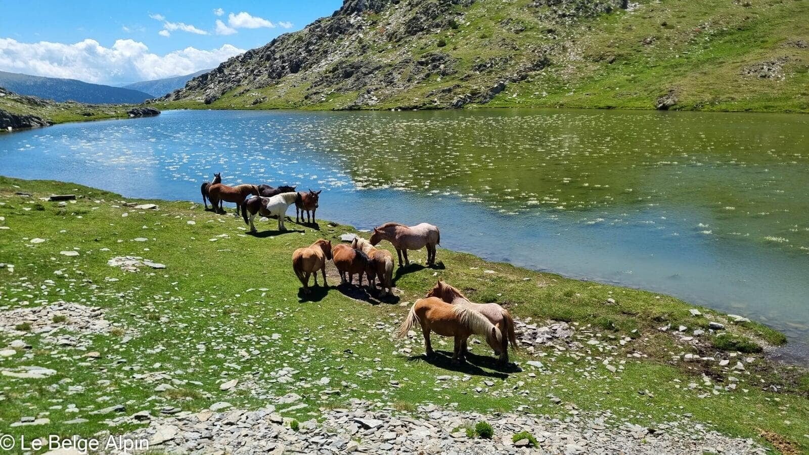
Descent and wild horses
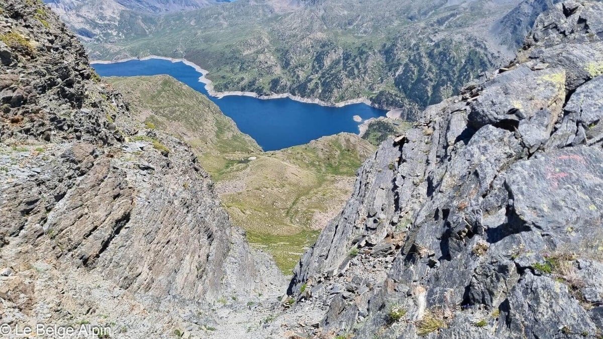

The descent follows the same route. As we got close to the last estany, we were surprised to come across a small herd of wild horses drinking and grazing. Suspended moment, obligatory photo from a respectful distance. It’s one of the charms of the high Cerdagne pastures: the farm animals are at home, the hikers are the visitors.
Practical info
1125 m of gain, 14 km, count on 5 to 6 hours depending on your pace and time spent at the summit. A relatively accessible hike technically, but the distance and exposure matter, in heavy summer heat leave early or favor early autumn for milder temperatures.
The France-Spain border has no checkpoint at this altitude, but carrying your ID is still recommended. For conditions, a call to the Puigcerda tourist office or a local lodge will give you the current state of the track and the trail.
Practical info
Starting point
From the N320 on the Spanish side (Lleida-Puigcerda), spot the stony track that climbs toward the alpine pastures (often marked as a parking area shared with livestock). We spent the night on site in our converted minivans, open-sky parking, cows and horses as neighbors. Avoid in the rain, the track gets difficult.
GPX track
Import the GPS track into your watch or app (Garmin Connect, Komoot, Gaia GPS, Iphigenie...).
Sign in to downloadTourist office (current conditions)
Cerdagne Tourist Office, Puigcerda
Carrer Querol, 1, 17520 Puigcerda, Spain
Garmin track
Gallery
13 photos, click to enlarge


Weather, Puigcerda
Conditions and forecasts for the itinerary
In the mountains, conditions change fast. A thunderstorm can become dangerous, fog disorients, residual snow slows every step. Before leaving, check the bulletins, plan a stable weather window, and when in doubt, call the tourist office or the local guides office.
Learn to read mountain weather →Questions fréquentes
Where exactly is Puig Pedros?
+
On the Spain-France border, at the heart of the Campcardos massif, east of Andorra and north of Puigcerda (Spanish Cerdagne). It's the highest point in the province of Girona. The most natural approach is from the N320 on the Spanish side.
Is the access track drivable?
+
Yes, but it's a stony track shared with livestock. A low car works in dry weather if you drive carefully. Avoid it if rain has soaked everything, it gets slippery and the underside of the car takes a beating.
Is the summit marked?
+
Yes, a summit tripod is visible from a distance. The ridge is wide before the final peak, easy to follow in clear weather. In fog, GPS and compass are recommended, the plateau can disorient you.