
A wild 22.66 km loop starting from Harre, in the municipality of Manhay. 720 metres of climbing, wide rolling forest tracks, a mix of spruce plantations, beech woods and Ardennes meadows. A long day, with one private passage on the route that needs an honest word.
I walked this big loop at Harre, in the municipality of Manhay, while building fitness before heading to the Alps. It is exactly the kind of terrain I need for that: long, rolling, wild, with no technical difficulty but enough kilometres and climbing to work the legs. A fine Ardennes loop, the sort you go for when you want quiet rather than busy tourist trails.
A big loop, not a short stroll
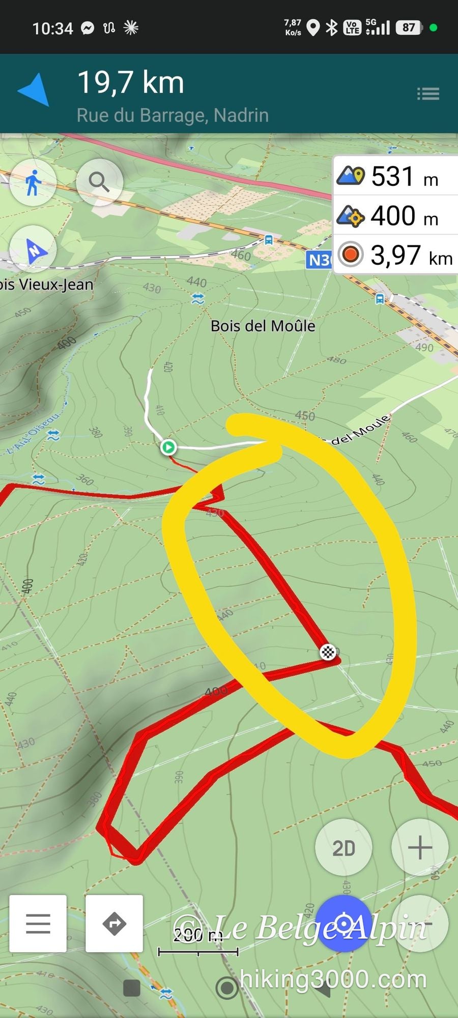
On paper it could pass for an easy walk. In reality it is 22.66 kilometres and 720 metres of climbing, and count close to 4h45 on the ground (3h53 of actual walking, the rest in breaks). Nothing alpine, nothing dizzying, but the distance deserves respect. Set off expecting to be done in two hours and you will feel it.
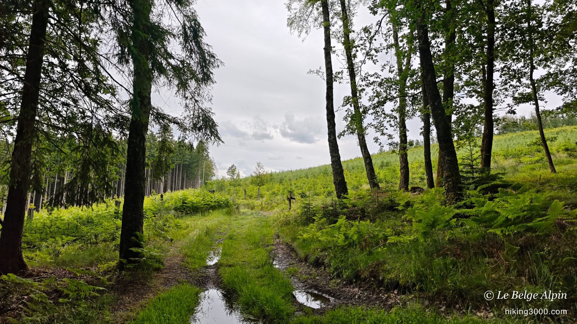
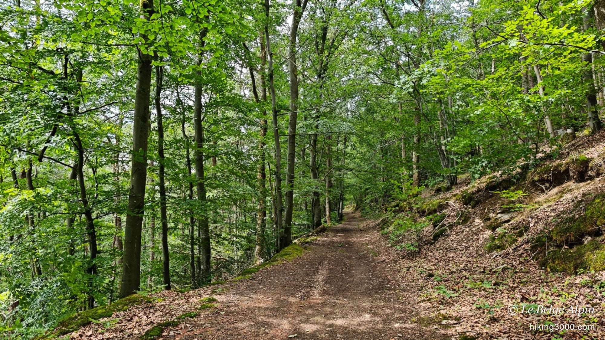
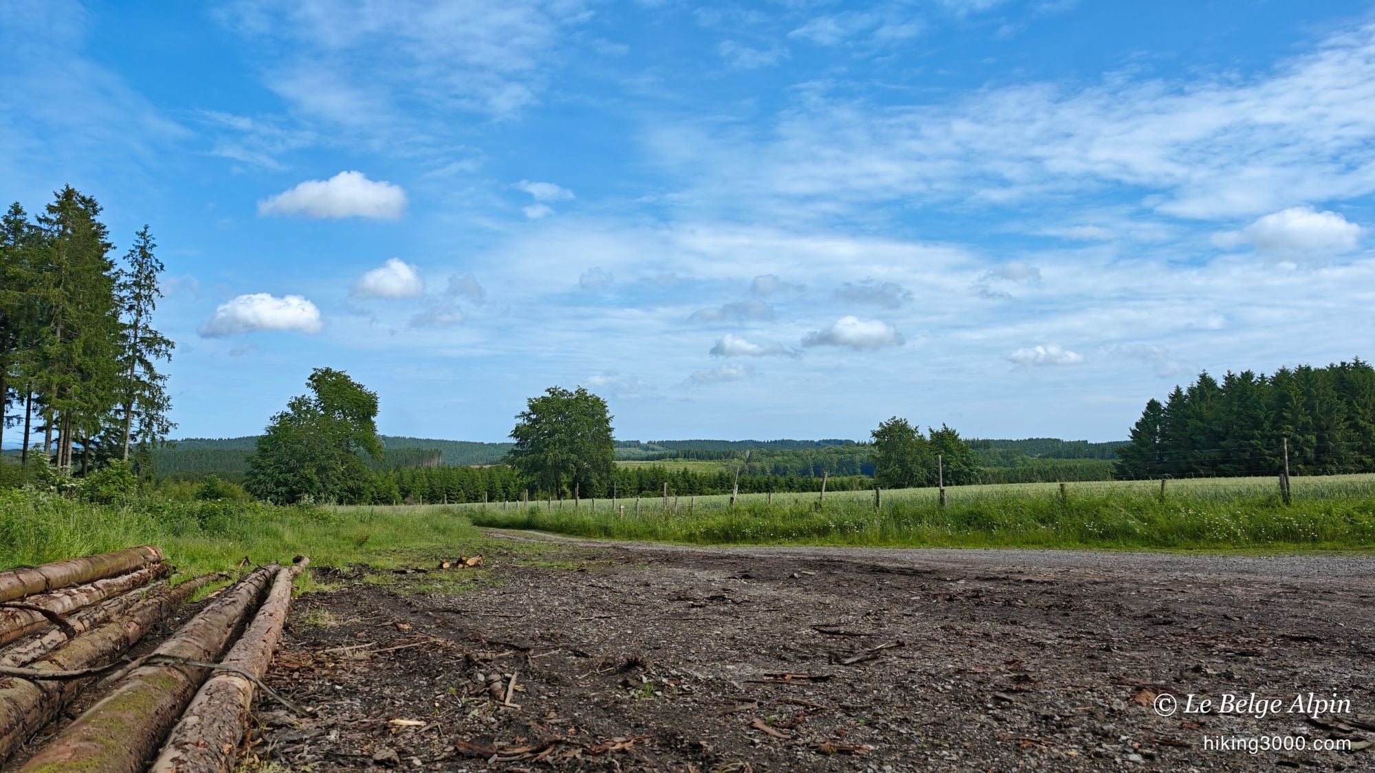
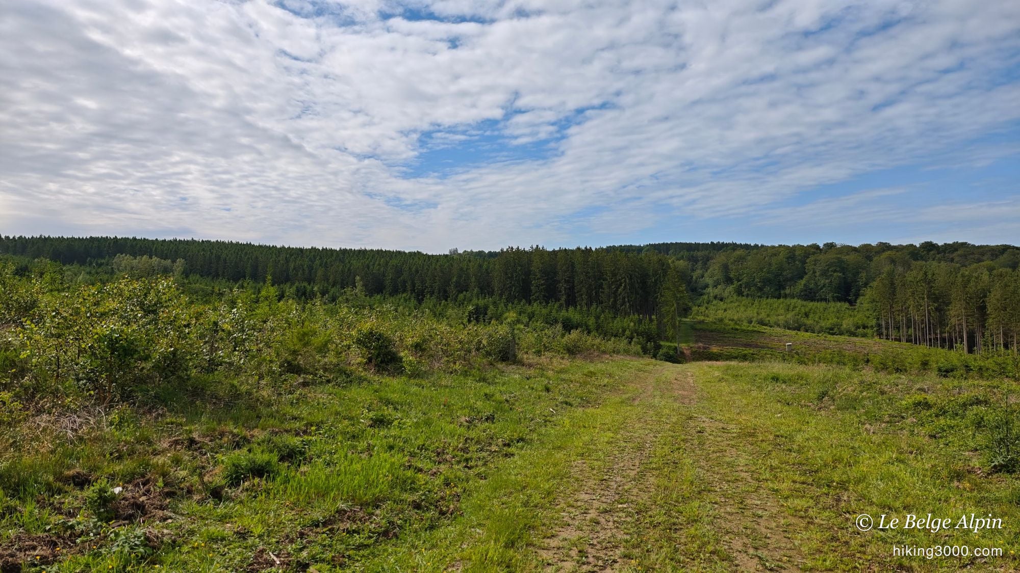
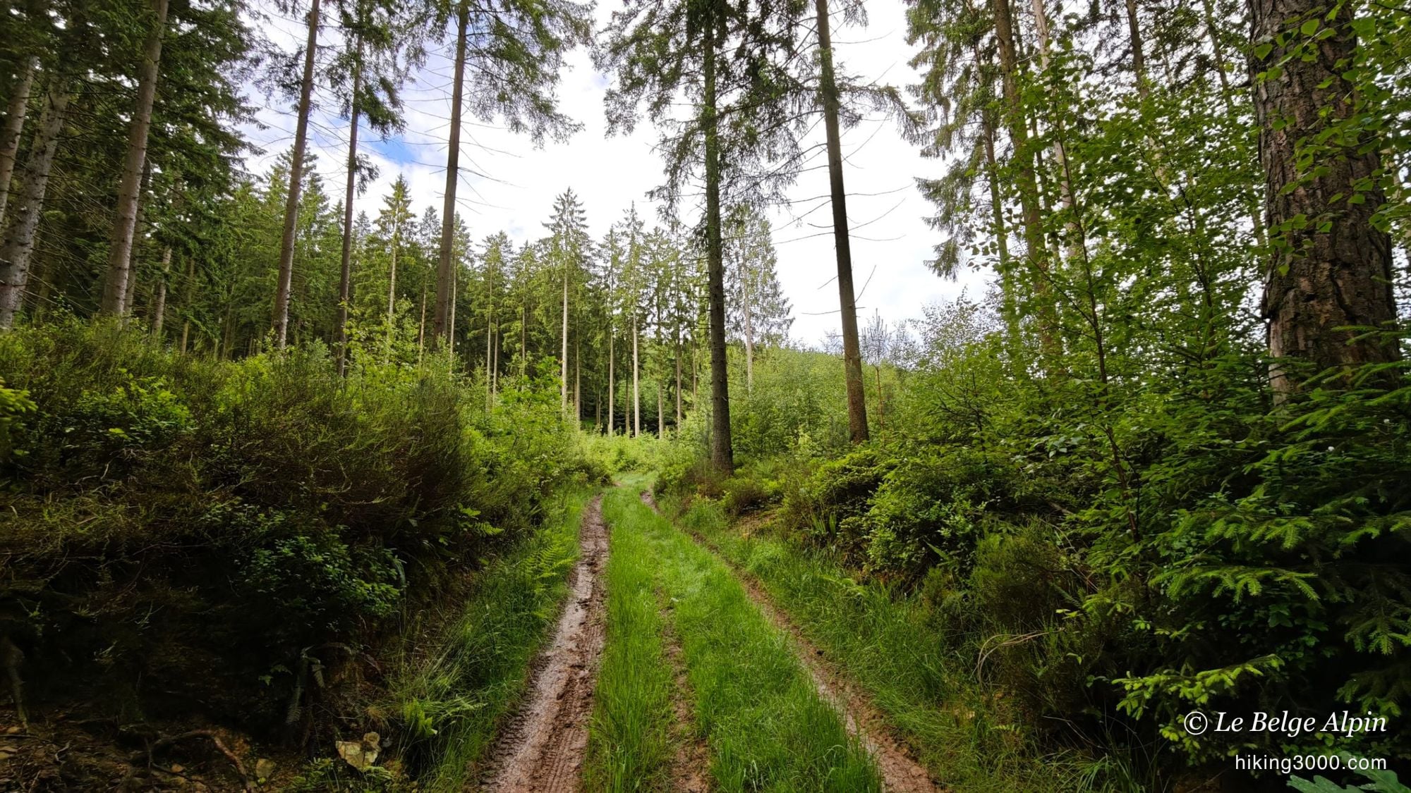
The terrain is generous: wide forest tracks that roll along nicely, where you make progress without fighting for footing. That is what makes this loop pleasant for training. You walk, you take in the scenery, you tick off the kilometres. A few sections are muddier, with deep water-filled ruts, but nothing you can’t manage in shoes that grip.
🌲 From spruce stands to the meadows of Harre
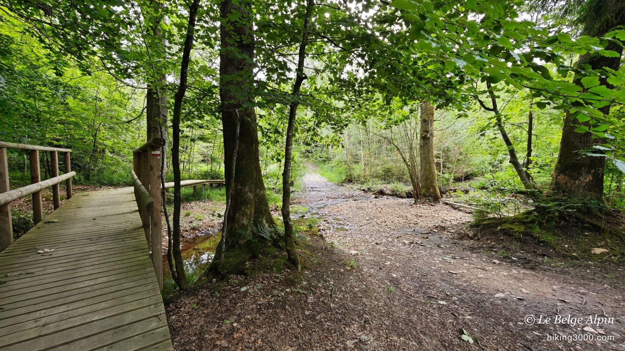
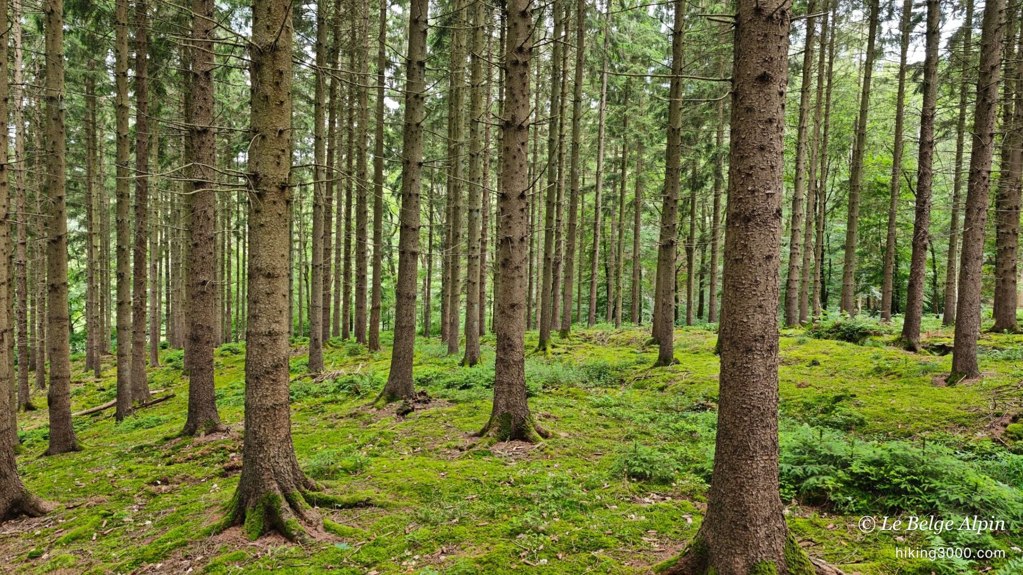
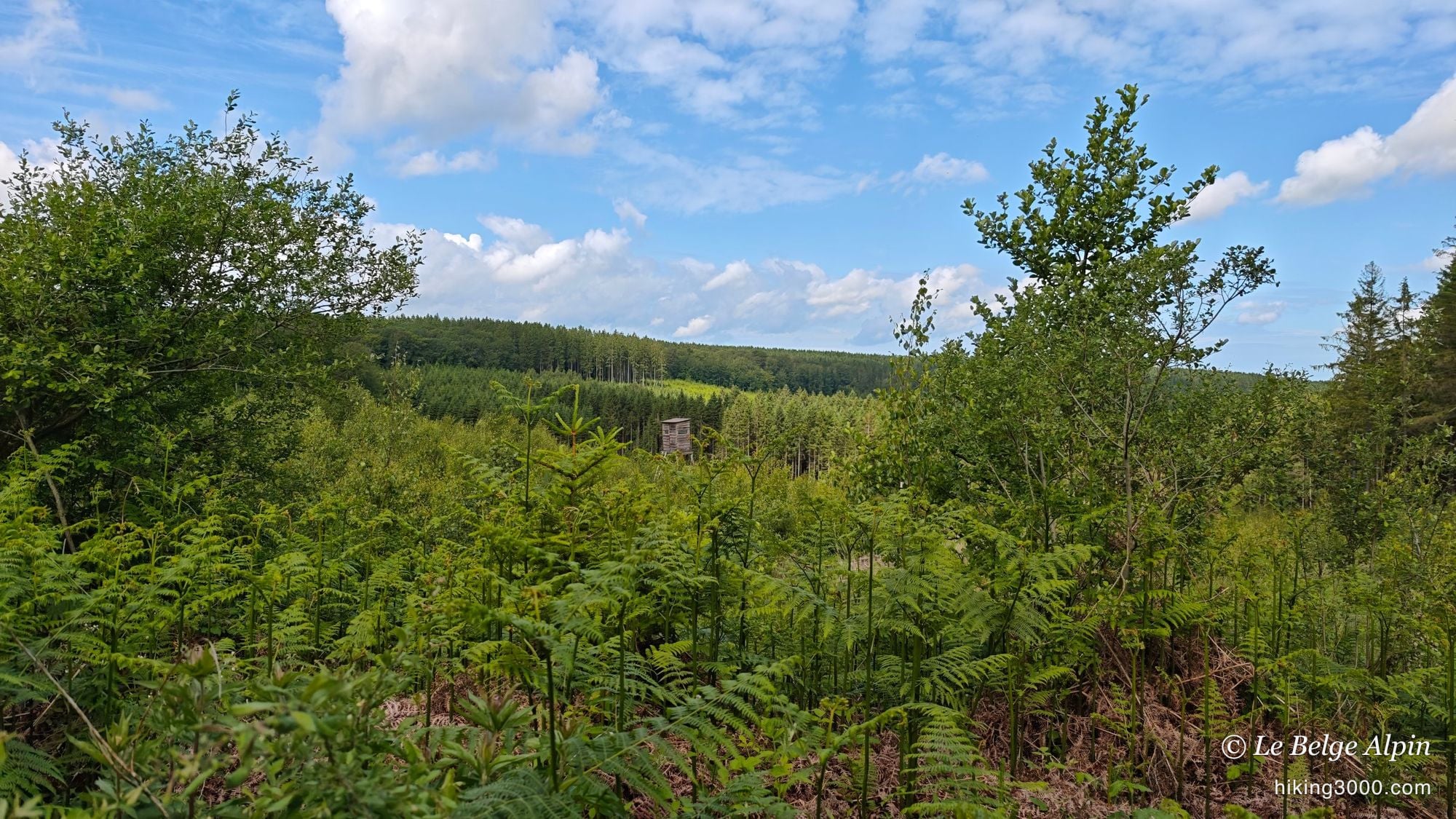
What I like here is the variety. You move from dark, moss-carpeted spruce plantations to fine beech woods where the path runs along a balcony beneath the grey trunks. A wooden footbridge crosses a stream, and forest clearings suddenly open up the sky and the view over wooded valleys.
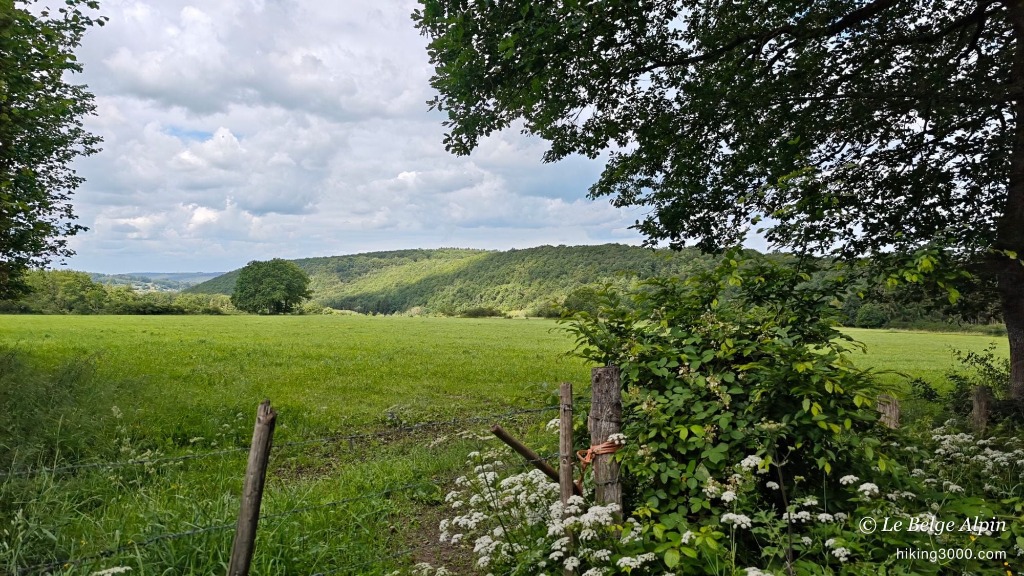
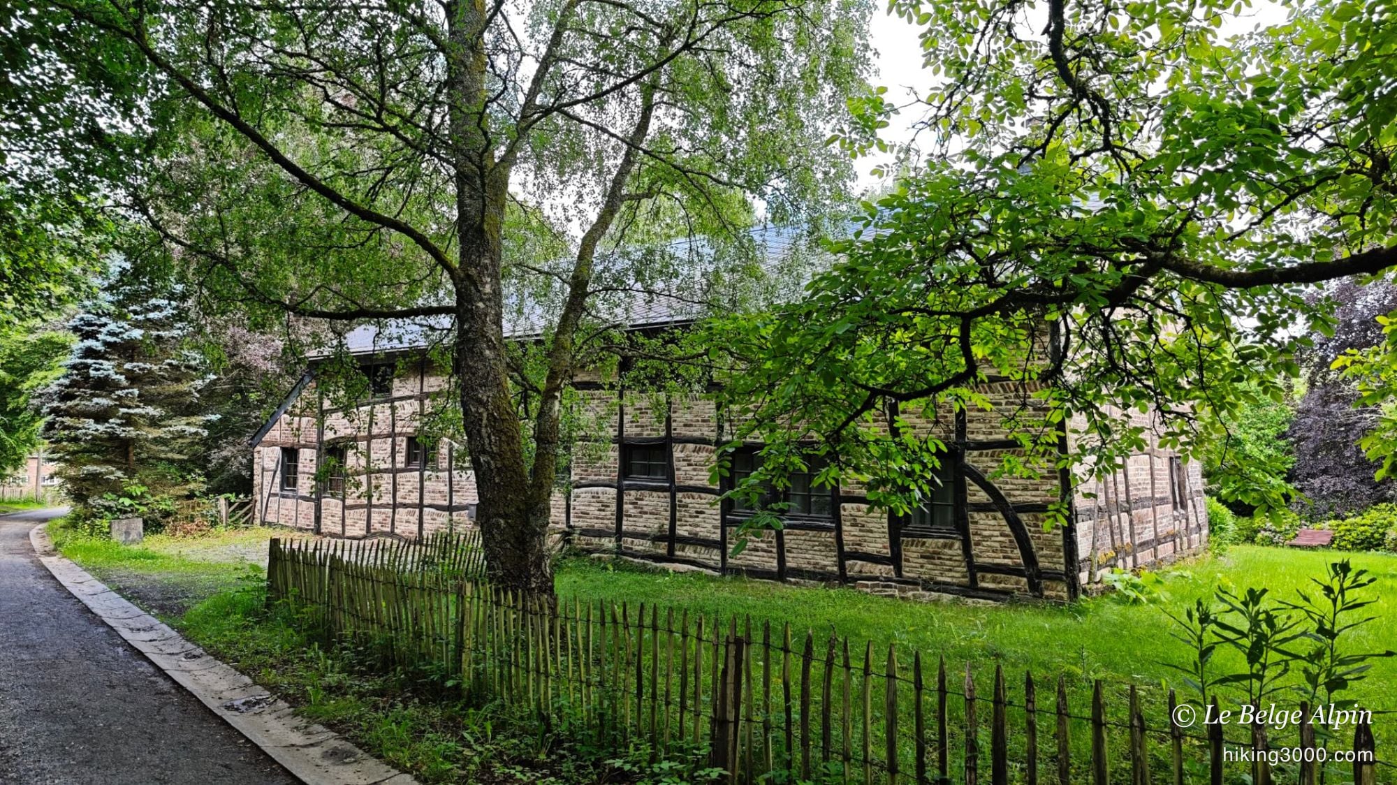
And then there are the meadows, on the edge of the villages. A wooden fence, wild chervil in flower in the foreground, and behind it the green rolls of the Ardennes fading toward the horizon. Crossing Harre, you also pass an old half-timbered farm, the kind of building that reminds you this corner has a long rural history. It is varied, it feels alive, and it is rarely busy.
⚠️ The private passage: let’s be honest about it
There is one point I would rather raise openly. On the route, one stretch follows a path marked with several private property signs, in a wooded section of the loop. No physical barrier on site, no gate or fence, but the owner keeps a close watch on the passage, most likely by camera, and challenges hikers.
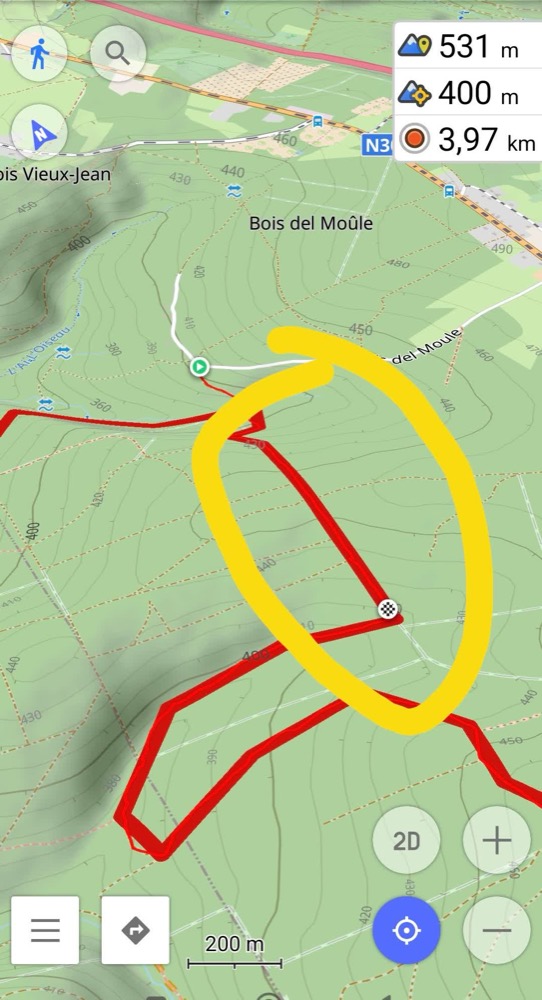
A quick legal note, because it applies to plenty of trails in Wallonia. A private property sign is not enough on its own to make a path legally off limits. Many trails crossing private parcels are in fact public local rights of way, recorded in the 1841 Atlas of local roads, on which passage is guaranteed even without the owner’s agreement. Conversely, a genuine private path must be marked unambiguously: a physical barrier, or a no entry sign. To check a path’s real status, use the Wallonia Geoportal (atlas of local rights of way) or the chemins.be website.
My recommendation stays the same: out of respect and to avoid any conflict, go around this particular passage. And more broadly, when in doubt about a path, check its status before you leave, calmly at home, rather than arguing about it on the ground. That too is respect for the place: you don’t block a field entrance, you don’t cut across a meadow, and if a local says something, you stay cool, it’s their home.
🧭 Practical notes
- 22.66 km for 720 m gain: plan the day, or at least a proper half day. This is not a hike to improvise.
- Wide rolling tracks, but muddy in places. Shoes that grip, not trainers.
- Water and a snack: there is no resupply on the route.
- GPX track recommended: many forest junctions look alike.
- Go around the marked private passage, and check a path’s status when in doubt.
- Spring or early autumn preferably, for the light and firmer ground.
If you are after other big wild loops nearby, take a look at the Werbomont loop, right next door in Ferrières, or the Nisramont lake loop further south, which really does feel like the mountains. And before a long outing like this one, a glance at my gear tips never hurts.
Getting to the start
The start is in Harre, at the place called Chêne-al'Pierre, in the municipality of Manhay. Park in the village without blocking a farm entrance or a field track. From there, the loop heads straight into the woods. Plan a proper half day: with 22 km on the clock, this is not an outing you improvise after lunch.
Please respect local rules:
- Never park in front of a field entrance or on private property.
- Do not block farm accesses.
- Stay discreet, especially early in the morning or late in the evening.
- And if a local says something, keep it friendly: it is their home.
Gallery
11 photos, click to enlarge
Garmin track
Full recording of the outing: GPS track, elevation, speed, heart rate when available.
Downloadable GPX track
Download the GPS track to import it into your watch or app (Garmin Connect, Komoot, Gaia GPS...).
Sign in to downloadWeather, Manhay
Animated maps and real-time forecasts
Even in Belgium, the weather can turn a quiet outing into a rough day. A big thunderstorm in the forest is never pleasant (and sometimes dangerous), thick fog can easily disorient you, and a good downpour turns trails muddy, slippery and exhausting.
Questions fréquentes
Is this a big hike?
+
Yes, bigger than it looks. 22.66 kilometres and 720 metres of climbing make for a real day of walking, even though the tracks are wide and rolling. The terrain won't break your legs, but the distance is felt by the end. Set off early, carry water and a snack, there is no resupply anywhere on the loop.
Can I use the private passage or not?
+
On the route, one stretch follows a path marked with private property signs, and the owner keeps a close watch on it. My advice is simple: go around it, out of respect and to spare yourself an argument on the ground. That said, in Wallonia a private property sign is not always enough to make a path legally off limits: many trails crossing private parcels are in fact public local rights of way. If you want certainty, check the path's status on the Wallonia Geoportal or on chemins.be before you leave.
Do I need the GPX track?
+
I recommend it. The loop strings together forest junctions, and several tracks look alike once you are under the spruce. The track saves you hesitation and pointless backtracking. Download available for logged-in users.
What is the best season?
+
Spring and early autumn. In high summer the forest clearings and trail edges close in fast under the ferns, and some sections get muddy. From April to June, then September and October, you get the light and firmer ground underfoot.