
A 21 km wild loop starting from Lorcé, in the municipality of Stoumont. Mixed forests of conifers and broadleaves, Amblève gorges, quiet streams. A near-empty Saturday in the Ardennes, perfect to wake up the legs before the Alps.
A short warm-up before heading to the Alps this summer. Lorcé, a quiet hamlet in the municipality of Stoumont, and a 21 km loop in a part of the Ardennes I’m particularly fond of: wild, lightly travelled, alternating between deep forest and the banks of the Amblève. A Saturday outing, and only one couple crossed on the whole route.
A wild loop, near-empty on a Saturday
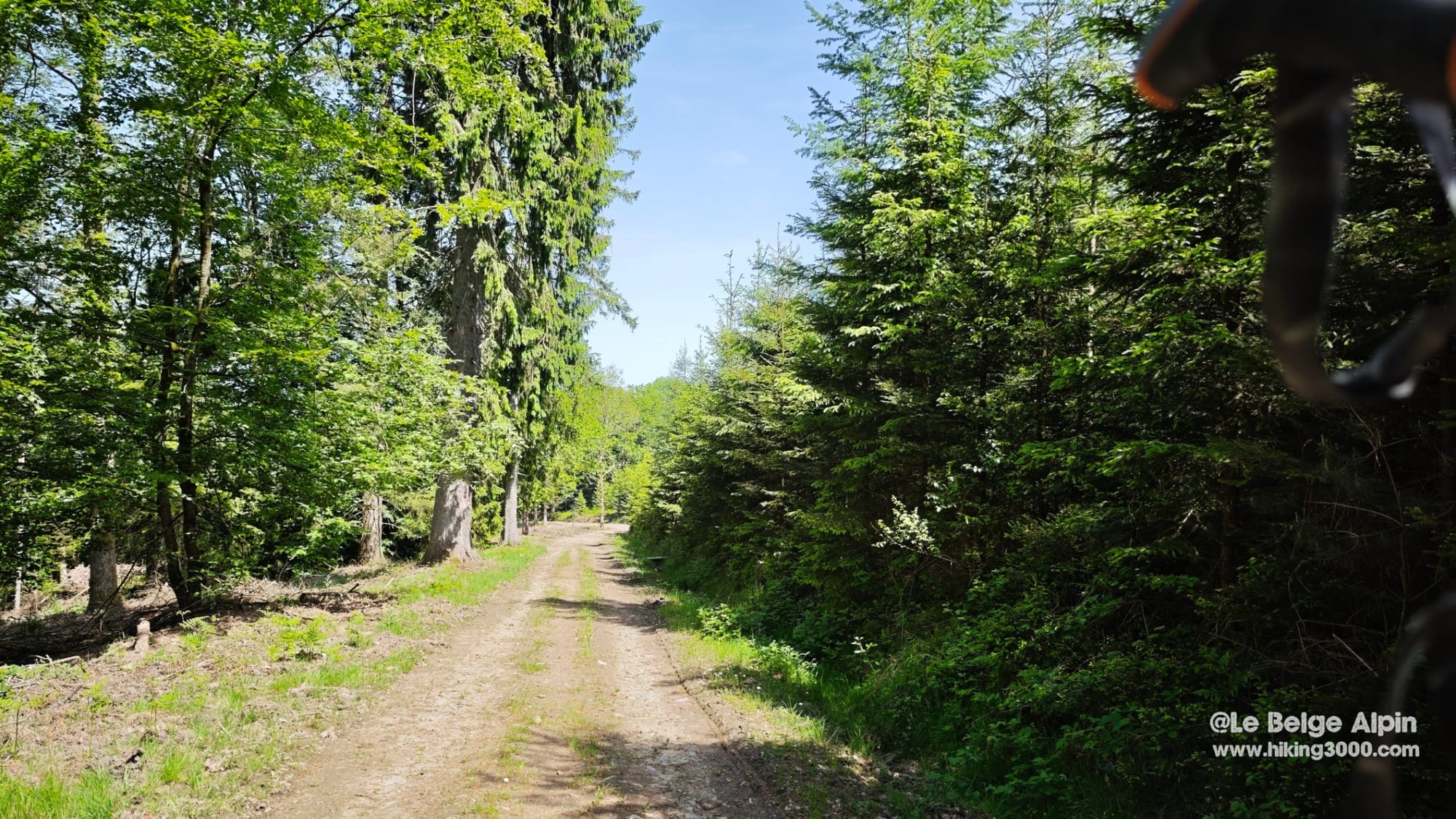
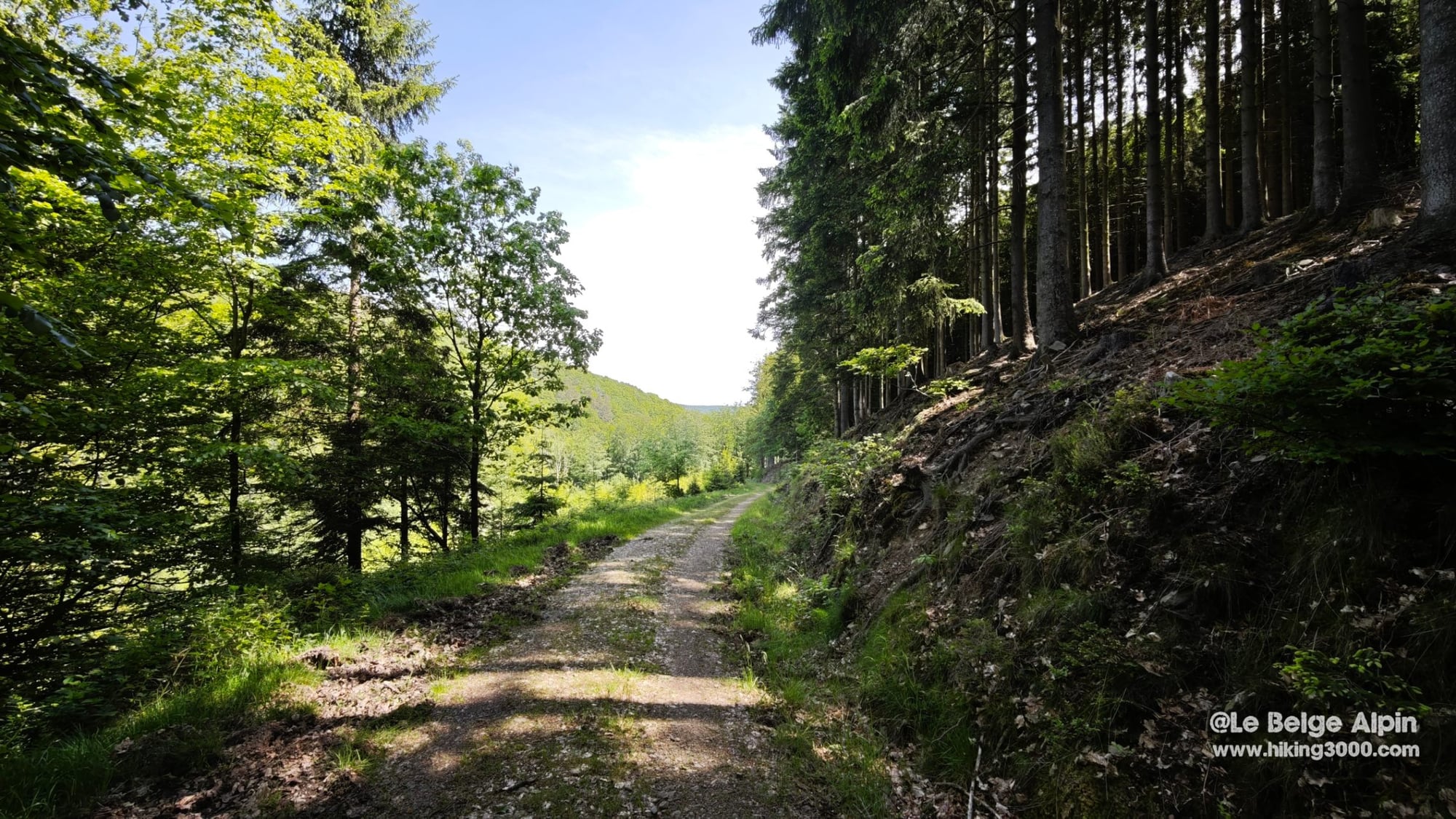
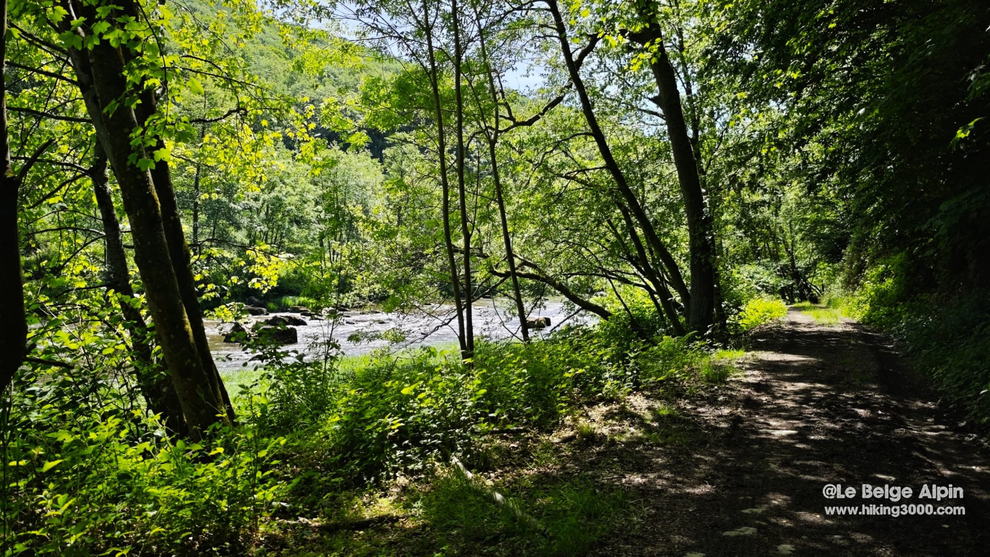
The start is in the hamlet of Lorcé, roadside. No dedicated parking, just a few discreet spots at the entrance. From the first few kilometres the trail alternates between dark conifer stands and more open beech woods. It stays wide and easy to walk on, perfect to settle into a good rhythm without watching your feet every step.
What stands out on this loop is the quiet. The region is well known, the Amblève draws crowds in season, but the route avoids the touristy spots. On a sunny Saturday in May I crossed exactly two people. That’s rare in Belgium on a loop of this quality.
⚠️ The forced detour around the hydroelectric station
This is the thing to know before you leave. When you reach the hydroelectric dam on the Amblève, the trail that was meant to continue on the right bank was no longer practicable when I did it. The only way through goes via the hydroelectric station, normally off-limits to the public.
The detour drops you onto the road heading toward Coo. It’s clearly not the most enjoyable part of the hike, and it cuts into the wild atmosphere you’ve been soaking up for two hours. But it’s short, and the rest more than makes up for it.
If anyone has more recent information on the trail’s condition past the dam, I’d take it gladly and update the article.
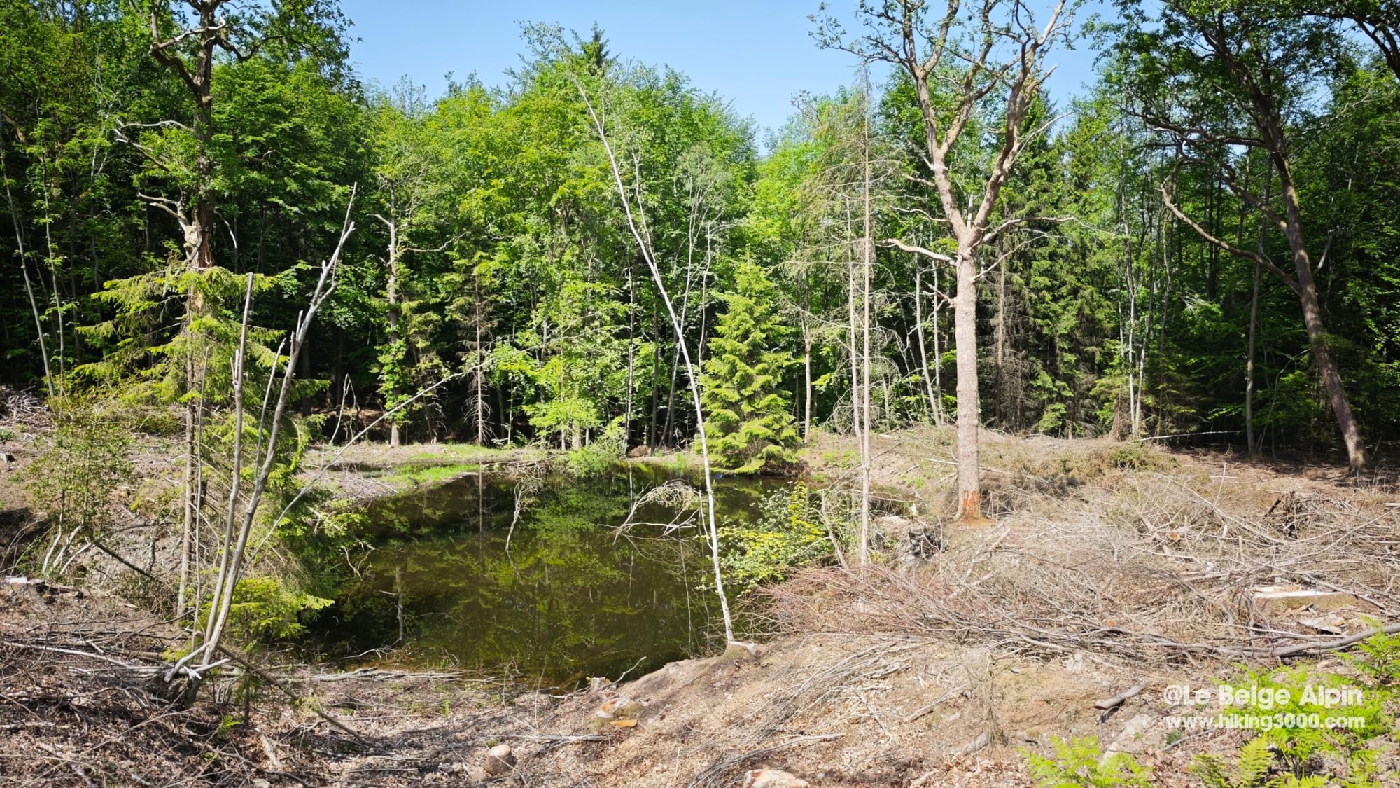
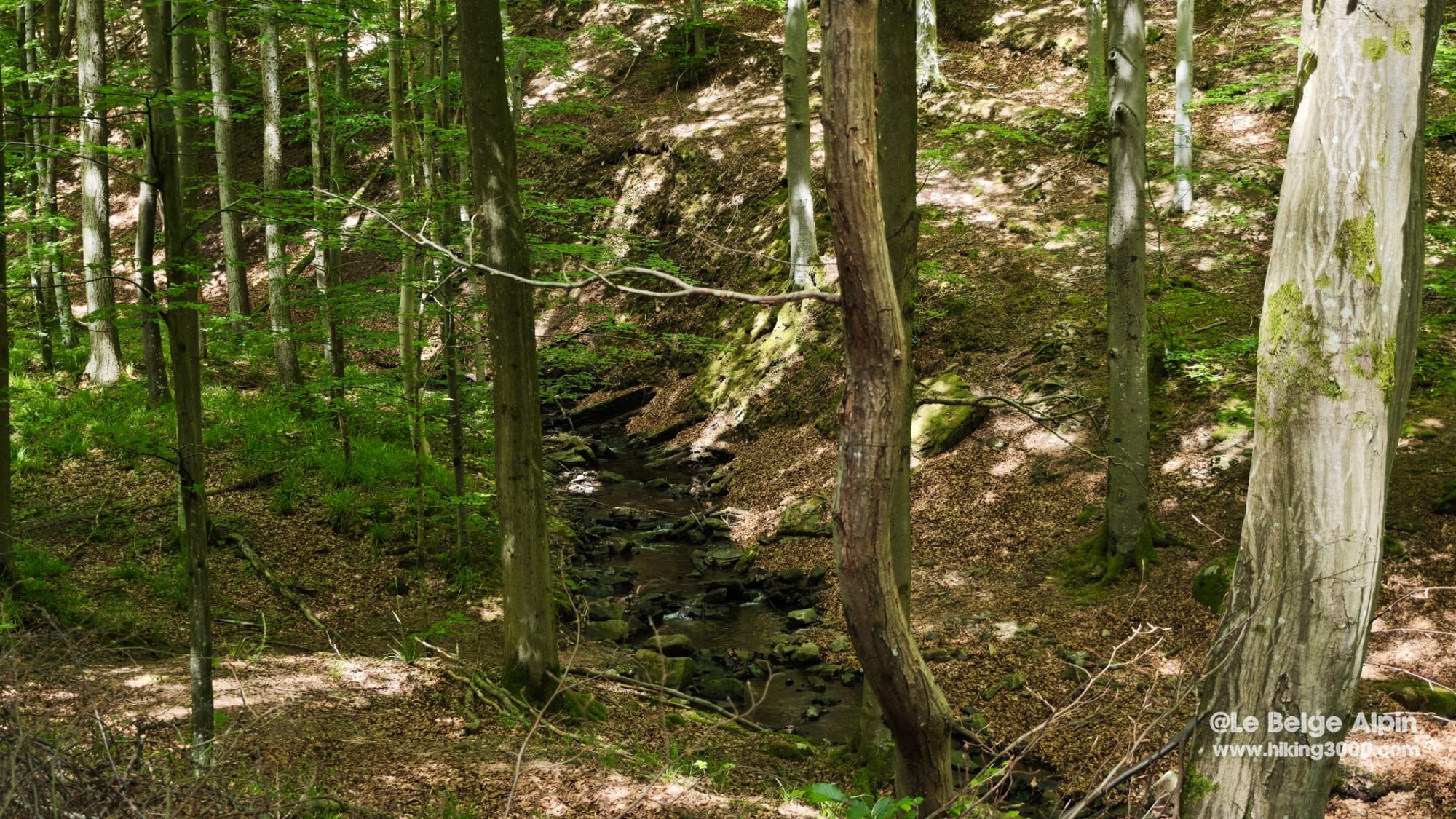
🌲 Mixed forests, streams and valley floor
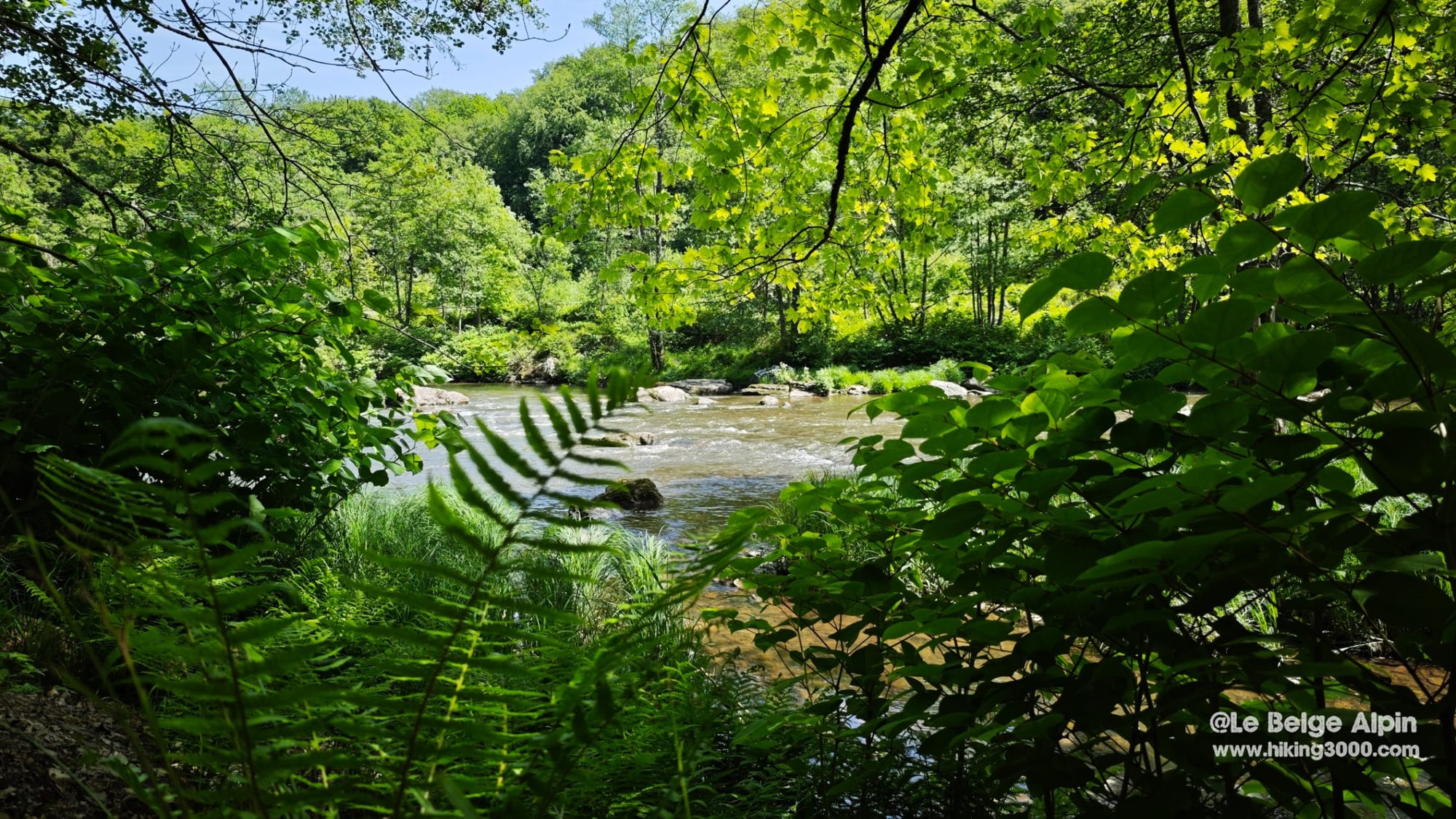
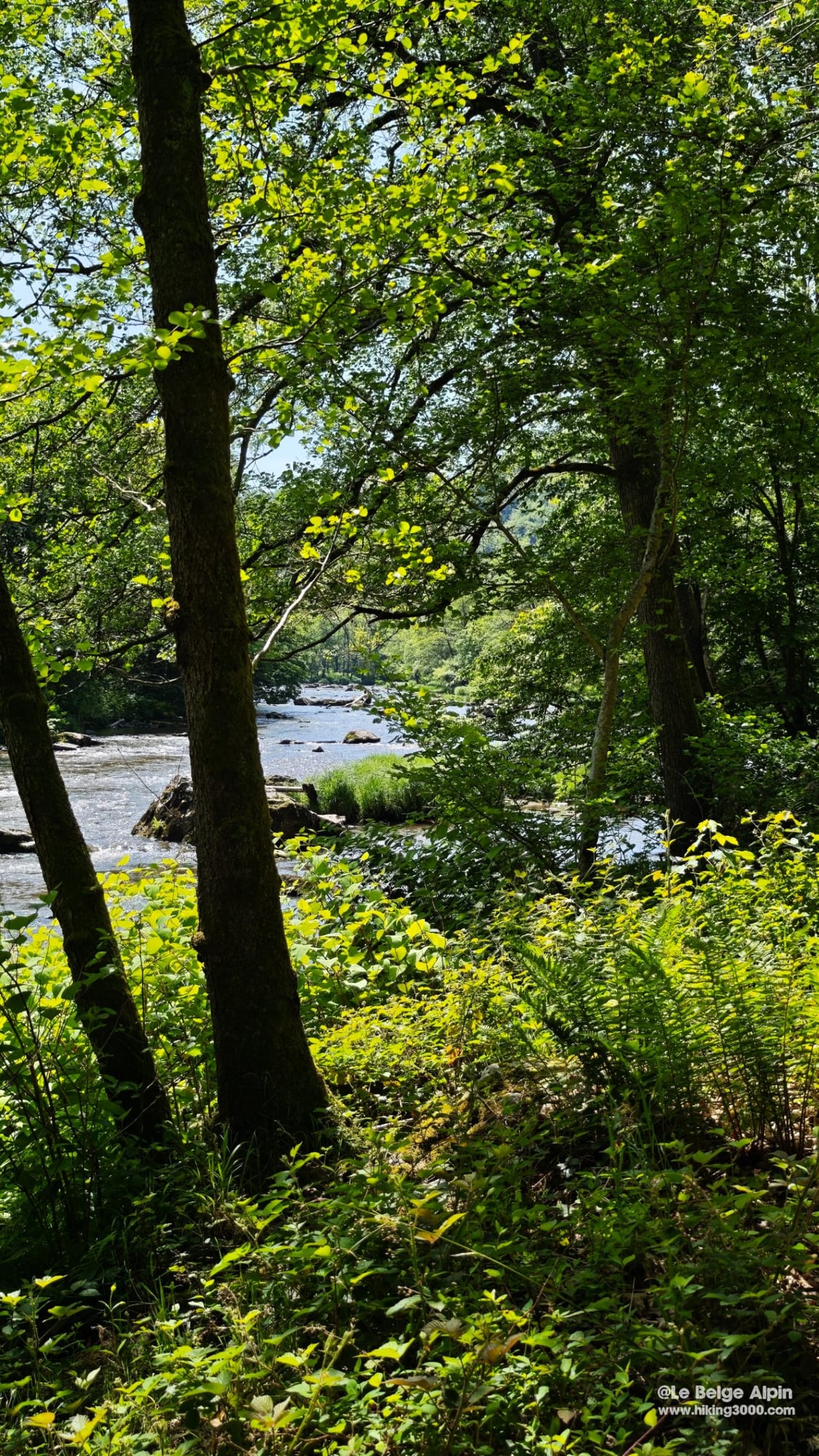
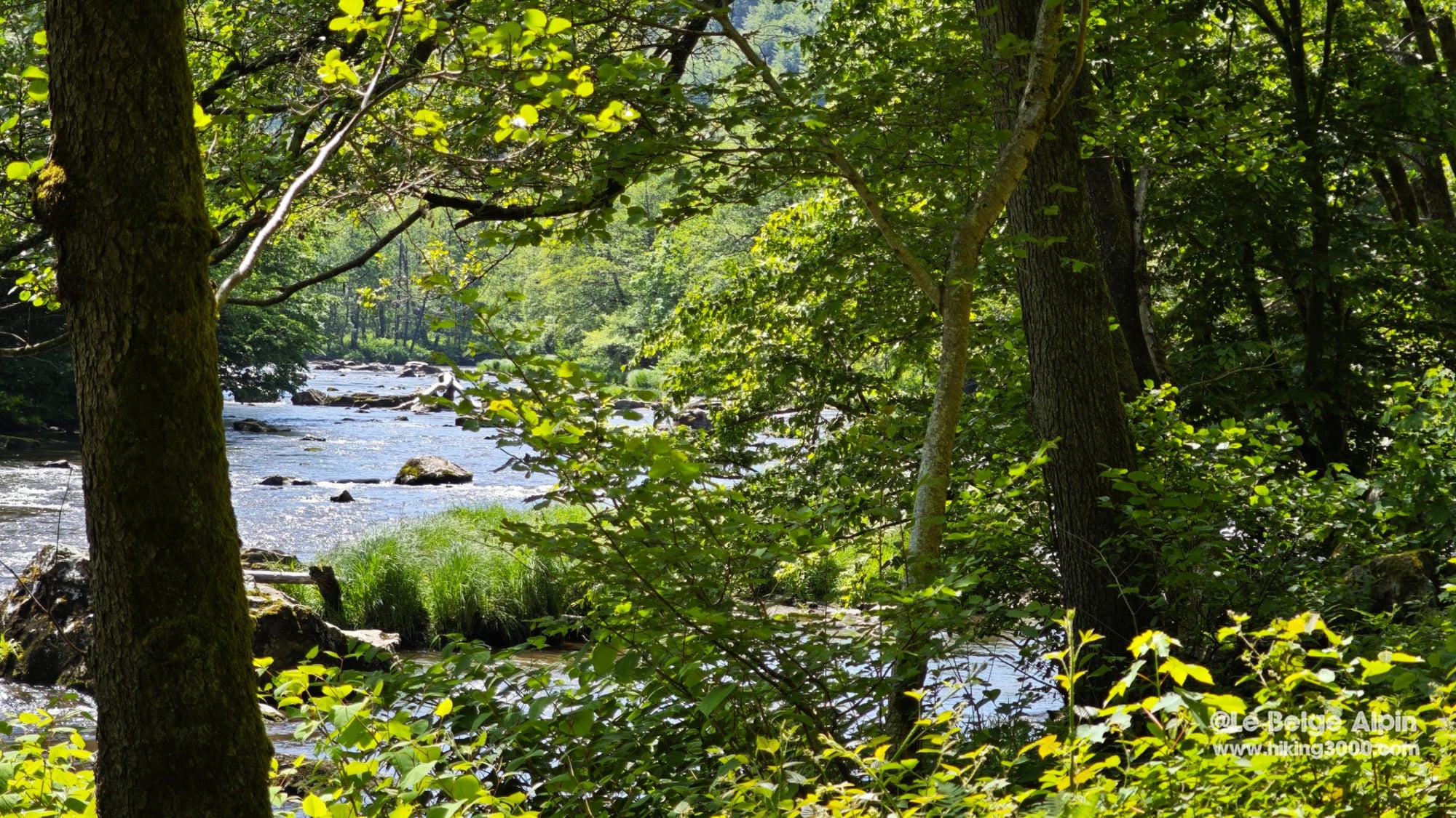
The rest of the route is exactly what I come to look for in the Ardennes: conifer and broadleaf forests alternating, trails following small streams, valley-floor sections along the Amblève. The river opens up some good clear views between the trunks, with rocky rapids that remind you this isn’t a quiet canal.
A few stretches cross wilder zones where the path gets less obvious. Nothing technical, just forest reclaiming its ground. That’s also why carrying the GPS track helps.
The most memorable section is probably the Amblève bank in the gorge, under the beeches: light filtering through the leaves, ferns in the foreground, water running over the boulders. Belgian, yes, but nothing to sneeze at.
🧭 In practice
- 520 m of elevation gain well spread over 21 km, nothing brutal if you have some baseline fitness.
- Sturdy shoes all the same, some sections are damp along the river.
- 1.5 L of water in summer, no refill point on the loop.
- GPS track recommended, junctions in the undergrowth aren’t always marked.
- Respect the place: don’t park in front of property entrances at Lorcé; the locals are few and the hamlet is quiet. Stick to the trails, especially in the wilder sections.
A hike I’ll do again in autumn for the colours. If you’re looking for a serious Ardennes loop without the crowds, this one ticks the boxes.
Getting to the start
Start from the hamlet of Lorcé, in the municipality of Stoumont. Quiet roadside parking at the entrance to the hamlet. Don't park in front of houses; spots are available a bit further on.
Please respect local rules:
- Never park in front of a field entrance or on private property.
- Do not block farm accesses.
- Stay discreet, especially early in the morning or late in the evening.
- And if a local says something, keep it friendly: it is their home.
Gallery
8 photos, click to enlarge
Garmin track
Full recording of the outing: GPS track, elevation, speed, heart rate when available.
Downloadable GPX track
Download the GPS track to import it into your watch or app (Garmin Connect, Komoot, Gaia GPS...).
Sign in to downloadWeather, Stoumont
Animated maps and real-time forecasts
Even in Belgium, the weather can turn a quiet outing into a rough day. A big thunderstorm in the forest is never pleasant (and sometimes dangerous), thick fog can easily disorient you, and a good downpour turns trails muddy, slippery and exhausting.
Questions fréquentes
Is the detour through the hydroelectric station really required?
+
On the day of the hike, yes. The trail meant to continue along the Amblève past the dam was no longer practicable, and the only way through goes via the hydroelectric station, normally off-limits. The detour drops you onto the road heading toward Coo, which kills the wild vibe for a short stretch. If you have more recent intel on the trail's condition, let me know.
Is 21 km in the Belgian Ardennes demanding?
+
Call it serious without being exhausting. The 520 metres of gain are well spread out, but 21 km does ask for a baseline of walking habit. Plan 4h30 to 5h at a steady pace, more if you stop along the Amblève. Sturdy shoes and at least 1.5 litres of water in summer.
Will I see many people on this route?
+
Very few. I did it on a Saturday and only crossed one couple over the whole loop. That's one of its strengths in a region where popular loops can be crowded on weekends. The Amblève stretch sees the most foot traffic in high season, but you're never in a crowd.
What's the best season?
+
Spring and autumn. April-May for the woods turning green again and longer days; September-October for the autumn colours along the Amblève. Summer is fine but the road detour can get hot. In winter, watch for frost near the river.
Is the waymarking enough or do I need a GPS track?
+
Not everywhere. Several junctions in the forest aren't consistently marked, and the detour around the station obviously isn't on any official map. Carry the GPX track to avoid pointless back-and-forth. Download is available for logged-in users.